United States Public Health Service Building
United States Public Health Service Building | |
 | |
| Location | 1951 Constitution Avenue, NW, Washington, District of Columbia |
|---|---|
| Coordinates | 38°53′33.36″N 77°2′39.12″W / 38.8926000°N 77.0442000°W |
| Built | 1932 |
| Architect | Jules Henri de Sibour |
| Architectural style | Classical Revival |
| NRHP reference No. | 07000641 [1] |
| Added to NRHP | July 05, 2007 |
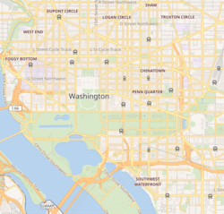
The United States Public Health Service Building, also known as the Department of the Interior - South Building, is a historic government office building, the headquarters of the Office of Surface Mining. It is located at 1951 Constitution Avenue, Northwest, Washington, D.C., adjacent to the Eccles Building.
History
The site was home to a YWCA.
It was designed by Jules Henri de Sibour, for the Public Health Service in 1931. It was renamed to the Combined Chiefs of Staff Building on January 30, 1942. It was the site of the planning for the Manhattan Project; the Atomic Energy Commission occupied the site from its creation in 1947 until its relocation to Germantown, Maryland in 1958.[2] The Bureau of Indian Affairs began using the building in April 1965, and Office of Surface Mining joined them in 1977.[3] The building has since been used by several offices and bureaus of the Department of the Interior which is headquartered next door.
On November 3, 1972, a group of around 500 American Indians with the AIM took over the building, the culmination of their Trail of Broken Treaties walk. They intended to bring attention to American Indian issues, including their demands for renewed negotiation of treaties, enforcement of treaty rights and improvement in living standards. They occupied the Department of the Interior headquarters from November 3 to November 9, 1972.[4]
Architectural Description
The structure is a three story E-shaped building featuring a raised basement, shallow projecting corner pavillions, and a gabled tile roof. The structural system is composed of a concealed steel frame and concrete floors. At the east, south, and west elevations the building is surrounded by raised terrace separated from the exterior walls by an areaway. The principal exterior building materials consist of marble on the east, south, and west facades; limestone within the two courtyards; and stucco on the north facades of the east and west wings.[5]
The primary facade is faced in white Georgia marble and features a thirteen bay, engaged double-height colonnade of fluted Doric pilasters flanked by shallow projecting corner pavillions. A large entabulature composed of a plain frieze and enriched ornamental cavetto cornice surmounts these pilasters. A single-height entrance pavilion composed of three pedimented formal entryways is centered on the facade.[5]
Notable interior spaces include an elaborate marble entrance lobby, marble stair and elevator lobbies, and an ornamental auditorium space, all of which feature decorative painted finishes on ornamental plaster and compo features. An elaborate wood panelled primary executive office suite is located on the second floor.[5]
See also
References
- ^ "National Register Information System". National Register of Historic Places. National Park Service. March 13, 2009.
- ^ "U.S. Department of Energy - Germantown Site History". Archived from the original on October 25, 2011.
{{cite web}}: Unknown parameter|deadurl=ignored (|url-status=suggested) (help) - ^ A short history of the South Interior Building, Headquarters for the Office of Surface Mining.
- ^ Paul Smith and Robert Warrior, Like a Hurricane: The Indian Movement from Alcatraz to Wounded Knee, New York: The New Press, 1996.
- ^ a b c General Services Administration page.


