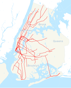
New York City Subway station in Manhattan, New York   |
|---|
|
 Downtown platform with an Arts for Transit artwork, Lariat Seat Loops, on the columns | |
| Address | East 33rd Street & Park Avenue
New York, NY |
|---|
| Borough | Manhattan |
|---|
| Locale | Murray Hill, Kips Bay |
|---|
| Coordinates | 40°44′47″N 73°58′55″W / 40.74639°N 73.98194°W / 40.74639; -73.98194 |
|---|
| Division | A (IRT)[1] |
|---|
| Line | IRT Lexington Avenue Line |
|---|
| Services | 4  (late nights) (late nights)
6  (all times) <6> (all times) <6>  (weekdays until 8:45 p.m., peak direction) (weekdays until 8:45 p.m., peak direction) |
|---|
| Transit |  NYCT Bus: M15, M15 SBS, M34 SBS, M34A SBS, M101, M102, M103 NYCT Bus: M15, M15 SBS, M34 SBS, M34A SBS, M101, M102, M103
 MTA Bus: BM5, BxM1, QM12, QM15, QM16, QM17, QM18, QM24 MTA Bus: BM5, BxM1, QM12, QM15, QM16, QM17, QM18, QM24
 NYC Ferry: Astoria and Soundview Routes NYC Ferry: Astoria and Soundview Routes
(on FDR Drive and East 34th Street) |
|---|
| Structure | Underground |
|---|
| Platforms | 2 side platforms |
|---|
| Tracks | 4 |
|---|
|
| Opened | October 27, 1904 (120 years ago) (1904-10-27)[2] |
|---|
Opposite-
direction
transfer | Yes |
|---|
|
| | 2023 | [3] |
|---|
|
| | Rank | out of 423[3] |
|---|
| |
| Location |
Show map of New York City Subway Show map of New York City |
| |
| Street map |
|

|
|
| Station service legend |
| Symbol |
Description |
 |
Stops all times |
 |
Stops late nights only |
 |
Stops rush hours in the peak direction only |
|
| |
33rd Street Subway Station (IRT) | | | |
| | MPS | New York City Subway System MPS |
|---|
| NRHP reference No. | 04001014[4] |
|---|
| NYCL No. | 1096 |
|---|
|
| Added to NRHP | September 17, 2004 |
|---|
| Designated NYCL | October 23, 1979[5] |
|---|
|
|
|
33 Street   |
|---|
|
 Downtown platform with an Arts for Transit artwork, Lariat Seat Loops, on the columns | |
| Location | East 33rd Street & Park Avenue
New York, NY
Murray Hill, Kips Bay,
Manhattan |
|---|
| Coordinates | 40°44′47″N 73°58′55″W / 40.74639°N 73.98194°W / 40.74639; -73.98194 |
|---|
| Line(s) | IRT Lexington Avenue Line |
|---|
| Platforms | 2 side platforms |
|---|
| Tracks | 4 |
|---|
| Connections |  NYCT Bus: M15, M15 SBS, M34 SBS, M34A SBS, M101, M102, M103 NYCT Bus: M15, M15 SBS, M34 SBS, M34A SBS, M101, M102, M103
 MTA Bus: BM5, BxM1, QM12, QM15, QM16, QM17, QM18, QM24 MTA Bus: BM5, BxM1, QM12, QM15, QM16, QM17, QM18, QM24
 NYC Ferry: Astoria and Soundview Routes NYC Ferry: Astoria and Soundview Routes
(on FDR Drive and East 34th Street) |
|---|
|
| Structure type | Underground
(No opposite direction transfer) |
|---|
|
| Classification | A Division |
|---|
|
| Opened | October 27, 1904 (120 years ago) (1904-10-27)[2] |
|---|
| Original company | Interborough Rapid Transit |
|---|
| |
|
| |
| |
Non-revenue lines and services |
|---|
|
|
| |
| |
| |
33rd Street Subway Station (IRT) | | | |
| | MPS | New York City Subway System MPS |
|---|
| NRHP reference No. | 04001014[4] |
|---|
| NYCL No. | 1096 |
|---|
|
| Added to NRHP | September 17, 2004 |
|---|
| Designated NYCL | October 23, 1979[5] |
|---|
|
| | |
Location within New York City Subway |  |
| |
Service(s) 4  (late nights) 6  (all times) <6>  (weekdays until 8:45 p.m., peak direction) Station service legend |
 |
Stops all times |
 |
Stops late nights only |
 |
Stops rush hours in the peak direction only |
|
|
|
|


