
User:Sertmann/sandbox/Nørrebro bicycle route

.jpg)
Nørrebro bicycle route (Danish: Nørrebro cykelrute) is a completely segregated bicycle route in Copenhagen, Denmark. Mostly following a disused railway alignment, it meanders 9,2 km (5.7 miles) through Nørrebro from Emdrup in the north to Valby in the south. At an estimated cost of 76 million kroner (approximately US $13 million) it is the single most costly piece of bicycle infrastructure in Copenhagen[1][2]. It connects stations on the metro and S-train network; Danshøj, Frederiksberg and Bispebjerg with densely populated areas of the city, and major educational institutions; The Royal Veterinary and Agricultural University and Copenhagen Business School.
History[edit]
For much of its alignment, the bicycle route follows disused sections of the northern and southern railway lines Right-of-way leading into the previous central station that lay near Kampmannsgade in central Copenhagen. Following the construction of the new central station and the Boulevard Line, the right-of way was subsequently used as a freight railway and ultimately abandoned in the 1930'ties. Following the abandonment much of the old railway terrain was taken over by the city of Copenhagen and gradually grew into the Nørrebroparken park.[3] By 1989 the Danish Cyclists Federation released a proposal for a number of green bicycle routes in Copenhagen, and 7 years later the Danish Ministry of Transport released funds to co-finance a high-class cycle route on the corridor. In 1997 the first stage of the route was opened and it was gradually expanded through staged construction in the following years, until a legal battle with a autodealer blocking the alignment halted work. In 2004 the city an Architectural design competition for a redesign of the park, which substantially changed and upgraded the surroundings of the alignment through Nørrebroparken, another upgrade was the construction of the "Superkilen" park just to the north which was finished by 2012. During the same year the final stage of the route, between Rantzausgade and Jagtvej, was completed.
Åbuen bridge[edit]
Designed by architects Dissing+Weitling and danish engineering company Cowi, the 63 meter (206 feet) long steel bridge carries pedestrians and cyclists safely 4.6 meters over one of the busiest access routes in Copenhagen. It was opened in 2008 at a cost of 31,5 million kroner (approximately US$5.5 million).
Hovedspændet af brodrageren understøttes af en slank cirkelkrum rørbue. krummer på flere leder. Entreprenøren og ingeniøren blev udfordret med et forførende flot design, der var på grænsen af det teknisk mulige. http://asp.vejtid.dk/Artikler/2009/02%5C5454.pdf
Dissing+Weitling valgte blandt andet den buede form for at skabe en naturlig fortsættelse af den i forvejen slyngede Nørrebro cykelrute.
buebro, hvor buen hælder ca. 45 grader. Ideen er at videreføre stiens slyngede forløb til broen og udnytte denne krumning til at matche den hældende bue
Gallery[edit]
-
 A section through the "Superkilen" park on Nørrebro.
 -
 Crossing the busy Åboulevard on the Åbuen bridge.
 -
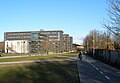 The route through Copenhagen Business School.
 -
 Bicycle counter on the Frederiksberg section of the route
 -
 Crossing the quite residential street Kronprinsensvej on Frederiksberg.


Possible expansion[edit]
Two proposals exits for expanding and realigning the route. In the southern end the original proposal suggests continuing the route along the abandoned railway terrain west of Danshøj station and following the Vestbanen railways tracks to join up with another green bicycle route, Vigerslev ruten, at the Harrestrup stream in the Vigerslev Park near Hvidovre station. As this
References[edit]
- ^ "Cykelruten Valby — Frederiksberg — Nørrebro — Lyngbyvej". Ministry of Transport.
- ^ Pedersen, Lars Dalsgård. "Aarsleff binder Nørrebro sammen". Danish Building Supply.
- ^ Bjarnholt. "http://www.geocaching.com/seek/cache_details.aspx?guid=d40dac41-0367-4ea3-bf87-5a10eb90f01c". Geocaching.
{{cite web}}: External link in|title=