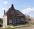
Varik
Appearance
Varik | |
|---|---|
Village | |
 Varik, windmill: korenmolen de Bol | |
| Coordinates: 51°49′24″N 5°22′9″E / 51.82333°N 5.36917°E | |
| Country | Netherlands |
| Province | Gelderland |
| Municipality | West Betuwe |
| Area | |
| • Total | 5.53 km2 (2.14 sq mi) |
| Elevation | 6 m (20 ft) |
| Population (2021)[1] | |
| • Total | 1,070 |
| • Density | 190/km2 (500/sq mi) |
| Time zone | UTC+1 (CET) |
| • Summer (DST) | UTC+2 (CEST) |
| Postal code | 4064[1] |
| Dialing code | 0344 |
Varik is a village in the Dutch province of Gelderland. It is a part of the municipality of West Betuwe, and lies about 8 km south of Tiel.
Varik was a separate municipality until 1978, when it became a part of Neerijnen.[3]
History
[edit]It was first mentioned between 968 and 971 as Feldrike. The etymology is unclear.[4] Varik developed along the Waal River as a stretched out esdorp The tower of the Dutch Reformed Church dates from the 15th century and received its spire in 1844. The church building dates from 1881. The Roman Catholic church was constructed between 1877 and 1879.[5] In 1840, Varik was home to 749 people.[6] The grist mill De Bol was built in1867, and nowadays serves as a residential house.[7]
Born in Varik
[edit]Gallery
[edit]-
Farm near the dike
-
Dutch Reformed Church
-
Clergy house
-
House on the dike
References
[edit]- ^ a b c "Kerncijfers wijken en buurten 2021". Central Bureau of Statistics. Retrieved 24 March 2022.
two entries
- ^ "Postcodetool for 4064CB". Actueel Hoogtebestand Nederland (in Dutch). Het Waterschapshuis. Retrieved 24 March 2022.
- ^ Ad van der Meer and Onno Boonstra, Repertorium van Nederlandse gemeenten, KNAW, 2011.
- ^ "Varik - (geografische naam)". Etymologiebank (in Dutch). Retrieved 24 March 2022.
- ^ Ronald Stenvert & Sabine Broekhoven (2000). "Varik" (in Dutch). Zwolle: Waanders. ISBN 90 400 9406 3. Retrieved 24 March 2022.
- ^ "Varik". Plaatsengids (in Dutch). Retrieved 24 March 2022.
- ^ "De Bol". Molen database (in Dutch). Retrieved 24 March 2022.


