Westwood Power Station
Appearance
| Westwood Power Station | |
|---|---|
 | |
| Country | England |
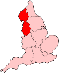
| Location | Greater Manchester, North West England |
| Coordinates | 53°32′18″N 2°37′40″W / 53.538197°N 2.627654°W |
| Commission date | 1950s |
| Decommission date | 1980s |
| Operator | Central Electricity Generating Board |
| Thermal power station | |
| Primary fuel | Coal-fired |
grid reference SD585048 | |
Westwood Power Station was a coal-fired power station situated adjacent to the Leeds and Liverpool Canal in Ince-in-Makerfield in Greater Manchester, North West England. The station was constructed in 1950. It used two 314 feet (96 m) tall cooling towers to cool its water. The station was demolished in 1989.[1]
References
- ^ "Westwood Power Station" (PHP). http://www.wiganworld.co.uk/. Retrieved 8 March 2009.
{{cite web}}: External link in|work=

