
Wikipedia:Graphics Lab/Map workshop/Archive/Apr 2023
| This page is an archive. Do not edit the contents of this page. Please direct any additional comments to the current main page. |
 | Archives of 2023: January, February, March, April, May, June, July, August, September, October, November, December |
Distribution of the indigenous peoples of Siberia in Siberia
-
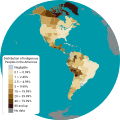 Make the map in the same style as this image.

- Article(s)
- Indigenous peoples of Siberia
- Request
- Make a map of the distribution of the indigenous peoples of Siberia in Siberia in the same style as this image. -- Treetoes023 (talk) 00:50, 2 April 2023 (UTC)
- Discussion
Administrative division of the Czech Republic
- Article(s)
- Administrativní dělení Česka
- Request
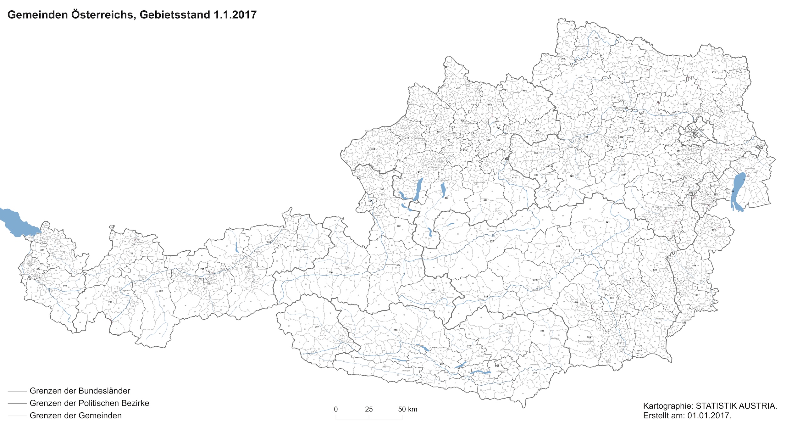
- Hi, would it be possible to create .svg administrative municipal location map of the Czech Republic (similar to this map of Austria: https://en.populationdata.net/wp-content/uploads/2017/01/autriche-administrative-1.jpg also similar to https://upload.wikimedia.org/wikipedia/commons/f/fd/Germany_%28%2Bdistricts_%2Bmunicipalities%29_location_map_current.svg) As background map should be used: https://es.m.wikipedia.org/wiki/Archivo:Czech_Republic_adm_location_map.svg
Note: article exists only in Czech (https://cs.wikipedia.org/wiki/Administrativn%C3%AD_d%C4%9Blen%C3%AD_%C4%8Ceska#:~:text=%C4%8Cesk%C3%A1%20republika%20se%20d%C4%9Bl%C3%AD%20na,na%20rove%C5%88%20postaven%C3%BDch%20vojensk%C3%BDch%20%C3%BAjezd%C5%AF.)
- Discussion
Havana Consejo Popular Map
-
 Map of Municipalities of Havana with Centro Habana shaded.
 -
 Map of Centro Habana with CP Cayo Hueso shaded.
 -
 Map of Havana with CP Diezmero, San Miguel del Padrón shaded.

.png)
.png)
- Article(s)
- Havana
- Request
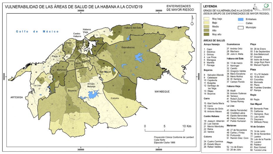
- The consejo popular (CP) or transalted as "Popular Councils" in english are basically electoral wards of Cuba. Im requesting a CP blank map of Havana, that we can also use as a location map. I would also like one for every province, but its hard to find maps of the CP in rural areas so only Havana will be good. Source - CubanoBoi (talk) 22:49, 4 April 2023 (UTC)
- Discussion
Post-imperial organisations map - Gabon, Togo, Vanuatu, The Gambia and the Maldives
{{resolved}} (this request is also present in the Commons:Graphic Lab/Map workshop)

- Article(s)
- Any article this map already appears on.
- Request
- Alright, could someone please make the following changes to the above map:
- 1) Gabon and Togo joined the Commonwealth of Nations on 25 June 2022, while also retaining their membership of La Francophonie, hence they should be changed to blue-and-red stripes (like Canada, Cameroon and Rwanda) to refect that.
- 2) Vanuatu has been a member of both the CON and LF since independence, so it should also have blue-and-red stripes.
- 3) The Gambia and the Maldives rejoined the Commonwealth in 2018 and 2020 respectively, so they should both be changed from white to red.
- Thanks. Snow Lion Fenian (talk) 10:32, 23 May 2023 (UTC)
- Discussion
![]() Request taken by Dragon401k (talk) 17:19, 23 May 2023 (UTC).
Request taken by Dragon401k (talk) 17:19, 23 May 2023 (UTC).

- I made an SVG version that includes all of your changes plus a few more changes for accuracy I noticed while compiling the list of members of each organization. Something's wonky with the striped patterns that's making them disappear from the thumbnail, so I'm not marking this complete yet, as I'll come back later and fix it (may need to just have different colors to show each combination). — Preceding unsigned comment added by Dragon401k (talk • contribs) 18:45, 23 May 2023 (UTC)
- @Snow Lion Fenian
 Done So it seems like the problem with the first version is that when rendering patterns that are less than 1px wide at a given resolution, librsvg just fails to load the entire pattern. The size of this map versus the size of some of the micronations that need patterned fills means it's not practical to use patterns here. I've gone ahead and combined the colors of each pair of organizations to create a color to denote "both X and Y", but it's tricky to create colors that 1) look nice 2) are colorblind accessible and 3) make intuitive sense with this set of data. Happy to let someone else take a stab at this! I'm not going to add the {{vector version available}} template to the PNG version since I don't think the SVG one is vastly superior. Dragon401k (talk) 22:15, 23 May 2023 (UTC)
- @Dragon401k: That's fantastic, thank you for doing this so quickly! It's so great to have an SVG version of this map with all the necessary corrections.
- Say, I know this wasn't part of my original request, but while we're still here, I can't help but ask if you'd be willing to add the Community of Portuguese Language Countries (which has nine members) to the SVG map, as it seems as though it would fit into the same category as the other international organisations already shown? Or would you rather if I made that as a separate request? Snow Lion Fenian (talk) 23:14, 23 May 2023 (UTC)
- Adding CPLC to the map complicates it in a way I think makes it far less readable, adding five new categories to cover just 9 total countries. Here's a preview of a version I mocked up that adds CPLC in black (so combinations are just darkened versions of the other colors). I don't think it makes for a good/useful map.
- Just brainstorming here, but one way to get around this would be to outline the countries with the color instead of filling them in, so that you could stack outlines on top of each other to show countries with multiple affiliations. I have no idea how to even begin accomplishing that cleanly-- I messed around in Inkscape for awhile to make this as a proof of concept, but there's loads of issues (see the outlines of the French overseas departments drifting way off course, plus I accomplished this by duplicating each country, which adds a ton of bloat to the file). Maybe someone with a better grasp on SVG editing could figure out a way to accomplish this, or maybe there's another way to display this info more cleanly, but as is that's all I've got. Dragon401k (talk) 01:53, 24 May 2023 (UTC)
- @Dragon401k: That's okay, I understand your concerns. And don't worry about the issue of the shadings. I'll most likely make another request at some point in the future, to see if anyone can do the things you pointed out. Anyhow, thanks again for creating this great SVG map, I appreciate it greatly. Snow Lion Fenian (talk) 12:07, 24 May 2023 (UTC)
- Say, I know this wasn't part of my original request, but while we're still here, I can't help but ask if you'd be willing to add the Community of Portuguese Language Countries (which has nine members) to the SVG map, as it seems as though it would fit into the same category as the other international organisations already shown? Or would you rather if I made that as a separate request? Snow Lion Fenian (talk) 23:14, 23 May 2023 (UTC)
New shark range map
-
 The current one
 -
 Finished map


- Article(s)
- Oceanic whitetip shark
- Request
- Make a new range map for the oceanic whitetip shark based on the new IUCN map. The current one is outdated. LittleJerry (talk) 00:30, 30 March 2023 (UTC)
- Discussion
- I'll look into it, though at first glance, I can't see a substantial difference between the two. M.Bitton (talk) 16:21, 30 March 2023 (UTC)
 Request taken by M.Bitton (talk) 11:32, 12 April 2023 (UTC).
- @LittleJerry: Done M.Bitton (talk) 20:40, 12 April 2023 (UTC)
- Thank you! LittleJerry (talk) 20:48, 12 April 2023 (UTC)
Wolf Distribution Maps
- Requested Maps to edit
-
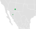 Mexican wolf (Canis lupus baileyi) range
 -
 North American wolf subspecies distribution
 -
 Global range of Canis lupus according to IUCN, including national borders

_%26_MSW3_(2005).png)
- Article(s)
- Mexican wolf
- List of gray wolf populations by country
- Northern Rocky Mountain wolf
- Southern Rocky Mountain wolf
- Arctic wolf
- Alaskan tundra wolf
- Great Plains wolf
- Interior Alaskan wolf
- Greenland wolf
- Northwestern wolf
- Baffin Island wolf
- Mackenzie River wolf
- Alexander Archipelago wolf
- Labrador wolf
- Hudson Bay wolf
- Vancouver Coastal Sea wolf
- British Columbia wolf
- Kenai Peninsula wolf
- Newfoundland wolf
- Bernard's wolf
- Cascade mountain wolf
- Manitoba wolf
- Mogollon mountain wolf
- Texas wolf
- Request
- I'd like to request the following updates to wolf distribution maps in all of the articles listed (Sources with detailed maps below):
Mexican wolf range: The Arizona and New Mexico ranges should expand northward, at least to Highway I-40. This is the farthest north that they are currently allowed by the US Fish and Wildlife Service, and individuals often disperse this far.
The Arizona range should be expanded westward toward at least the center of the state, and southward toward the border with Mexico.
The New Mexico range should also be expanded south toward the Mexico border, and eastward toward Highway I-25.
Great Lakes Wolf Range: Expanded range southward into Wisconsin
Northern Rockies Gray Wolf Range: Expanded range in Wyoming (southward)
Expanded range in Oregon and Washington State (eastward)
Presence in northern California and northern Colorado
Sources: The updated Mexican Wolf population distribution can be viewed here: https://www.fws.gov/species/mexican-wolf-canis-lupus-baileyi/map
The updated Mexican Wolf Experimental Population Area and Blue Range Recovery Area in the US can be found here: https://www.fws.gov/program/conserving-mexican-wolf/species
This US Federal Government delisting of Gray wolves from 2020 includes up-to-date maps of all wolf distributions and future range to expand in the US: https://www.regulations.gov/document/FWS-HQ-ES-2018-0097-107831
It's a long document, but the updated map I'm referring to is Figure 2: https://img.federalregister.gov/ER03NO20.017/ER03NO20.017_original_size.png
Summary Most of the articles listed above contain the same maps (North American Gray Wolf Subspecies Ranges), and would just need to replace that one map in each.
If these maps need to be prioritized, I request that the Mexican wolf Distribution map take precedence as it requires the greatest update, since the current map shows only two points where they were introduced. However, their present distribution and future range has greatly expanded (see first source).
Thank you for reviewing this request. This is my first time requesting a map update, so I apologize for any unnecessary complexity or missing elements. Please let me know if I can elaborate on anything and/or provide additional sources.
-- Bbreslau (talk) 08:07, 28 February 2023 (UTC)
- Discussion
Aswell, me (User:Gimly24), would like to request the distributional updates to European wolves. I am currently recensing studies and links in Talk:List of gray wolf populations by country but I for some countries, I already know what map i would give as source for the updates i would like :
Europe (2012-2016) : (https://www.lcie.org/Large-carnivores/Wolf-)
The above give a general overlook of the then distribution of wolves in Europe. It expanded considerably since.
Austria : Map 2020-2021 (https://www.lifewolfalps.eu/wp-content/uploads/2022/07/AUSTRIA_Wolf_monitoring_annual_report_2020-2021_VUW.pdf)
Also see : https://baer-wolf-luchs.at/verbreitungskarten/wolf-verbreitung (Wolf - Distribution Austria, 2023, 2022, and before)
Czechia/Czech Republic : Map 2020/2021 (http://www.mapa.selmy.cz/cs?layers=101)
Finland : Map 2022 (https://luonnonvaratieto.luke.fi/kartat?panel=suurpedot) (Wolf, Territory Boundaries)
France : Map 2020-2021 (https://www.loupfrance.fr/wp-content/uploads/BILAN_ESTIVAL_2021_3.pdf)
Germany : Map 2021-2022 (https://www.dbb-wolf.de/Wolfsvorkommen/besetzte-Rasterzellen)
Romania : Map by the Romanian Ministry of Environment (2016?) (https://drive.google.com/file/d/13J1t5prJRf-kTqudj5MH09IhQJxAxwj0/view)
- in "Wolf (Canis lupus) in the Eastern Romanian Carpathians: First estimates of population parameters based on a non-invasive integrated sampling design" (Sin et al, 2017)
Scandinavia (Norway/Sweden) : Map 2021-2022 (https://brage.nina.no/nina-xmlui/bitstream/handle/11250/2997123/bestandsstatusstorerovdyr2022_1.pdf?sequence=3&isAllowed=y)
Slovenia : Map 2020-2021 (https://www.lifewolfalps.eu/wp-content/uploads/2022/04/C4_ER_Wolf_monitoring_annual_report_2020-2021_SLO.pdf (Monitoring of Conservation Status of Wolves in Slovenia in 2020-2021 season, SUMMARY)
Switzerland :
- MAP 2016 (https://www.loupfrance.fr/wp-content/uploads/WAG_report_2015_2016_final1.pdf) [I might change the link if i find a newer one]
- MAP 2023 (https://chwolf.org/woelfe-in-der-schweiz/wolfspraesenz/aktuelle-daten)
I will probably edit my comments and perhaps add some articles pages to the above comments by @User:Bbreslau later.
Thank you very much.
Signature : Gimly24 (talk) 21:13, 5 March 2023 (UTC)
Adultery laws (US states) map update
{{resolved}}
-
 Map
Map -
 Finished map


- Article(s)
- Adultery laws
- Request
- Minnesota to be colored in light pink (for repeals past 2020), same as Idaho, the bill has just been signed into law -- Fixmaster (talk) 16:32, 22 May 2023 (UTC)
- Discussion
![]() Request taken by Dragon401k (talk) 22:47, 22 May 2023 (UTC).
Request taken by Dragon401k (talk) 22:47, 22 May 2023 (UTC).
- Done I created an SVG version, made the change you requested with Minnesota, altered the color scheme to be more readable, and collapsed the categories from 10 year to 20 years, because with the old version there were a couple of colors that had only 1 or 2 states associated. I also added US territories to the map-- PR is the only territory with adultery laws ever on the books, as far as I could tell. Dragon401k (talk) 00:32, 23 May 2023 (UTC)
Silk Road map
{{resolved}}
-
 current image
 -
 Template

.svg)
- Article(s)
- Silk Road and other related articles
- Request
- Can someone reproject the routes in the flat map image to a glove like in the template? I don't have any experience with working with Generic Mapping Tools. CactiStaccingCrane (talk) 13:57, 30 May 2023 (UTC)
- Discussion
- Done File:Silk_road_Kazakhstan.svg. Without being sure of the projection used in the original map, I have manually warped the route onto the sphere in inkscape by eyeballing the positions of the towns along it. After about an hour of refinement using this process, I think this is an acceptable result. I'm not sure if you wanted Kazakhstan to remain highlighted, but that can easily be removed. small jars
tc19:45, 31 May 2023 (UTC)
- Thanks a lot for your hard work! I know how to fix Kazakhstan color and increase the stroke thickness in SVG, so don't worry about it. CactiStaccingCrane (talk) 03:43, 1 June 2023 (UTC)
Accessibility improvements for distribution of Quechuan languages
{{Resolved}}
-
 Map of the current distribution of the Quechuan languages (solid) with the historical extent of the Inca Empire (shaded)
.svg)
- Article(s)
- Quechuan languages
- Quechua people
- Request
- This map may be hard to read for people with difficulty seeing low-contrast images, or for people viewing a smaller thumbnail. Please reformat it so that it is easier to understand. Guidance may be found at MOS:CONTRAST. Thanks! -- Wracking 💬 18:05, 23 March 2023 (UTC)
- Discussion
@Wracking ![]() Done Dragon401k (talk) 17:11, 5 May 2023 (UTC)
Done Dragon401k (talk) 17:11, 5 May 2023 (UTC)
- Thank you so much, @Dragon401k!! Much appreciated. Wracking 💬 17:14, 5 May 2023 (UTC)
Aral Sea Isolines
{{resolved}} Have gotten a textfile [sic!] that should contain the shorelines of the shrinking Aral Sea, from a local researcher. But I cannot open the file in QGIS or Inkscape, it is somewhat broken. Could one of the more skilled people here look at that file?--Antemister (talk) 18:12, 30 March 2023 (UTC)
- @Antemister: where is the file? You can paste it here. M.Bitton (talk) 12:48, 4 May 2023 (UTC)
- @M.Bitton:, did not look here in the meantime, was told by a GIS expert that the file is broken.--Antemister (talk) 17:10, 27 May 2023 (UTC)
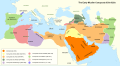
Improved, English Map of the Early Muslim Conquests (ca. 632-750)
{{resolved}}
-
 An old (1886) German-language map showing the main phases of the early Muslim conquest by reign (i.e. expansion phases under the various caliphs)
 -
 A modern map of the Umayyad Caliphate at its height in c. 740 by Cplakidas
 -
 Map by Amitchell125


- Article(s)
- Early Muslim conquests; Rashidun Caliphate, Umayyad Caliphate, Abu Bakr, Umar, Uthman, Mu'awiya I (FA), Abd al-Malik ibn Marwan (FA), and al-Walid I (FAC).
- Request
- A new, English-language map showing the phases of the early Muslim conquests (632–715) by reign. Our best map depicting the main phases of the early Muslim conquests by reign dates to the late 19th century, is in German, not high quality, too detailed, and needs to be recolored for clarity. The quality and issues with the map have been raised by reviewers in a number of FAC's, most recently the current FAC for al-Walid I. The new map should essentially be based on the German map but with far less detail. It should show the main expansion phases under Abu Bakr, Umar, Uthman, Mu'awiya I, Abd al-Malik, and al-Walid. It can use the second map above showing the Umayyad Caliphate at its height in 740 and the major neighboring states and peoples as its template. One important change would be to show the entire Maghreb region (Morocco) as it is cut off from the other two maps. Ideally, the revised can be easily amended by other users in the near future. -- Al Ameer (talk) 18:15, 30 March 2023 (UTC)
- Discussion
![]() Request taken by Amitchell125 (talk) 15:21, 2 April 2023 (UTC).
Request taken by Amitchell125 (talk) 15:21, 2 April 2023 (UTC).
- Done Amitchell125 (talk) 20:30, 28 April 2023 (UTC)
Opuntia austrina range map update
{{resolved}}
-
 Current range map
 -
 Map showing the range of the Opuntia austrinaExtant (resident)


- Article(s)
- Opuntia austrina
- Request
- Current range map is too broad. Need a replacement that matches the range shown at https://www.iucnredlist.org/species/199642/121620558 -- UtherSRG (talk) 15:50, 20 April 2023 (UTC)
- Discussion
- Request taken by M.Bitton (talk) 17:36, 21 April 2023 (UTC).
- @UtherSRG: Done please note that unlike the source it's based on, this map shows Lake Okeechobee and Lake Istokpoga. Let me know if you'd rather have them hidden. M.Bitton (talk) 15:24, 22 April 2023 (UTC)
Horn of Africa relief map
{{Resolved}}
-
 Non relief map
 -
 Relief map
.svg)

- Article(s)
- Nairobi, Mogadishu, Kisumu
- Request
- While there is an existing map of the Horn of Africa in the appropriate template, there is no relief map specific to the region, which means that articles like Nairobi, Mogadishu, and Kisumi have a strange-looking map in the infobox, which cycles between standard and relief maps. Would it be possible to easily create a relief map based on the existing non-relief map?
Existing module with the non-relief map
I've never created a map before but would be very keen to take a stab if there's a good guide on how to get started (just couldn't find any, so if there are those which I couldn't see, please link me)
Thanks!!
-- KluskaSlaska (talk) 08:36, 6 May 2023 (UTC)
- Discussion
- Request taken by M.Bitton (talk) 00:25, 12 May 2023 (UTC).
- @KluskaSlaska: Done I kept the borders unchanged, except for Somaliland's (it was slightly off). M.Bitton (talk) 21:53, 14 May 2023 (UTC)
- @M.Bitton: oh wow, this looks amazing. Thanks so much for taking the time and for the beautiful result :) this week is super hectic but will start to integrate the map into articles next week! KluskaSlaska (talk) 07:10, 16 May 2023 (UTC)
South Carolina Area Code Maps
{{Resolved}}
-
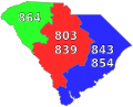 South Carolina area code map
 -
 SC area code 864 map
 -
 SC area code 803 (and 839) map
 -
 SC Area code 843 (and 854) map


- Article(s)
- List of South Carolina area codes, Area code 864, Area codes 803 and 839, Area codes 843 and 854
- Request
- All four maps need to be updated to include the new area code of 839 and 854. It would be greatly appreciated if someone could update these maps but the first file should be prioritized the most. The changes that are needed in all four files are: 864 (green color), no change; 803 (red color), add 839 below the number there currently; 843 (blue color), add 854 below the number there currently. Thank you for your time and have a great day! -- DiscoA340 (talk) 23:39, 10 May 2023 (UTC)
- Discussion
![]() Request taken by Dragon401k (talk) 21:40, 13 May 2023 (UTC).
Request taken by Dragon401k (talk) 21:40, 13 May 2023 (UTC).
-
 South Carolina Area Code 864
 -
 South Carolina Area Codes 803 and 839
 -
 South Carolina Area Codes 843 and 854


![]() Done @DiscoA340 I updated the main map and uploaded .svg versions of the three specific maps (could't overwrite the existing ones as they're .png files). You'll need to manually switch out any use of the old .png files with the new .svg ones in order to make use of them. Dragon401k (talk) 22:08, 13 May 2023 (UTC)
Done @DiscoA340 I updated the main map and uploaded .svg versions of the three specific maps (could't overwrite the existing ones as they're .png files). You'll need to manually switch out any use of the old .png files with the new .svg ones in order to make use of them. Dragon401k (talk) 22:08, 13 May 2023 (UTC)
- @Dragon401k Much appreciated, have a great day! DiscoA340 (talk) 02:25, 14 May 2023 (UTC)
New location map for Vancouver Island
{{resolved}}
-
 Current location map
 -
 New map
 -
 New relief map


- Article(s)
- List of articles on Wiki image page: https://en.wikipedia.org/wiki/File:Vancouver_Island_contour_map.png
- Request
- I'm not totally sure on the process of altering a location map. While I appreciate the retro nature of the existing one for Vancouver Island, it would be lovely to have an updated map with topography (and another with just lines would be bonus) that could be used particularly for infoboxes!
- For example, in the style of the Washington state location maps. In addition to topography/rivers/coastline, it would be good to show the Canada-USA border.
- If someone has time to take up this request, thanks so much in advance and I can integrate into existing articles. Would love to learn how to make those template-style maps at some point. Cheers! Uninspired Username (talk) 19:19, 24 May 2023 (UTC)
- Discussion
- Hi Uninspired Username, Done with File:Canada Vancouver Island location map.svg. I've also updated the module so all pages using the old location map should be updated. I've chosen a better projection and used an inset, though I'm happy to make modifications as desired. I wasn't sure if you wanted a relief map (showing gradients, etc.), but I thought it would be best to bring the current location map up to standard first. I can have a go at making a map like this if desired (thought I am not great at these).
- As for making a map yourself, it's a bit of a steep learning curve but have a look at the navbox at the bottom of the conventions to learn a bit about it. Hope this helps – Isochrone (T) 16:28, 4 June 2023 (UTC)
- I've also made a relief map. It's not perfect, and I'll work on improving it later. Perhaps someone else who is more experienced with such maps can have a go as well. – Isochrone (T) 19:30, 4 June 2023 (UTC)
- Thank you so much! You are making dreams come true! These are excellent, and a big improvement. Cheers, Uninspired Username (talk) 03:47, 5 June 2023 (UTC)
- I've also made a relief map. It's not perfect, and I'll work on improving it later. Perhaps someone else who is more experienced with such maps can have a go as well. – Isochrone (T) 19:30, 4 June 2023 (UTC)
Northwest Territory
-

-
 New map

.svg)
Hello. I created this map in 2004. It is very small and very terrible and I never dreamed it would still be in use in 2023 and on multiple wikis. As a mercy to a middle-school student who may need to use it in a report, I humbly request that someone please remake it. Thank you kindly.
jengod (talk) 19:51, 30 March 2023 (UTC)
- How much of the original text do you want to keep in the new image? Qbox673 (talk) 16:58, 23 April 2023 (UTC)
- Pinging @Jengod – Isochrone (T) 14:48, 5 June 2023 (UTC)
- Oh wow hello @Qbox673 and @Isochrone. Keep Mississippi River, Ohio River and Great Lakes please, partly bc the official name was like Territory Northwest of the River Ohio or something. The rest can (and should!) be explained in a caption. Gosh I'm so nervous.
- Other NW Territory maps if they help:
- Thank you. jengod (talk) 15:01, 5 June 2023 (UTC)
- Hi Jengod, Done with File:Northwest Territory locator map (1787).svg. Feel free to suggest any changes. – Isochrone (T) 18:17, 5 June 2023 (UTC)
- That is very very wonderful. I'm having a moment right now—Wikipedia is so full of diverse talents and skills. Thank you Isochrone. I don't know SOP on map/graphic replacement but for now I'm going to replace on a few key pages and hopefully it will filter. Really, thank you. jengod (talk) 18:30, 5 June 2023 (UTC)
- Hi Jengod,
- Pinging @Jengod – Isochrone (T) 14:48, 5 June 2023 (UTC)
Locator map of Kurdistan in the gray and green globe scheme
-
 Map of Kurdistan.
 -
 New map
_box_inset_removed.jpg)
.svg)
- Article(s)
- Kurdistan
- Request
- Create a locator map of Kurdistan in the gray and green globe scheme.
- Color Kurdistan this shade of green:
- Color the countries that Kurdistan is located in this shade of green:
- -- Treetoes023 (talk) 12:01, 22 May 2023 (UTC)
- Discussion
- @M.Bitton: Would you be up to the task? – Treetoes023 (talk) 11:53, 23 May 2023 (UTC)
- Request taken. – Isochrone (T) 16:43, 5 June 2023 (UTC)
- Treetoes023 Done with File:Kurdish-inhabited areas (orthographic projection with inset).svg. Feel free to suggest any modifications if applicable (I added an inset but can also make a version without it if wanted). – Isochrone (T) 16:55, 5 June 2023 (UTC)
-
- @Isochrone: Thank you so much! – Treetoes023 (talk) 15:45, 6 June 2023 (UTC)
-
- Treetoes023
{{Resolved}}
Bloc Québécois 2019 election results

- Article(s)
- Bloc Québécois
- 2019 Canadian federal election
- Results of the 2019 Canadian federal election
- Request
- Hi i just wondering i saw a map (above) on the page of Bloc Québécois and it was the low point of the party in 2015 election, can somebody make a Map for the 2019 elections on the party's showing then. Thanks. La lopi (talk) 11:03, 17 February 2023 (UTC)
Here are the results.
- Avignon—La Mitis—Matane—Matapédia, PQ got 51.43%
- Bellechasse—Les Etchemins—Lévis, PQ got 22.89%
- Gaspésie—Les Îles-de-la-Madeleine, PQ got 40.80%
- Montmagny—L'Islet—Kamouraska—Rivière-du-Loup, PQ got 32.27%
- Rimouski-Neigette—Témiscouata—Les Basques, PQ got 37.83%
- Beauport—Côte-de-Beaupré—Île d'Orléans—Charlevoix, PQ got 36.35%
- Chicoutimi—Le Fjord, PQ got 34.91%
- Jonquière, PQ got 35.60%
- Lac-Saint-Jean, PQ got 43.96%
- Manicouagan, PQ got 53.89%
- Beauport—Limoilou, PQ got 30.18%
- Charlesbourg—Haute-Saint-Charles, PQ got 27.16%
- Louis-Hébert, PQ got 28.00%
- Louis-Saint-Laurent, PQ got 22.38%
- Québec, PQ got 32.70%
- Bécancour—Nicolet—Saurel, PQ got 56.66%
- Berthier—Maskinongé, PQ got 37.62%
- Joliette, PQ got 58.22%
- Lévis—Lotbinière, PQ got 25.08%
- Montcalm, PQ got 58.01%
- Portneuf—Jacques-Cartier, PQ got 24.29%
- Repentigny, PQ got 53.22%
- Saint-Maurice—Champlain, PQ got 34.15%
- Trois-Rivières, PQ got 28.48%
- Beauce, PQ got 14.15%
- Brome—Missisquoi, PQ got 34.43%
- Compton—Stanstead, PQ got 31.89%
- Drummond, PQ got 44.82%
- Mégantic—L'Érable, PQ got 25.78%
- Richmond—Arthabaska, PQ got 28.21%
- Saint-Hyacinthe—Bagot, PQ got 41.39%
- Shefford, PQ got 38.58%
- Sherbrooke, PQ got 25.90%
- Beloeil—Chambly, PQ got 50.46%
- Brossard—Saint-Lambert, PQ got 19.65%
- Châteauguay—Lacolle, PQ got 37.17%
- La Prairie, PQ got 41.76%
- Longueuil—Charles-LeMoyne, PQ got 36.46%
- Longueuil—Saint-Hubert, PQ got 38.54%
- Montarville, PQ got 42.83%
- Pierre-Boucher—Les Patriotes—Verchères, PQ got 51.02%
- Saint-Jean, PQ got 44.85%
- Salaberry—Suroît, PQ got 47.65%
- Vaudreuil—Soulanges, PQ got 24.36%
- Hochelaga, PQ got 33.34%
- Honoré-Mercier, PQ got 19.81%
- La Pointe-de-l'Île, PQ got 46.84%
- Laurier—Sainte-Marie, PQ got 22.82%
- Rosemont—La Petite-Patrie, PQ got 23.76%
- Dorval—Lachine—LaSalle, PQ got 17.07%
- Lac-Saint-Louis, PQ got 5.32%
- LaSalle—Émard—Verdun, PQ got 24.09%
- Mount Royal, PQ got 4.02%
- Notre-Dame-de-Grâce—Westmount, PQ got 4.69%
- Outremont, PQ got 13.85%
- Pierrefonds—Dollard, PQ got 8.06%
- Saint-Laurent, PQ got 7.09%
- Ville-Marie—Le Sud-Ouest—Île-des-Sœurs, PQ got 13.14%
- Ahuntsic-Cartierville, PQ got 21.73%
- Alfred-Pellan, PQ got 28.63%
- Bourassa, PQ got 22.41%
- Laval—Les Îles, PQ got 20.61%
- Marc-Aurèle-Fortin, PQ got 32.37%
- Papineau, PQ got 16.00%
- Saint-Léonard—Saint-Michel, PQ got 9.58%
- Vimy, PQ got 27.83%
- Abitibi—Baie-James—Nunavik—Eeyou, PQ got 36.11%
- Abitibi—Témiscamingue, PQ got 45.47%
- Argenteuil—La Petite-Nation, PQ got 36.34%
- Gatineau, PQ got 21.38%
- Hull—Aylmer, PQ got 14.57%
- Laurentides—Labelle, PQ got 46.82%
- Mirabel, PQ got 51.08%
- Pontiac, PQ got 16.05%
- Rivière-des-Mille-Îles, PQ got 40.61%
- Rivière-du-Nord, PQ got 52.05%
- Terrebonne, PQ got 50.59%
- Thérèse-De Blainville, PQ got 41.82%
La lopi (talk) 02:15, 22 March 2023 (UTC) ??? La lopi (talk) 10:31, 24 April 2023 (UTC)
- Discussion
Request for the tornado outbreak of May 23–24, 1946
-
 Example of the style of map being requested and example for the triangles and lines explained below

- Article(s)
- Tornado outbreak of May 23–24, 1946
- Request
- A lot tornado outbreaks articles have a map showing either the intensity of the tornadoes or in recent years intensity plus tracks. There is no exact coordinates for any of the tornadoes from this outbreak, but we have intensity and approximate locations and approximate tracks (i.e. X town to Y town to Z town). Is it possible to get a map with like a triangle at the approximate start location (or only mentioned location for some) and a line matching that color along with a triangle at the start for the ones with an approximate path? All the tornadoes were rated on the Fujita scale, which has a color table established for each of the 7 ratings. For the source, recommend using the article’s table, which provides “location” (town), county/parish, and state. -- Elijahandskip (talk) 01:01, 28 April 2023 (UTC)
- Discussion