
Yokoshibahikari
Yokoshibahikari
横芝光町 | |
|---|---|
Town | |
 Hamlet of Hikari, Chiba | |
 Flag  Seal | |
 Location of Yokoshibahikari in Chiba Prefecture | |
 Yokoshibahikari | |
| Coordinates: 35°40′N 140°30′E / 35.667°N 140.500°E | |
| Country | Japan |
| Region | Kantō |
| Prefecture | Chiba Prefecture |
| District | Sanbu |
| Area | |
| • Total | 66.91 km2 (25.83 sq mi) |
| Population (April 2012) | |
| • Total | 24,315 |
| • Density | 363/km2 (940/sq mi) |
| Time zone | UTC+9 (Japan Standard Time) |
| City symbols | |
| • Tree | Prunus mume |
| • Flower | Sakura |
| • Bird | Little tern |
| Phone number | 0479-84-1211 |
| Address | 11902 Miyagawa, Yohoshibahikaro-machi, Chiba-ken 289-1727 |
| Website | http://www.town.yokoshibahikari.chiba.jp/ |

Yokoshibahikari (横芝光町, Yokoshibahikari-machi) is a town located in Chiba Prefecture, Japan. As of April 2012, the town had an estimated population of 24,315, and a population density of 363 persons per km2. The total area is 66.91 km2.[1]
Geography
Yokoshibahikari is located in northeastern Bōsō Peninsula, bordered by the Pacific Ocean to the east. The town lacks a center, but instead consists of a collection of hamlets scattered over the countryside extending from the Yokoshiba Station on the Sōbu Main Line. Given such sparse structure, it takes quite a long time for the bus lines to serve the whole town. The coastal area of Yokoshibahikari, which makes up part of Kujūkuri Beach, is protected as part of Kujūkuri Prefectural Natural Park.[1]
Surrounding Municipalities
History
Yokoshibahikari was formed by the merger on March 27, 2006 of the towns of Hikari, from Sōsa District, and the town of Yokoshiba, from Sanbu District. Sōsa District was dissolved as a result of this merger.
Economy
Agriculture has been a mainstay of the economy of Yokoshibahikari since early times. The town has a cool winter and mild summer. Other than extensive rice cultivation, the town is a center of production of negi, the Welsh onion, tomatoes, and kabocha, a Japanese variety of winter squash. Pig and dairy farms are also found in the town.[1] The town traditionally produced ceramics. In 1991 the northern part of the town was designated as the Yokoshiba Industrial Park due to its close proximity to Narita International Airport.
Transportation
Railway
Highway
Noted people from Sodegaura
- Konishiki Yasokichi I – Sumo wrestler
Gallery
-
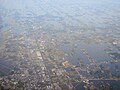 Yokoshiba (foreground) and Miyagawa (background)
 -
 Hikari (near Arai)

References
External links
| Chiba |
| |||
|---|---|---|---|---|
| Core cities | ||||
| Cities | ||||
| Districts | ||||