Konya Airport
Appearance
Konya Airport Konya Havalimanı | |||||||||||||||
|---|---|---|---|---|---|---|---|---|---|---|---|---|---|---|---|
 | |||||||||||||||
| Summary | |||||||||||||||
| Airport type | Public / military | ||||||||||||||
| Operator | DHMİ (State Airports Administration) Turkish Air Force | ||||||||||||||
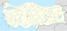
| Location | Konya, Turkey | ||||||||||||||
| Elevation AMSL | 3,381 ft / 1,031 m | ||||||||||||||
| Coordinates | 37°58′44.40″N 032°33′42.70″E / 37.9790000°N 32.5618611°E | ||||||||||||||
| Map | |||||||||||||||
 | |||||||||||||||
| Runways | |||||||||||||||
| |||||||||||||||
Konya Airport (Template:Lang-tr) (IATA: KYA, ICAO: LTAN) is a military air base and public airport in Konya, Turkey. The airport is also used by NATO. Opened to the public in 2000, the airport is 18 km from the city. In 2006, Konya Airport served 2,924 aircraft and 262,561 passengers.[1] The passenger terminal of the airport covers an area of 2,650 m2 and has parking for 278 cars.
Konya Airport is home to the 3rd Air Wing (Ana Jet Üssü or AJÜ) of the 1st Air Force Command (Hava Kuvvet Komutanlığı) of the Turkish Air Force (Türk Hava Kuvvetleri). Other wings of this command are located in Eskişehir (LTBI), Ankara Akıncı (LTAE), Bandırma (LTBG) and Balıkesir (LTBF).[3]
Airlines and destinations
| Airlines | Destinations |
|---|---|
| AnadoluJet | Istanbul–Sabiha Gökçen Seasonal: Copenhagen |
| Corendon Airlines | Seasonal: Amsterdam, Rotterdam[4] |
| Pegasus Airlines | Istanbul–Sabiha Gökçen Seasonal: Copenhagen |
| SunExpress[5] | Izmir Seasonal: Amsterdam, Copenhagen, Düsseldorf, Stockholm–Arlanda[6] |
| Turkish Airlines | Istanbul |
Traffic statistics
Graphs are unavailable due to technical issues. There is more info on Phabricator and on MediaWiki.org. |
Annual passenger traffic at KYA airport.
See Wikidata query.
| Year (months) | Domestic | % change | International | % change | Total | % change |
|---|---|---|---|---|---|---|
| 2015 | 976,297 | 91,456 | 1.067,753 | |||
| 2014 | 906,530 | 82,868 | 989,398 | |||
| 2013 | 767,123 | 68,828 | 835,951 | |||
| 2012 | 590,615 | 68,594 | 659,209 | |||
| 2011 | 538,377 | 70,070 | 608,447 | |||
| 2010 | 499,040 | 46,521 | 545,561 | |||
| 2009 | 267,518 | 34,206 | 301,724 | |||
| 2008 | 230,442 | 35,701 | 266,143 | |||
| 2007 | 214,857 | 33,213 | 248,070 |
(*)Source: DHMI.gov.tr[7]
References
- ^ a b (in Turkish) Konya Hava Meydanı Archived 2010-01-13 at the Wayback Machine at DHMİ (State Airports Authority)
- ^ "Airport information for LTAN". World Aero Data. Archived from the original on 2019-03-05.
{{cite web}}: CS1 maint: unfit URL (link) Data current as of October 2006. Source: DAFIF. - ^ Turkish Air Force Archived December 13, 2007, at the Wayback Machine - Scramble
- ^ https://www.corendonairlines.com/
- ^ Liu, Jim (3 September 2020). "SunExpress 01-19SEP20 International operations as of 30AUG20". routesonline.com.
- ^ "SunExpress plans new routes in S18". routesonline.com.
- ^ Statistics
External links


