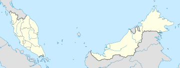
Mukim Pulai, Johor
Appearance
Pulai
Mukim Pulai | |
|---|---|
| Other transcription(s) | |
| • Jawi | ڤولاي |
| • Chinese | 蒲來 |
| • Tamil | வேளை |
 | |
| Coordinates: 1°32′00″N 103°40′00″E / 1.53333°N 103.66667°E | |
| Country | |
| State | |
| District | |
| Municipality | |
| Electorate | P161 Pulai N46 Perling N47 Kempas P162 Iskandar Puteri N49 Kota Iskandar N48 Skudai |
| Time zone | UTC+8 (MST) |
| • Summer (DST) | Not observed |
Pulai or Mukim Pulai is the largest mukim in District of Johor Bahru, State of Johor Darul Ta'zim, Federation of Malaysia.
Name

Mukim Pulai was named after Pulai River.[1] Pulai is a species of tree (sp. Alstonia angustiloba). The tree can be found in abundance at Mount Pulai where Pulai River come from.[2][3]

Geography
The mukim spans over an area of 520 km2.[1]
Administrative Centre
Pulai host most of Federal and State government and agencies in district Johor Bahru.
- Federal Government's headquarters, Wisma Persekutuan at Jalan Air Molek[4]
- Johor State Administrative Centre, Kota Iskandar[5]
- Former Johor Bahru City Council's headquarter at Jalan Tun Razak[6]
- Former Iskandar Puteri City Council's headquarter at Jalan Skudai
- New Iskandar Puteri City Council's headquarter at Medini[7]
- Johor Official Royal Palace, Istana Serene at Serene Hill[8]
- Johor Official Royal Palace, Istana Besar[9]
- Johor Government Building, Sultan Ibrahim Building at Timbalan Hill[10]
- Johor Islamic Center, Pusat Islam Iskandar at Mahmoodiah Hill[11]
Transportation
The area is easily accessible via CIQ or Senai Airport. It is accessible by Muafakat Bus route P-403.[12] or Causeway Link (5B, 51B) from Johor Bahru Sentral railway station.[13]
See also
- Johor Bahru
- Iskandar Puteri
- Pulai Mutiara, Johor
- Pulai Indah, Johor
- Pulai Hijauan, Johor
- Bandar Baru Kangkar Pulai
- Kangkar Pulai
References
- ^ a b http://jpbd.johor.gov.my/images/jpbd_DokumenTerbitan/Handbook.pdf [bare URL PDF]
- ^ "Alstonia angustiloba". Plants of the World Online. Royal Botanic Gardens, Kew. Retrieved 23 August 2020.
- ^ Sidiyasa, Kade (September 2004). "Alstonia angustiloba Miq.". In Soepadmo, E.; Saw, L. G.; Chung, R. C. K. (eds.). Tree Flora of Sabah and Sarawak. (free online from the publisher, lesser resolution scan PDF versions). Vol. 5. Forest Research Institute Malaysia. pp. 17, 19. ISBN 983-2181-59-3. Archived from the original (PDF) on 27 September 2013.
- ^ "CIMMS".
- ^ "Kota Iskandar - Johor's Living Legacy".
- ^ "Pejabat Utama dan Pejabat-pejabat lain Majlis Bandaraya Johor Bahru". 21 June 2020.
- ^ "Master Plan | Medini".
- ^ "Istana Bukit Serene, Johor Bahru". 9 January 2015.
- ^ "Istana Besar, Johor Bahru". 7 January 2015.
- ^ "Bangunan Sultan Ibrahim".
- ^ "Portal Rasmi Jabatan Agama Islam Negeri Johor – Islam Sebagai Cara Hidup".
- ^ "Laluan Bas Muafakat". Bas Muafakat Johor (in Malay). Retrieved 17 March 2018.
- ^ "Causeway Link Bus Routes & Bus Schedule".


