
Penteli, Greece
You can help expand this article with text translated from the corresponding article in Greek. (October 2012) Click [show] for important translation instructions.
|
Penteli
Πεντέλη | |
|---|---|
 | |
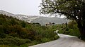
 Penteli Location within the region  | |
| Coordinates: 38°03′09″N 23°52′06″E / 38.05250°N 23.86833°E | |
| Country | Greece |
| Administrative region | Attica |
| Regional unit | North Athens |
| Government | |
| • Mayor | Natassa Kosmopoulou[1] (since 2023) |
| Area | |
• Municipality | 36.064 km2 (13.924 sq mi) |
| • Municipal unit | 28.878 km2 (11.150 sq mi) |
| Elevation | 422 m (1,385 ft) |
| Population (2021)[2] | |
• Municipality | 35,610 |
| • Density | 990/km2 (2,600/sq mi) |
| • Municipal unit | 5,076 |
| • Municipal unit density | 180/km2 (460/sq mi) |
| Time zone | UTC+2 (EET) |
| • Summer (DST) | UTC+3 (EEST) |
| Postal code | 152 36 |
| Area code(s) | 210 |
| Vehicle registration | Z |
| Website | penteli |
Penteli (Greek: Πεντέλη) is a village and a municipality in the North Athens regional unit, Attica, Greece. Belonging to the Athens rural area, it takes its name from Mount Pentelicus.
Municipality
[edit]The municipality Penteli was formed at the 2011 local government reform by the merger of the following 3 former municipalities, that became municipal units:[3]
- Melissia
- Nea Penteli
- Penteli
Geography
[edit]Penteli is situated on the southern slopes of the limestone Penteli mountains. The municipality has an area of 36.064 km2, the municipal unit Penteli 28.878 km2.[4] It is 14 km northeast of central Athens. Some of the neighbourhoods of Penteli are Agia Triada, Agios Dimitrios, Daou and Kallithea.
History
[edit]The bones of prehistoric animals - mastodons, rhinoceros, antelope, and giraffe, along with giant turtles, hyenas and other animals no longer extant in the area - have been found among the limestone crags of the mountain that looms over the present suburb of Athens. The Penteli mountains were renowned in Classical Greece as well as in the Roman Empire as a source of "Pentelic" marble, notably used to build the Parthenon and the Tower of the Winds. The Romans constructed a 140-foot water tower and aqueduct to supply water to the city of Athens. Penteli is the site of the ancient town of Pentele.[5]
During the Greek War of Independence, the French philhellene Sophie de Marbois-Lebrun, Duchess of Plaisance supported the revolutionary leaders. When she settled in Greece in 1834, she bought large plots of land in Athens and on the Penteli mountain. She had the Rododafni Castle built for her.
In July 1995, Penteli was ravaged by a large forest fire. According to Turkish former prime minister, Mesut Yilmaz, many of the forest fires that raged the Greek countryside during that summer were actually started by Turkish secret service agents.[citation needed] The forests of Penteli suffered damage again from the August 2007 fires.
Transport
[edit]The area is serviced by Pentelis railway station on the Athens Airport–Patras line.
Historical population
[edit]| Year | Municipal unit | Municipality |
|---|---|---|
| 1981 | 2,286 | - |
| 1991 | 3,197 | - |
| 2001 | 4,829 | - |
| 2011 | 4,995 | 34,934 |
| 2021 | 5,076 | 35,610 |
Sights
[edit]
- Monastery of Penteli
- Rododafni Castle, also known as Pyrgos Doukissis Plakentias, a mansion built for the Duchess of Plaisance. Construction was started in 1840, but it was not finished until 1961, when Constantine II of Greece moved into it.[6]
- The Penteli Astronomical Station of the National Observatory of Athens, completed in 1936
Byzantine monuments
[edit]The catholicon of the old Monastery of St.Nicholas (Kallesia-Penteli). A wall painting monument of George Markou the Argus,[7] the great and prolific post-Byzantine ecclesiastic iconographer of the 18th century.[8]
Gallery
[edit]-
 Center of Penteli
 -
 Penteli Monastery entrance
 -
 Inside the monastery of Penteli
 -
 Penteli fields
 -
 Tourelle tower
 -
 Penteli fallen residents monument


_%CE%A0%CE%B5%CE%BD%CF%84%CE%AD%CE%BB%CE%B7.jpg)

See also
[edit]References
[edit]- ^ Municipality of Penteli, Municipal elections – October 2023, Ministry of Interior
- ^ "Αποτελέσματα Απογραφής Πληθυσμού - Κατοικιών 2021, Μόνιμος Πληθυσμός κατά οικισμό" [Results of the 2021 Population - Housing Census, Permanent population by settlement] (in Greek). Hellenic Statistical Authority. 29 March 2024.
- ^ "ΦΕΚ A 87/2010, Kallikratis reform law text" (in Greek). Government Gazette.
- ^ "Population & housing census 2001 (incl. area and average elevation)" (PDF) (in Greek). National Statistical Service of Greece.
- ^ Richard Talbert, ed. (2000). Barrington Atlas of the Greek and Roman World. Princeton University Press. p. 59, and directory notes accompanying. ISBN 978-0-691-03169-9.
- ^ "Rododafni Castle". Retrieved Dec 21, 2022.
- ^ ".:BiblioNet : Ανδρέου, Ευάγγελος". www.biblionet.gr. Retrieved 2018-11-17.
- ^ ("...Nel 1727, Marcou si trova di nuovo ad Atene, dove assume l’agiografia dei Templi di....e di San Nicola Callision a Pendeli. E evidente, che Marcou acquistò, di nuovo, la conoscenza con il Monastero Pendelis...") Evangelos Andreou [1]
External links
[edit]![]() Media related to Penteli at Wikimedia Commons
Media related to Penteli at Wikimedia Commons
- Official website (in Greek)
Places adjacent to Penteli, Greece | |
|---|---|
Administrative divisions of the Attica Region | ||
|---|---|---|
| Regional unit of Central Athens |  | |
| Regional unit of North Athens | ||
| Regional unit of West Athens | ||
| Regional unit of South Athens | ||
| Regional unit of Piraeus | ||
| Regional unit of East Attica | ||
| Regional unit of West Attica | ||
| Regional unit of Islands | ||
| ||