
Santa Ana, Pampanga
Santa Ana | |
|---|---|
| Municipality of Santa Ana | |
 Santa Ana Town Hall | |
 Seal | |
| Nickname: Balen Pinpin | |
 Map of Pampanga with Santa Ana highlighted | |
OpenStreetMap  | |
.svg) Santa Ana Location within the Philippines | |
| Coordinates: 15°05′38″N 120°46′05″E / 15.0939°N 120.7681°E | |
| Country | Philippines |
| Region | Central Luzon |
| Province | Pampanga |
| District | 3rd district |
| Founded | Founded 1598 as Pimpin Reinstated January 1, 1913[1] |
| Named for | Saint Anne |
| Barangays | 14 (see Barangays) |
| Government | |
| • Type | Sangguniang Bayan |
| • Mayor | Norberto G. Gamboa |
| • Vice Mayor | Ramoncito C. Barro V |
| • Representative | Aurelio D. Gonzales Jr. |
| • Municipal Council | Members |
| • Electorate | 34,534 voters (2022) |
| Area | |
| • Total | 39.84 km2 (15.38 sq mi) |
| Elevation | 9.0 m (29.5 ft) |
| Highest elevation | 33 m (108 ft) |
| Lowest elevation | 1 m (3 ft) |
| Population (2020 census)[4] | |
| • Total | 61,537 |
| • Density | 1,500/km2 (4,000/sq mi) |
| • Households | 13,567 |
| Economy | |
| • Income class | 3rd municipal income class |
| • Poverty incidence | 6.18 |
| • Revenue | ₱ 174.8 million (2020) |
| • Assets | ₱ 366.4 million (2020) |
| • Expenditure | ₱ 136 million (2020) |
| • Liabilities | ₱ 101.3 million (2020) |
| Service provider | |
| • Electricity | Pampanga Rural Electric Service Cooperative (PRESCO) |
| Time zone | UTC+8 (PST) |
| ZIP code | 2022 |
| PSGC | |
| IDD : area code | +63 (0)45 |
| Native languages | Kapampangan Tagalog |
Santa Ana, officially the Municipality of Santa Ana (Kapampangan: Balen ning Santa Ana; Tagalog: Bayan ng Santa Ana), is a 3rd class municipality in the province of Pampanga, Philippines. According to the 2020 census, it has a population of 61,537 people.[4]
History of Santa Ana (Town and Parish)[edit]
The chapter of December 19, 1598 accepted the town of Pinpin (meaning "land laid aside") as a visita of Arayat. Sta. Ana was a track of forest and bordered by the towns of Arayat, Candaba, Mexico and San Luis. A settlement was established by people who came from the neighboring towns. They cleared the area and as the years passed, more people came to settle the place. Years later, they selected a leader among themselves, the bravest, most diligent and who can defend and provide the needs of the people, whom they addressed as DATU, CAT and APOL.
The name of the town was changed to Santa Ana, who became the titular patroness of the town. The town continued as a visita of Arayat in 1617.
Augustinian historians mark 1756 as the year the church was made independent. Rev. Fr. Lorenzo Guerra was the first parish priest.
Fr. Vicente Ferrer started the construction of the present church in 1853. Fray Lucas Gonzalez, OSA finished it and constructed a five-store belfry in 1857. Materials used for the construction of the church vary from stones brought from Meycauayan and wood from Betis and Porac. Fray Antonio Redondo built the convent with stone in 1866. Fray Francisco Diaz, OSA began restoration work in 1872, which was continued by Fray Paulino Fernandez, OSA in 1877.
On 1910, Sta. Ana became a barrio of Arayat, but on January 1, 1913 it is reinstated back to its status as a town.
During the Japanese Occupation, the church convent was converted into a garrison where Japanese Soldiers torture captured Filipino and American soldiers using the "water cure" method.
On November 29, 1945, Sta. Ana established its first private catholic school, the Holy Cross Academy thru the efforts of Rev. Msgr. Francisco Lansangan as its founder.
In October 22,2013, the National Historical Commission, installed a historical marker in the church belfry, bearing the church's history. It was inaugurated with the town former Mayor Rommel Concepcion, Archbishop Emeritus Paciano B. Aniceto D.D and the Rev. Fr. Nolasco L. Fernandez, parish priest.
The town celebrates its annual town fiesta every July 26. In honor of their patroness Santa Ana, the mother of the Blessed Virgin Mary. Santa Ana Parish also have a daughter parish, San Agustin Parish in Brgy. San Agustin (Sumpung) that established in 1992.
Majigangga Festival[edit]
If there’s one reason to visit Pampanga, it’s to attend one of their festivals. The practice of manufacturing Majiganggas in the town of Santa Ana, Pampanga, is one of the re-emerging festivals to look out for. The festival has proven to be one of the most memorable events in Santa Ana, being more colorful and vibrant than ever before.
The Majiganggas, or enormous puppets, are claimed to be inspired by John the Baptist, who cleared the way for the arrival of the Savior. The Majiganggas follow the light processions in Santa Ana and are also present for the three major festivities such as Christmas, New Year’s, and the feast of the Three Kings.
The puppets, which stand 10 feet tall, are made by both children and adults out of bamboo, springs, steel rods, and colorful paper mache and cloth. These puppets’ faces feature comically large eyebrows and mustaches made of dried durian bark, the body is constructed of discarded tarpaulins, and the hair is made of recycled sacks — a creative and unique approach! During the event, the people also work together to control the huge puppets that dance around the streets of Santa Ana.
The custom of making Majiganggas goes all the way back to before World War II and was pioneered by Jacinto Quiambao. It was supposedly suspended during the Japanese occupation, but was restored by Quiambao’s family members in the 1970s, and was ultimately brought back by the barangay and municipal administration in 2010 and is still going on today. The local administration intends to make it a popular celebration that future generations will enjoy.
Geography[edit]
Santa Ana municipal boundaries are: Municipalities of Arayat and Magalang, Pampanga to the north; Municipality of Candaba to the east; Municipality of San Luis, to the south; Municipality of Mexico to the west. The town can be accessed by via Olongapo-Gapan Road, Candaba-Santa Ana Road (Santa Lucia) and Magalang-Arayat-Santa Ana Road (San Pablo).
Barangays[edit]
Santa Ana is politically subdivided into 14 barangays. Each barangay consists of puroks and some have sitios.
- San Agustin (Sumpung)
- San Bartolome (Patayum)
- San Isidro (Quenabuan)
- San Joaquin (Poblacion, Canukil)
- San Jose (Catmun)
- San Juan (Tinajeru)
- San Nicolas (Sepung Ilug)
- San Pablo (Darabulbul)
- San Pedro (Calumpang)
- San Roque (Tuclung)
- Santa Lucia (Calinan)
- Santa Maria (Balen Bayu)
- Santiago (Barrio Libutad)
- Santo Rosario (Pagbatuan)
Climate[edit]
| Climate data for Santa Ana, Pampanga | |||||||||||||
|---|---|---|---|---|---|---|---|---|---|---|---|---|---|
| Month | Jan | Feb | Mar | Apr | May | Jun | Jul | Aug | Sep | Oct | Nov | Dec | Year |
| Mean daily maximum °C (°F) | 28 (82) |
29 (84) |
31 (88) |
33 (91) |
32 (90) |
31 (88) |
30 (86) |
29 (84) |
29 (84) |
30 (86) |
30 (86) |
28 (82) |
30 (86) |
| Mean daily minimum °C (°F) | 20 (68) |
20 (68) |
21 (70) |
23 (73) |
24 (75) |
24 (75) |
24 (75) |
24 (75) |
24 (75) |
23 (73) |
22 (72) |
21 (70) |
23 (72) |
| Average precipitation mm (inches) | 6 (0.2) |
4 (0.2) |
6 (0.2) |
17 (0.7) |
82 (3.2) |
122 (4.8) |
151 (5.9) |
123 (4.8) |
124 (4.9) |
99 (3.9) |
37 (1.5) |
21 (0.8) |
792 (31.1) |
| Average rainy days | 3.3 | 2.5 | 3.6 | 6.6 | 17.7 | 22.2 | 25.2 | 23.7 | 23.2 | 17.9 | 9.2 | 5.2 | 160.3 |
| Source: Meteoblue[6] | |||||||||||||
Demographics[edit]
|
| |||||||||||||||||||||||||||||||||||||||||||||||||||
| Source: Philippine Statistics Authority[7][8][9][10] | ||||||||||||||||||||||||||||||||||||||||||||||||||||
In the 2020 census, the population of Santa Ana, Pampanga, was 61,537 people,[4] with a density of 1,500 inhabitants per square kilometre or 3,900 inhabitants per square mile.
Economy[edit]
Graphs are unavailable due to technical issues. There is more info on Phabricator and on MediaWiki.org. |
Government[edit]
Local government[edit]
The Municipal Government is divided into three branches: executive, legislative and judiciary. The Judicial Branch is administered solely by the Supreme Court of the Philippines. The executive branch is composed of the mayor and the barangay captain for the barangays. The legislative branch is composed of the Sangguniang Bayan (town assembly), Sangguniang Barangay (barangay council), and the Sangguniang Kabataan for the youth sector.
Education[edit]
Private schools[edit]
- Holy Cross College Pampanga
- Saint Mary's Angels College of Pampanga
- Adelle Grace Montesorri School Inc., Santa Ana
Public secondary schools[edit]
- Sta. Ana Central High School
- Sta. Ana National High School
- San Isidro High School
- Telesforo and Natividad Alfonso High School
Elementary schools[edit]
- Fulgencio Matias Elementary School – San Joaquin
- San Juan/San Pedro Elementary School – San Pedro
- San Agustin Elementary School – San Agustin
- Sto Rosario Elementary School – Sto Rosario
- San Roque Elementary School – San Roque
- San Pablo Elementary School – San Pablo
- Santiago Elementary School – Santiago
- San Isidro Elementary School – San Isidro
- San Nicolas Elementary School – San Nicolas
- Sta Lucia Elementary School – Sta Lucia
- Sta Maria Elementary School – Sta Maria
- Sta. Ana Elementary School - Sta. Lucia, Sta. Ana
Gallery[edit]
-
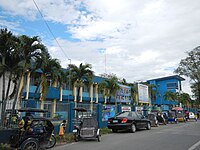
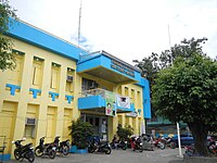 Town hall
 -
 Public market
 -
 St. Anne Parish Church (Founded 1756, Built on 1836)
 -
 Saint Mary's Angels College
 -
 Holy Cross College


.jpg)


References[edit]
- ^ http://pampanga.gov.ph/index.php/component/content/article/189-capitol/tourism/municipality/320-sta-ana.html [dead link]
- ^ Municipality of Santa Ana | (DILG)
- ^ "2015 Census of Population, Report No. 3 – Population, Land Area, and Population Density" (PDF). Philippine Statistics Authority. Quezon City, Philippines. August 2016. ISSN 0117-1453. Archived (PDF) from the original on May 25, 2021. Retrieved July 16, 2021.
- ^ a b c Census of Population (2020). "Region III (Central Luzon)". Total Population by Province, City, Municipality and Barangay. Philippine Statistics Authority. Retrieved July 8, 2021.
- ^ "PSA Releases the 2018 Municipal and City Level Poverty Estimates". Philippine Statistics Authority. December 15, 2021. Retrieved January 22, 2022.
- ^ "Santa Ana: Average Temperatures and Rainfall". Meteoblue. Retrieved May 5, 2020.
- ^ Census of Population (2015). "Region III (Central Luzon)". Total Population by Province, City, Municipality and Barangay. Philippine Statistics Authority. Retrieved June 20, 2016.
- ^ Census of Population and Housing (2010). "Region III (Central Luzon)" (PDF). Total Population by Province, City, Municipality and Barangay. National Statistics Office. Retrieved June 29, 2016.
- ^ Censuses of Population (1903–2007). "Region III (Central Luzon)". Table 1. Population Enumerated in Various Censuses by Province/Highly Urbanized City: 1903 to 2007. National Statistics Office.
{{cite encyclopedia}}: CS1 maint: numeric names: authors list (link) - ^ "Province of Pampanga". Municipality Population Data. Local Water Utilities Administration Research Division. Retrieved December 17, 2016.
- ^ "Poverty incidence (PI):". Philippine Statistics Authority. Retrieved December 28, 2020.
- ^ "Estimation of Local Poverty in the Philippines" (PDF). Philippine Statistics Authority. November 29, 2005.
- ^ "2003 City and Municipal Level Poverty Estimates" (PDF). Philippine Statistics Authority. March 23, 2009.
- ^ "City and Municipal Level Poverty Estimates; 2006 and 2009" (PDF). Philippine Statistics Authority. August 3, 2012.
- ^ "2012 Municipal and City Level Poverty Estimates" (PDF). Philippine Statistics Authority. May 31, 2016.
- ^ "Municipal and City Level Small Area Poverty Estimates; 2009, 2012 and 2015". Philippine Statistics Authority. July 10, 2019.
- ^ "PSA Releases the 2018 Municipal and City Level Poverty Estimates". Philippine Statistics Authority. December 15, 2021. Retrieved January 22, 2022.
External links[edit]
- Santa Ana Profile at PhilAtlas.com
- Philippine Standard Geographic Code
- Philippine Census Information
- Local Governance Performance Management System
| Municipalities | |
|---|---|
| Component cities | |
| Highly urbanized city |
|