Vostervatnet
Tools
Actions
General
Print/export
In other projects
Appearance
From Wikipedia, the free encyclopedia
This is an old revision of this page, as edited by Aymatth2 (talk | contribs) at 19:03, 26 January 2022 (→top: lang). The present address (URL) is a permanent link to this revision, which may differ significantly from the current revision.
| Vostervatnet | |
|---|---|
| Vostervatnet (Bokmål) | |
| Location | Strand, Rogaland |
| Coordinates | 59°05′45″N 5°58′42″E / 59.0959°N 5.9784°E / 59.0959; 5.9784 |
| Primary outflows | Fiskåna |
| Catchment area | 11.18 km2 (4.32 sq mi) |
| Basin countries | Norway |
| Max. length | 2.9 kilometres (1.8 mi) |
| Max. width | 1.4 kilometres (0.87 mi) |
| Surface area | 2.62 km2 (1.01 sq mi) |
| Shore length1 | 10.88 kilometres (6.76 mi) |
| Surface elevation | 54 metres (177 ft) |
| References | NVE |
| 1 Shore length is not a well-defined measure. | |
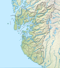
Vostervatnet is a lake in the municipality of Strand in Rogaland county, Norway.[1] The 2.62-square-kilometre (1.01 sq mi) lake lies in the northwestern part of Strand, just south of the Fognafjorden. The village of Tau lies about 3.5 kilometres (2.2 mi) southwest of the lake. The main outflow of the lake is the river Fiskåna, which flows north from the northeastern corner of the lake, down the hill to the village of Fiskå on the shore of the fjord.
See also
References
- ^ "Vostervatnet, Strand (Rogaland)" (in Norwegian). yr.no. Retrieved 2016-02-02.
Hidden categories:
- Pages using gadget WikiMiniAtlas
- CS1 Norwegian-language sources (no)
- Articles containing Bokmål-language text
- Coordinates on Wikidata
- Articles using infobox body of water without image
- Articles using infobox body of water without pushpin map alt
- Articles using infobox body of water without image bathymetry
- All stub articles


