Black Mesa (Oklahoma, Colorado, New Mexico): Difference between revisions
Appearance
Content deleted Content added
clean up Infobox mountain using AWB |
No edit summary |
||
| Line 23: | Line 23: | ||
| first_ascent = |
| first_ascent = |
||
| easiest_route = Hike |
| easiest_route = Hike |
||
| listing = [[List of U.S. states by elevation|US State High Point]] of Oklahoma |
| listing = [[List of U.S. states by elevation|US State High Point]] of Oklahoma (at 4,973 feet/1,516 m) |
||
}} |
}} |
||
Revision as of 14:27, 20 March 2010
| Black Mesa | |
|---|---|
| Highest point | |
| Elevation | 5,700 ft (1,700 m) |
| Listing | US State High Point of Oklahoma (at 4,973 feet/1,516 m) |
| Geography | |
| Location | Colorado / New Mexico / Oklahoma, USA |
| Region | US-OK |
| Topo map | USGS Jacks Gap |
| Geology | |
| Mountain type | Mesa |
| Climbing | |
| Easiest route | Hike |
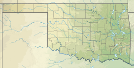
Black Mesa is a mesa that extends from Mesa de Maya in Colorado southeasterly 28 miles (45 km) along the north bank of the Cimarron River, crossing the northeast corner of New Mexico to end at the confluence of the Cimarron and Carrizo Creek near Kenton in the Oklahoma panhandle. Its highest elevation is over 5,700 feet (1,737 m) in Colorado; in New Mexico it attains 5,239 feet (1,597 m); and in northwestern Cimarron County, Oklahoma, it reaches 4,973 feet (1,516 m), the highest point in that state.
The summit is believed to have formed many millennia ago when black lava rock coated the top.
In Oklahoma it is home to Black Mesa State Park and Black Mesa Nature Preserve.
External links
- Black Mesa Nature Preserve
- Black Mesa State Park
- TopoQuest map of Black Mesa State Park
- Encyclopedia of Oklahoma History and Culture - Black Mesa

