
San Salvador: Difference between revisions
No edit summary |
Locochris3 (talk | contribs) |
||
| Line 106: | Line 106: | ||
===City Mayors since 1964=== |
===City Mayors since 1964=== |
||
[[File: |
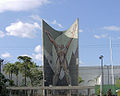
[[File:PlazaSalvadorDelmundo.jpg|thumb|right|[[Monumento al Divino Salvador del Mundo]] (Monument to the Savior of the World)]] |
||
* José Napoleón Duarte (1964–1970) |
* José Napoleón Duarte (1964–1970) |
||
* Carlos Antonio Herrera Rebollo (1970–1974) |
* Carlos Antonio Herrera Rebollo (1970–1974) |
||
Revision as of 02:15, 21 December 2010
This article's factual accuracy is disputed. (December 2010) |
This article needs additional citations for verification. (May 2007) |
San Salvador | |
|---|---|
City | |
 San Salvador (Entrance to the AMSS thru San Martin | |
 | |
| Country | |
| Department | San Salvador |
| Established | 1525 |
| Government | |
| • Mayor | Norman Quijano |
| Area | |
| • City | 72.25 km2 (27.90 sq mi) |
| • Metro | 620.86 km2 (239.72 sq mi) |
| Elevation | 658 m (2,159 ft) |
| Population (2009 Census) | |
| • City | 540,932 |
| • Density | 7,500/km2 (19,000/sq mi) |
| • Metro | 2,177,432 |
| • Metro density | 3,500/km2 (9,100/sq mi) |
| Time zone | UTC-6 (Central Standard Time) |
| Website | sansalvador.gob.sv |
San Salvador City is the capital and largest city of the nation of El Salvador. It is the third most populous city in Central America after Guatemala City and Managua. Home to one-half of El Salvador's wealth, the city's per capita GDP - PPP is approximately USD11,200, compared to a national average of USD5,260 (2002). The city has a long history, with origins dating back to the Spanish conquest of the Pipil tribes.[1] The name of the city means "Holy Savior" in Spanish.[2][3]
History

The origins of the city can be traced to before the Spanish Conquest. It is near the present location of San Salvador that the Pipil groups, established their capital, Cuscatlán. Not much is known about this city, since it was abandoned by its inhabitants in an effort to avoid Spanish rule.
Under the orders of Pedro de Alvarado, Gonzalo de Alvarado and Diego de Holguín were ordered to take the settlement they found and develop it. Diego de Holguín became the first mayor of San Salvador after the town was founded on April 1, 1525. However, later in the sixteenth century, it was rebuilt and changed locations twice in 1528 and 1545. Originally founded in what is now the archaeological site Ciudad Vieja, north of the present-day city, it was moved to the Valle de Las Hamacas or the Acelhuate Valley, named so due to the intense seismic activity that characterizes it. The new site was chosen as it had more space and more fertile land, thanks to the pristine (though now extremely polluted) Acelhuate River. As the population of the country remained relatively small up until the early twentieth century, the city grew very slowly.
During the presidency of Dr. Rafael Zaldivar on January 1885, businessmen and the president's family built generously the Sara Zaldivar Asylum for Indigents and the Elderly. The president's wife was excited by the project and donated her property in Colonia Costa Rica in San Salvador.
In 1902, the new hospital San Salvador was built and was called Hospital Rosales after its benefactor Dr. Jose Rosales, a banker who gave his fortune to the hospital and to the orphanage. The hospital was started by president Carlos Ezeta and finished during the presidency of Tomás Regalado.
In 1905 president Pedro José Escalón started building the National Palace which was built from coffee exportation taxes.
In 1911, the Monument to the Liberty in San Salvador and the Teatro Nacional were built during Dr. Manuel Enrique Araujo's presidency.
In 1917, an earthquake damaged the capital during the Carlos Melendez presidency.
On December 4, 1931, after a coup president Arturo Araujo was ousted by the military. As the Times Magazine states, the military were not paid their salary for some months and decided to revolt installing a Military Directorate. The Directorate named then vice-president Maximiliano Hernandez Martínez as president and Araujo went into exile. The Martínez regime lasted from December 2, 1931 to May 6, 1944.
In 1964, the Christian Democratic Party (PDC) candidate, José Napoleon Duarte, an engineer, won the election for city mayor. He was elected freely because then-president Adalberto Rivera let democracy happen in mayoralties and the National Assembly elections. Duarte was Mayor of San Salvador from 1964 to 1970. He built the Pancho Lara park in Vista Hermosa neighborhood, renewed the electricity system in the capital. He also started the Evening Adult Schools helping a lot of adult workers study during evenings and this helped many to become new technicians.
In 1969, after the war with Honduras was over and soldiers returned home, there was a huge celebration in the National Stadium to welcome the national heroes. This story is in Duarte's biography. Boulevard de los Héroes (Heroes Boulevard) was named after the Salvadoran soldiers who fought in Honduras.
In 1986, a major earthquake destroyed many government buildings and other important structures such as the "El Siglo" building, once a well-known department store within the city. The capital was still in ruins through the end of the 1990s. Many homeless children lived inside the ruins. People would call them "niños huelepega" (children addicted to sniffing glue).
In 1986, Mayor Morales Ehrlich decided to close some streets in downtown San Salvador for a Farmer's Market; this has resulted in major traffic jams affecting the downtown area ever since. In an editorial on February 10, 2010, Ehrlich reflected on his two terms as Mayor of San Salvador.[4]
El Salvador celebrated the Peace Accords on Thursday, January 16, 1992, after the signing of those accords in Mexico, it was seen by TV on a national holiday. There were crowds of people celebrating this special event in downtown San Salvador in Plaza Gerardo Barrios and in La Libertad Park. It was the beginning of a new stage in the history of the country after 22 years of actual conflict between the radical movements of the Left, the death squads (the ultra-Right), and the Army. It was a time of glory and blessing for the people of El Salvador. The white doves of peace flew in the event.
In San Salvador are the tombs of many famous Salvadoran presidents: Matias Delgado and Manuel José Arce (La Merced Church), Francisco Morazán and Gerardo Barrios (Los Ilustres Cemetery), and José Napoleon Duarte (Jardines del Recuerdo Cemetery).
Municipal Government
El Salvador, by constitutional provisions, municipalities are autonomous in economic, technical and administrative (Art. 203). They are governed by a council consisting of a mayor (elected by free and direct vote every three years with an option to be re-elected), a trustee and two or more aldermen whose number varies in proportion to the population of the municipality. In the case of this city, is currently governed by Mayor Norman Quijano ARENA, for the period 2009-2012. He is accompanied by a liquidator, twelve aldermen and four substitutes, and a secretary. The functions and powers of this government are framed within the rules of the Municipal Code.
As for the administration of the municipality include organizational aspects. San Salvador has decentralized (celebrations committee, administration of the El Espino, Cuscatlan Park, management of cemeteries, etc.). To safeguard the interests of the municipality has a board of Metropolitan agents, the management structure comprises markets and services to citizens, under the direction of a gender unit; Managements districts of the municipality (which is six, to decentralize municipal work), financial management, and management of the historic center, etc. The township also is part of the Council of Mayors of the Metropolitan Area of San Salvador (COAMSS), composed of fourteen local councils that make up the area known as Gran San Salvador.
Population
Forty-eight percent of El Salvador's population reside in San Salvador. The city's 2.1 million inhabitants make it one of the most densely populated cities in Central America. About 87% of the population are mestizo, 1% are indigenous, and 12% are Caucasian. Roughly 57% of the population are Roman Catholic, signifying a steady rise in the city's Protestant population. The growth rate of San Salvador's population is 1.7% while 90.1% of the population is literate.
City Mayors since 1964
- José Napoleón Duarte (1964–1970)
- Carlos Antonio Herrera Rebollo (1970–1974)
- José Antonio Morales Ehrlich (1974–1976)
- Alejandro Duarte (1982–1985)
- José Antonio Morales Ehrlich (1985–1988)
- Armando Calderón Sol (1988–1994)
- Mario Valiente (1994–1997)
- Héctor Silva Arguello (1997–2003)
- Carlos Rivas Zamora (2003–2006)
- Violeta Menjívar(2006–2009)
- Norman Quijano (2009-)
City Symbols
The symbols of the city are the shield, flag, anthem and the rod edicilia. The first three emerged at the initiative of a contest launched in 1943. The shield (designed by the painter José Mejía Vides) shows four quadrants: the two at the top right and bottom left oblique carry the blue and white (representing the Federal and National Flag), the top left frame displays an emerald necklace, symbol and the remaining Cuscatlán the bell of the Church of La Merced, which is awarded to José Matías Delgado having ringing in the 1811 Independence Movement.
As the flag was designed at the initiative of the authorities. Was chosen as the anthem produced by Carlos Bustamante (lyrics) and Ciriaco de Jesus Wings (music).
The municipal staff, meanwhile, shows a series of figures and symbols relating to local history. From top to bottom these images are: Image is representative of local breed, first Mayor Don Diego de Olguín, Carlos V of Spain, Royal Decree which named San Salvador City Mayor Don Antonio Gutierrez, 1811, Priest José Matías Delgado, Seal Liberation 1811, 1821 Independence Seal, Shield Current Municipal Freedom Union National Emblem God.
Geography

The city's altitude average of 560 meters above sea level, gaining altitude toward 1000 meters above sea level at the foothills of the Quezaltepec, or San Salvador, volcano. In fact, the valley got its nickname from the Spaniards who called the area "El Valle de las Hamacas" (The Valley of the Hammocks) due to its constant seismic activity. Just East of the city, lies Lake Illopango, the largest volcanic lake in the nation.[5]
Climate
San Salvador features a tropical wet and dry climate under the Koppen climate classification. San Salvador is mainly hot, the coolest months being November through February. The temperature varies widely between midday and midnight, due to changing levels of humidity throughout the day. The highest reading ever recorded in San Salvador was 38.5 °C (101.3 °F), the lowest was 8.2 °C (46.8 °F). The highest dew point was 27 °C (81 °F) and the lowest −10 °C (14 °F). San Salvador has two seasons: rainy and dry. The dry season lasts from November through April, and the rainy From May through October. Sometimes, when strong cold fronts affect El Salvador during the dry season, the dew point may fall to temperatures below 10 °C, an event that would be too cold for most of the inhabitants, but this rarely has any effect due to the fact that humidity remains low, which means the dew point remains less relevant, therefore a 7 °C-10 °C dew point is actually felt as a 15 °C-18 °C temperature.[6][7]
| Climate data for San Salvador | |||||||||||||
|---|---|---|---|---|---|---|---|---|---|---|---|---|---|
| Month | Jan | Feb | Mar | Apr | May | Jun | Jul | Aug | Sep | Oct | Nov | Dec | Year |
| Mean daily maximum °C (°F) | 30.1 (86.2) |
30.3 (86.5) |
32.0 (89.6) |
32.2 (90.0) |
30.8 (87.4) |
29.5 (85.1) |
30.1 (86.2) |
30.0 (86.0) |
29.0 (84.2) |
29.1 (84.4) |
28.0 (82.4) |
28.6 (83.5) |
30.1 (86.2) |
| Mean daily minimum °C (°F) | 15.9 (60.6) |
16.8 (62.2) |
17.7 (63.9) |
19.0 (66.2) |
20.0 (68.0) |
19.6 (67.3) |
19.1 (66.4) |
19.3 (66.7) |
19.4 (66.9) |
18.0 (64.4) |
17.9 (64.2) |
15.1 (59.2) |
18.4 (65.1) |
| Average precipitation mm (inches) | 5.0 (0.20) |
2.0 (0.08) |
9.0 (0.35) |
36.0 (1.42) |
152.0 (5.98) |
292.0 (11.50) |
316.0 (12.44) |
311.0 (12.24) |
348.0 (13.70) |
217.0 (8.54) |
36.0 (1.42) |
10.0 (0.39) |
1,734 (68.3) |
| Source: worldweather.org;[8] | |||||||||||||
Mountains
Cerro El Picacho, Cerro San Jacinto, Cerro Chantecuán and La Torre and Candelaria are some of the more notable hills within San Salvador. Soil types include regosol, latosol, andosol, lava rocks and andesitic and basaltic lava.
Hydrology
The main rivers are the Rio Acelhuate municipality which is 2.2 km. of the city and the river Iohuapa to 5.2 km. rivers are also Matalapa, The Iguana, San Antonio, Urbina and Casa de Piedra. [12] These streams are the Garrobo, Sirimullo, The Quebradona, the lame, Las Lajas, El sleeve, La Chouette, La Mascota, San Philip Tutunichapa and Mejicanos.
Economy


As the Capital, San San Salvador has many economical activities, such as food production, beverages, handicrafts, construction materials, pharmaceutical and chemical industries, automobile and appliances repairs, Grupo TACA, a multinational consortium which includes the national airline of El Salvador, Costa Rica, and other Central American countries, has its headquarters in San Salvador.[9] Unicomer Group.,[10] Almacenes Simán, Grupo Roble, Grupo Real, Excel Automotríz, Grupo Q, and many others.
Peg with the United States Dollar
Since December 1999, net international reserves equaled U.S. $ 1.8 billion dollars. Having this buffer to work hard currency, the Government of El Salvador undertook a monetary integration plan beginning January 1, 2001, whereby the U.S. dollar became legal tender alongside the Salvadoran colón and all formal accounting was done in U.S. dollars. Thus, the government has formally limited its possibility of implementing open market monetary policies to influence short term variables in the economy. Since 2001, the colón is no longer used to make transactions, but some stores still inform the public of prices in both colónes and in dollars. In general, the population supported the change of the colón to the dollar, although wages remained the same despite the increased price of everything else. For example, whatever earned in 5 colónes (or the equivalent of US$0.57), now costs US$1. The change to the dollar also precipitated a pattern of lower interest rates in El Salvador, helping many to secure credit to buy a house or a car. Some economists estimate that this price increase would have happened just because of inflation without monetary change had occurred. The left-wing political sectors have been highly critical of the dollarization process, considering it as favoring the interests of financial sector companies. [citation needed]
Communications
San Salvador is home to many communication company headquarters. El Salvador some of the highest rates of people that can access internet, telephone communication and television communication. The Most popular communication companies in El Salvador are, Tigo, Claro-Telecom, Movistar-Telefonica, and Digicel. All of these companies provide 3G networks in El Salvador, TV-Cable, Internet and International Roaming. San Salvador also has the headquarters for Television. In El Salvador, the local television channels are: 2, 4, 6-By TCS, 8-Agape, 10-Canal de El Salvador, 12-Now controlled by Azteca TV, 15, 19-Nickelodeon, 21, 23-Star Channel (Music), 27, 33, and 35-VTV. There is also a Catholic and government communications channel.
Financial Sector
San Salvador's banking headquarters include banks such as Banco Agrícola, Citibank, HSBC, Scotiabank, BAC-Credomatic, Banco Promérica, Banco Pro-Credit and the Mexican Banco Azteca.
Also this Financial groups have important insurance companies such as Asesuisa, SISA, Mapfre-La Centroamericana and Scotia Seguros
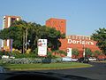
El Salvador's most popular department/general stores include Almacenes Siman and Dorian's.
Also the most popular retail companies are HiperPaiz, La Despensa de Don Juan, Super Selectos and PriceSmart
Demographics
|
|
Approximately 87% of the population are mestizos (mix of Native American and European ancestry), 12% are white, and 1% are Native Americans and other small ethnic groups, including Chinese, Jews, and Arabs.
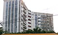
City Skyline
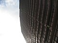
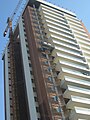
Contrary to other cities, the financial center of San Salvador is not located downtown, but at the periphery, especially towards the northwestern sections of the city. (Please review this commentary as in the last PLAMADUR - Urban Study done at the end of the 90´s - the Central Business District of San Salvador is located in the Municipality of San Salvador were presently HSBC, Scotiabank and Banco Agricola Headquarters are located and the northwestern section of the Metropolitan Area of San San Salvador (please difference the city of San Salvador from the Metropolitan Area of San Salvador) is located in the Municipality of Antiguo Cuscatlan and Santa Tecla, were CityBank is located)Downtown or "Old" San Salvador possesses many historical buildings, including the National Palace, the National Theatre, the Plaza Libertad, and the Cathedral. Due to continuous seismic activity, Downtown San Salvador has currently no major high rise buildings. However, improving building technologies are allowing the construction of taller earthquake-resistant buildings in San Salvador. In fact, many of the newest high-rise buildings are appearing towards the western sectors of the city, especially around the areas of the Zona Rosa (or "Alive Zone"), San Benito, Escalón and Antiguo Cuscatlán. Buildings such as El Pedregal, Terra Alta, Campestre 105, Complex Las Americas (Telefonica Towers), Edificio Avante, the World Trade Center and many others are shaping the cityscape of San Salvador.
Escalon Skyline
Escalon holds most of the high-rises in San Salvador, most of them for apartment uses such buildings are: 105 Campestre Torre A, B and Tower C. Terra Alta Apartments, Torre Futura and the world trade center complex, Torre Telefonica (CFG) among many other small high rises that give the area a beautiful look. Escalon holds most of the buildings used for business purposes. The Escalon Skyline holds the 2nd, 3rd, 5th, 6th and 7th tallest building of El Salvador.
San Benito Skyline
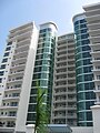
Right next to Escalon lies San Benito, San Benito is mostly composed of apartment building, the buildings that stand out the most are: La Capilla 525, La Capilla 515, La Capilla 370, Las Terrazas, La Castellana, Hilton Princess of San Salvador. A new complex of apartments that will become part of the skyline these 3 new buildings include: Alisios 115 1 tower of 26 floors, and Magnolias 159 2 towers of 26 floors each. Even though San Benito has countless buildings, it only holds the 8th, tallest building, but after the 3 buildigns are finished, the zone will hold the 4th and 8th tallest building in the country.
Antiguo has been a small city of the Metro Area with the least skyline development until 2008, since 2008 the are experienced a boom, the tallest building in El Salvador stands in Antiguo Cuscatlan, and under construction 3 towers that will take the 3 first places, all part of the Europlaza Buisness Center Complex, 1 Tower with 40 Floors - 150meters the 2nd one with 32 Floors and the 3 Tower a Hotel with 28 Floors will have the same height as the currently tallest building. Antiguo also has the best buisness Center of El Salvador. Antiguo Holds the 1st, and 9th tallest buildings in El Salvador
The Tallest of San Salvador
Central America(excluding Panama) has a total of 23 Tallest Buildings or High Rises, that are above 65 meters in height. Out of these 23 High-Rises 12 are located in San Salvador, 5 in Guatemala, Honduras and Nicaragua each has 2, and Costa Rica has one building in this list.
San Salvador is not only known for the tallest high-rises in central america (excluding Panama) but fot its modern architecture, and modern style buildings:
Here is a list of the 10 tallest buildings in the Metropolitan Area of San Salvador (all of the buildings are in the most highly developed cities of the country, Antiguo Cuscatlan and San Salvador.
- 1st - El Pedregal also known as Multiplaza Apartamentos 110.3meters/361.8feet
- 2nd - Torre Futura or Torre 3 at the World Trade Center 99.0meters/324.8feet
- 3rd - Terra Alta Apartments 98.0meters/321.5feet
- 4th - Torre Cuscatlan Citi-Bank Tower or Torre Democracia 79meters/259.1feet
- 5th - 105 Campestre Torre A 76.65meters/257feet
- 6th - Torre Telefonica (CFG) 77.0 meters/252.6feet
- 7th - 105 Campestre Torre B 73.25meters/240feet
- 8th - Torre 525 Avenida La Capilla 71.0meters/232.9 feet
- 9th - Edificio Avante 67.1meters/220.1feet
- 10th - Ministerio de Gobernacion 65meters/213.2feet
-
 Torre El Pedregal 1
 -
 Torre Futura 2
 -
 Terra Alta Apartments
 -
 Citi-Bank Tower
 -
 105 Campestre Tower A
 -
 Telefonica Tower(right of Red Tower)
 -
 105 Campestre Tower B
 -
 525 Avenida La Capilla
 -
Avante Building
-
 Government Center Tower 4


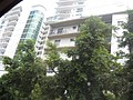
Apartment Life
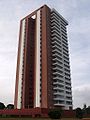
San Salvador’s unimagined fast urban growth has put space for developments at a limit. Since the 2.1 million people living in San Salvador are hemmed in by natural obstacles, like The San Salvador Volcano, Lake Ilopango, and San Jacinto Hill, the city has begun to build taller. In recent years, San Salvador has seen a remarkable growth of apartment buildings. The areas with most apartments buildings are Escalon (buildings include Terra Alta, Las Vistas, Torre Campestre 105, Torre del Sole, Suites Massferrer and other) and San Benito/Zona Rosa (Avenida La Capilla 370, Las Terrazas, La Capilla 515, La Capilla 510, La Capilla 525, Oceano 511, Torres del Bosque, Torre Maquilishuat, and Torre San Benito). The only apartment building not standing in one of these neighborhoods is El Pedregal,[11] which is Central America’s tallest building outside of Panama at a height of 106 meters and 28 floors. All of the buildings listed above have between 10-24 floors.
Home Life
.JPG)
In San Salvador, homes are classified or grouped in the following ways: Casa-ciudad are homes on main roads, in the middle of the city; Callejon is a group of homes by the side of a narrow street, normally lower-middle class people live there; Colonias are large areas where middle-class people live in; Colonias Privadas are where upper-middle income people live, they usually contain entrances that are guarded; and there are Fincas, or suburbs where many upper-middle income and rich people live. These areas tend to be walled and protected with an armed guard. The poor in San Salvador live in Marginales, which can be unsafe areas. As such, people are warned to stay away from these neighborhoods.
Urban Development

Earlier colonial urban developments for the city of San Salvador failed to predict the growth of the city into great urban areas in the following centuries. Thus, the many narrow streets that span the city create traffic problems and overcrowded sidewalks. As the urban expansion of San Salvador continues, newer and better facilities and amenities are needed to cope with such expansion.
During the 60's, urban expansion was most prevalent towards the north and south, while the 70's saw growth continue further south, north and west. Colonias Miravalle, Montebello, Satellite, Maquilishuat, San Mateo Lomas de San Francisco, Alta Mira, Loma Linda, La Floresta, and Jardines de la Libertad were built.
The expansion of San Salvador during this period, while in all directions, was geared more heavily towards the volcano of San Salvador. The expansion in housing was due to an increase of the middle class, military, professional, and due to Salvadorans returning from Honduras.
At the dawn of the century, the city expansion decreased westward. There was an expansion of middle-class neighborhoods such as Merliot, Santa Elena and the Tier, but the product of internal migration and cessation of armed conflict created a high demand for urban public housing. This gave rise to large urban development projects mostly to the east and north, to the phenomenon of "dormitory towns" and to a disorderly urban growth.
AMSS (San Salvador Metropolitan Area)
San Salvador was founded in the year 1525, it was the second city in Central America made by the Spanish. By the Year 1821 the year of Independence for El Salvador, San Salvador had a population of 10,000 inhabitants, four years later in 1825 the city grew to 25,000 Inhabitants, this was the result of internal migration to the capital city, this process happens twice in the history of San Salvador.Santa Tecla was founded as "Nueva San Salvador" on August 8, 1854 by the president José María San Martín after the capital city was destroyed by an earthquake. It served as capital of the republic from 1855 to 1859 and became departmental capital in 1865. The continued development of the city was spurred by the success of the local coffee industry, becoming a very productive commercial city. By the year 1890 San Salvador had 94,580 Inhabitants, in 1901 San Salvador was composed of the Urban Center (80,167), Vista Hermosa(13,123), y Planes de Rendero(1,560). In the following years San Salvador kept on growing from Downtown towards the outskirts of the volcano. It was not untile the 70's when the city took a great leap in population from 430,500 to 700,000 as San Salvador grew it joined other cities and The AMSS was created. The Metropolitan Area of San Salvador (AMSS) is a conglomerate formed by 14 municipalities. It was instituted in 1993, through Legislative Decree No. 732 of the Law on Territorial Development and the Metropolitan Area of San Salvador and neighboring municipalities. The Act defines that, depending on its urban development, these cities form a single urban unit.
Since 1990, it was felt that urban development in the Municipality of San Salvador and neighboring municipalities was having a remarkable growth, and even be defined as a big city. This situation required the planning and control of urban development in these municipalities and their conformation as a metropolitan area.
Currently, the AMSS constitutes the directional center of the country in political, financial, economic and cultural life and where he also accounts for 27% of the population and 70% of the public and private investment in 3% of the national territory .
Today the AMSS is composed of San Salvador, Santa Tecla, Soyapango, Ilopango, Antiguo Cuscatlan, Apopa, Ayutuxtepeque, San Marcos, Ciudad Delgado, Cuscatancingo, Mejicanos, Nejapa, San Martin, Tonacatepeque, Cuscatancingo. Together they give the AMSS a total population of 2,177,432 inhabitants (2009 census). Goveremnt expects a total population of 2.5 million by the beginning of the year 2011.
Sites of interest
San Salvador is rich in European-style buildings and architect; including the National Palace, and the Metropolitan Cathedral.
National Palace
The National Palace is considered one of the most majestic buildings in El Salvador. The idea to build the structure came from Captain General Gerardo Barrios, one of the most popular presidents the country's history. Construction commenced in 1866, under the leadership of Ildefonso Marín and José Dolores Melara, and continued until it's completion in 1870. Unfortunately, on November 19, 1889, a fire reduced it to rubble.
The current palace was designed by engineer Jose Emilio Alcaine and built between 1905 and 1911. The project fell under the leadership of Jose María Peralta Lagos, while Don Pascasio Gonzalez was the foreman. The building materials were imported from Germany, Belgium, Italy and other countries.
Metropolitan Cathedral

The Metropolitan Cathedral of the Holy Savior (Catedral Metropolitana de San Salvador) is the principal church of the Roman Catholic Archdiocese of San Salvador and the seat of the Archbishop of San Salvador. The church was twice visited by Pope John Paul II who said that the cathedral was "intimately allied with the joys and hopes of the Salvadoran people." During his visits in 1983 and 1996, the Pope knelt and prayed before the Tomb of Archbishop Óscar Romero, assassinated in 1980, whose tomb here is a major pilgrim draw.
Theaters
Teatro Nacional de El Salvador, or National Theater of El Salvador, is the oldest theater in Central America. Construction started on November 3, 1911, by the French architect Daniel Beylard, and inaugurated March 1, 1917. It is of French Renaissance style with modern touches. It was decorated by the Italian architect Lucio Capellaro, and its Great Hall is considered one of the most beautiful and elegant in Central America.
Among new theaters, there is the FEPADE Auditorium where shows are held. It is also a popular place for schools to rent out for their school functions/events. There is also El Centro Español (the Spanish Center), and the Teatro Presidente or Presidential Theater, which hosts ballets, symphonies and other events.[12][13] Teatro Luis Poma, located in Metrocentro, has a small Italian stage with 227 seats. The theater hosts a series of plays by local and international groups. Additionally, its lobby is often used for small art exhibitions.
Shopping centers

The Metropolitan Area of San Salvador has some of the best malls and life-style centers of Central America such as Multiplaza, Las Fuentes, La Gran Via, Las Cascadas, Galerias, Plaza Futura at WTC San Salvador, El Paseo, Plaza Mundo, Plaza San Benito , Blasilea (most known as Zona Rosa, a street in San Salvador where there are open air restaurants, stores, and where The Hilton Princess Hotel is located in), Plaza Merliot, Las Azaleas,[14] and Central America's largest Metrocentro San Salvador.
Cuisine
The restaurant scene in San Salvador is influenced by many different cultures. Food options include Italian, Korean, Japanese, Thai, French, Chilean, American, Peruvian, Mexican, Spanish, Middle Eastern, German, Chinese, Argentine and others. Local food options include several "Pupuserias" where one can purchase the famous Salvadoran Pupusas.
-
 Mc Donalds & Hilton of San Salvador
 -
 Siman at La Gran Via
 -
 Apartments in San Benito
 -
 Multiplaza Mall
 -
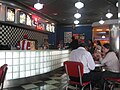 Comet Diner


Museums
San Salvador has a set of many museums. Among the largest two and the most popular are Museo Nacional de Antropologia de El Salvador (MUNA) and Museo de Arte de El Salvador. Muna's mission is to make Salvadorans reflect on their cultural identity through exhibitions, research, publications, and educational programs in the fields of archeology and anthropology as a testimony of the social processes of the various human groups who inhabited and inhabit the length and width homeland. MARTE's mission is to contribute to the development of the country's education and culture through the conservation and dissemination of the artistic patrimony, strenghening historic knowledge, reafirming cultural values that shape our identity, and promoting new artistic languages. MARTE, a private, nonprofit organization, opened on 22 May 2003. In the short time that it has existed, the museum has become an essential reference in the cultural life of Central America, with its representative view of art from the mid-nineteenth century to contemporary times.[15][16]
A different, but equally popular museum is Tin Marín Museo de los Niños (Tin Marin Children's Museum), located between Gimnasio Nacional José Adolfo Pineda and Parque Cuscatlán.[17] Tin Marín seeks to contribute to children becoming integral and creative citizens through significant learning, cultural stimuli, and entertaining experimentation.[18] The museum has more than 25 exhibits including The Airplane, The Grocery Store, and the Planetarium.
Hotels

San Salvador has the most luxurious hotels in Central America, among these hotels San Salvador has are: Hotel Real Intercontinental de San Salvador, Courtyard by Marriott which is connected to a luxurious mall called La Gran Via, Sheraton Presidente, Crowne Plaza which is connected to the San Salvador World Trade Center, Hilton Princess, Holiday Inn, and many others.[19]
San Salvador has many attraction from Bars, to Museums, to Historical Places that will be not found anywhere else in Central America.
Gastronomic festivals
All over the country there are gastronomic festivals, where people sell food, art, and music, at San Salvador one is held at Las Fuentes de Bethoven Park every month.
Sports

Estadio Cuscatlan The Stadium, with a capacity of over 35,000, is the largest football venue not only in Central America, but the Caribbean as well. In addition to being the largest, Estadio Cuscatlán is often referred to as the most modern stadium in the region also It was announced on November 16, 2007 that Estadio Cuscatlán would become the first soccer stadium in Central America and Caribbean to have a large LED screen where the supporters can view the action. The screen is 40 meters in height and width and was completed in March, 2008. Also the Estadio Nacional de la Flor Blanca with a capacity of 32,000, this stadium held the Central American and Caribbean Games in 2002 (El Salvador came in 6th place among 37 countries).
Estadio Cuscatlan was built in the early 1980s right before the beginning of the civil war, this building among many other were supposed to start the great modernization of San Salvador in the 80's but the civil war took 12 years of development of the country.
Alianza Football Club San Salvador´s most popular football team are Alianza FC. They play their home games in the Estadio Cuscatlan following many years of playing at the Estadio Flor Blanca. Alianza are reknowned throughout El Salvador for their loyal supporters and for the atmosphere created during games. Alianza gained fame in Central America for winning the CONCACAF Championship and for beating the Brazilian team, Santos, when their side featured the football legend Pele. They play in a kit composed of white shirts, shorts and socks and their nickname is ´The Albos´or ´The Pachiderms´.
Transportation
San Salvador, like many major metropolitan areas around the world, heavily relies on public transportation. There are may roads that lead to the city from different parts of the nation. San Salvador is also located near the El Salvador's international airport.
Airport

San Salvador was first served by Ilopango International Airport, but on January 31, 1980, Ilopango was substituted by the bigger El Salvador International Airport Comalapa International Airport (IATA: SAL, ICAO: MSLP), commonly known as Cuscatlán International Airport, is located about 50 km (30 miles) from San Salvador in El Salvador. It was built in the late 1970s to replace its predecessor, Ilopango International Airport, which is now used for military and charter aviation, but will be rehabilitated as a commercial airport by 2009. There are also plans to build a new airport on the Salvadoran coast of El Tamarindo, La Unión, along with tourist facilities on the beach or near to La Unión according to the demand that will be presented by the new modern port. With 2,076,258 passengers in 2008, it was the third busiest airport by passenger traffic in Central America.
Roads


In the Metropolitan Area of San Salvador circulating around 200,000 registered vehicles per day. By the same municipality of San Salvador in the morning rush hour, about 300,000 trips are made. Around the city there are primary ways that communicate with the interior of the country, this being the North Core, directed towards Apopa and Chalatenango, Santa Tecla road due west of the country, the road Comalapa International Airport, and Boulevard of the National Army, who heads the East. As the city a must if you cross the territory, the government has built since the beginning of the century, various ways to the decongestion of traffic. These roads are the way North Trunk Soyapango, Constitution Boulevard extension, and the Boulevard Diego de Holguín (under construction).
The numerical designation of streets and avenues is organized according to the four squares that form the intersection of Avenida and Avenida Cuscatlán Spain (north and south, respectively), and Delgado Arce street (to the west and east) in the downtown. Thus the odd-numbered avenues north and south are to the west of this crossing and even numbers to the east. The streets, meanwhile, with an odd name west and east, are north of the junction, the even-west and east, south. Among the streets and main avenues of the city include the Paseo General Escalon, the section Alameda Alameda Manuel Enrique Araujo, Franklin D. Roosevelt-Calle Rubén Darío, the Alameda Juan Pablo II, Boulevard of Heroes Boulevard Venezuela, Autopista Sur (also known as Boulevard Los Proceres), etc. Constitution Boulevard, Diego de Holguin Boulevard(7th Highway in the Metropolitan Area, to be finished by November 2010).
With regard to public transport, there is a substantial availability of buses and minibuses at a cost of $ 0.20 for first and $ 0.25 for the latter. In San Salvador are also the East and West terminals are units about buses going to various parts of the country (West Terminal hosting companies that provide services to Guatemala and Mexico). As for the international bus service from Terminal Puerto Bus routes to nearby towns depart from Central America. Furthermore, since October 1, 2007, the National Railways of El Salvador (FENADESAL) have resumed service at an affordable cost of $ 0.10. The train departs from near the East Bus Station to the town of Apopa.
Education
San Salvador has a Evangelical high school: Colegio Cristiano Josue. Also there are Catholic private high schools such as: Liceo Salvadoreño, Externado San José, Colegio Don Bosco, Colegio La Asunción and other non-religious such as García Flamenco and Colegio Augusto Walte. San Salvador also has many private bilingual schools, such as: Academia Británica Cuscatleca (British English), Colegio Internacional de San Salvador (English), Escuela Americana (English), Escuela Panamericana (English), Liceo Francés (French) and Escuela Alemana (German). El Salvador has a school classification system made by the government teaching service called, MINED, which gives scores to private and public schools, (A) being among the highest and (C) schools that need a lot of improvement. Unlike the United States El Salvador has many more Private Schools than public.
San Salvador is home to many higher education institutions. The only public University in the country is Universidad de El Salvador. Other private universities, like Universidad Centroamericana José Simeón Cañas and Universidad Dr. José Matías Delgado, two of the best universities in Central America, are located in the capital city, also other universities that teach a variety of professions are: Escuela de Comunicacion Monica Herrera, ESEN (Escueala Superior de Economia y Negocios), Escuale Militar (Military School) and many others.
Disasters

The city has suffered from severe earthquakes over the years, the most disastrous of which occurred in 1854. Also worthy of mentioning is the 1917 eruption of the San Salvador volcano, which resulted in three major earthquakes and damaged the city so extensively that the government was forced to move the capital to the present-day city of Santa Tecla, then named Nueva San Salvador. The most recent earthquake, in 2001, resulted in considerable damage, especially in Las Colinas suburb where a landslide destroyed homes and killed many people.
During the 1980s, conflicts in El Salvador erupted into a civil war, and many people fled to the city since most of the fighting occurred outside of it (San Salvador itself was not directly affected by the war until the final offensive of 1989). Hurricanes, tsunamis, and landslides also pose a threat.
On November 2009, the Hurricane Ida hit the departments of San Salvador, San Vicente and Cuzcatlan. In San Vicente, the municipality of Verapaz and Guadalupe were totally destroyed by the rain that was brought by the Hurricane and a landslide that brought huge rocks. Many thousands of people were left homeless. However, the Army and the Red Cross rescued many people and the government opened public schools as temporary shelters for 3 months. The Hurricane destroyed a some bridges and some towns were uncommunicated. The people of El Salvador helped raising money for the homeless and international aid came from friend countries such as the United States, Mexico, Nicaragua and Guatemala and the European Union.
Tropical Storm Agatha
See also: Tropical Storm Agatha (2010)

On it hit the Central American coast on Thursday, may 27th, 2010, about 3 feet of water over a period of 5 days has been registered, in the Metropolitan Area of San Salvador, sinkholes, flooding, and devastation near downtown, and zona el picacho, also areas such as Montebello, etc. Have been warned of future evacuation.
The remnants of Agatha continue to produce torrential rain in Central America across Guatemala, El Salvador, Belize and Honduras. Some areas have already picked up well over a foot of rain. Rainfall totals in some mountain locations could reach 30 inches over the next day or so. More life-threatening flash flooding and mudslides are likely.
The origins of Agatha were from an area of convection, or thunderstorms, that developed on May 24 off the west coast of Costa Rica. At the time, there was a trough in the region that extended into the southwestern Caribbean Sea, associated with the Intertropical Convergence Zone. The system drifted northwestward, and conditions favored further development.On May 25, the convection became more concentrated, and the National Hurricane Center (NHC) noted the potential for a tropical depression to develop.The next day, it briefly became disorganized,as its circulation was broad and elongated; however, the disturbance was in a very moist environment, and multiple low level centers gradually organized into one.The low continued to get better organized; however, there was a lack of a well-defined circulation.On May 29, after further organization of the circulation and convection, the NHC initiated advisories on Tropical Depression One-E while the system was located about 295 miles (475 km) west of San Salvador, El Salvador.
n El Salvador, widespread flooding took place as heavy rains fell across the country. Throughout San Salvador and five other cities threatened by flooding, emergency officials urged residents to evacuate to shelters. A total of 140 landslides occurred.[43] The highest known rainfall total in the country was 400 mm (15.7 in); however, further rains have fallen since this total was reported. A total of six people were killed in the country. At least two other people are reported missing in the country. By May 30, President Mauricio Funes declared a country-wide state of emergency due to the widespread damage wrought by Agatha.
Religion
As in much of the country, Roman Catholicism plays a prominent role in San Salvador. The city's own festivities, also known as "La Fiesta de Agosto", center around Jesus Christ, the "Salvador del Mundo", after which the city was named. Famous Oscar Romero was the archbishop of San Salvador at the time of his assassination. The current archbishop of El Salvador is José Luis Escobar Alas.
Culture
San Salvador is a rich cultural city, with many places such as the historical centre or downtown, which marks some of the most beautiful architectures in town. One of the main historical places of the capital city is the National Theatre. Recently remodelled, it was originally built in 1866.[20] The National Palace keeps its original front, and combines neoclassic, neogothics and renaissance architectural details on its structure.
San Salvador also has other cultural places such as the El Salvador's Art Museum (Museo de Arte de El Salvador, MARTE), the National Museum David J. Guzmán, the Luis Poma's Theatre, and the museum for kids Tin Marin, among others.[21]
Crime
This section needs expansion. You can help by adding to it. (June 2010) |
The security situation has taken a downturn in San Salvador within the last five years. In 2002 there were over 9000 intentional homicides in the city of San Salvador. 2007 and 2008 saw a worsening security situation San Salvador, with the trend continuing in 2009. Crimes have increased to 13 daily, with this sharp increase having occurred in the last three years.[22]
Landmarks
- Catedral Metropolitana, Metropolitan Cathedral
- Teatro Nacional de El Salvador, the National Theatre of El Salvador
- Palacio Nacional, the National Palace
- Monumento al Divino Salvador del Mundo, Monument to the Savior of the World
- Casa Presidencial, the Presidential Mansion
- Monumento a La Libertad, Monument to Liberty
- Torre Cuscatlan, a city landmark owned by Citibank
- Multiplaza Apartamentos The tallest building in Central America(excluding Panama) with a height of 104m floor count of 26
- Torre Futura High Rise Building part of the WTC Complex in San Salvador with a floor count of 19
- Estadio Cuscatlan
- 105 Campestre Torre A, 105 Campestre Torre B and Campestre 105 Torre C
- Edificio Avante
- Terra Alta Apartamentos
Photo gallery of sites in San Salvador
-
 Avante Santa Elena
 -
 Apartments in San Salvador
 -
 El Pedregal
 -
 Citi-bank Tower
 -
 Cuscatlan Stadium
 -
 Urban Apartments
 -
 Greater San Salvador, seen from the Quetzaltepec volcano.
 -
 Northwest San Salvador
 -
 The Metropolitan Cathedral
 -
 Monumento al Divino Salvador del Mundo (Monument to the Savior of the World)
 -
 Monument to the Revolution
 -
 Apartment Complex
 -
 El Pedregal Side View
 -
 San Benito Apartment Zone
 -
Terra Alta
-
 Luxurios La Gran Via
 -
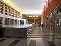 Multiplaza Mall
 -
 Multiplaza Mall
 -

-
-
 Escalon Apartments
 -
 Escalon Apartments
 -
 Escalon Apartments
 -
 Highway entering San Salvador through Santa Tecla.
 -
 Five star Hilton Hotel in zona rosa.
 -
Office buildings near the 'Salvador del Mundo.
-
 Shell Gas Station & Apartment building
 -
National Palace


International relations
Twin towns — sister cities
San Salvador is twinned with:
Column-generating template families
The templates listed here are not interchangeable. For example, using {{col-float}} with {{col-end}} instead of {{col-float-end}} would leave a <div>...</div> open, potentially harming any subsequent formatting.
| Type | Family | Handles wiki
table code?† |
Responsive/ mobile suited |
Start template | Column divider | End template |
|---|---|---|---|---|---|---|
| Float | "col-float" | Yes | Yes | {{col-float}} | {{col-float-break}} | {{col-float-end}} |
| "columns-start" | Yes | Yes | {{columns-start}} | {{column}} | {{columns-end}} | |
| Columns | "div col" | Yes | Yes | {{div col}} | – | {{div col end}} |
| "columns-list" | No | Yes | {{columns-list}} (wraps div col) | – | – | |
| Flexbox | "flex columns" | No | Yes | {{flex columns}} | – | – |
| Table | "col" | Yes | No | {{col-begin}}, {{col-begin-fixed}} or {{col-begin-small}} |
{{col-break}} or {{col-2}} .. {{col-5}} |
{{col-end}} |
† Can template handle the basic wiki markup {| | || |- |} used to create tables? If not, special templates that produce these elements (such as {{(!}}, {{!}}, {{!!}}, {{!-}}, {{!)}})—or HTML tags (<table>...</table>, <tr>...</tr>, etc.)—need to be used instead.
References
- ^ http://hdr.undp.org/docs/reports/national/ELS_El_Salvador/El_Salvador_2003_sp.pdf [dead link]
- ^ elsalvador.com :.: Las noticias de El Salvador en el Internet - San Salvador, El Salvador, CA
- ^ Proyecciónes de población, República de El Salvador
- ^ Opinión - Mi versión del centro - ElFaro.net El Primer Periódico Digital Latinoamericano
- ^ San Salvador, the Capital of El Salvador - AlfaTravelGuide.com
- ^ Average Weather for San Salvador, * - Temperature and Precipitation
- ^ Servicio de Informacion Meteorologica Mundial - San Salvador
- ^ "[[:Template:En icon]] Weather Information for San Salvador". Retrieved June 5, 2010.
{{cite web}}: URL–wikilink conflict (help) - ^ "Grupo Taca threatened by El Salvador's rating drop." Flight International. June 20, 2000. Retrieved on October 6, 2009.
- ^ "Prelude." (Select "English," then select the mail icon in the upper right hand corner of the screen) Unicomer Group. Retrieved on March 4, 2010.
- ^ "El Pedregal" (in Spanish).
- ^ Bienvenido a casa
- ^ Teatro Nacional en San Salvador
- ^ http://www.elsalvador.com/mwedh/nota/nota_completa.asp?idArt=3113909&idCat=6374
- ^ Marte, Museo de Arte de El Salvador
- ^ MUNA - Museo Nacional de Antropologia de el Salvador
- ^ http://www.explore-beautiful-el-salvador.com/cuscatlan.html
- ^ http://tinmarin.org/museo/el-museo/mision-y-vision
- ^ San Salvador Hotels: Read San Salvador Hotel Reviews and Compare Prices - TripAdvisor
- ^ Teatro Nacional Template:Es icon
- ^ Museos y centros culturales Template:Es icon
- ^ "Homicidios en siete municipios altamente poblados en El Salvador" (PDF) (in Spanish). OCAVI. Retrieved 2008-06-20.
External links
- Municipality of the city of San Salvador
- Template:Wikitravel
- The Tramways of San Salvador, 1876-1929
