
Talk:Control of cities during the Syrian civil war: Difference between revisions
| Line 1,468: | Line 1,468: | ||
Everyone posting that Yarmouk Army pledged to IS, but no comment from the Yarmouk Army. I believe that they didn't pledged and Nusra is basically using that excuse to attack FSA in the south. If it was true other Free Syrian Army brigades, that vastly outnumber Nusra, would join the battle in Nusra side, since they hate IS. While Yarmouk Army is the biggest FSA faction in Daara, FSA still number some 25/30 thousand outside the Yarmouk Brigade. |
Everyone posting that Yarmouk Army pledged to IS, but no comment from the Yarmouk Army. I believe that they didn't pledged and Nusra is basically using that excuse to attack FSA in the south. If it was true other Free Syrian Army brigades, that vastly outnumber Nusra, would join the battle in Nusra side, since they hate IS. While Yarmouk Army is the biggest FSA faction in Daara, FSA still number some 25/30 thousand outside the Yarmouk Brigade. |
||
Here is a Daily Star source: http://www.dailystar.com.lb/News/Middle-East/2014/Dec-20/281728-nusra-front-and-rivals-clash-in-deraa-and-qalamoun.ashx |
|||
It seems that the situation is as following: Nusra accused the Yarmouk Army of pledging to ISIS. The Yarmouk Army denied, and fighting started around Tasil. Nusra says it is trying to cleanse the area of "corruption", the same statement it used to fight the SRF and Hazm in Idlib province. The Yarmouk Army is one of the most powerful FSA groups in Daraa, and a leading member of the Southern Front. Mediation attempts have failed so far. Other FSA groups seem to be grouping around the Yarmouk Army. This does not mean a large infighting between secularists and Islamists. Many Islamist brigades are in the Southern Front, but Nusra never was. Nusra only seems to have an ally in the al-Muhatta Islamist brigade, a small local brigade. I say we wait a few days before editing this map, for we don't know if this becomes a full-scale war or just some skirmishes like we have seen before. |
|||
== Abu l Duhur Airbase == |
== Abu l Duhur Airbase == |
||
Revision as of 12:46, 20 December 2014
| This is the talk page for discussing improvements to the Control of cities during the Syrian civil war article. This is not a forum for general discussion of the article's subject. |
Article policies
|
| Find sources: Google (books · news · scholar · free images · WP refs) · FENS · JSTOR · TWL |
| Archives: Index, 1, 2, 3, 4, 5, 6, 7, 8, 9, 10, 11, 12, 13, 14, 15, 16, 17, 18, 19, 20, 21, 22, 23, 24, 25, 26, 27, 28, 29, 30, 31, 32, 33, 34, 35, 36, 37, 38, 39, 40, 41, 42, 43, 44, 45, 46, 47, 48, 49, 50, 51, 52, 53, 54, 55, 56, 57, 58, 59, 60, 61, 62, 63, 64, 65Auto-archiving period: 14 days |
| This page is not a forum for general discussion about Control of cities during the Syrian civil war. Any such comments may be removed or refactored. Please limit discussion to improvement of this article. You may wish to ask factual questions about Control of cities during the Syrian civil war at the Reference desk. |
| This article is of interest to the following WikiProjects: | |||||||||||||||||||||||||||||||||||||||||||||
Please add the quality rating to the {{WikiProject banner shell}} template instead of this project banner. See WP:PIQA for details.
Please add the quality rating to the {{WikiProject banner shell}} template instead of this project banner. See WP:PIQA for details.
| |||||||||||||||||||||||||||||||||||||||||||||


.svg)
| To help centralise discussions and keep related topics together, Template talk:Syrian Civil War detailed map redirects here. |
Template:Syrian Civil War sanctions
|
Index 1, 2, 3, 4, 5, 6, 7, 8, 9, 10 |
|
This page has archives. Sections older than 14 days may be automatically archived by Lowercase sigmabot III when more than 4 sections are present. |
Roads
Shouldn't this map show at least the major roads and railways? After all, maneuver is critical in warfare, and that would explain more why this or that city or village is strategic. — Preceding unsigned comment added by 24.8.182.120 (talk)
- Absolutely. Someone please create a version of the base Syria location map with those features drawn. Alternatively, we need a picture file that has syria roads on it and nothing else. I can then use the "overlay_image =" parameter in the "Template:Location map+" to overlay that "road file" on top of our map. For an example of the result of this parameter, see a "Location map+" where a picture file with arrows was overlayed on top of it. Unfortunately, i don't know how to create picture files. If anyone can create such a file (same size as our map; with a transparent background) and put it in commons, then i can overlay it on top of our map. Tradediatalk I brought this back from archives as this is still an ongoing issue. And while we are at this, it would be good to also draw Lake Jabbūl Tradediatalk
- I agree that adding some of the most important highways to the map would make it more useful. It would have to be done delicately, because it could quickly make the map very cluttered. Looking at road maps of Syria, I would suggest something showing a few major highways, along the lines of this (scroll down slightly), rather than something more like this, which would overwhelm the map. Hulahoop122 (talk)
- Good idea. Between those 2 examples, the difference seems more how the roads are drawn (thin red lines vs. wide light brown lines), than the number of roads. In some areas, there seems to be more roads on the first map with the roads in red.
- Note that our map is bigger, so we could probably place more roads (if appropriate) without problem. In some areas there are many alternative roads allowing easy passage around the main routes, so it might be a good idea to indicate that.
- With a good source map with the roads already on it (and not too many complicated things in the same colour), I could produce the road overlay. The colour of the roads could be changed to whatever you like.
- There is a map on my computer that might be good, with many roads, except it could be as much as 20 years old. (The latest date on the map is a 1994 border treaty.) It is better to have something not long before the civil war started.
- According to my map, most of lake Jabbul is dry much of the year. (All except the north-west corner.) It also has rivers and railways, which might be interesting to show. (the roads, water, and railways could be put on separate layers so as to be easier to maintain, if necessary. Not hard since they are all different colours.) André437 (talk)
- If you have the skills to put that map layer together, that would be great. You could post it on a test page, just as you did with all of the conflict icons you created, and see how the community reacts. Hulahoop122 (talk)
- Ok, as I have time. It could take a while, since I will have to use google maps or equivalent to fill in the few places where a small window overlay covers roads, etc in some areas, and also clean up any stray marks I find. (There are a lot of annotations, but mostly outside Syria.)
- I'll also have to adjust the scale and align it, which will be the most difficult part.
- I'll put the roads/water/railways in separate layers initially as well. Easy to do since they are separate colours. That way it will be really quick to modify (or remove) one without affecting the others.
- That icon project helped remind me of a few tricks with the software I use. (gimp)
- BTW, I have an unrelated idea for locations contested from one side only : using a semicircle open on the opposite side. And for truces, using a broken outside circle, instead of a continuous one. Just mentioning it as something to think about.
- I'll keep you posted :) André437 (talk)
- If you have the skills to put that map layer together, that would be great. You could post it on a test page, just as you did with all of the conflict icons you created, and see how the community reacts. Hulahoop122 (talk)
- This section disappeared for a while and I became occupied elsewhere, but my map turned out to be so overwritten with place names so as to be almost useless. Most roads, rivers, etc were obscured in many places. It would be faster to draw features freehand using google maps in satellite mode. Not one of my talents. So I can't help much with that.
- I've noticed that some waterways have been added. It looks really nice. André437 (talk)
- There are maps like that, already. Be patient, they load slowly because they are "Flash". - http://www.fps-predators.com/#/middle-east-conflict/4585140400 Shaded areas show more detailed maps of the same area (click on them to access). — Preceding unsigned comment added by Comins2008 (talk • contribs)
Syrian Army captured more Towns in North Hama
Syria TV report with subtittles. https://www.youtube.com/watch?v=5wx-VBCu4X0
Al Qaeda is in All Green Towns
All Qaeda is in All Green Towns not only in Idlib Towns
The so called Islamic Front Was created by Al Qaeda member Abu Khaled al-Suri he was killed by the ISIS http://www.cbc.ca/news/world/syria-suicide-bombers-kill-al-qaeda-rebel-leader-in-aleppo-1.2548340
Even if you don't consider the islamic front as part of AQ, the nusra which is cleARLY AQ is in the vast majority of green areas.
SHouldn't a grey dot be put then within most of the greens (if it can be documented)? That could be used to show they are working together.
If hezbollah is the main garrison in any government town, I would understand putting a yellow dot within the red. Although I think they are primarily focused in a few areas, from what I've read.
Menagh & northern Aleppo
A frightening situation , this article explains that FSA has withdrawn from Menagh and Nursa has taken control of this. It says fighting between Nusra and FSA has moved to Aleppo’s countryside. So it is not just in Idlib countryside now. http://www.al-monitor.com/pulse/originals/2014/11/jabhat-al-nusra-idlib-islamic-emirate.html
- Dozens of fighters from Jabhat al-Nusra pledged allegiance to the IS northeast of Aleppo.SOHR
Jaz'ah
According to SOHR's report http://syriahr.com/en/2014/11/7-militants-died-in-clashes-with-ypg-in-ras-al-ayn/ 2 villages(Mestriha and Felastin) south of Jaz'ah should be contested.
There we Go Again ...
And again we have pro-SAA editors change the Daraa and Quneitra map towards their own views without sources. I want the following questions answered with neutral sources:
1. Why was Dilli changed back to red and why is the 60th Engeneering Regiment nearby deleted as a green army base dot? 2. Why is the green circle around Mahajjah deleted, whilst SANA itself says there were bombings there, so rebels nearby? 3. Why is the city of Bosra changed from contested to red without a neutral source given? 4. There is a grey JaN ring in Nawa, whilst there is no infighting in southern Syria. So why the grey ring?! 5. Why is Tell Antar contested? No sources given
And before people start bombarding this post with PetroLucum or Al-Masdar stuff, I mean neutral sources. Al-Minotor wrote an article which states Sheikh Maskin and Brigade 82 should be green, as well as many towns north of it. We ignored it based on Al-Masdar reports (could as well listen to SANA). So, if that's the case, I will use Twitter sources from opposition activistst to change towns to green, since that is what pro-SAA people here do to contested and rebel towns in the south.
1- Dilli needs to be contested. The rebels took it, the regime counter-attacked and now clashes are happening inside the village. You used a totally pro-regime source to change it back to red. Also, SOHR reported 60th Batallion to be on rebel hands, so put it back(it's a small base, so maybe use a checkpoint icon).
2- Add the Daara Central Prison back, as it was AGAIN excluded. This is getting really boring.
Army offensive against ISIS in Hasakah
Earlier one of the most reliable source The Independent reported that Syrian forces have retaken 20 miles of territory in the north-east of Hasakah province. Also pro opposition map show some success of army in this area. According data on this map army now control some villages (Tawarij, Tall at Tibn, Jiha Kabirah, Halabiyah and Khirbat Hassan) to south from city of Qamishli. Hanibal911 (talk) 21:51, 26 November 2014 (UTC)
- Today Syrian troops regained control over the two towns of al-Khair(or Bab Al-Khayr) and al-Jammo in Hasaka countryside after fierce clashes with ISIL. This data confirmed pro government sources Turkey NewsAl ManarAl Masdar pro opposition source Documents.syAra News and also this data confirm SOHR Hanibal911 (talk) 10:03, 6 December 2014 (UTC)
Anyway, can you put out the villages not already on the map please. Rhocagil (talk) 13:32, 27 November 2014 (UTC)
- In support of data from reliable source The Independent the opposition map shows which the villages for now are under the control of the army.here Hanibal911 (talk) 11:59, 8 December 2014 (UTC)
ISIS Presence in SouthEast Damascus/North of Suweida
A very interesting article by Al-Arabiyya (huge pro-opp source) mentioning areas in the Damascus Desert that are controlled by ISIS. This article explains 2 things: 1) It explains how Al Nusra managed to retreat from Deir-El-Zoor to Daraa' and 2) Reveals ISIS presence close to Damascus and the 2 border provinces of Daraa' and Suweida. http://www.alarabiya.net/ar/arab-and-world/syria/2014/11/29/-%D8%AF%D8%A7%D8%B9%D8%B4-%D9%8A%D9%82%D8%AA%D8%B1%D8%A8-%D9%85%D9%86-%D9%85%D8%AD%D8%A7%D9%81%D8%B8%D8%AA%D9%8A-%D8%A7%D9%84%D8%B3%D9%88%D9%8A%D8%AF%D8%A7%D8%A1-%D9%88%D8%AF%D8%B1%D8%B9%D8%A7-%D8%AC%D9%86%D9%88%D8%A8-%D8%B3%D9%88%D8%B1%D9%8A%D8%A7-.html Translating it using google translate won't help but I'm a native arabic speaker and the areas mentioned under ISIS control between SE Rif Dimashq and NE Suweida are: checkpoints near the Al-Asfar (الأصفر) village + control over the Sarikhi/Saraykhi (الصريخي) area, and (شنوان والقصر والأصفر والساقية ورجم الدولة) areas which are Al-Qasr, Shinwan, Al-Asfar, Al Sakiyah and Rajm-Al-Dawla,Al-Saqrainyah.Alhanuty (talk) 01:58, 3 December 2014 (UTC) ChrissCh94 (talk) 14:08, 30 November 2014 (UTC)
- I'm sorry but your translation is not accurate. Source not said that area about which you said between SE Rif Dimashq and NE Suweida are under control by ISIS. Because a little over two weeks ago reliable source BBC clear show that no ISIS positions in this area.BBC Just Saudi source of Al Arabia may not be a reliable source on this issue because they opposed to the Syrian regime and support Syrian opposition as well as those who are fighting against it.. And for such a significant change we need more information. Also here the map dated 29 November which clear show that no ISIS in this area. So we need more data. Hanibal911 (talk) 15:35, 30 November 2014 (UTC)
- Hold it right there.. I CORRECTLY translated what was in the article. YOU may consider the article inaccurate and that's okay but my translation? Excuse me but I've been living in the MiddleEast for 20 years :) I perfectly translated what was in the article so the CONTENT could be inaccurate but my translation is flawless. It's not my fault if the source is unreliable, all I did was CORRECTLY translate it. ChrissCh94 (talk) 15:54, 30 November 2014 (UTC)
Desert areas have few sources ,if only camels could talk ;)Pyphon (talk) 16:00, 30 November 2014 (UTC)pyphon
- Source just said that after the Front Al Nusra (or Front victory) forces withdraw of of Deir al-Zour province (eastern Syria) a few months ago, and heading across the Syrian desert to shield the border province with Jordan (southern Syria), his territory in Deir ez Zor moved under the control of ISIS and also the Military airports and large number oil wells. Also source said that Al Suwayda it is one of the most secure areas are currently in Syria.Al Arabia And if you have lived 20 years in the Middle East why you translate this article using Google translator. But for now it is not important. Just although this source is dated for 29 November , but the article says about the events that took place a few months ago, however, I gave you the data from the sources which confirm my words that not ISIS militants in the Suwayda province.BBChere Hanibal911 (talk) 16:26, 30 November 2014 (UTC)
- Also here the map dated 20 November which also clear show that no ISIS in this area.Institute for the Study of War Hanibal911 (talk) 16:51, 30 November 2014 (UTC)
- When I talked about Google translate it was addressed to you not me. How else are you gonna understand Arabic texts? I said using Google translate won't help you because the translation is not comprehensible. That's why I TRANSLATED IT. That's my translation that you can't get from the Internet. And a desert doesn't mean it is uninhabited. You have hundreds of Bedouin tribes there just look up the Syrian Desert article in Wikipedia :) All I did was suggest this article and translate it for you and suddenly I get attacked? Nice way of showing your open-mindedness. Here is another pro-opp source mentionning clashes in the area between rebels and ISIS: https://twitter.com/archicivilians/status/537675628666187777
- Also here the map dated 20 November which also clear show that no ISIS in this area.Institute for the Study of War Hanibal911 (talk) 16:51, 30 November 2014 (UTC)
https://twitter.com/archicivilians/status/537578297266155521 You're welcome. And thank you for your hostility. ChrissCh94 (talk) 17:03, 30 November 2014 (UTC)
- All I did was suggest this article so we could discuss it yet you mocked it, mocked me/my arabic? I wasn't asking for a drastic map change and for your information, this map isn't YOURSHanibal911, it's ours and belongs to the whole community. Every time someone provides a source you immediately counter with a series of sources. We're not attacking you here when we suggest articles/suggest map changes. We just want to make it better and more precise. So change that attitude of yours and open up your mind because this is a TALK page. WE TALK. ChrissCh94 (talk) 17:07, 30 November 2014 (UTC)
- I dont attack you I just simply to provide a sources that confirms my words. And I proved data from reliable source but you provide data from the too biased anti government source. Although I agree with you and I think that the discussion of the data from some articles this is useful work for search of true. Hanibal911 (talk) 17:21, 30 November 2014 (UTC)
- Okay you cleared this up a bit. I did follow the rule: Biased pro-opp source stating ISIS/Regime gains is considered legit. It's like when a regime biased source states rebel/ISIS gains. And despite showing 3 very biased pro-rebel sources saying the rebels lost and ISIS won, I didn't immediately ask for a map change. (Even though I could have and it's perfectly legit). I'm just opening a discussion. ChrissCh94 (talk) 17:30, 30 November 2014 (UTC)
- ChrissCh94 Nevertheless, I am sorry for abrupt behavior from my side in your adress. Just I have a bad mood today. So that buddy accept my sincere apologies. Also we cant use data from this source herehere because he openly opposed the government. We have already discussed this source and it was decided not to use this source for display success of all anti-government groups. Hanibal911 (talk) 17:41, 30 November 2014 (UTC)
- ChrissCh94And as I said earlier Archicivilians is an outspoken opponent of the Syrian regime and can not be an objective source in the struggle between the army and ISIS. Just as we should not use pro government sources in the struggle between ISIS and moderate rebel groups. Because their data cant be objective in this situation. Hanibal911 (talk) 17:49, 30 November 2014 (UTC)
- Alright thanks man apologies accepted :) Then it's my mistake I thought we could use a third party as a source in another conflict. I thought pro-rebel sources could be used in the Regime-Isis conflict etc.. But nonetheless Archiviliians stated something in the Rebel-Isis conflict where he admitted the rebels lost and Isis advanced on behalf of the rebels. Get my point? The regime is absent here in this discussion it's about Rebels and Isis ChrissCh94 (talk) 17:54, 30 November 2014 (UTC)
- ChrissCh94 Then here's my suggestion. We will not ignore this information but we must try find more information from more reliable and neutral sources about the situation in the area. Just as I convinced of the situation with the city of Rastan that there is no need to rush to editing but just need gather more information before proceed to editing. Hanibal911 (talk) 18:54, 30 November 2014 (UTC)
- Alright we wait for more reliable sources. ChrissCh94 (talk) 18:58, 30 November 2014 (UTC)
- ChrissCh94 Then here's my suggestion. We will not ignore this information but we must try find more information from more reliable and neutral sources about the situation in the area. Just as I convinced of the situation with the city of Rastan that there is no need to rush to editing but just need gather more information before proceed to editing. Hanibal911 (talk) 18:54, 30 November 2014 (UTC)
- Alright thanks man apologies accepted :) Then it's my mistake I thought we could use a third party as a source in another conflict. I thought pro-rebel sources could be used in the Regime-Isis conflict etc.. But nonetheless Archiviliians stated something in the Rebel-Isis conflict where he admitted the rebels lost and Isis advanced on behalf of the rebels. Get my point? The regime is absent here in this discussion it's about Rebels and Isis ChrissCh94 (talk) 17:54, 30 November 2014 (UTC)
- ChrissCh94And as I said earlier Archicivilians is an outspoken opponent of the Syrian regime and can not be an objective source in the struggle between the army and ISIS. Just as we should not use pro government sources in the struggle between ISIS and moderate rebel groups. Because their data cant be objective in this situation. Hanibal911 (talk) 17:49, 30 November 2014 (UTC)
- ChrissCh94 Nevertheless, I am sorry for abrupt behavior from my side in your adress. Just I have a bad mood today. So that buddy accept my sincere apologies. Also we cant use data from this source herehere because he openly opposed the government. We have already discussed this source and it was decided not to use this source for display success of all anti-government groups. Hanibal911 (talk) 17:41, 30 November 2014 (UTC)
- Okay you cleared this up a bit. I did follow the rule: Biased pro-opp source stating ISIS/Regime gains is considered legit. It's like when a regime biased source states rebel/ISIS gains. And despite showing 3 very biased pro-rebel sources saying the rebels lost and ISIS won, I didn't immediately ask for a map change. (Even though I could have and it's perfectly legit). I'm just opening a discussion. ChrissCh94 (talk) 17:30, 30 November 2014 (UTC)
- Some points :
- 1) I've seen reference that say that ISIS came via the desert to a point in the desert not far east of Damascus. I don't have them handy, but there were several twitter references to one, on a web page with a map, as well as a wikimapia post indicating where they went to.
- 2) An earlier report from a western journalist held by al-Nusra and released for ransom (paid by Qatar when released at the Israeli border crossing), recounted being captured in the north, held in the Deir al-Zor area, and being taken on a long journey through the desert as al-Nusra fled during the night from Deir al-Zor, working their way south to Daraa, illustrates how easy it is to pass undetected.
- 3) Saudi references should be accepted for ISIS and al-Nusra advances, since the Saudis have been fighting al-Qaida even before the US. And sometime Qatar support for al-Nusra is part of the disagreements Saudi Arabia has with Qatar.
- BTW, it is good to know that ChrissCh94 can translate for us, since google translate is TERRIBLE André437 (talk) 15:47, 1 December 2014 (UTC)
- Thank you André437. I agree with you where it seems the sources here I provided are enough to prove ISIS and other rebel groups do use this area for transport, supply routes etc. But we don't know if they control any areas there since Hanibal911 correctly provided numerous pro-opp sources showing it under undisturbed SAA control. So we all have a point here. It's like the situation in the Homs Desert or Western Qalamoun only more difficult than those 2. So I agree with Hanibal911 that we should wait for more sources to mention it and for more clashes to appear so that we could have a clearer and wider view on the matter. And about the translation well, anything I can do to help you guys out with Arabic sources since many come in informal Arabic that's very difficult to translate over the Internet. Plus many areas in Syria (and the Middle East in general) are named after common names/colors/combinations. Even SOHR has this issue. So for example: Asfar (اصفر) in Arabic means Yellow, it's a color. But Al-Asfar area is not a color obviously. Google translate doesn't know that and so you'll get weirdly named areas. It's here where I could be of assistance. ChrissCh94 (talk) 18:35, 1 December 2014 (UTC)
- I totally agree with ChrissCh94 At the moment, we do not have reliable sources of clashes between the army and the ISI in the area. Also for now we not have clear confirmation from reliable sources that ISIS controls some town or village in the area. But If they use deserted area in the desert for smuggling weapons or anything else b this not a reason to display it is on the map. We need more data. Because now most part of reliable and opposition sources do not confirm the presence of ISIS in this area. So also Saudi news sources in this issue cant be neutral because Saudi Arabia for long time support ISIS. So that Qatar and Saudi Arabia for a long time supported an Islamic State.The AtlanticDaily PaulQatar Daily StarThe Daily BeastForeign PolicyYahoo NewsCNN Hanibal911 (talk) 19:38, 1 December 2014 (UTC)
- Thank you André437. I agree with you where it seems the sources here I provided are enough to prove ISIS and other rebel groups do use this area for transport, supply routes etc. But we don't know if they control any areas there since Hanibal911 correctly provided numerous pro-opp sources showing it under undisturbed SAA control. So we all have a point here. It's like the situation in the Homs Desert or Western Qalamoun only more difficult than those 2. So I agree with Hanibal911 that we should wait for more sources to mention it and for more clashes to appear so that we could have a clearer and wider view on the matter. And about the translation well, anything I can do to help you guys out with Arabic sources since many come in informal Arabic that's very difficult to translate over the Internet. Plus many areas in Syria (and the Middle East in general) are named after common names/colors/combinations. Even SOHR has this issue. So for example: Asfar (اصفر) in Arabic means Yellow, it's a color. But Al-Asfar area is not a color obviously. Google translate doesn't know that and so you'll get weirdly named areas. It's here where I could be of assistance. ChrissCh94 (talk) 18:35, 1 December 2014 (UTC)
- You realise you've been conscripted ;)
- As far as translation goes, I've had a lot of experience between english and french, and can largely make out technical writing in some other european languages. Even without counting synonyms or place names with a meaning (quite common in any language), google obviously does word for word translation with no consideration for grammar. Word order is evidently quite different.
- No problem waiting before assigning control. Note that mere presence in an area, particularly the desert, doesn't necessarily mean control. If it did, the regime wouldn't be able to truck supplies to Deir al-Zor, nor pass supplies through the desert to Aleppo, through territories frequented by the rebels and Daesh. As well, much so-called regime control is illusory, as other forces often easily pass through those areas. Rebels from Daraa have been able to go all the way to Turkey without problem, just bypassing checkpoints en route. André437 (talk) 19:31, 1 December 2014 (UTC)
- Here map from BBC clear show that no ISIS in this area. Also here the map dated 20 November which also clear show that no ISIS in this area.Institute for the Study of War and here map dated 29 november also clear show that no ISIS in this area.here Hanibal911 (talk) 19:42, 1 December 2014 (UTC)
- Also here is the information about the fact how Saudi Arabia is fighting terrorism. Here Saudi octogenarian foreign secretary, Saud al-Faisal, said certain ‘circles’ inside the Saudi regime is assisting terrorist activities in the kingdom and overseas.AWD News Hanibal911 (talk) 19:50, 1 December 2014 (UTC)
- Alrighty then but just one thing I need to make clear Hanibal911, I never said clashes there were between ISIS and the SAA. I was referring to clashes between rebels and ISIS there. That's why I provided rebel sources saying they lost v/s ISIS there. The SAA is not concerned in this section just to be clear ^^. Cheers guys
- Also here is the information about the fact how Saudi Arabia is fighting terrorism. Here Saudi octogenarian foreign secretary, Saud al-Faisal, said certain ‘circles’ inside the Saudi regime is assisting terrorist activities in the kingdom and overseas.AWD News Hanibal911 (talk) 19:50, 1 December 2014 (UTC)
- Here map from BBC clear show that no ISIS in this area. Also here the map dated 20 November which also clear show that no ISIS in this area.Institute for the Study of War and here map dated 29 november also clear show that no ISIS in this area.here Hanibal911 (talk) 19:42, 1 December 2014 (UTC)
André437 Hanibal911 the most serious debate i ever have seen on wikipedia,well ISIS does exist in Suwayda,i don't know why Hannibal wants to hide this one also,never mind,firstly alot of loyalist Accounts and pages from Suwayda have confirmed the ISIS advance via https://www.facebook.com/Lahitha.News.Network/photos/a.1430795117184616.1073741828.1429218997342228/1507280426202751/?type=1, https://www.facebook.com/Lahitha.News.Network/photos/a.1507861989477928.1073742144.1429218997342228/1507862066144587/?type=1, https://www.facebook.com/Lahitha.News.Network/photos/a.1507861989477928.1073742144.1429218997342228/1507862066144587/?type=1 ,Pro-Opposition accounts confirmed ISIS advance in Bir Qassab and Suwayda,and the most important evidence is that Former US Ambassador Robert Ford has confirmed the advance https://twitter.com/fordrs58/status/537678598250188800. Aldo Al-Mayadeen confirmed it via https://www.facebook.com/video.php?v=1507874006143393.Alhanuty (talk) 23:49, 1 December 2014 (UTC)
- Well he did provide pro-gov sources confirming Isis advances in the area at the expense of rebels. I provided pro-rebel sources confirming Isis advances in the area at the expense of the rebels themselves. So please add all the villages stated in those sources as ISIS controlled, especially BeerQasab and the 4-5 villages I mentioned in my first post. ChrissCh94 (talk) 00:57, 2 December 2014 (UTC)
- We cant use as a source only data from the biased pro opposition activists. And I cant understand how we can use as source of broken links in Facebook which provide Alhanuty. And Robert Ford not proved that ISIS controlled this area. Also what makes you think that this account belongs the Former US Ambassador Robert Ford. Because on he page in Twitter about which you said did not specified that this guy is Former US Ambassador.here Ok, we can use as a source video from the pro-government channel Al-Mayadeen here But the problem is that the video is in Arabic and we dont know which villages indicate in this source. I also gave you a map which denies the presence of ISIS in the area about which you are talking.here Hanibal911 (talk) 09:31, 2 December 2014 (UTC)
- Just guys we need understand that I not opposed noted some villages which maybe controlled by ISIS. But before we show it is on the map we need to be absolutely sure that we properly edit. Just as you can see a SOHR have never pointed to the presence of ISIS forces in this area. Hanibal911 (talk) 09:41, 2 December 2014 (UTC)
- And video from Al-Mayadeen basically tells about the events in the Quneitra province. But about ISIS source only said that Beit Jann is a key gathering place for insurgents and logistically located about six kilometers from the Lebanese Shebaa, the victory moved large numbers of fighters from the countryside to shield Bear cane area southeast of Damascus in an area up the countryside east of Daraa and Sweida Rural Damascus. "Daash" also sent in an earlier convoy time to the same area and made an agreement with local groups to enter through the countryside of Daraa and directed the Army of Islam, including the killing of a group of it which will affect the course of the victory in the battles.Al-Mayadeen But source not said that ISIS control some villages in Al Suweyda province. Hanibal911 (talk) 09:53, 2 December 2014 (UTC)
- And guys the one of most reliable sources BBC clear show that for now ISIS not present in this areas about which you said.here Hanibal911 (talk) 10:16, 2 December 2014 (UTC)
- ChrissCh94André437AlhanutyOk! Let us as a compromise and in connection with a plurality of data we add on the map Bi’r Qassab about which mentioned by some opposition sources. And which show under control by ISIS the one of opposition sources.here Hanibal911 (talk) 11:03, 2 December 2014 (UTC)
- And guys the one of most reliable sources BBC clear show that for now ISIS not present in this areas about which you said.here Hanibal911 (talk) 10:16, 2 December 2014 (UTC)
- And video from Al-Mayadeen basically tells about the events in the Quneitra province. But about ISIS source only said that Beit Jann is a key gathering place for insurgents and logistically located about six kilometers from the Lebanese Shebaa, the victory moved large numbers of fighters from the countryside to shield Bear cane area southeast of Damascus in an area up the countryside east of Daraa and Sweida Rural Damascus. "Daash" also sent in an earlier convoy time to the same area and made an agreement with local groups to enter through the countryside of Daraa and directed the Army of Islam, including the killing of a group of it which will affect the course of the victory in the battles.Al-Mayadeen But source not said that ISIS control some villages in Al Suweyda province. Hanibal911 (talk) 09:53, 2 December 2014 (UTC)
- Just guys we need understand that I not opposed noted some villages which maybe controlled by ISIS. But before we show it is on the map we need to be absolutely sure that we properly edit. Just as you can see a SOHR have never pointed to the presence of ISIS forces in this area. Hanibal911 (talk) 09:41, 2 December 2014 (UTC)
Not sure if this source is posted yet (you guys wrote a LOT), but here's France24 stating that the IS penetrated as far as Bir al-Qassab, the site noted about by Hanibal Boredwhytekid (talk) 16:56, 2 December 2014 (UTC)
 Done I add village Bir Qassab. Hanibal911 (talk) 18:10, 2 December 2014 (UTC)
- Agreed, we compromise on having Beer Qassab ISIS held. Thanks Hanibal911 ChrissCh94 (talk) 18:27, 2 December 2014 (UTC)
- I could not find mention of Bir Al-Qassad in there. Also, adding this village contradicts almost every map on the situation in Syria right now [CNN, RT, BBC, Peto Lucem, Desyrecuse, Archicivillians, and pro-ISIS maps]. I would strongly consider a lot more sources before adding and ISIS presence so close to Damascus. Even though ISIS is not advancing, nor do they claim too, our map continues to show them creeping farther and farther south. XJ-0461 v2 (talk) 21:05, 2 December 2014 (UTC)
- Archicivillians (anti-gov) and Mayadeen (pro-gov), both deeply involved in the crisis, mentioned it. I don't expect CNN, BBC or any mainstream media to mention ISIS took control of a couple of abandoned houses in the middle of nowhere! ChrissCh94 (talk) 22:46, 2 December 2014 (UTC)
- I could not find mention of Bir Al-Qassad in there. Also, adding this village contradicts almost every map on the situation in Syria right now [CNN, RT, BBC, Peto Lucem, Desyrecuse, Archicivillians, and pro-ISIS maps]. I would strongly consider a lot more sources before adding and ISIS presence so close to Damascus. Even though ISIS is not advancing, nor do they claim too, our map continues to show them creeping farther and farther south. XJ-0461 v2 (talk) 21:05, 2 December 2014 (UTC)
- Agreed, we compromise on having Beer Qassab ISIS held. Thanks Hanibal911 ChrissCh94 (talk) 18:27, 2 December 2014 (UTC)
Hannibal,the links are clear Now,also the twitter account is confirmed to be that of Former Ambassador Robert Ford.why would multiple analyst follow him.Alhanuty (talk) 00:11, 3 December 2014 (UTC) http://www.alaraby.co.uk/politics/0c346e65-6636-4834-8a7d-bb570407fc66 now ,the new araby confirmed the advance.noe there is multiple sources,on that advance,please ass the towns.Alhanuty (talk) 00:55, 3 December 2014 (UTC) Now SOHR confirmed it https://www.facebook.com/syriahroe/posts/619229571518718.Alhanuty (talk) 01:04, 3 December 2014 (UTC)
- A note about BBC maps : they are notoriously vague, useless for any detailed information about locations held. For example, look at the BBC map posted in this section. The area around Kobane in the north (all Daesh held areas in fact recently acquired), and the Daraa border crossing in the south (rebel held in fact, with a link across the M5) are both inaccurate. So not reasonable to expect their maps to show smaller Daesh controlled areas in the desert or the south.
- I don't think their map makers even intend to represent the detail accurately. Their focus is the general picture, for an audience that doesn't care much (if at all) about the details.
- It is not only BBC that produces this nature of maps. Which is why I strongly prefer using maps only if annotated to indicate when particular locations were acquired. Like Labrousse/Arab Chronicle used to produce. André437 (talk) 01:05, 3 December 2014 (UTC)
Al-Alam confirmed it http://www.alalam.ir/news/1654439.Alhanuty (talk) 01:56, 3 December 2014 (UTC)
- Done Hanibal911 (talk) 10:21, 3 December 2014 (UTC)
- Here source Middle East Eye in which map clear show that no ISIS in south part Syria. Nevertheless, according to the data given above, I added some villages in the northern part of the Suwayda province which controlled by ISIS. Hanibal911 (talk) 14:30, 3 December 2014 (UTC)
- Thank you Hanibal911 and I'm glad my suggestion turned out to be a useful one after all. Cheers guys ChrissCh94 (talk) 17:42, 3 December 2014 (UTC)
- Firstly Alhanuty dont need make not justified editings. You sources not aid about calshes in the village Al Saqraniyah in Darra province. Secondly you source cleal said that ISIS captured village Al Safir in Al Suwayda province byt not said that ISIS captured Tall Al Safir.Al Araby And thirdly SOHR only said that violent clashes took place yesterday night between fighters and NDF in Ber Hamam area located between the two villages of al- Sora al- Kobra and Braq. SOHR said that ckashes in area of Ber Hamam but not inside this village and also sohr not said that clashes between NDS vs ISIS.SOHR It could be local fighters or smugglers. So Alhanuty or are you going to edit according to the sources or do I will notify to admins about your not justified actions and that you are editing as you want and you are deliberately distort the data as you need for edit. Hanibal911 (talk) 08:31, 4 December 2014 (UTC)
- Thank you Hanibal911 and I'm glad my suggestion turned out to be a useful one after all. Cheers guys ChrissCh94 (talk) 17:42, 3 December 2014 (UTC)
- Here source Middle East Eye in which map clear show that no ISIS in south part Syria. Nevertheless, according to the data given above, I added some villages in the northern part of the Suwayda province which controlled by ISIS. Hanibal911 (talk) 14:30, 3 December 2014 (UTC)
Hanibal, firstly claim down, secondly i am not distorting info, thirdly don't threaten me, fourthly the location that you put Al-Asfar village is wrong, the location yours is called Bir Asfar, while, the correct location is the Al-Asfar near Tal Asfar, secondly, Al-Shaqraniyah was mentioned inb the sources above as ISIS-held,for Bir Hamam,SOHR mentioned Clashes, so i putted it as contested.no need to send threats to fellow editors,and HANIBAL, I edit edit according to the sources, you also do the same mistake also. Alhanuty (talk) 14:40, 4 December 2014 (UTC)
Also, don't accuse me of distorting info. Alhanuty (talk) 14:41, 4 December 2014 (UTC)
- I was not going threaten you I have only said about mistakes which you made. And source Al Arabia not said that Al-Shaqraniyah now under control by ISIS and i correct noted village Al Asfar. And also no one source not confirmed that clashes in Bir Hamam between Army vs ISIS. And SOHR only said that clashes between fighters and NDF in Ber Hamam area. But dont confirmed that fighting in the area of village Bir Hamam was between NDF against ISIS.SOHR So that I correctly noted the changes on the map. And how I said in this issue we need more data. And pro oppositione source also on 2 December only said that ISIS took over a rebel checkpoint in the Bir al-Qasb area in northern Daraa. www.syriadirect.org/rss/1722-syria-direct-news-update-12-3-14 about this also reported.Alaan Tv And we cant use Saudi source Al Arabia because many source said that Saudi Arabia previously supported by ISIS The AtlanticDaily PaulQatar Daily StarThe Daily BeastForeign PolicyYahoo NewsCNN and still support ISIS.AWD News And pro opposition map also confirms of my editing.here And reliable source said that ISIS only captured villge Bir al-Qassab France24 Hanibal911 (talk) 18:02, 4 December 2014 (UTC)
well,what does this mean واستبق "داعش" هذا التقدّم، بنقل قوات كبيرة تابعة له، من مناطق سيطرته في ريف حمص الشرقي نحو منطقة الشقرانية في محافظة ريف دمشق، ليتمكّن من السيطرة عليها بسهولة ومن دون أي مقاومة، - See more at: http://www.alaraby.co.uk/politics/0c346e65-6636-4834-8a7d-bb570407fc66#sthash.3otCpTAO.dpuf translate it and you will understand the shaqraniyah edit,for SOHR i believe they forgot to put IS before fighters,for Asfar,the location is wrong,here it is http://wikimapia.org/#lang=en&lat=33.012694&lon=36.589279&z=11&m=b&show=/11464910/al-Asfar-Village.Alhanuty (talk) 18:13, 4 December 2014 (UTC)
- Firstly as I said if SOHR dont said about ISIS we cant draw their own conclusions as I said it could be a run-in with local fighters. And dont have to invent because Al Arabiya not said about Al-Shaqraniyah. We need confirmation from English source which can clear said tha this village was captured ISIS. And how I said in this situation Al Arabia is biased source which clear opposes of Syrian regime in this conflict. So let's just wait and the situation will clear up by itself. Hanibal911 (talk) 18:36, 4 December 2014 (UTC)
well Al-Arabiya mentions Al-Shaqraniyah, وفي هذا السياق، قال الناشط أبو خلدون المعروفي من ريف السويداء، إن فصائل المعارضة السورية رصدت رتلاً عسكرياً لتنظيم "داعش" شرق قرية الشقرانية التي تقطنها عشائر من البدو، so,please Hanibal,just admit your mistake
Also Al-Araby is known to be a neutral source,more neutral than Al-Masdar.Alhanuty (talk) 19:00, 4 December 2014 (UTC)
- Al Arabia said that ISIS transfer of large affiliated forces from the controlled areas in east Homs toward Alhqranih area in Damascus province, to be able to easily control them and without any resistance. But source not said that ISIS captured village Ash Shuqraniyah which located in Dara province. And Al Arabia only said that ISIS transfer large forces from east Homs in area village Alhqranih (Alhqranih it is not Ash Shuqraniyah) in Damascus province that would be able to easily take control but did not say that ISIS took control this village and also village Ash Shuqraniyah loacate in Daraa province. And i never said that Al Masdar is more reliable source than Al Arabia. They are both biased but to different directions. Al Masdar in government side but Al Arabia in the rebel side. Hanibal911 (talk) 19:21, 4 December 2014 (UTC)
- So that the maximum wherein I could go wrong it is in relation to the village Al Asfar. And here I am ready to correct his mistake but in the rest I'm right. And as i said my words confirms pro-opposition source here which clear show that no ISIS in area wher located village Al-Shaqraniyah. So let's in as a compromise we stop on it. Hanibal911 (talk) 19:30, 4 December 2014 (UTC)
Hanibal,i will give you the translation ,الشقرانية=Al-Shaqraniyah,so stop distorting info.Alhanuty (talk) 19:40, 4 December 2014 (UTC)
- Only in your fantasy. And your source talking about Alhqranih in tha Damascus province but village Al-Shaqraniyah locaed in Darra province so dear, you are contradict yourself to yourself. I also gave you a pro-opposition map here which confirms my words so Alhanuty take it easy. And in the future I recommend you to provide data from English sources to avoid misunderstandings and disputes. Regards Hanibal911 (talk) 20:45, 4 December 2014 (UTC)
Hanibal i am an arabic speaker and i understand Arabic clearly,you don't,do you want another arabic user to come here and translate it to you,it is going to embarrassing when he gives you the same translation.Alhanuty (talk) 21:00, 4 December 2014 (UTC)
@ChrissCh94,can you please translate الشقرانية to hanibal please.Alhanuty (talk) 21:02, 4 December 2014 (UTC) Archicivilians stated 2 hours ago that Bir Qasab was retaken by rebels( mainly IF)...too biased to take it seriously? Fab8405 (talk) 20:27, 4 December 2014 (UTC)
- Al-Shakraniyya ChrissCh94 (talk) 22:21, 4 December 2014 (UTC)
- Alhanuty Pro opposition source Al Arabia dated on 29 November and its data is not confirm not one a reliable source. Also you have to understand that source says about the village in the Damascus province but you mark the village under the control of ISIS in the province of Darra. This is contrary to common sense. Also I provided in here pro-opposition source which dated 1 December and clear show that area where located a village Al-Shaqraniyah still is under control by regime troops. Hanibal911 (talk) 21:39, 4 December 2014 (UTC)
- Also Al Arabia just said that activist Abu Khaldoun Maaroufi said that the Syrian opposition factions spotted ISIS military convoy to east from village Alhqranih where inhabited by tribes of nomads. But not said that ISIS entered in this village or captured it. Nevertheless 1 December biased pro-opposition source confirmed that the area where located the village of which you spoke is still under the control of the army. Hanibal911 (talk) 22:00, 4 December 2014 (UTC)
Anti Assad source from December 5 no showing IS Presence in this area http://campaign.r20.constantcontact.com/render?ca=a3b60f0c-7f1c-4666-b671-5753603361d6&c=a494ff50-f60e-11e3-ab57-d4ae526edc76&ch=a499ba40-f60e-11e3-ab57-d4ae526edc76 --Pototo1 (talk) 01:25, 7 December 2014 (UTC)
- Reliable source Al Araby confirmded that ISIS captured some villages in Al Suweyda province. Also pro opposition map show that amry recaptured some areas but some villages still under control by ISIS.here Hanibal911 (talk) 10:34, 8 December 2014 (UTC)
Qala'at Al Madiq - Hama
I have searched all available local news networks (pro-regime and pro-opp) and I can't find any clear information about the situation in Qala'at Al Madiq. Does anyone have a source that can help us know if it is: Besieged by the SAA - Contested - Under Truce - SAA held? The reason behind my query is that this village is strategic since it is considered the gateway to Al Ghab plain and and the second gateway to southern Idlib (other than Morek that is). So any useful sources on the situation? According to this source it is SAA held: https://twitter.com/PetoLucem/status/529701072777256960/photo/1 I also found that Huwwayjah village (slightly north of Qala'at Al Madiq) is rebel-held according to this relatively neutral source: https://twitter.com/PetoLucem/status/529002015062777856/photo/1 ChrissCh94 (talk) 18:52, 2 December 2014 (UTC)
- Only thing I've been able to scrounge up is this (assumedly pro-op) directory of rebel brigades - it lists Falcons of al-Ghab (Tajammu Suqour al-Ghab) as being headquartered in Qala'at al Madiq and is the sole source of the wikiarticle on the group. Boredwhytekid (talk) 21:06, 2 December 2014 (UTC)
- Washington Institute report titled "The Potential for an Assad Statelet in Syria" lists Qala'at Al Madiq as rebel held (pages 23 and 24) - written 12 months ago Boredwhytekid (talk) 21:14, 2 December 2014 (UTC)
- Alright thanks. I haven't seen any reports about conflicts there, not by SOHR not by SANA not by ANYBODY! So you guys think it's under some sort of ceasefire/truce? ChrissCh94 (talk) 22:36, 2 December 2014 (UTC)
I doubt it, but who knows. It's right on the frontline, so it doesn't fit the pattern of a ceasefire site, which have typically been isolated or surrounded areas. Let's keep looking for definitive confirmation on who controls it presently. In any case, I have to imagine that if/when the SAA makes a push into southern Idlib, up to date sources will present themselves. Boredwhytekid (talk) 13:46, 3 December 2014 (UTC) That's the annoying part! How come such an important town has so little info about it? ChrissCh94 (talk) 17:39, 3 December 2014 (UTC)
- According to the Wikipedia article about Qalaat al-Madiq (& sources in there):
- “… anti-government rebels gained control over much of the town, but the Syrian Army has maintained its position in the fortress, which overlooks the town. In September 2011 the police were evicted from the town by the rebels there. Services are provided to Qalaat al-Madiq's residents by rebel groups in the town, the largest of which is Suqour al-Ghab faction which fights under the banner of the FSA. In March 2012 Qalaat al-Madiq was shelled and targeted by heavy fire for a successive 17 days by the Syrian Army in an attempt to oust rebel forces. On 28 March the army entered the town, but were unable to take full control of it. Since the March clashes, there has been a relative ceasefire between the two sides, with a few incidents where the army has allegedly attacked demonstrations, which have continued in Qalaat al-Madiq, as of late November 2012.”
- So since there is no news of clashes, it might be that the status quo has persisted to this day. Also, notice on our map all the checkpoints around the town (they were sourced to a Sep 2013 report by the Institute for the Study of War based on a video by a rebel group). So the army seems to have this area under some sort of a containment… Tradediatalk 20:28, 8 December 2014 (UTC)
FSA fighter claiming that JAN captured him in Qalat al Madiq here Boredwhytekid (talk) 15:14, 9 December 2014 (UTC)
Highway between Homs - Deir Ez Zor
Hey guys someone have there is data from reliable source about who controls it is highway. Which passes from the city of Homs through the city of Palmyra to the city of Deir Ez Zor. Because i found map which show that this highway still under control by army.here Hanibal911 (talk) 14:22, 3 December 2014 (UTC)
Articles on Al-Masdar frequently imply that this road is still controlled by the government. Several of their reports about fighting in Eastern Homs have mentioned the importance of the supply route to Deir Ez Zour.
- Haven't seen a source specifically mention to two major transit towns al-Sulah and Kabajeb in months. Is the SAA supplying via Highway 7? Or airdrops like Nubl and al Zahraa? Pieter v map shows the area as IS held. Unclear. Boredwhytekid (talk) 15:41, 3 December 2014 (UTC)
This highway is controlled by the army since October 2013 https://www.youtube.com/watch?v=vudzW9u0BPA but no with extensive military presence ISIS cross this zone many times in Direction to Raqqah. --Pototo1 (talk) 15:54, 3 December 2014 (UTC)
- Bun other map show that this highway still under control by army.here Since, unlike Shia towns Nublo and Al Zahra the city of Deir Ez Zor too large and strategically important for government and would not be possible to maintain this city using only the supply of arms and ammunition on air. Also would be very difficult to supply fuel and heavy weapons into the city. Also this would be very difficult to supply fuel and heavy weapons into the city for the to continue fights against ISIS. Hanibal911 (talk) 16:33, 3 December 2014 (UTC)
- Also here map which showed that ISIS fighters just attack this area where passes this highway but not said that now ISIS fully control this area. Hanibal911 (talk) 16:39, 3 December 2014 (UTC)
Very true. Doubtful that either side has complete control or set positions Boredwhytekid (talk) 17:07, 3 December 2014 (UTC)
My guess would be that the Army doesn't actually control the road 24/7 but that they occasionally use it to send in a very well protected supply convoy.
The Army can resupply Deir Ez Zor every the time using this road with tons of munitions, but it's not possible permanent presence in this way it's a desert, many areas in Black on these maps just need to be writhe the ISIS in Syria got too low manpower for controlled all this black territory --Pototo1 (talk) 20:26, 3 December 2014 (UTC)
- So maybe that the some villages (Kabajeb and Al-Shulah) which located on this highway need marked in red with black circles around. According this mapherehere Hanibal911 (talk) 20:49, 3 December 2014 (UTC)
Eh. I'd say more sources needed. The SAA probably goes down the road with well protected supply convoys to supply Deir el Zor, but we don't have any indication that they actually have a permanent presence/occupying force in any towns that far East of as-Sukhnah Boredwhytekid (talk) 20:57, 3 December 2014 (UTC)
- Probably you're right. But we know that, according to pro opposition map that the village of Bayt Alyawi Zubaylan which located near highway and a village of Nujayb which located on this highway for now under army control. So I suggest for now add those villages to the map. Hanibal911 (talk) 21:29, 3 December 2014 (UTC)
Is Nujayb on the desyracuse map? As goes Bayt Alyawi Zubaylan - I mean, yea, go ahead and add it if you want, but, why? It's 2 random buildings right next to Bayt Hassun al Ahmad, which is already on our map. That's my take on it. But, no objections if you think it's necessary. The one thing that makes me uneasy about it though, is that desyracuse is the lone source. I mean, look at the Nawa area on his map - it's so outdated - THAT is precisely why I'm always against using these amateur maps as lone sources. Boredwhytekid (talk) 13:52, 4 December 2014 (UTC)
- Is anything coming of the "Presence" icons suggestions? This would be a perfect place to use them - between Kabajeb (IS) and Kasrat Faraj (SAA) we should mark both IS and SAA presence Boredwhytekid (talk) 14:37, 4 December 2014 (UTC)
- Boredwhytekid Here pro opposition map show that part of highway which goimg from Deir ez Zor still contolled by army.here But who controls this highway further still unknown. Hanibal911 (talk) 19:43, 6 December 2014 (UTC)
ISIS offensivein and Army counter-offensivein in Al Mari'iyah
Opp.s.: #Islamic_State has captured Al-Mari'iyah area and clashes with #SAA in Jaffra village, located SE of #Deir_Ezzor Airport. #Syria source: https://twitter.com/PetoLucem/status/540267300776333313 — Preceding unsigned comment added by Herrhorace (talk • contribs) 23:57, 3 December 2014 (UTC)
- Opposition Sources are not reliable to report ISIS gains. Peto Lucem is pro-gov, but he is quoting Opp-sources. XJ-0461 v2 (talk) 00:11, 4 December 2014 (UTC)
- No need in debate because SOHR clear said that 19 members from the regime forces and NDF died when an IS militant blew himself up in a booby- trapped vehicle yesterday night at al- Masemekeh Building located in the vicinity of the airbase of Deir Ezzor, and due to the clashes followed the suicide bombing in Hwayjet al- Mre’eyyi area near the airbase, coincided with IS violent shelling on the regime held village of al- Jafra and its positions inside the airbase.SOHR So that SOHR clear saud that the village Jafra still under control by army and ISIS only shelling of this village. Hanibal911 (talk) 08:49, 4 December 2014 (UTC)
- According to this link http://syriadirect.org/rss/1729-syria-direct-news-update-12-4-14 Jaffra has been conquered by ISIS, and I quote:
- No need in debate because SOHR clear said that 19 members from the regime forces and NDF died when an IS militant blew himself up in a booby- trapped vehicle yesterday night at al- Masemekeh Building located in the vicinity of the airbase of Deir Ezzor, and due to the clashes followed the suicide bombing in Hwayjet al- Mre’eyyi area near the airbase, coincided with IS violent shelling on the regime held village of al- Jafra and its positions inside the airbase.SOHR So that SOHR clear saud that the village Jafra still under control by army and ISIS only shelling of this village. Hanibal911 (talk) 08:49, 4 December 2014 (UTC)
"“Jafra is a town that sits opposite the airport on the other side of a main road connecting Deir e-Zor city to its eastern countryside,” a citizen journalist from Deir e-Zor city told Syria Direct Thursday, confirming the fall of the town from regime control to the Islamic State." Hence changes must be made in this map and in the Deir-Ez-Zor map, large offensive from ISIS from southeast on the march. Gomes89 (talk) 14:49, 4 December 2014 (UTC)
Confirmed by reliable sources, Al Meri'iyah and Jafrah under IS control, who also attacks in Saqr Island to sorround the Airport. https://twitter.com/EjmAlrai/status/540547861826764802 Fab8405 (talk) 16:56, 4 December 2014 (UTC)
- Al Meri'iyah teken by ISIS but not Jafrah. ISIS just gained control on new areas in it after violent clashes but clashes still ongoing.SOHRSOHR Hanibal911 (talk) 22:08, 4 December 2014 (UTC)
- I'd say Mari'iyah to ISIS-held and Jafra contested. ChrissCh94 (talk) 22:20, 4 December 2014 (UTC)
- I support this. At least the eastern part of Jafra contested. Problem we will have in the future is, however, how will we know if the SAA launches a counterattack? SOHR has not been helpful in reporting SAA gains in Deir-Ez-Zor. XJ-0461 v2 (talk) 23:03, 4 December 2014 (UTC)
- I'd say Mari'iyah to ISIS-held and Jafra contested. ChrissCh94 (talk) 22:20, 4 December 2014 (UTC)
Detailed report from Al Masdar [1]: basically Al-Mari’ayyi contested Jafra in SAA control. Fighting ongoing in several areas.95.244.159.103 (talk) 22:21, 4 December 2014 (UTC)
SOHR is reporting normally in Deir Ez-Zor. So, Elijah is one of the most reliable sources of Syria, so Mariyah IS held, and Jafra contested on the map. Someone should edit the map. — Preceding unsigned comment added by 179.180.185.190 (talk) 23:47, 4 December 2014 (UTC)
- SOHR informed that the IS took control al-Jafra village between Hweja Saker and the military airport and reached the gates of the airport after violent clashes against regime forces.source Hanibal911 (talk) 10:42, 5 December 2014 (UTC)
- The reliable source reported that Army during the counter-offensive recovered Al Mari'iyah from IS and regain control of the Deir-ezzour airport perimeter from IS.Elijah J. Magnier Hanibal911 (talk) 11:43, 5 December 2014 (UTC)
- He also implied that ISIS is not in fact in Jaffra or has been repelled here https://twitter.com/EjmAlrai/status/540979262506143744. Should I change the map? XJ-0461 v2 (talk) 22:22, 5 December 2014 (UTC)
- SOHR reported about clashes between IS and the regime forces on the mountain overlooking Deir Ezzor. In this mountain there are a radar and an artillery battery and separates the airbase and the regime - held neighborhood of Deir Ezzor. Information reported that IS militants could control some positions and seize heavy machine guns and artillery, while the clashes resulted in the death of some regime elements.SOHR And ISIS took control on the missiles battalion to northeast of the Airport.SOHR But later SOHR informed that the IS advances in area the airport stopped after heavy shelling and bombardment by regime forces. Also ISIS pulled back from areas in the mount overlooking Deir ez Zor where located a radar and artillery battery after it was exposed heavy bombardment a regime forces.SOHRSOHRElijah J. Magnier Hanibal911 (talk) 11:27, 6 December 2014 (UTC)
- Does this mean that the SAA retook the radar and artillery battalion? XJ-0461 v2 (talk) 17:41, 6 December 2014 (UTC)
- SOHR reported about clashes between IS and the regime forces on the mountain overlooking Deir Ezzor. In this mountain there are a radar and an artillery battery and separates the airbase and the regime - held neighborhood of Deir Ezzor. Information reported that IS militants could control some positions and seize heavy machine guns and artillery, while the clashes resulted in the death of some regime elements.SOHR And ISIS took control on the missiles battalion to northeast of the Airport.SOHR But later SOHR informed that the IS advances in area the airport stopped after heavy shelling and bombardment by regime forces. Also ISIS pulled back from areas in the mount overlooking Deir ez Zor where located a radar and artillery battery after it was exposed heavy bombardment a regime forces.SOHRSOHRElijah J. Magnier Hanibal911 (talk) 11:27, 6 December 2014 (UTC)
- He also implied that ISIS is not in fact in Jaffra or has been repelled here https://twitter.com/EjmAlrai/status/540979262506143744. Should I change the map? XJ-0461 v2 (talk) 22:22, 5 December 2014 (UTC)
- The reliable source reported that Army during the counter-offensive recovered Al Mari'iyah from IS and regain control of the Deir-ezzour airport perimeter from IS.Elijah J. Magnier Hanibal911 (talk) 11:43, 5 December 2014 (UTC)
Why did Al Meri'iyah turn back red? I know yesterday Magnier said this, but was before the late night- today morning offensive...if they are at the airport entrance, Al Mery'iyah is obviously black. Fab8405 (talk) 18:19, 6 December 2014 (UTC)
- Two things. First, I need a source for the fact that ISIS is at the airport entrance. Latest SOHR post said they were repelled from the perimeter and out of the mountains. Second, you cannot assume that since they are at the entrance, then Al Mery'iyah is black. That is original research. You need a source that says that ISIS has recaptured it. XJ-0461 v2 (talk) 18:51, 6 December 2014 (UTC)
From Elijah J Magnier, SyAF attacks IS positions in Al Meri'iyah and Sakr Island, so at least Al Meri'iyah is contested. https://twitter.com/EjmAlrai/status/541605045314543617 Fab8405 (talk) 14:52, 7 December 2014 (UTC)
Do Something for stop the systematic Boredwhytekid vandalism in Qalamoun Area.
The user Boredwhytekid is doing systematic vandalism in Qalamoun area he or other pro Insurgent editor are drawing there green circles who no exit or he just is not got a good documentation about that (Is irrelevant who made these green circles because are incorrect anyway) -
- The Syrian Army in April 2014 took the control from al-Jebbah Here is the Official Syrian TV Report this is well know for ALL!
- In April too the Syrian Army captured Ras Maara Here is the Diadly Star source (A lot more exist just need to used Google) SINCE TODAY I NO FOUND A SINCE SOURCE TALKING ABOUT INSURGENT PRESENCE AL-JEBBAH OR RAS MARAA AREA
Boredwhytekid just no have sources for draw or keep these green circles there because that no exit very simple
- No sources no changes --Pototo1 (talk) 16:47, 4 December 2014 (UTC)
- No sources no changes - those circles were there, you took them down without a source. And now you say, no sources no changes. There is no point talking to you. Those circles went up mid-October, based on this article, that specifies Jebbah AND the road/area between there and Assal al-Ward. You have not posted a single source negating this. Boredwhytekid (talk) 16:57, 4 December 2014 (UTC)
those circles present the Jurud area,the mountain area near to the towns,because these moutains are under rebel control,the battlefield in the Qalamoun is different,than the rest of Syria.Alhanuty (talk) 17:04, 4 December 2014 (UTC)
- Agree! In this case semicircles are needed that would show that the rebels are still in the area and sometimes there are clashes in the area of these cities. Hanibal911 (talk) 17:34, 4 December 2014 (UTC)
- This Field report Al Alam TV is in November from 2014 is the West from Assal Al Ward https://www.youtube.com/watch?v=K8AwcfSb3No how you can see in Assal Al Ward is not besieged on the West and I Let the Kid keep his green semi circle there.
The question is simple =
Are these towns blocked / Besiege in all the west sector by the Insurgents ?
No it's not.
If you put semi circles in these towns in Qalamoun you should need to put green circles in ALL Greens Towns in Homs province, in ALL Green towns of North of Idlib province and all green towns of North of Latakia, in all Greens tonws because clashed are usual there with army troops.
The Insurgents presence there is low they are no able there to made important actions against the Army basically just low scale armed activities - The Situation is very different in Jordan / Israeli border.
Minor clash is not enough evidence to make a entire west side for these towns under permanent siege In Qalamoun region the Army have a clear military superiority over the Insurgents so how can the Insurgents in this way made a permanent siegue in the West side of these towns ?
Just look Hirak town in Daraa in fron is the Brigade 52 base we should put Hirak blocked in the west by the Army too?
I'm against to put these greens circles in Qalamoun based on
- Nothing sources or too vague most sources talking only Assal Al Ward (Zone when the Green Circle are not removed)
- The solid Army control in Al-Jebbah and Ras al-Maraa is well know since April 2014.
- The Army got a very extensive military superiority against the Insurgents in Qalamoun
- The only zones when I have information from Insurgent activity is Assal al Ward and his attacks were defeated.
- The Qalamoun Battle finish time ago https://en.wikipedia.org/wiki/Battle_of_Qalamoun
- Wikipedia old Map showing them with nothing insurgent presence near Al-Jebbah and Ras al-Maraa https://en.wikipedia.org/wiki/Battle_of_Qalamoun#mediaviewer/File:Battle_of_Qalamoun.svg
- Lucem Map show nothing insurgent presence near Al-Jebbah and Ras al-Maraa https://pbs.twimg.com/media/Bu6MGKyIEAA46Ji.jpg
- The Lebanese Army fight the Insurgents and no let them used Lebanon as safe Territory (Different Situation with Turkey, Jordan, Israel) .
The Kid claim "Few presence of rebels still there" but clear insurgents group 100% in some cases is just impossible some examples = PKK in Turkey, FARC guerilla in Colombia, Drug Cartels in Mexico --Pototo1 (talk) 19:12, 4 December 2014 (UTC)
- I just don't get the importance of those half circles (red or green doesn't matter). Just chill guys even if someone added them it doesn't change much.. just notes heavy armed presence nothing more so take it easy. Both of you Boredwhytekid and Pototo1 have helped make this map what it is now so try to maintain this consistency. Cheers to constructive discussion ChrissCh94 (talk) 18:25, 5 December 2014 (UTC)
- Gotta disagree with you buddy - though, in light of Andre's new icons, the half circles will be removed and this whole discussion is voided. Beforehand though, they are/were strategically important as the only indication on this map that the Qalamoun front existed, actively. That's important. They're important as a matter of principle too - editors can't just go removing things from the map without posting sources. Boredwhytekid (talk) 19:10, 5 December 2014 (UTC)
- Yes I know that but I meant it isn't as important as adding new dots or changing their colours. I'm just trying to defuse the situation here by lowering their importance COMPARED to other aspects of the map. Good thing the problem has been solved with the Rural Presence thing ChrissCh94 (talk) 19:45, 7 December 2014 (UTC)
- Gotta disagree with you buddy - though, in light of Andre's new icons, the half circles will be removed and this whole discussion is voided. Beforehand though, they are/were strategically important as the only indication on this map that the Qalamoun front existed, actively. That's important. They're important as a matter of principle too - editors can't just go removing things from the map without posting sources. Boredwhytekid (talk) 19:10, 5 December 2014 (UTC)
So now we have icons to show fighting outside of towns and villages for every combatant group , its going to get very conjested as you cant just have this for one area or one group . I am against this but if this is what the majority want then goodluck .Pyphon (talk) 22:05, 5 December 2014 (UTC)pyphon
You can use the "Rural presence" Icons --Pototo1 (talk) 21:28, 6 December 2014 (UTC)
Nubl and Zaharā
The circles must be there since both are besieged but the color must be Gray not Green.200.48.214.19 (talk) 17:47, 4 December 2014 (UTC)
The main problem is basically Al Qaeda is in all greens towns others groups like Islamic Front are considerate moderated rebels but their doctrine is the Same than AQ.
The Insurgents launch very powerful attempts to captured Zahara and I think the Islamic front was with them --Pototo1 (talk) 19:16, 4 December 2014 (UTC)
- And pro government map confirm that moderate rebels besieged those towns. Syrian Al-Quds brigade in FB released this map of Aleppo City + Countryside.here Hanibal911 (talk) 20:03, 4 December 2014 (UTC)
- I agree with Popoto1 and Hanibal911. Numerous (non-official) twitter reports support IF and/or FSA involvement. Note that al-Nusra is far from dominant among the rebels in Aleppo.
- Also I would not say that IF has the same doctrine as AQ. The official declarations of IF imply elections of some sort and never a caliphate, in contrast with al-Nusra. In addition to the level of brutality of al-Nusra. Not saying al-Nusra is as bad as Daesh, but their doctrines are much closer. André437 (talk) 21:08, 8 December 2014 (UTC)
IS in Ghouta ?? Some green needs to be turned grey here ??
See tweet from reliable source Elijah J. Magnier: https://twitter.com/EjmAlrai/status/540587708163555328 — Preceding unsigned comment added by 71.102.129.12 (talk) 19:41, 4 December 2014 (UTC)
- Hardly. Magnier tends to be pro-regime, and doesn't take the rebels seriously. So it is not surprising that he amplifies the few defections from rebel ranks to the ISIS.
- As well, with barrel bombs, air strikes, heavy artillery and the extensive systematic torture, the Assad regime is a much bigger, more violent enemy of Syrians, except maybe the relatively small part of the population in ISIS-dominated areas. Meaning that some rebels will be tempted to join the ISIS just to fight Assad. André437 (talk) 13:26, 5 December 2014 (UTC)
- Source Elijah J. Magnier this is one of more than neutral and reliable sources which tells the true information. It is international correspondent which reported about situation in war zones in Middle East and Europe. Hanibal911 (talk) 14:37, 5 December 2014 (UTC)
- Unless he has changed radically from one to two years ago, Magnier is not present in Syria and has few local contacts, and often "fills in the blanks" (presumes from limited info), to produce false or misleading posts. When in doubt, he tends to favour regime positions. Note that Robert Fisk is an international correspondent with numerous awards, but is highly unreliable. So being an "international correspondent" doesn't necessarily mean much. André437 (talk) 06:13, 6 December 2014 (UTC)
- Can you provide examples of such incorrect posts? So far in covering the ISIS-SAA conflict in Deir-Ez-Zor over the past few days, he has been more reliable than all other sources/ XJ-0461 v2 (talk) 17:40, 6 December 2014 (UTC)
Andre can you point to specific examples where he was wrong about something he posted? Otherwise its just a disparaging remark on your part.
Disparaging remarks are what he says to anyone who disagrees with his views .Pyphon (talk) 20:11, 7 December 2014 (UTC)pyphon
- Specific examples would date at least a year back, largely about the situation in the south. At the time he was definitely not in Syria. I'm not saying that he tries to be partisan, but there were many cases where his reports were later proven to be misinformed. Other "reliable sources" abstained at the time for lack of info. He didn't.
- In sum, all I'm saying that it would be better to wait for confirmation from other sources. André437 (talk) 20:50, 8 December 2014 (UTC)
Any visual evidences from ISIS presence in As-Suwayda province exist ?
I know we no used random photos or videos from the Insurgents but is important to know
Any visual evidence from the ISIS in As-Suwayda province exit ?
Is possible to know the veracity of video comparing the structures visible on the video / Pothos with google earth--Pototo1 (talk) 20:08, 4 December 2014 (UTC)
- This doesn't really answer your question, but here is a guide to major ISIS presence in Syria (and Iraq).
- It doesn't try to cover small locations, or isolated zones, but at least it presents major areas where they have a strong presence or control. Note that even in Raqqa, they don't have a strong presence in most of the territory. I think that this reflects the reality. How could they, with only 10000 to 30000 combatants (depending on the guestimates) have even a significant presence in a territory as large as Syria ? (counting both Syria and Iraq)
- The group producing this map is a major independent international conflict think tank based in the U.S. They have a mailing list if you are interested in following their detailed analyses, which appear almost every day (for Syria and/or Iraq) see. André437 (talk) 14:29, 6 December 2014 (UTC)
This is cool as source so is the ISW is well know for their anti Assad tendency. --Pototo1 (talk) 01:29, 7 December 2014 (UTC)
- Considering the numerous condemnations by the UN and affiliated organizations of the Assad regime for gross violation of human rights, and the massive civilian protests against the regime, one should expect that any objective reporting would be anti-Assad regime on average. Note that ISW positions are often critical of US gov't policies. Although currently focusing on Syria and Iraq, they cover other armed conflicts as well. André437 (talk) 21:39, 8 December 2014 (UTC)
new icons
Just to make everything more complicated ;) , there are now new icons intended to show a presence in rural areas. (That is, outside cities and towns.)
Up to now, we have been using the besieged-one-side semicircles for that, but that has led to evident confusion and controversy. Thanks to Hanibal911 for ideas to work around this problem.
In the caption under the "control" icons there are now "rural presence" icons.
Originally the idea was a 4x4 grid of dots, but 3x3 seems to show the different colours better, since the dots are so small. I put both shapes there. When we have a consensus, I'll remove the unwanted ones. Enjoy :) André437 (talk) 12:58, 5 December 2014 (UTC)
More complicated ,more conjested and more arguments this map was designed to show who controls cities and towns .If you really want to show presents in barren areas you should have made shaded areas like most other peoples maps do or extend the city maps all over Syria .Good luck with it .Pyphon (talk) 11:54, 6 December 2014 (UTC)pyphon
- There has already been a consensus to show rebel presence in the Damascus province area using semicircles. This resulted from a recognition that such rebel presence had a significant impact on the situation. André437 (talk) 14:41, 6 December 2014 (UTC)
I do not want to and have never removed any icon from this map this so called consensus is made up of about 4 editors and I for one will give my opinion and if you ANDRE don't like it well its to bad .Also you stated that this was created to show rebel presence in Damascus , are you saying its only Damascus or for everywhere and all combatant groups? Pyphon (talk) 16:51, 6 December 2014 (UTC)pyphon
- Pyphon, what is your objection to the "presence" icons? Is it truly just that this map was originally intended just to show the situation in populated places and you think that's how it should remain? I don't get that. If we're all here out of some sort of interest in the Syrian war, then we have an interest in showing the reality of active combat zones anywhere in the country. We can use these icons to update Qalamoun (personal crusade lol) as we can use them to show the SAA presence along the highway to Deir el-Zor - those two applications alone make me on board with using them widely. Idk. Any way we can show a more accurate depiction of the conflict as a whole is an asset in my book. Boredwhytekid (talk) 19:53, 6 December 2014 (UTC)
Bored .Thanks for your polite comment (unlike andres threats and bullying )First as you know I have always been unbiased in that I like clear confirmation before any changes be them saa or rebel are made to our map and this will present a challenge trying to get reliable info on areas such as barrens ,wastelands and other such areas .Its difficult to get editors to agree on cities and towns let alone these unpopulated areas .Second every time fighting is reported anywhere outside a city ,town or village editors will be asking for new icons which they have every right to do and the net result will be more and more icons and arguments about removing them .Third recently rebels tried to enter Rankous but were pushed back .That's as much as we know ,how far back ,where is the icon going to go .I know you want a accurate depiction and understand why you believe this is needed along with other editors so as I said (before being accused of vandalism} I do not think its helpful but I wish you good luck buddy ;)Pyphon (talk) 21:20, 6 December 2014 (UTC)pyphon
WOW ! that's a big bad ass icon lol .A few dozen of them and its going to get funky baby .Pyphon (talk) 22:09, 6 December 2014 (UTC)pyphon
Haha smart aleck. To point - I think the dearth of reliable information is precisely why we need these icons. We know the rebels are in both Eastern and Western Qalamoun but don't have sources. Same for the SAA running supplies to Deir el-Zor. And for the IS in that blank stretch on our map between Raqqa province and their holdings in eastern Homs province. Place one of these big bad ass babies right smack in the middle of those zones and issue resolved until definitive sources come. You're right about the arguing, but, I've come to realize that's a mainstay of this talk page no matter what lol. Look, in one fell swoop all argument about Ras al-Maara, Jebbah, Flitah is POOF! Gone baby. Seriously though I hope your objection to the use of the icons will not keep you from lending your two sense as to where/when they are appropriate. Boredwhytekid (talk) 22:15, 6 December 2014 (UTC)
Ok lets see how it works out. Pyphon (talk) 22:39, 6 December 2014 (UTC)pyphon
- Sorry Pyphon, for the negative comments. I had confused you with another editor. (A side effect of doing things instead of sleeping.) I commented out the negative parts. Hopefully you can accept my apology.
- BTW, even though I made the icons, it wasn't initially my idea. I mentioned Damascus since using some icon to represent presence was discussed for areas in the Damascus governorates, but of course it could be applied anywhere that is appropriate. André437 (talk) 05:20, 8 December 2014 (UTC)
Andre437 Ok we all make mistakes you do a great job with the icons .Pyphon (talk) 17:47, 10 December 2014 (UTC)pyphon
Thank you for the 'Rural 'presence' Icons, almost every map regarding Syria these days is based on this map we have here. Please assign one more icon to the corner where Aleppo, Idlib, and Hamah Provinces meet. — Preceding unsigned comment added by 76.127.127.203 (talk) 22:15, 10 December 2014 (UTC)
Talbise, Homs
From SOHR Talbise is contested [2].79.54.139.69 (talk) 15:57, 6 December 2014 (UTC)
- Likely clashes in the western outskirts of the city. Hanibal911 (talk) 17:10, 6 December 2014 (UTC)
IS positions in SE Damascus/N Suwayda
Why did they become red? The discussion over the past days seemed to have shown this presence...Fab8405 (talk) 20:41, 6 December 2014 (UTC)
This last anti Assad source no showing IS Activity in this place. http://campaign.r20.constantcontact.com/render?ca=a3b60f0c-7f1c-4666-b671-5753603361d6&c=a494ff50-f60e-11e3-ab57-d4ae526edc76&ch=a499ba40-f60e-11e3-ab57-d4ae526edc76
When IS captured something is very usual to see mass beheading, executions and a lot evidences (Tons of photos and videos) right now the Only actions against the Army are on Deir Ez Zor Airport. --Pototo1 (talk) 21:22, 6 December 2014 (UTC)
What troubles me with the supposed IS presence in Suwayda, is the the IS (at least according to IS wikipedia article) has not made any claim of this teritory.Rhocagil (talk) 03:01, 7 December 2014 (UTC)
I think IS claims go from Spain to India passing for Africa...;according to archicivilians Bir Qasab is contested between IS and Rebels https://twitter.com/archicivilians/status/541199007062585345 and the same American source talked about IS presence in the area http://iswsyria.blogspot.it/ ....about Suwayda, I think the previous discussion was exhaustive...Fab8405 (talk) 11:48, 7 December 2014 (UTC)
ISW says "IS cells reportedly emerged...prompting JN to deploy a heavily armed convoy..." The wording implies that the reports are unconfirmed. Moreover, it also implies that the regime does not control the areas. We need an icon for "unknown control." — Preceding unsigned comment added by ChuckTheMad (talk • contribs) 23:58, 7 December 2014 (UTC)
Rebel presence in Eastern Qalamoun
I suggest adding the dotted square thing, that you guys added in Western Qalamoun, in the Eastern Qalamoun region. It's fair considering both regions contain a relatively high number of rebels waging a guerrilla war against static SAA positions. Rebels can also travel easily between those 2 regions so it only makes sense adding that new dotted symbol in Eastern Qalamoun ChrissCh94 (talk) 23:10, 6 December 2014 (UTC)
- I agree with this suggestion. There are also 2 black and 2 red ones that I think should be added. Red one between Kasrat Faraj and Kabajeb to show that the SAA runs supplies to Deir el Zor. Red one between Rasm Abu Alba and Al-Hamam to show the same but to Aleppo. Black one between T2 pumping station and Jabal al Ghurab. And a black one between Jubb al-Abyad and Qastal al Ghazi to show the IS presence between Raqqa province and their holdings in eastern Homs/Hama provinces. I think those, combined with the 2 green ones for Eastern/Western Qalamoun, are the spots of biggest need for this icon. And hopefully we can avoid argument seeing as how we'd be adding 2 for each side. Boredwhytekid (talk) 23:56, 6 December 2014 (UTC)
Abu al-duhur airbase
At least four villages around Abu al-duhur airbase marked contested changed to green. Why? I is there a source for this? where? Please change back or please enlighten with a source.Rhocagil (talk) 02:25, 7 December 2014 (UTC)
I have same question. --Pototo1 (talk) 02:49, 7 December 2014 (UTC)
- The villages were changed to green because the same source that was used to mark them contested (see Talk:Cities_and_towns_during_the_Syrian_Civil_War#Abu Duhur Airbase), later said the army went back to airport after hit & run attack: https://twitter.com/EjmAlrai/status/538330384359235584 Also pro-gov source (https://www.facebook.com/news.edlib/posts/1577309989167381) confirmed it. Elijah J. Magnier (the main source) further explains that “SAA won't spread in an exposed area when the airport represents a better shelter and defense line”.
- However, later, this edit reverted back to contested based on http://umap.openstreetmap.fr/fr/map/desyracuse-syria-civil-war-8-december-2014_23532#13/35.7665/37.1334 However, if you look at the map source and if you click on the red dot labeled “Humaymat ad Da’ir”, it will write: “On November 27, reports of Government troops coming from Abu Duhur base, seizing Humaymat”. Notice that the date is 27 November. This is a day before the source that was used to make the villages green. So this desyracuse map is based on the attack (27 Nov), but does not take into account the return of troops to the airport (28 Nov). This is all in spite of desyracuse map being dated “8 december”. So the desyracuse map is outdated compared to our map. It is therefore a shame that our map was correct, but we made it wrong because we copied an outdated map! We should realize that a map on the internet made by some amateur is not a real source. A source is a professional media organization. Amateur maps on the internet (desyracuse, Syrian perspective/petolucem, Thomas von linge, archicivilian, etc.) are not professional media organizations, but rather they are our competitors. Therefore, they should be used with extreme care.
- Notice that previously to the attack, desyracuse map (for example the one dated November 8) had only the airport in red (and all other villages around it in green). So he made the villages red or contested because of the hit & run attack of Nov 27. However, he did not realize that the troops have returned back to airport. We were better than him this time and we might be better than him in the future… So keep that in mind, and use these amateur maps with extreme care. A real source is a media organization that has journalists on the ground and are reporting on what they are seeing… We don’t always have great sources to use, however, that does not mean that we should forget that some of the things we use to edit our map are shaky and should be used with care and a healthy dose of skepticism. The fact that desyracuse is considered pro-opp did not prevent him from overstating gov control around Abu Duhur! I am sure he didn’t do it on purpose. It’s just that it is hard to keep track of all the events (I wonder if he has research assistants) and no one called him from the airport to tell him the troops came back… Tradediatalk 20:28, 8 December 2014 (UTC)
- Good point, well explained. Why, among other factors, maps with dated annotations are much better. André437 (talk) 21:58, 8 December 2014 (UTC)
- TradediaThis source only said that army returned to air base. But source dont say that all military returned or the fact that they left the villages which was captured. Elijah J. MagnierAnd also this source just said that the villages had been captured but dont say that the all military just left the village because they could leave for protection of these villages NDF.here So need more data! 08:21, 9 December 2014 (UTC)Hanibal911 (talk)
- Also area where located village al khashir was marked as contested earlier in August because then it confirmed other pro opposition source.Archicivilians Hanibal911 (talk) 08:39, 9 December 2014 (UTC)
- The statement by Elijah J. Magnier: “SAA returned to air base.” was in response to the question: “Did they fall back or still hold those two villages?” So it means that the troops are no longer in the villages. Also, his statement: “SAA won't spread in an exposed area when the airport represents a better shelter and defense line” confirms this. We have to keep in mind the context. These are troops that have been under siege in the airport for a long time surrounded from every side by rebels. They are not in a position to keep control of towns. If in addition to this, we are not seeing reports of clashes in the area, then the most likely conclusion is that the troops returned to the airport.
- The pro-gov source does say they returned to airport. Here is a translation of the source giving details about the operation:
- “In early morning, army units heavily armed moved from Abu Duhur airport under cover of artillery and air force and began combing operations at the airport perimeter from the northern side until they reached the village of Humaimat Waldeyer 6 km north of the airport and the village was stormed by surprise and in hours has control of the village and combed and destroyed the nests of insurgents. Then the troops continued to progress to Almstrihh village 10 km north of the airport. The village was also stormed and violent clashes broke during which the Air Force intervened and destroyed a number of militants trucks. And after combing Almstrihh village at the time of sunset troops returned to airport and the results were successful where they killed and wounded dozens of terrorists and destroy their vehicles and their hideouts and captured a number of them also were confiscated light weapons and ammunition in addition to the herd of sheep was in one of the dens of terrorists in the vicinity of Humaimat Waldeyer. On the other hand, there were some light and medium injuries among the troops” (my emphasis added)
- Now this is a real source! And not the “one sentence” articles that you have been linking… This here tells you the whole story. The source is called “شبكة ادلب الأسد الاخبارية” which translates into “Assad Idlib News Network”. So they are based in the governorates & specialize in military events in the governorate. This is as opposed to other general media who will just copy the news in one uninformative sentence…
- Concerning al khashir, archicivilians in the link you provide says: ”No clear information about who is controlling al-Khashir checkpoint, but it was destroyed and burned by rebels in 2013” So since there is ”no clear information”, the right thing to do would be to comment out al-Khashir until more clear information becomes available. Tradediatalk 00:15, 10 December 2014 (UTC)
Hasakah province
According to Almasdar news villages Al-Siyyaha and Touq Al-Malah in west Al-Hasakah were taken over by SAA from ISIS. I know there is a discussion about the neutral reliability in Almasdar... But anyway I can´t find the villages on the map, so can someone please put them out.Rhocagil (talk) 02:25, 7 December 2014 (UTC)
- But for now about this reported only government or pro government sources.Electronic ResistanceSyria 24Islamic Iinvitation TurkeySyrian Perspective Hanibal911 (talk) 13:18, 7 December 2014 (UTC)
Yes, but Hanibal you are good with the map, could you fid the villages and put them out. red - black - contested, I don´t know? but still put them them out there. :) Rhocagil (talk) 13:41, 7 December 2014 (UTC)
Re:
Can someone revert this edit? I already reverted 1x. The user has been blocked for making this edit. Boredwhytekid (talk) 15:58, 7 December 2014 (UTC)
- Isn't the rule for vandalism unlimited reverts ? And aren't the edits of a blocked editor automatically considered vandalism ? If I'm not mistaken ... André437 (talk) 05:30, 8 December 2014 (UTC)
I think you're right, but was not going to press my luck and risk a block myself Boredwhytekid (talk) 13:49, 8 December 2014 (UTC)
Map
I have removed {{Syrian Civil War detailed map}}, for the time being. It currently breaks the page. If it can be brought down to a reasonable size and remain useful, then it can be restored. All the best: Rich Farmbrough, 00:21, 8 December 2014 (UTC).
- The template was replaced by a scribunto module, for that very reason, so it is obsolete, and can be deleted.
- The scribunto module uses much less memory and works very well. André437 (talk) 05:38, 8 December 2014 (UTC)
- The reference below says that the template was automatically restored, and it turns out that it is necessary to access the module André437 (talk) 22:48, 8 December 2014 (UTC)
- The map is far too large for any reasonable screen, and the page takes an extremely long time to load. The
{{navbar|Module:Syrian Civil War detailed map}}does nothing useful, it does not take one to the appropriate places when clicked (I have removed it but you can test it in the history version). The module itself generates about 8,500 lines of HTML, about three quarters of the 11,500+ lines of the whole page, which runs to 2,961 kilobytes. Without the map the page (unsurprisingly) loads in about 3 seconds, which is reasonable for such a large page. - If this level of detail is needed, then I would suggest splitting the page by governorate, and maintaining an overview here.
- All the best: Rich Farmbrough, 14:16, 8 December 2014 (UTC).
- See also. All the best: Rich Farmbrough, 14:43, 8 December 2014 (UTC).
- See also. All the best: Rich Farmbrough, 14:43, 8 December 2014 (UTC).
- The map is far too large for any reasonable screen, and the page takes an extremely long time to load. The
- I would disagree with splitting the map, as often the overlap between that adjacent governorates is very useful for understanding the situation. Many conflict zones cross governorate borders. (e.g. Homs/Hama, Hama/Idlib, Idlib/Aleppo, Quneitra/Daraa, among others. Only a few governorates are not much affected.) Note that when the map was much smaller, with many fewer points coded, it was still fairly slow to load. Switching to scribunto module sped that up considerably. Now it generally loads in much less than a minute. I would expect that users interested in following the map would likely leave it loaded, so the load time should not be a deterrent.
- As for having to scroll to see the whole map, that is very easily done, as least in the desktop mode. The only down side is that the icon index only shows up when at the bottom near the left. (It is normally possible in html to code a floating index, but personally I don't know how.)
- If the navbar removed wasn't automatically restored, its' removal doesn't seem to have led to any loss of function. All the clickable links seem to work as before. Even a (usually accidental) click on the background still links to the blank background image, which is rather inconvenient.
- I do agree that it would be much better to document everything on the main page (where the map is transluded), but it depends on editors to do the work in a fast changing situation. The editors are few and overloaded. However, as noted, changes are documented on the talk page. André437 (talk) 22:48, 8 December 2014 (UTC)
I cannot access the map anymore. What should I do to be able to edit it again?Paolowalter (talk) 10:26, 9 December 2014 (UTC)
- I fixed it. A helpful outside editor made an incorrect edit.
- If you have a similar problem in the future, don't hesitate to contact me. Usually I'll be able to fix it. If not, I have contacts who can :) André437 (talk) 21:54, 9 December 2014 (UTC)
No evidences from IS in As-Suwayda.
- Information too vague
- No Photos
- No Videos
- No Visual evidences
- SORH (Usual Anti Assad source) never report ISIS presence in As-Suwayda.
- This anti Assad source from December 5 no showing the ISIS in As-Suwayda.
Question
When they take these towns ?
When IS Captured something they usually executing and beheading a lit people.
If you want to prove the IS is in As-Suwayda you need to prove that town by town --Pototo1 (talk) 08:44, 8 December 2014 (UTC)
- ISIS militants controls some villages in Suwayda province and it is proven from many sources. So just carefully read this discussionhere So you must stop to revert other people's edits. Just understand that if you will continue provoke the war of edits you can be blocked by admins. Regards! Hanibal911 (talk) 13:34, 8 December 2014 (UTC)
No graphic information from IS in As-Suwayda. — Preceding unsigned comment added by 201.211.172.80 (talk) 15:54, 8 December 2014 (UTC)
- I would classify the ISW as a neutral source and not anti-Assad, unless you want the classify the UN and almost all other sources not pro-Assad as anti-Assad. I would also classify it as reliable. But note that the ISW covers only major control areas, so it would not be useful for small areas of control like villages, which is the focus of this section.
- Also note that I agree with Hanibal911 that one should reflect very carefully before reverting the edits of others. Either provide reliable contrary sources, or show how the sources provided by the original edit are not adequate. The simple lack of reports by some sources does not in itself negate reports by other sources. For example, SOHR often misses events in areas where they have few sources on the ground. And ISW never reports very small areas of control. André437 (talk) 23:10, 8 December 2014 (UTC)
ISW Is anti Assad the ISIS presence in As-Suwayda just no exist --Pototo1 (talk) 13:20, 9 December 2014 (UTC)
Quneitra towns
Found this article from the Times of Israel today: http://www.timesofisrael.com/idf-says-will-attack-syrian-druze-town-if-troops-threatened/ and http://rt.com/news/212319-israel-helps-syrian-militants/
The article in the Times of Israel claims that "all of Quneitra is in rebel hands, except Hader and Khan Arnabah. I personaly think Brigade 90 and surroundings are under loyalist control, considering the alledged Israeli airstrike yesterday. However, what about the towns of Turnajah, As-Samdaniyah, Beit Jinn and Ma'dinat al-Baath? Last is loyalist I think, but the rest might be rebel held. — Preceding unsigned comment added by 84.24.43.183 (talk) 12:42, 8 December 2014 (UTC)
- Firstly city town of Beit Jinn located in Rif Dimashq and now contested. Secondly Israeli outdated source (deted 3 November)Times of Israel or Russian RT not said that Turnajah, As-Samdaniyah, Beit Jinn and Ma'dinat al-Baath under control by rebels. And pro opposition source clear show that Ma'dinat al-Baath under control by army but As-Samdaniyah contested.here and we cant use in this issue Israeli source because Israel opposed to Syrian regime. And this situation has been discussed previously. So you can read this hereHanibal911 (talk) 13:25, 8 December 2014 (UTC)
I don't agree. Here is another report: http://www.thenational.ae/world/middle-east/syrias-southern-rebels-draw-up-new-game-plan#page2 You are using a Twitter map for your opinion, but I give you three neutral sources. Each of them say that Hader, Baath and Arnabah are the last regime held areas in Quneitra province. That means that Turanjah, As-Samdaniyah and possibly Jabah should go to green. Neutral sources always win from pro-rebel or pro-regime sources, certainly if you start using Twitter sources and say "Israel is opposed to the Syrian regime". Israel is neutral in this case.
- No need to invent! Firstly, after an air strike by Israel on territory under the control of the army Israel can not be a neutral party so that stop talking nonsense. And secondly your source The National did not say that towns of Turanjah, As-Samdaniyah and Jabah should go under control by rebels. Hanibal911 (talk) 12:02, 9 December 2014 (UTC)
- Also biased pro opposition source on 21 November showed that town of Jabah still controlled by regime.here But maybe you are right about a situation with the town of Samdaniyah. Hanibal911 (talk) 12:13, 9 December 2014 (UTC)
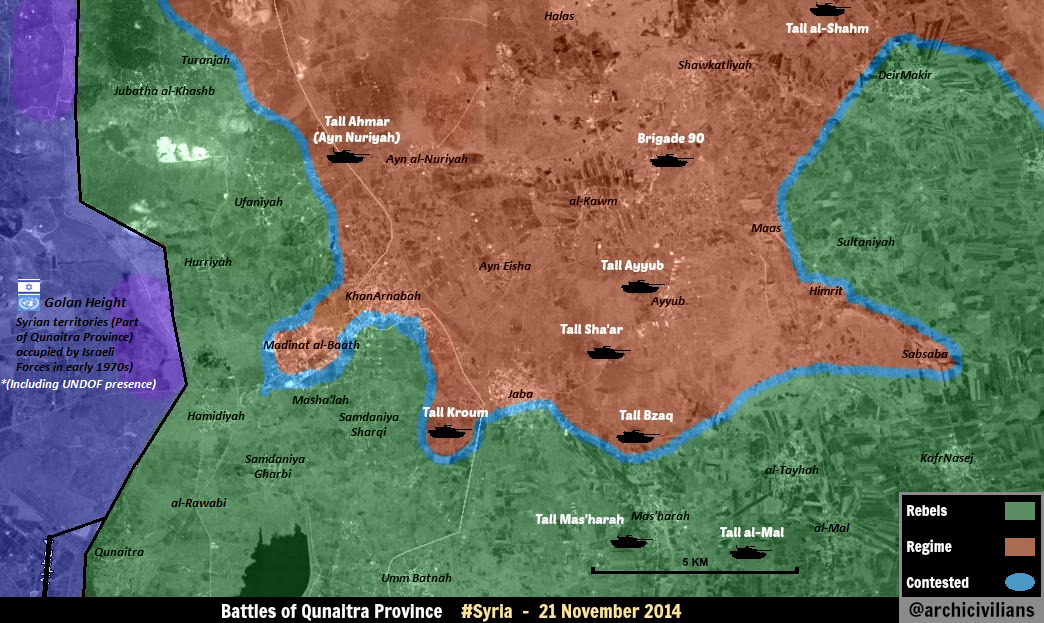
- As for the neutrality of Israel, we should also consider the purpose of their attacks. If it is apparently against the Hizbolla (such as destroying arms destined for them), it is not overtly anti-Assad (despite the Hizbolla being an Assad ally), and should not be considered as such. Israeli attacks are too infrequent and selective to greatly impact the regime. Even though Israel would probably prefer Assad gone, if Israel were to overtly oppose Assad, it would backfire with increased support for Assad from arab countries, thus be counter-productive. André437 (talk) 14:23, 10 December 2014 (UTC)
Desyracuse, take 5.
Here, desyracuse has edited his map, showing SAA presence in Raqqa province, based on "On November 17, pro-govt Ba'ath Brigades announced having entered Raqqah governate". - so, he's editing his map based (in this case) exclusively off of what a pro-gov't outlet said. And, we.. then used desyracuse to make the same edit on our map, here. So, in summary, we took the Ba'ath Brigades at their word and made a pro-gov't edit based on their unconfirmed announcement. Explain to me again how desyracuse is pro-op? We're changing villages around Duhur airbase, and we're adding more villages based off his map, when he's just taking pro-gov't media at its word.. Boredwhytekid (talk) 15:18, 8 December 2014 (UTC)
- This source pro opposition because it is basically repeats the data from other pro opposition sources. Simply, he is more accurate than some other pro opposition sources. Also I remove red mark in the province of Raqqa. Because you are right and also the source @de Syracuse clear said that about the army advance in Raqqa in the province reported only government source but I did not pay attention on this notice. But on about the achievements of army in area the Abu al- Duhur air base also reported the some of reliable sources. Hanibal911 (talk) 15:34, 8 December 2014 (UTC)
He clearly takes ANY source at it's word - if he's marking gov't gains based exclusively on Ba'ath Brigade announcements, how in the world can we consider his map pro-op biased? Boredwhytekid (talk) 15:39, 8 December 2014 (UTC)
- And also area where I add those villages adding more villages under control by army and this also confirmed on another more biased pro opposition map.here Also this source previously changed the territory controlled by the Army on the ISIS controlled on the basis of preconceived opposition source.here Hanibal911 (talk) 15:46, 8 December 2014 (UTC)
- Also this map said that city Sawran to north Aleppo now under control by rebels but we only have data from opposition sources that now this city under control by rebels and ISIS tried storm him.here Also as we have previously recognized that the source @deSyracuse pro oppositionbut it is less biased and more accurate showed situation unlike other heavily biased opposition sources. Hanibal911 (talk) 15:58, 8 December 2014 (UTC)
- And also area where I add those villages adding more villages under control by army and this also confirmed on another more biased pro opposition map.here Also this source previously changed the territory controlled by the Army on the ISIS controlled on the basis of preconceived opposition source.here Hanibal911 (talk) 15:46, 8 December 2014 (UTC)
If desyracuse is the only source, no edit should be made. It's that simple - he'll use any source to update his map... we should try to be better than that. Boredwhytekid (talk) 16:11, 8 December 2014 (UTC)
- So, for the changing villages around Duhur airbase - any other sources? For all we know desyracuse got his info about this area straight from the Ba'ath Brigades... Boredwhytekid (talk) 16:13, 8 December 2014 (UTC)
- Also a reliable source said that control of Khaz'zanat helped regime forces inside Abu Al-Duhur military airport to advance into nearby villages Tal Selmo and Mustariha.Elijah J. Magnier Also earlier pro opposition source said that Assad-forces try to storm Haymat ad Dayir north of Abu ad-Duhur - Military Airbase here so maybe army captured this village.And here other source said that army controls the towns of Humaimat and Mustrihah in the vicinity "Abu Aldhor" airport in the southern countryside of Idlib.Kalam AkhbarCyber AmanLebanese Info[]El Marada Hanibal911 (talk) 16:42, 8 December 2014 (UTC) Hanibal911 (talk) 16:42, 8 December 2014 (UTC)
That's more like it. Objection retracted. Boredwhytekid (talk) 16:49, 8 December 2014 (UTC)
I see some recent NDF reports in Raqqah but nothing official at the moment (I'm not very active now) --Pototo1 (talk) 18:39, 8 December 2014 (UTC)
- From my point of view I think Desyracuse is moderately pro-opp just cause he/she works with Archicivillians, a very well known pro-opp and anti-regime activist. But DeSyracuse's work is quite honest and to be fair it's more or less neutral. Cedric Labrousse (a huge pro-opp activist) reported NDF activity from Ithriya towards Raqqa. You may check his tweets anytime. I'm not with changing all our map based on DeSyracuse's maps but when we lack sources I think he's a reliable one. ChrissCh94 (talk) 20:01, 8 December 2014 (UTC)
Tradedia's insights here further cement me in the opinion that these amateur maps should be relegated to secondary source status for our map, only to be used when supported by reliable/usable primary sources OR community consensus on specific situations. Boredwhytekid (talk) 20:49, 8 December 2014 (UTC)
- I totally agree with ChrissCh94 the Desyracuse is moderately pro-opp source. So that in the some situations if we not have clear data we can use it. And about situation with some villages near Abu Al Duhur Air Base i provide some reliable sources which confirm my editings.Kalam AkhbarCyber AmanLebanese InfoEl MaradaAl-Fayhaa TVAl-QabasAl Ghadeer TV also here confirmation from pro government sources Al VefaghSyria unbreakableShaam TimesAl AlamHosein mortadaSlab NewsBuratha newsAl Baath MediaMiddle East PanoramaAlahed News And not one of the reliable and pro-government sources no said that the army later some time retreated from those villages. Hanibal911 (talk) 09:51, 9 December 2014 (UTC)
- And also here source @deSyracuse showed on map where most active frontlines on 8 December. Hanibal911 (talk) 10:02, 9 December 2014 (UTC)
- But all except 1 of those sources (not including the pro-gov't ones), are dated from the 27th or earlier - which still leaves Tradedia's point valid, that desyracuse's map is inaccurate in this case. Boredwhytekid (talk) 14:00, 9 December 2014 (UTC)
- Al-Fayhaa TV(independent Arabic television channel 29 November) Cyber Aman(28 Nowember) Hanibal911 (talk) 15:13, 9 December 2014 (UTC)
- Correctly me if I'm wrong, but doesn't al Fayhaa refer to the rebels generally as "terrorists"? If so that doesn't really indicate a neutral stance.. Seeing as how any outlet that says "regime" instead if "government" is classified as pro-op.. Boredwhytekid (talk) 15:27, 9 December 2014 (UTC)
- Boredwhytekid In Wikipedia says that Al-Fayhaa TV (Iraq) is an independent Arabic television channel which broadcasting from Suleymaniyah, Iraq which launched on 20 July 2004, and was among the first channels that emerged after the 2003 Iraq war, began its work in the United Arab Emirates.herehere Also source said that these villages were under the control of Al Nusra or allies which also and in US are called terrorists. Hanibal911 (talk) 16:22, 9 December 2014 (UTC)
- Boredwhytekid Al Nuara has been designated as a terrorist organization by the United NationsAl Jazeera AustraliaABC News Turkey, Canada, New Zealand, Hurriyet Daily Newshere Saudi Arabia and United KingdomFox News the United StatesAl Jazeera United Arab EmiratesReuters Hanibal911 (talk) 16:38, 9 December 2014 (UTC)
- Correctly me if I'm wrong, but doesn't al Fayhaa refer to the rebels generally as "terrorists"? If so that doesn't really indicate a neutral stance.. Seeing as how any outlet that says "regime" instead if "government" is classified as pro-op.. Boredwhytekid (talk) 15:27, 9 December 2014 (UTC)
- Al-Fayhaa TV(independent Arabic television channel 29 November) Cyber Aman(28 Nowember) Hanibal911 (talk) 15:13, 9 December 2014 (UTC)
- But all except 1 of those sources (not including the pro-gov't ones), are dated from the 27th or earlier - which still leaves Tradedia's point valid, that desyracuse's map is inaccurate in this case. Boredwhytekid (talk) 14:00, 9 December 2014 (UTC)
- Wiki also says Al-Fayhaa TV (Iraq) leans toward Shia-Islam, and the Shia channels have been, for obvious reasons, overwhelmingly pro-Syrian gov't, the same way Sunni channels and state medias are pro-rebels - which is why we don't use most Saudi or Qatari outlets to show alleged rebel gains. Boredwhytekid (talk) 16:40, 9 December 2014 (UTC)
- al-Fayhaa isn't the point though. It's the use of desyracuse as a SOLE source - and I think there have been plenty of proofs that his/her source screening does not meet the standards of this map (no pro-op for pro-op gains, vice versa). And it doesn't really seem appropriate to back up desyracuse's (Ba'ath Brigade announcement) edit with a Shia leaning outlet. Boredwhytekid (talk) 16:43, 9 December 2014 (UTC)
- The Al-Fayhaa TV article uses the expression: “ارهابيي جبهة ثوار سوريا” which translates into “the terrorists of the Syria Revolutionaries Front” Any source that calls Syria Revolutionaries Front terrorists is clearly pro-gov. Tradediatalk 00:15, 10 December 2014 (UTC)
- Also here confirmation from Qatari source that those villages was captured by army.here from another Iaraqi sourcehere Lebanese sourcehere and from some other sources.JP NewsChaled News Hanibal911 (talk) 17:01, 9 December 2014 (UTC)
- Simply, we can use the source @deSyracuse if its data are supported by other sources. Hanibal911 (talk) 17:06, 9 December 2014 (UTC)
- Agree with Hanibal911, we SHOULD of course use DeSyracuse with other sources but we COULD also use his/her maps when we lack reliable sources. ChrissCh94 (talk) 22:44, 9 December 2014 (UTC)
- As long as desyracuse's source is not clearly the Ba'ath Brigades reporting their own battlefield successes, or any similar scenario regarding ANY of the groups/sides/belligerents. Boredwhytekid (talk) 00:03, 10 December 2014 (UTC)
- 1- None of your sources is reliable. You list 12 sources that you call “reliable”. First, I will remove Al-Qabas & Al Ghadeer TV because they talk about a completely different topic. Second, I will remove Lebanese Info, El Marada & Kalam Akhbar because they are dated 27 nov, so they are outdated. This leaves us with:
- - Cyber Aman: This is not a source. It is a website that works following the model of Wikipedia. Anonymous users submit news! This one line news was submitted by an anonymous user called “Rabie Mahdy”!
- - Al-Fayhaa TV: The article uses the expression: “ارهابيي جبهة ثوار سوريا” which translates into “the terrorists of the Syria Revolutionaries Front” Any source that calls Syria Revolutionaries Front terrorists is clearly pro-gov.…
- - masdark: this is not a source but simply a website that collects articles from other sources… It doesn’t even say where they got the article from…
- - iraqnacl.com: Look at it! It’s just a vBulletin message by an anonymous user called “Prince Adhamiya”!
- - afwajamal.com: this is the mouthpiece of the shia Lebanese militia “Amal” (see Lebanese civil war for more info about it)
- - JP News: they copied the article that uses the expression: “ارهابيي جبهة ثوار سوريا” which translates into “the terrorists of the Syria Revolutionaries Front” Any source that calls Syria Revolutionaries Front terrorists is clearly pro-gov
- - Chaled News: is not reliable but pro-gov.
- 2- Now, lets look at the content of your sources (which are all unreliable as I showed in item 1- above). I skip those that are dated 27 nov, since they are outdated. All the articles are general articles about the events in the whole of Syria during the day. The events at Abu Duhur are covered in only one sentence. This makes these articles very superficial. We cannot conclude much from them. You say: “they didn’t say the army left the villages”. I say: “they didn’t say the army stayed in the villages!” In reality, in one sentence, you are not going to be able to say much. So these are not good sources. You need a source that describe the events in detail.
- Conclusion: Not one of the “sources” you present is useful. On the other hand, we have a reliable (by your own words) source saying the troops returned to the airport and a pro-gov source detailing the whole operation and saying they returned back to the airport. See a translation of the details of the operation in Talk:Cities_and_towns_during_the_Syrian_Civil_War#Abu al-duhur airbase. Tradediatalk 00:15, 10 December 2014 (UTC)
- Nice try but Fron victory (جبهة النصرة لأهل الشام ) it is Al Nusra but not Syria Revolutionaries Front( جبهة ثوار سوريا) and sources which i provide here said that army retake villages from the Front victory but not SRF. And as I said above Al Nusra recognized by leading Western countries as terrorists. And Cyber AmanMas Dark and Al Fayhait is sreliable news sources which said about Al Nusra. Also reliable source Elijah J. Magnier just said that SAA returned to air base but not said that they all returned on base and just left villages which they captured. This message here was dated 27 November but also not said that army just left villages without protection and Al Nusra retake them and also more recent reports have confirmed that these villages under the control of the army. Regards! Hanibal911 (talk) 07:18, 10 December 2014 (UTC)
- No. Look at the article carefully. It calls both Al Nusra and Syria Revolutionaries Front "terrorists" when it mentions that they are fighting in Idlib (not at Abu Duhur). Look at Al-Fayhaa TV At word 34 from the bottom, it starts a sentence that says:
- Nice try but Fron victory (جبهة النصرة لأهل الشام ) it is Al Nusra but not Syria Revolutionaries Front( جبهة ثوار سوريا) and sources which i provide here said that army retake villages from the Front victory but not SRF. And as I said above Al Nusra recognized by leading Western countries as terrorists. And Cyber AmanMas Dark and Al Fayhait is sreliable news sources which said about Al Nusra. Also reliable source Elijah J. Magnier just said that SAA returned to air base but not said that they all returned on base and just left villages which they captured. This message here was dated 27 November but also not said that army just left villages without protection and Al Nusra retake them and also more recent reports have confirmed that these villages under the control of the army. Regards! Hanibal911 (talk) 07:18, 10 December 2014 (UTC)
- 1- None of your sources is reliable. You list 12 sources that you call “reliable”. First, I will remove Al-Qabas & Al Ghadeer TV because they talk about a completely different topic. Second, I will remove Lebanese Info, El Marada & Kalam Akhbar because they are dated 27 nov, so they are outdated. This leaves us with:
- “تجددت المواجهات بين ارهابيي النصرة وارهابيي جبهة ثوار سوريا”
- This translates into:
- تجددت المواجهات بين = Clashes broke out between
- ارهابيي النصرة = terrorists victory (Al Nusra)
- ارهابيي = & terrorists
- جبهة ثوار سوريا = Syria Revolutionaries Front
- It is the same for JP News.
- Concerning Elijah J. Magnier & the detailed pro-gov source, it should be understood that “they all returned on base and just left villages which they captured” (see my response @Talk:Cities_and_towns_during_the_Syrian_Civil_War#Abu al-duhur airbase for more details about this argument). Again, all other “sources” are unreliable & uninformative (one sentence) as I showed above. Tradediatalk 10:04, 10 December 2014 (UTC)
- Here reliable source clear said that Syrian army took control of the towns and Humaimat Almstrihh in the vicinity of Abu military airport Aldhor Brive Idlib, while the number of people killed after clashes between the army and the victory of free front in the same area.Mas Dark Or do you even think that the Qatari source also government source. This also confirmed another not government source.Ceber Aman Also about source Afwajamal this source said that Syrian army took control of the towns and Humaimat Almstrihh in the vicinity of Abu military airport Aldhor Brive Idlib, while the number of people killed after clashes between the army and the victory of free front in the same area. And not said that rebels from SRF it is terrorists. Also we agree use for editing the opposition source SOHR but which many a reliable sources called of anti-government source but we in as a compromise, decided to use it because it has more data from the ground in Syria, though SOHR and opposed to Syrian regime. However personally I not opposed use data from SOHR because they have many activists in areas where going clashes. And all the data which I provided now confirmed in many sources and dont need blame me that all source which I provide pro-government. Also we use to display the success of rebels a news sources from Saudi Arabia and Qatari although these countries strongly support the Syrian opposition and rebel groups who are fighting against the Syrian regime. So that you need understand if the army left these villages and they are once again under rebel control, we need more data which clear says that those again under control by rebels. So me it was nice to talk about this issue but more I will not try to convince you. Since I gave you all the possible facts from reliable and pro-government sources which said that troops captured those villages and not one of these sources not said that the army had just stepped back and villages again under control by moderate rebels. Cheers! Hanibal911 (talk) 12:01, 10 December 2014 (UTC)
- I strongly agree that every time we have a source article, we should analyse it as Tradedia suggests above.
- For deSyracuse maps, I consider them accurate for the time in question, but agree that by the time they are published specific locations are often outdated. He doesn't have the resources to update his maps on a daily or hourly basis. Meaning we need to confirm that specific locations are still up to date. As we should for all sources.
- Even the best sources make mistakes, and are often quickly outdated. André437 (talk) 11:12, 10 December 2014 (UTC)
- masdark is not Qatari. On its “contact us page” you can see that its address is “مصر - القليوبية - بنها - كفر الجزار - 13111” the first word is “مصر” which is translated into Egypt. Their phone number is 201125285640, which starts with 20. 20 is Egypt country code. As I indicated above, masdark is not a source. It is simply a website that collects articles from other sources. It did not even say where they got the article from, which is highly unprofessional. They state on their “about page” that:
- مصدرك هو خدمة تجميع وتصنيف للأخبار، ويتحمل كل مصدر من المصادر مسئولية الأخبار الصادرة عنه وكل ما يقوم به مصدرك" هو إعادة نشر الخبر والاشارة لمصدر المحتوى مع رابط مباشر للمصدر بالاضافة لمساحة اعلانية للمصدر.”
- which google translates into:
- “masdark is a compilation and classification of the news service, and each of the sources responsible for the news of him and all what masdark is the re-deployment of news and reference to the source of the content with a direct link to the source in addition to the area of advertising to the source.” (my emphasis added)
- So it is clearly not a source. I went ahead and did a google search on the title of the article “الجيش يستعيد بلدتين بادلب، واهالي نُبُّل والزهراء يصدون هجمات”. I discocered that it is in reality an article from Iranian Alalam.
- Cyber Aman is not a source either. It is a website that works following the model of Wikipedia. Anonymous users submit news! This one line news was submitted by an anonymous user called “Rabie Mahdy”! The “about page” says:
- “س: ما هو هدفكم من هذا الموقع ؟
- هل سمعت بـ ويكيبديا من قبل ؟,و كيف أغنت البشرية بمحتواها الحر ؟ نحن نقدم شبكة إجتماعية إخبارية تنشر الخبر كما يرسله الأشخاص العاديون دون مقص للرقابة و دون الأخذ بعين الاعتبار وجهة نظر سياسية محددة, سايبر أمان تجربة إخبارية فريدة تجعل أي فرد في أي بلد يطّلع على أخبار بلد آخر بحرية تامة , خاصة للمغتربين و المهتمين بامور بلدان أخرى , الشباب في عصرنا الحالي تتوق لمثل هذه التجربة و أصبحت تمل من أخبار على شاكلة "إستقبل و ودع" و صحافة القص و اللصق.”
- which google translates into:
- “Q: What is the aim of this site?
- Have you ever heard of Wikipedia before?, And how enriched the human heat its contents? We provide news Social Network publishes news as sends ordinary people without scissors controlled and without taking into account the political point of view specific, Cyber Aman unique news experience make any individual in any country seen the news another country freely, especially for expatriates and interested to matters other countries , young people in the present era yearns for such an experience and become bored of news along the lines of "received and let" and press the sternum and pasting.”
- So they are clearly not a source. Just like Wikipedia is not a source.
- Concerning afwajamal.com, I never said they “said that rebels from SRF it is terrorists”. Those that called SRF rebels terrorists are Al-Fayhaa TV & JP News. afwajamal.com is the mouthpiece of the shia Lebanese Amal Movement. Their article is titled: “الجيش يستعيد بلدتين بادلب، واهالي نُبُّل والزهراء يصدون هجمات”. Rings a bell? Yes, this is the same article that was copied from Iranian Alalam!
- The problem is not just that all the “sources” you have linked are unreliable. The problem is that they are uninformative. They are general articles that give a summary of all events in Syria during that day. They just mention the events at abu duhur in one sentence. On the other hand, we have 2 sources (one of them reliable) that talk about the events at abu duhur in detail. It is obvious that all the “sources” you have linked have just copy/pasted the pro-gov “summary of the day” on their website. There was no journalistic work involved, no investigation, no critical thinking. These are websites that have a very general focus. In “one sentence”, you are not able to say much. So the argument that they didn’t say this or that means that this or that didn’t happen does not hold. It is usual for biased sources to mention the advance of their favorite party, but then “forget” to mention their retreat.
- On the other hand, we have an expert on the matter (Elijah J. Magnier) who is following the events closely, give details & explanations on what happened. Also, we have a source that is based in Idlib (Assad Idlib News Network) & specializes in military events in the governorate and has close ties with the army describe the events in detail in about a dozen lines. They are pro-gov, so they have no reason to understate the achievements of the army. They clearly say: “troops returned to airport”. They then carry on in saying: “the results were successful where they killed and wounded dozens of terrorists and destroy their vehicles and their hideouts and captured a number of them also were confiscated light weapons and ammunition in addition to the herd of sheep was in one of the dens of terrorists in the vicinity of Humaimat Waldeyer.” which makes it clear that the objective of the army mission was to hit the “terrorists” and not control towns. Elijah J. Magnier also makes it clear when he says: “SAA won't spread in an exposed area when the airport represents a better shelter and defense line”. We have to realize that these are troops that have been under siege for a long time in a very hostile environment with rebels all around them… The fortified airport was the only reason they were able to withstand the siege. If they stay any length of time in a town outside the fortifications of the airport, they become very vulnerable to rebel attacks. Tradediatalk 01:40, 11 December 2014 (UTC)
The IS Presence in no exit.
The IS is not there I'm 99,99% the only information about IS presence in As-Suwayda come from Al Arabiya in Arabic only who most probability is a fake rumor.
The most usually Anti Assad source SOHR NEVER Report IS Presence in As-Suwayda --Pototo1 (talk) 13:26, 9 December 2014 (UTC)
- There is no 100% reliable Source in this war, even SOHR looked ridiculous with the Aleppo Prison breach by AL Nusra. Witch resulted in a fiasco.200.48.214.19 (talk) 13:34, 9 December 2014 (UTC)
- Just be careful look for more sources, edit outright and keep an eye on past edits, info tends to change in content and numbers in time.200.48.214.19 (talk) 13:36, 9 December 2014 (UTC)
Lots of sources discussed here. Boredwhytekid (talk) 13:39, 9 December 2014 (UTC)
"Lots of sources" NO just one a single Al Arabiya link only in Arabic very vague.
Show me a Single SOHR the Link the "Official" Anti Assad source talking about IS Presence in As-Suwayda
Show me a single video a single photo?
Common the most recent ISW (Anti Assad source) no showing the IS there http://campaign.r20.constantcontact.com/render?ca=a3b60f0c-7f1c-4666-b671-5753603361d6&c=a494ff50-f60e-11e3-ab57-d4ae526edc76&ch=a499ba40-f60e-11e3-ab57-d4ae526edc76
Just be realist the IS it's not in As-Suwayda --Pototo1 (talk) 17:22, 9 December 2014 (UTC)
- lol there are sources in that section from al Arabiya, archicivilians, lahitha news net, Robert ford, al mayadeen, france 24 and al alam - that's "lots of sources" Boredwhytekid (talk) 17:42, 9 December 2014 (UTC)
- Agree with Boredwhytekid many source confirmed the fact that ISIS present in this area and controlled some villages. Hanibal911 (talk) 18:16, 9 December 2014 (UTC)
Pototo your blood pressure is to high.DuckZz (talk) 22:17, 9 December 2014 (UTC)
- +1 :) ... It is not a life-or-death issue for us as editors. We are just doing our best to create an accurate map André437 (talk) 10:51, 10 December 2014 (UTC)
Latest from ISW acknowledges IS presence in the Bir al-Qassab area Boredwhytekid (talk) 14:46, 10 December 2014 (UTC)
^ There the Pro Israeli ISW Anti Assad club only talking abut Damascus province no about As-Suwayda --Pototo1 (talk) 19:16, 10 December 2014 (UTC)
Khan Touma army depot
The Khan Tuman army depot seem to be under SAA control. It is here. It is not marked on the Aleppo map. It should go red. Furthermore the Ammunition storage base is green, but it is located in a area marked red on the mapPaolowalter (talk) 14:42, 9 December 2014 (UTC).
- Also pro opposition activists also said that rebels try to regain Khan Tuman army depots on the south western outskirts of Aleppo.here Nevertheless, we need data from more reliable sources. Hanibal911 (talk) 12:25, 10 December 2014 (UTC)
Additional confirmation from pro-opp source http://www.petercliffordonline.com/syria-iraq-news-4/192.135.12.144 (talk) 08:08, 11 December 2014 (UTC)
ISIS presence in damascus Suburbs, yeah Suburbs.
Check this, dont know if the Source is considered Reliable but found this some minutes ago. http://www.al-monitor.com/pulse/security/2014/12/recent-developments-on-ground-syria-december-2014.html 200.48.214.19 (talk) 12:58, 10 December 2014 (UTC)
- In some areas in East Ghouta and to south of Damascus in city Al-Hajar al-Aswad but not inside city of Damascus.Al Monitor Hanibal911 (talk) 13:25, 10 December 2014 (UTC)
- Pro opposition source said that pro-regime military forces imposed their control on the town of Darayya in the western Ghouta of Damascus countryside. One of the FSA’s fighters was reported dead Tuesday afternoon, during clashes with pro-regime forces in Darayya. Speaking in Damascus, civil rights activist Ahmed Sabbagh said that clashes broke out between FSA-linked faction of the Islamic Union of Ajnad al-Sham and members of the pro-regime forces in the Kornish Qadima area eastern the city, while the pro-regime forces blew up a tunnel in the region, killing at least one fighter from Ajnad al-Sham.ARA News Hanibal911 (talk) 17:18, 10 December 2014 (UTC)
HAHAHAH,it is the opposite Hanibal,the rebels are advancing in Darayya. http://syriahr.com/en/2014/12/3-fighters-at-least-killed-in-rif-dimashq-while-violent-clashes-erupts-in-ayn-al-dinar-region-in-homs/.Alhanuty (talk) 00:22, 11 December 2014 (UTC)
- Yeahhh, no they are not. You have a pro-opp source that just said that the rebels lost the area. A report from the increasingly defunct SOHR will not change that. Also, the ARA news article is a day newer than your article. XJ-0461 v2 (talk) 00:27, 11 December 2014 (UTC)
SOHR is way more reliable than the defunct Aranews and the pro-regime Al-Masdar.Alhanuty (talk) 01:16, 11 December 2014 (UTC)
- It is not Al-Masdar that speaks. Why did you mention it? It is the PRO-OPP [You side remember] ARA News that is reporting this, so they can be used as a source. XJ-0461 v2 (talk) 01:30, 11 December 2014 (UTC)
it is pro-kurd,not pro-opposition.Alhanuty (talk) 02:49, 11 December 2014 (UTC)
- Perhaps you are right. Let me rephrase what I said. It is Anti-Assad. Throughout the article, it continuously refers to the SAA as "pro-regime forces/militias". The site also hosts many articles about the SAA supposedly using Chlorine gas as well as numerous rebel accounts of battle. Since it is anti-regime, it can be used to back up regime advances. XJ-0461 v2 (talk) 02:57, 11 December 2014 (UTC)
- Alhanuty no need inventing this source to 100% pro-opposition. It has long been recognized so that enough deny it. This source is one of those sources are openly opposed to the Syrian government and clears support moderate rebels and Syrian opposition. Also, you should know that many Kurds in the ranks of the Syrian opposition so it is possible that the Kurds which supported opposition and engaged in financing and leadership of this source. Hanibal911 (talk) 07:35, 11 December 2014 (UTC)
The suburbs when IS are is in East Goutha with others armed groups since a lot time ago that's nothing news
Same case with the Insurgent presence in Darayya - Nothing news --Pototo1 (talk) 10:31, 11 December 2014 (UTC)
Aleppo
Syrian Army forces advance inside Aleppo source:[3].Daki122 (talk) 14:51, 10 December 2014 (UTC)
Where are those areas mentioned? I've looked on Wikimapia, Google Earth and Google Maps. None of them even mentioned those areas in central Aleppo? — Preceding unsigned comment added by 84.24.43.183 (talk) 10:24, 11 December 2014 (UTC)
Hanano district is in east Aleppo near Sakhur district the other two I could not find.Daki122 (talk) 14:41, 11 December 2014 (UTC)
Why are no grey dots or circles within dots allowed in the south to show Nusra?
Has this topic been discussed here? This recent article on the BBC says that Nusra controls towns in the south: http://www.bbc.com/news/world-middle-east-30374581 "Christians in the town of Izraa have expressed fear for their lives because of the presence of the al-Qaeda affiliated group the Nusra Front, which recently gained control over two nearby towns." — Preceding unsigned comment added by 169.231.27.234 (talk) 03:42, 11 December 2014 (UTC)
Because there is no conflict between Al-Nusra and the Southern Command (FSA and IF) in southern Syria. Jabhat al-Nusra has a relatevelt small presence in the south. Estimates range from 3000-5000 Al-Nusra fighters and 15,000-20,000 more moderate rebels (of which some 12,000 seem to be FSA). Nusra works together with those brigades, like in Nawa and Sheikh Maskin. There is no conflict like in Idlib, that seemed to be a localized war. — Preceding unsigned comment added by 84.24.43.183 (talk) 10:22, 11 December 2014 (UTC)
Yes, you have a point. The journalist (Theo Padnos) talks about how he saw first hand how closely FSA and Nusra work together in the South. US & Jordanian policymakers must feel really proud of all the money they have sunk into the "southern campaign". Interview with Theo Padnos: http://www.nytimes.com/2014/10/28/magazine/theo-padnos-american-journalist-on-being-kidnapped-tortured-and-released-in-syria.html — Preceding unsigned comment added by 169.231.24.47 (talk) 20:33, 11 December 2014 (UTC)
that's not true. Since Nusra moved out of Deir Azzor the south is their stronghold. They de facto control quneitra, nawa, sheikh miskin and are leading ALL the offensives that take place in the south. South is Nusra land. — Preceding unsigned comment added by 132.231.182.134 (talk) 21:07, 13 December 2014 (UTC)
Hasakah area
According to sohr , saa advancing in western hasakah and saa captured 3 villages. http://www.syriahr.com/2014/12/%D9%86%D8%AD%D9%88-15-%D8%B4%D9%87%D9%8A%D8%AF%D8%A7%D9%8B-%D9%88%D8%AC%D8%B1%D9%8A%D8%AD%D8%A7%D9%8B-%D9%81%D9%8A-%D9%85%D8%AF%D9%8A%D9%86%D8%A9-%D8%AD%D9%84%D8%A8%D8%8C-%D9%88%D9%82%D9%88%D8%A7/Hwinsp (talk) 15:18, 10 December 2014 (UTC)
Also this article http://www.almasdarnews.com/article/al-hasakah-syrian-army-captures-7-villages-east/Rhocagil (talk) 19:40, 10 December 2014 (UTC)
- Pro opposition source said that Syrian troops took control of villages of Masoom, Hanash, Uwaina, Hajj Hasan, Tappa, Marouf, and Nasrat (south of Hasakah city) and installed several checkpoints in the area.ARA News Hanibal911 (talk) 13:07, 12 December 2014 (UTC)
Sheikh Miskin
https://twitter.com/EjmAlrai/status/542937451095150592
Elijah J Magnier claims Nusra/FSA(he didn't say FSA but they are taking part of the operation according to videos and Peto Lucem maps) are in control of Sheikh Miskin. Since no infighting in the South, I believe to change it to Green or to shared control(Gray+Green). — Preceding unsigned comment added by 179.183.251.245 (talk) 11:26, 11 December 2014 (UTC)
Haha moderate rebels, and who used a UNDOF apc as suicide bombing opening the way to the military housing? guess it was moderate rebels also right? 10% of the daraa snackbar army is MAYBE fsa — Preceding unsigned comment added by 89.132.122.57 (talk) 19:30, 12 December 2014 (UTC)
- Done I marked Shaykh Miskin to green color because moderate rebels more in this area and also put red ring to east from city because reliable source also showed that army still controlled Base Brigade 82Elijah J. Magnier and also army still present near with city from east and north.Elijah J. Magnier Hanibal911 (talk) 12:06, 11 December 2014 (UTC)
Disagree most strongly. That is a major change not reported by anybody else. The same day Petolucem (see below) gives a completely different picture. Even reliable source sometimes do mistakes. Other sources are needed. Paolowalter (talk) 18:03, 11 December 2014 (UTC)
December 10 map showing the army still controlling a minor part of the town https://twitter.com/PetoLucem/status/542773482388746240 --Pototo1 (talk) 17:30, 11 December 2014 (UTC)
- Perhaps you are right that to change large and strategically important cities need more data. Also yet there is no other evidence from other reliable sources. Even SOHR still silent about this situation. Hanibal911 (talk) 18:34, 11 December 2014 (UTC)
Shouldn't this still be marked as being contested? Why is Sheikh Miskin repeatedly marked as rebel held, when this not agreed upon? Have any (non-twitter) neutral or regime outlets said it is? Here is the so-far for the most part accurate though pro-regime site that says its still being battled over: http://www.almasdarnews.com/article/battle-map-update-sheikh-miskeen-al-jazeera-correspondent-killed/ — Preceding unsigned comment added by 169.231.24.47 (talk) 20:42, 11 December 2014 (UTC)
- Another reliable source said that in south is currently scene of one of the fiercest battles between the government and its armed opponents in and around the town of Sheikh Miskeen. So it is likely city Sheik Maskin need to remain marked as contested.Christian DailyReutersVoice of AmericaYahoo NewsMaktoob NewsLibya News Today Hanibal911 (talk) 10:24, 12 December 2014 (UTC)
- Also SOHR totay reported that Islamic fighter killed during clashes against regime forces in Shekh Meskin.SOHR Hanibal911 (talk) 12:10, 12 December 2014 (UTC)
IS Presence Icon
Pototo1 , please explain this edit. That icon is there to show the IS presence in a transit route, a low populated area - an area that on both the source you presented and our conjoining Template: Iraqi insurgency detailed map lies directly between the source-supported IS presence in Al-Qa'im, Iraq, and Jabal al-Ghurab and the T2 Pumping Station sites in Syria.
- Also, thank you for once again removing an icon arbitrarily instead of joining the appropriate talk page discussion. Boredwhytekid (talk) 15:19, 11 December 2014 (UTC)
This is a desert inhabited area area
The Islamic State Insurgents are in Eufrates River no in the middle of the desert.
Pro Insurgent map 1 http://umap.openstreetmap.fr/fr/map/desyracuse-syria-civil-war-8-december-2014_23532#7/35.639/39.117 Pro Insurgent map 2 http://1.bp.blogspot.com/-CFTUDGQDmj4/VIHJiy3sMhI/AAAAAAAACRc/6tIkwX23UE0/s1600/ISIS%2BMap%2BDEC%2B5.png --Pototo1 (talk) 15:46, 11 December 2014 (UTC)
- What route do you presume they transit to/from the Jabal al-Ghurab and al-Halbah area? There isn't a road open to them. I thought there was an equilibrium here - I used the same icon in red to mark two SAA-used highways/transit routes. Boredwhytekid (talk) 16:09, 11 December 2014 (UTC)
In this place are not routes or towns only a lot sand here is another map http://upload.wikimedia.org/wikipedia/commons/c/cf/Syria_Ethno-religious_composition..jpg --Pototo1 (talk) 17:33, 11 December 2014 (UTC)
I think we better stick to only using the new icons when we are sure there is a presence in the area or else we get to many arguments .Pyphon (talk) 18:37, 11 December 2014 (UTC)pyphon
- Look, if you're going to be silly then I'll just self-revert and take the red ones down too. Remember, there are no sources for ANY of the 2 black or red "presence" icons. Two of each were added to indicate major thoroughfares used by each side respectively. I added them in the common sense locations where the belligerents HAVE to transit to get to their front line positions. The only possible way for the IS to get to its front line positions at Jabal al-Ghurab and al-Halbah is through the desert/wastelands, since the highway is SAA-ontrolled. AND that area links IS holdings in Syria and Iraq. So, either all 4 red and black "presence" icons stay up, or I'll just take the remaining 2 red and 1 black icon down - since they all indicate supply routes and none of them have sources. Your choice. André437, Hanibal911, you are the other two editors mainly involved in respectively creating and implementing these icons: Preference? Boredwhytekid (talk) 21:56, 11 December 2014 (UTC)
- BoredwhytekidI'm for whatever be black icon was returned to place where it previously was installed. Hanibal911 (talk) 22:04, 11 December 2014 (UTC)
It is possible for 4x4 vehicles to travel across deserts they do not need tarmac and it is logical .Pyphon (talk) 23:11, 11 December 2014 (UTC)pyphon
- Boredwhytekid, Hanibal911 I agree on keeping the presence icons. They don't indicate control like the other icons. And we know they must regularly pass through the areas in question. André437 (talk) 03:41, 12 December 2014 (UTC)
- And please, let's everyone discuss things on this page before changing the map. Like was done when these presence icons were added. André437 (talk) 03:47, 12 December 2014 (UTC)
Does anyone else have anything to say on this topic? Or have all those interested spoken? Consensus seems to be to put the black icon back up. Boredwhytekid (talk) 14:41, 12 December 2014 (UTC)
This area is only a inhabited desert stop to do that. --Pototo1 (talk) 00:19, 13 December 2014 (UTC)
- Aaaand Pototo removed it again André437, Hanibal911, Pyphon. I'm fresh out of reverts, any of you wanna throw that icon back up? Boredwhytekid (talk) 00:31, 13 December 2014 (UTC)
- I got it. XJ-0461 v2 (talk) 04:29, 13 December 2014 (UTC)
He succeeded in getting himself banned. So we are protected for 3 months at least. André437 (talk) 20:59, 13 December 2014 (UTC)
- Good riddance that Pototo1 is blocked. Can't stand his obnoxious edits. New we can have a safer and clean page from vandals like him. --Damirgraffiti |☺Say Yo to Me!☺ 22:36, 13 December 2014 (UTC)
Serghaya
Why Serghaya (qalamoun) is marked under goverment control while it's marked under control of insurgents in the most of pro-gov maps ? ex: https://twitter.com/PetoLucem/status/499490650812080129/photo/1 — Preceding unsigned comment added by 82.233.227.191 (talk) 20:01, 11 December 2014 (UTC)
- That map is dated August 2014. XJ-0461 v2 (talk) 21:02, 11 December 2014 (UTC)
That is because those maps are wrong. If you look back many months ago you will see Al Akhbar on the ground report explains how government forces were in Serghaya.
- I also remember reading an Al Arabyya (pro-opp) article about how car bombs used to evade Serghaya while entering Lebanon because it is gov-controlled. If you want I'll look it up for you in case you aren't convinced. ChrissCh94 (talk) 21:21, 11 December 2014 (UTC)
- But reliable source on 8 September reported that city Serghaya under control by army and army from this city sent reinforcements for troops which fighting in Zabadani.Al Monitor Hanibal911 (talk) 21:50, 11 December 2014 (UTC)
- Yes, you guys are right, because the map he linked is dated for August 13, 2014 XJ-0461 v2 (talk) 22:31, 11 December 2014 (UTC)
- Pro-gov source mentioning Serghaya as regime controlled:http://assafir.com/Article/1/376663/MostRead
- Pro-opp source mentioning Serghaya as regime controlled: http://www.alarabiya.net/ar/arab-and-world/syria/2014/02/19/%D8%A7%D9%84%D9%85%D8%B9%D8%A7%D8%B1%D8%B6%D8%A9-%D8%A7%D9%84%D8%B3%D9%88%D8%B1%D9%8A%D8%A9-%D8%AD%D8%B2%D8%A8-%D8%A7%D9%84%D9%84%D9%87-%D8%AA%D9%83%D8%A8%D8%AF-%D8%AE%D8%B3%D8%A7%D8%A6%D8%B1-%D9%83%D8%A8%D9%8A%D8%B1%D8%A9-%D9%81%D9%8A-%D9%8A%D8%A8%D8%B1%D9%88%D8%AF-.html
- Pro-opp spokesman saying SAA has added another checkpoint INSIDE Serghaya 2km away from another checkpoint inside the town. https://www.facebook.com/madaya.mumete/posts/554743354669166 ChrissCh94 (talk) 23:37, 11 December 2014 (UTC)
- Yes, you guys are right, because the map he linked is dated for August 13, 2014 XJ-0461 v2 (talk) 22:31, 11 December 2014 (UTC)
- But reliable source on 8 September reported that city Serghaya under control by army and army from this city sent reinforcements for troops which fighting in Zabadani.Al Monitor Hanibal911 (talk) 21:50, 11 December 2014 (UTC)
Deir El Zoor
Just a confirmation in an Al Arabyya (pro-opp) article that regime forces have taken back Jafra and the Jabal (mountain) near the Deir l Zoor airbase: http://www.alarabiya.net/ar/arab-and-world/syria/2014/12/11/%D9%82%D9%88%D8%A7%D8%AA-%D8%A7%D9%84%D8%A3%D8%B3%D8%AF-%D8%AA%D9%86%D8%A7%D9%81%D8%B3-%D8%AF%D8%A7%D8%B9%D8%B4-%D8%A8%D9%82%D8%B7%D8%B9-%D8%A7%D9%84%D8%B1%D8%A4%D9%88%D8%B3.html ChrissCh94 (talk) 21:22, 11 December 2014 (UTC)
- Thank you. I have edited the map. XJ-0461 v2 (talk) 22:30, 11 December 2014 (UTC)
More detailed info from AlMasdar. Jafra is almost completely under SAA control while Al-Mari’iyyah is partially under ISIS control. The detailed map should be corrected and Al-Mari’iyyah should be contested.Paolowalter (talk) 21:48, 12 December 2014 (UTC)
- Post from EJM confirmed SAA is now in control of Jafra: https://twitter.com/EjmAlrai/status/543465540883603457 — Preceding unsigned comment added by XJ-0461 v2 (talk • contribs) 22:16, 12 December 2014 (UTC)
al-Hirak
Apparently according to SOHR the city is contested.Paolowalter (talk) 22:05, 11 December 2014 (UTC)
- So SOHR clear said that violent clashes are taking place between the regime forces supported by NDF against the rebel and Islamic battalions in the town of al-Hirak. So that we can mark his as contested. Hanibal911 (talk) 22:50, 11 December 2014 (UTC)
Reconciliation agreement
Reliable source reported that today 325 rebels with their weapons surrendered to the Syrian army in the provinces of Damascus, Homs and Hama as a result of "reconciliation agreement".Elijah J. Magnier So maybe that is not ruled out a political solution to the conflict. Hanibal911 (talk) 22:27, 11 December 2014 (UTC)
May be some rebel groups but not hardline islamists like ISIL or JAN .There has been talk of Russia/Turkish peace plan to form new government with Assad staying for 5 years then elections so lets wait and see .Pyphon (talk) 22:57, 11 December 2014 (UTC)pyphon
- This is the same source that reported the start of rebel withdrawal from Homs city about a month before it happened. Even before the agreement. Wouldn't be surprised if he is jumping the gun again. André437 (talk) 03:24, 12 December 2014 (UTC)
Not to mention the volcano(burkan) rocket use, he knew about it months before anyone else. lol — Preceding unsigned comment added by 89.132.122.57 (talk) 19:24, 12 December 2014 (UTC)
To avert all this bloodshed, they should have a done a "zimbabwe type" agreement at the start bringing opposition into top position with assad maintaining position- then they could have had open monitored elections.Both sides were too intent on total domination. now country is wrecked. — Preceding unsigned comment added by 169.231.26.207 (talk) 02:44, 13 December 2014 (UTC)
- Didn't notice the conciliatory attitude of the regime in response to similar proposals from some rebel leaders. Where have I been the last 45 months ?
- Seriously, do you think Assad would have voluntarily dismantled his system of torture chambers ? A less severe regime in Zimbabwe has continues its' abuses. Why would anyone expect Assad to be any different ? André437 (talk) 20:39, 13 December 2014 (UTC)
Yes, that is what I am saying- the government was not conciliatory. But also, neither were the rebels and they in no way offered that type of proposal- only recently a few of the most savvy from both sides have talked about this. If your calculus is from the perspective of saving lives and stopping the country's most ancient heritage from being turned to dust- then you have to break free of the one sided analysis. Both fighting sides have significant parts of the population behind them and powerful financial backers. I;m surprised more people here on wiki don't try to think about a peaceful way out of this mess we keep documenting.
Zones when insurgents are stronger or weak
That's just a tip to know in what areas they are stronger or weak
- Israeli border = Probability their most stronger position they are backed by Israeli Army, Israel usually shelling the SAA Position and shot down the Syrian Warplanes / Drones here the Insurgents have artillery guns, a lot ATGM, extensive manpower coming from Israeli held Golan and Jordan, in this area they are able to get important ground, the Israeli border and the high Insurgence there backed by Israel is the main problem for the Syrian Army
- East Goutha = That's the Insurgent most important position but seems the insurgents are weak in this area they used a black market network for get supplies since a lot time they are not able to doing effective attacks, if the situation no change they all East Goutha can fall in Army hands.
- Rural Homs = The non IS insurgents are just very weak there but seems the ISIS can do important damage there they killed a lot people in Shaer Field gas two times and the army the two time failed in repelled the IS attack.
- Al Qalamoun = The insurgents lost a lot fighters trying to defending this area and basically they lose everything there now they are in low scale insurgency, the Lebanese Army are fighting them too in the other side.
- Aleppo province = The Insurgents got a huge manpower there and many weapons from Turkey but they get defeated many times in this area and since September 2013 they advanced nothing and lost a lot ground, but the Insurgents still having a lot territories in Aleppo and seems army cant take that at the moment.
- Idlib Province = The Insurgents in this area got huge manpower a lot weapons from Turkey plus good organization but get Defeated in Mork and Again in a failed raid on Idlib City, after these two fails they star the infighting.
- Raqqah Province = Main IS Base in Syria with only small sector with Kurdish insurgent resistance.
- Deir ez Zor Province = the IS Insurgents controlled all the Euphrates river at the moment the Army success defending the Deir Ez Zor City, the Army won ground in Deir Ez Zor City Since ending 2013 Year still today, but ISIS proved several times ago can inflicted terrible defeats to the Army (Tabqa air base in Raqqah)
- Hasakah Province = The Kurdish insurgents no let the IS Insurgents gain grounds but is a zone when the IS is stronger because they dominated all Raqqah and major part from Deir ez Zor
- As-Suwayda province = The Insurgents no have presence in this place
- Tartous province = The Insurgents no have presence in this place
- Latakia province = Small but strong insurgent presence in north backed by Turkey they can attack Kessab again but Turkey need backed them again on it if they want do that.
- Hama province = Small IS Presence in East and Non IS insurgent on North but After the Mork defeat they are no able to doing important actions in this province.
Excluding Daraa The Insurgents (All of them) seems they can't captured any big city only rural areas.
This is just informative --Pototo1 (talk) 06:57, 12 December 2014 (UTC)
- A nice pro-regime summary. You do realize that "insurgent" implies that the government is legitimate. An opinion not shared by a majority of UN members, according to a UN General Assembly vote.
- Note that according to well established UN criteria, Syria has never held a real election since the Bathists came to power. The last "election" was the first not called a referendum by the regime, and was an evident farce. Not surprisingly, the total votes reported exceeded the number of qualified electors having access to voting.
- As well, given that the rebels are trying to change the system of government, "regime" is the most appropriate term. (At least in political science terminology.)
- BTW, just because the rebels aren't clearly winning doesn't mean that the regime will end up defeating the rebels.
- A lot of the above statements highly questionable. For example, it is an interesting that less than a dozen targeted interventions by Israel, most far from the border area, is expected to have a significant impact on rebel fortunes near the border. And I wasn't under the impression that half of Aleppo, and the cities/towns of Ma'arat al-Numan, Khan Shaykhun, al-Weir, Douma, and Daraya were rural areas. Not counting the many rebel held towns in Daraa, where the only real city, the capital, is only partially held by the regime. André437 (talk) 20:29, 13 December 2014 (UTC)
You would like to denie there are JIHADIST BEHEADERS from 83!!!! countries are in in Syria fighting against the syrian government meanwhile the MAYBE 10% remaining syrian anti government fighters are leaving by the hundreds getting amnesty and national reconcialiation? you fucking jihadist supporter
- He's summary is actually based on the main Wikipedia map which itself is based 90 percent on the opposition group SOHR. Guess that makes SOHR pro-regime now by your logic. Regardless of your personal opinions, "regime" is non-neutral wording and Wikipedia is based on a policy of neutrality, thus "government" is the proper term and not just because its neutral but also because its the legally proper term. Legally in the sense its still the legitimately recognised government of Syria per the United Nations, because, contrary to your assertion, there was never a UN General Assembly vote expressing the opinion on the legitimacy of the Syrian government. They voted on sanctions against the government AND certain rebel groups (for the government resolutions never passed), they voted on condemning both the government AND the rebels, they voted to call on both the government AND the rebels to halt the fighting. However, they never voted on the legitimacy of the government. As for who will win or not, at this point, considering the rebels only hold parts of Daraa and Quneitra in the south and parts of Idlib and Aleppo provinces in the north, with everything else being held by ether the government or ISIS (and a few scattered and surrounded rebel-held pockets) it is certainly evident that there is a strong chance that the rebels are no longer one of the two top contenders in this war. They have fallen through to third place. A strong indicator of the rebels being weak compared to the government and ISIS is that after 3 years they still don't control any provincial capitals (the ghost-city Quneitra doesn't really count) while ISIS holds Raqqah, three capitals (Aleppo, Daraa and Deir ez-Zoar) are divided 50-50 and everything else (9 provincial capitals) are government-held. Some could even say the YPG, which is the fourth top contender, actually has more legitimacy or chance to get some kind of win of independence or autonomy from this war than the rebels. EkoGraf (talk) 00:47, 14 December 2014 (UTC)
the Opposition in Daraa and Quneitra is holds a chance to change the military balance,if they can take the garrison city of Izra,then they will have the ability to alter the entire military Balance in Syria,and then go easily for Sanamayn and then reaching Rif Dimashq,making the prospect of a political solution to remove Assad possible,but lets wait and see what is going to happen,for Assad,he will never be able to retake Northern and Eastern Syria again,all the advances in Hasakah by Assad are because of the YPG approval of them,if YPG decides to stop its support,then these advances are lost,all eyes are on the southern front.ISIS will lose its strength in two years,and they will weaken.Alhanuty (talk) 02:47, 14 December 2014 (UTC)
The southern rebels being a game-changer that will force Assad to step down is at this point too little too late or wishful-thinking. Assad has no need to retake northern Syria from the rebels or the east from ISIS. The overall stalemate that has been going on for a long time (including in the south for the last month) mostly benefits Assad who is content to hold most of the central (and most populated) part of Syria and wait out both the rebels and ISIS. And the effects of the waiting are already showing with the US cutting off funding for most rebel forces in the north just last week. There is little chance the YPG will cut its alliance with Assad in Hasakah because it benefits them both. As for a possible ISIS decline in two years, yes I agree, they will possibly decline in two years, but two years is a very long time, many things could happen during that time, and besides, most ISIS territory borders Assad or YPG territory and not rebel territory. But nevermind, we shouldn't continue since Wikipedia has a policy on these discussions turning into forums. Nice talk! EkoGraf (talk) 03:02, 14 December 2014 (UTC)
I Agree,but the southern rebels advance is still very possible,the rebels broke in early November a defense line that held them by the Jordan border for nearly a year and a half,so a repeat of the libyan rebel advance from Nafusa mountain to the coast happening in Syria is possible,and also alot of analyst are indicating that an end for the conflict might be soon,and i agree,end of talk.Alhanuty (talk) 03:32, 14 December 2014 (UTC)
Don't expect an end any time soon (the same analysts have been saying the same thing for years). The war will probably last another 2-3 years. And Syria isn't really comparable to Libya and viceversa. In Libya Gaddafi's Army was only 10 percent of what Assad even now has at his disposal, not to mention the Gaddafi loyalists were under constant threat of air-strikes and had much poorer equipment. Plus less motivation. P.S. Congress just rejected Obama's request to send 300 million dollars to the rebels [4]. The US abandoning the northern rebels in a somewhat last-ditch attempt to prop-up the southern ones isn't really good strategy. EkoGraf (talk) 07:24, 14 December 2014 (UTC)
The southern rebels are the last real moderate front. There has been a lot going on there. A political program, better arms, a defense agreement. Nawa, Tasil, Harrah and Quneitra have fallen within four months. The rebels have the upper hand in Sheikh Maskin and are close to Izra and Sanamayn. If those two towns fall, it will end the Assad army in Daraa. Then the fighting will move to southern Damascus. This is almost inevitable, as the regime does not have the manpower to hold large swaths of land in north and south. IS is advancing in Homs and Palmyra. The regime is weaker then we think it is overall, I believe. — Preceding unsigned comment added by 84.31.204.195 (talk) 15:26, 14 December 2014 (UTC)
Yes, all true, but you do realize the government recently relocated some of its best generals and crack units to the south- also they are intensifying air bombardment and reports of close Nusra-FSA cooperation in area do not bode well. Just watch the videos of the attaches in the area, lots of nutty extremists. Read this interview too: http://www.nytimes.com/2014/10/28/magazine/theo-padnos-american-journalist-on-being-kidnapped-tortured-and-released-in-syria.html?_r=0 — Preceding unsigned comment added by 169.231.25.93 (talk) 19:12, 14 December 2014 (UTC)
They are not a political opposition they are armed insurgency too many factions and irregular armed group lacking of organization in Israeli border they are stronger because the Israeli military are backing them LOL --Pototo1 (talk) 18:41, 14 December 2014 (UTC) .
Contested areas
I just wanted to create a section so we can discuss places that show no source for being contested for a longer period of time. The first problem for me is Marat Um Hawsh, north of Aleppo. Is it really contested or rebel held ? DuckZz (talk) 01:35, 13 December 2014 (UTC)
- I think it is rebel held, we should look for more sources but I think we should add a black half circle to its east. ChrissCh94 (talk) 12:49, 13 December 2014 (UTC)
The IS Presence in As-Suwayda should be removed soon or latter.
The IS it's not in this area you found nothing graphic evidences from IS there, continue keeping these towns in this way is just trolling the map and play to the disinformation --Pototo1 (talk) 16:57, 13 December 2014 (UTC)
Pic109.175.42.118 (talk) 17:14, 13 December 2014 (UTC)
^ It's not a town. The allegations from IS Tonws in As Suwayda are just false but a lot anti Assad users want keep it --Pototo1 (talk) 18:30, 14 December 2014 (UTC)
Villages in Hama
THere are two willages with the same name Jubb Khessara ,can somebody correct that please the name of the village is Mintar al-Hijanah and correct some others villages positon to here. Lindi29 (talk) 11:41, 14 December 2014 (UTC)
Al Nuara advance around Wadi al-Deif and al-Hamdia camps
Jabhat al-Nusra and Islamic fighters take the checkpoints of al-Za’lan, al-Raii, al-Rab’an, al-Madakhen around Wadi al-Deif and al-Hamdia camps.SOHRSOHR And guys Islamic fighters it is not Islamic Front. Hanibal911 (talk) 18:40, 14 December 2014 (UTC)
Read the Arabic SOHR. They write Jabhat Islamya, which means Islamic front. Both JAN and IF have the main role in these battles, videos are being published on Islamic Front youtube channels showing their fighters. Also FSA Div13 members are participating tooDuckZz (talk) 19:26, 14 December 2014 (UTC)
- You provide data from biased the pro-opposition sources.ArchiciviliansArchiciviliansArchicivilians But SOHR said that Jabhat al-Nusra and Islamic fighters take the checkpoints of al-Za’lan, al-Raii, al-Rab’an ariound al-Hamdia camps.SOHRSOHR also more relialbe neutral source clear said that JAN initiating the attack against Wadi-al Deyf camp in Idlib with a suicide attack followed by assaultElijah J. Magnier and later controls al-Madakhen checkpoints but didn't manage to break into Wadi al-deif camp.Elijah J. Magnier And how I earlier said when sources say about Islamic fighters they does not mean about Islamic Front. Hanibal911 (talk) 19:56, 14 December 2014 (UTC)
- Islamic Front belongs to Islamic fighters but they are not alone. You have Ahrar Al Sham etc. ChrissCh94 (talk) 20:47, 14 December 2014 (UTC)
I think we should wait until they says "ISIS fighters" beacause the word islamic fighters is used for other pro-opp fighters too like islamic front etc Lindi29 (talk) 21:00, 14 December 2014 (UTC)
- Syrian political activist reported that Syrian branch of Al-Qaeda, Al-Nusra continues its offensive to besieged the Wadi al-Daif military base.here Hanibal911 (talk) 21:24, 14 December 2014 (UTC)
I'm just saying so you can understand. SOHR is a good source but translators working for them don't really care about groups in general. For example, an article from Arabic SOHR, they use the words "Jabhat Islamya" which means Islamic front or group doesn't matter, on the other hand English SOHR translates that as "Islamic batalion" which is good but .... on another article Arabic SOHR mentions again "Jabhat Islamya" , but English SOHR translates that as "Islamic fighters" WHY ? They don't care.
Here's an example on an article from today. SOHR says "JAN destroyed a tank using a TOW missile" I mean lol ? Do these guys, or these look like JAN members ? That's it.DuckZz (talk) 23:17, 14 December 2014 (UTC)
- how about these guys? [5] — Preceding unsigned comment added by AliMD7176 (talk • contribs) 17:57, 15 December 2014 (UTC)
- Why you are misrepresent data from SOHR. SOHR just said that Islamic battalions and Jabhat al-Nusra have taken over 7 checkpoints ” al-Dab’an, al-Raii, al-Za’lana in Wadi al-Deif, and al-Madajin, Habosh, Kamin, Mo’asasa al-Meyah in al-Hamedia camp.SOHR And SOHR not said about a ISF or FSA in those clashes. But we all know that moderate rebels and Al Nursa not cooperate in the Idlib province. Also data from opposition sources that you provide we cant used to display success the rebels. But you are well aware that moderate rebels lose ground in clashes against Al Nusra nevertheless noted captured objects by under the control of moderate rebels. That's not right. Also previously neutral source clear said that it is JAN initiating the attack against Wadi-al Deyf camp with a suicide attack followed by assault.Elijah J. Magnier Not moderate rebel groups. Hanibal911 (talk) 07:58, 15 December 2014 (UTC)
- Also reliables sources said that Front Al Nusra, backed by Jund al-Aqsa, seized control of the Wadi al-Deif military base.The Daily StarArab Today SOHR said that Al- Nusra Front supported by Jund al- Aqsa organization took control over the military camp of Wadi al- Deif and its vicinity in the countryside of city Ma’arret al- Nu’man.SOHR So maybe we need noted checkpoints around base under control by JAN. Hanibal911 (talk) 09:20, 15 December 2014 (UTC)
They are participating in every battle there but why should they take credit for everything ? This is not about if they have taken it but who is in control now, and if that's the case we can use pro-opposition sources. Islamic front members are posting pictures of their soldiers in every checkpoint they are around Marat Numan, same goes for other groups, same for JAN members. Now I'm not saying rebels (FSA) are in control of everything but it's not possible or logical that JAN controls every checkpoint SOHR or other mentions in the past 2 days ...
You know how it goes, it's more interesting for channels to post something affiliated with "Al Qaeda", doesn't matter in what numbers they were there. They don't care about other groups because they are not well known. That was the case for every bigger place that fell under rebel control in Darra province. Every channel was mentioning Al Qaeda even thought their numbers were only in few dozens, but they are well known to the readers.
My suggestion for this case is. Wadi Daif (as it's the biggest base there) should go JAN held, every other checkpoint (2 of them) to green (Islamic Front held). DuckZz (talk) 10:43, 15 December 2014 (UTC)
Yes I belive this is the best thing we can do. Wadi Daif should stay grey. We'll wait for Hamydijah and decide later. DuckZz (talk) 10:57, 15 December 2014 (UTC)
- DuckZz Also of other a pro opposition source showed that Wadi al Daif base and checkpoints around this base taken the JAN but some checkpoints to south from Maarat al Numan and near to Hamidiyah base taken moderate rebels from IF.here Hanibal911 (talk) 11:07, 15 December 2014 (UTC)
I know, it's a total mess, JAN is mixed with rebels. Wadi Daif should stay grey, checkpoints around to Ahrar (IF) control. Open a new section for Hamdyidah, this page is too long. DuckZz (talk) 11:34, 15 December 2014 (UTC)
- Listern man here SOHR reported that Al- Nusra supported by Jund al- Aqsa organization took control over the military camp of Wadi al- Deif and its vicinity.SOHR So that as said a pro opposition map JAN with allies taken Wadi Daif military camp and some checkpoints near this camp. But moderate rebels take some checkpoints south Maarat Numan and near with Hamidiyah military camp. Hanibal911 (talk) 11:46, 15 December 2014 (UTC)
- Also reliable source Elijah J. Magnier said that Al Nusra published a new map where showed that Wadi Daif and surrounding checkpoints under control by JAN. Also in Idlib province one of the groups from IF(Ahrar ash-Sham) cooperated with JAN in they fighting against moderate rebels. See this articleAl-Nusra Front–Syria Revolutionaries Front conflict So that here we have a very confusing situation. Hanibal911 (talk) 12:04, 15 December 2014 (UTC)
al-Hamidiyah army base to green/grey per:
- http://english.alarabiya.net/en/News/middle-east/2014/12/15/Al-Nusra-Front-captures-army-base-in-northwestern-Syria.html
- http://www.dailystar.com.lb/News/Middle-East/2014/Dec-15/281085-nusra-seizes-key-army-base-in-northwest-syria.ashx
- http://syriahr.com/en/2014/12/regime-forces-lose-7-checkpoints-in-idlib-countryside/
- https://twitter.com/PetoLucem/status/544470721842651137
It seems that rebels have taken control of Hamidiyah base and the villages of Hamidiyah and Basidah. PetroLucem source gives a map that shows the SAA south of Khan Shaykun (interesting for the status of Khan Shaykun as a contested city), but not north of Basidah. Opposition Twitter reports also mention the capture of both villages and clashes near Ma'ar Hattit. — Preceding unsigned comment added by 84.24.43.183 (talk) 13:40, 15 December 2014 (UTC)
- Just when Al Nusra together with other rebels capture city or village, we note those city or village under control moderate rebels because in the Dara province moderate rebels is the main force that is fighting against the Syrian army. But in the Idlib province the main strength it is Al Nusra and its allies so that we can not noted to under control by moderate rebels checkpoints which was captured Al Nusra even if some of moderate rebels are involved in their capture. Hanibal911 (talk) 14:03, 15 December 2014 (UTC)
- Sources clear said that Al Nusra in coordination with Islamist rebels of Jund al-Aqsa and Ahrar al-Sham, seized the Hamidiyeh and Wadi Deif bases.The Daily StarAl Arabia We also know that Jund al-Aqsa and Ahrar al-Sham support Al Nusrain in fights against moderate rebels in the Idlib province. See this article Al-Nusra Front–Syria Revolutionaries Front conflict Hanibal911 (talk) 14:14, 15 December 2014 (UTC)
- So according to many sources all checkpoints located near Wadi al Daif military camp now under control by Al Nusra and their allied. Hanibal911 (talk) 14:19, 15 December 2014 (UTC)
- I Ask speak out about this issue the other editors. EkoGraf Boredwhytekid ChrissCh94 Alhanuty XJ-0461 v2 Tradedia Daki122 André437 Waiting for your suggestions. Hanibal911 (talk) 14:29, 15 December 2014 (UTC)
- So according to many sources all checkpoints located near Wadi al Daif military camp now under control by Al Nusra and their allied. Hanibal911 (talk) 14:19, 15 December 2014 (UTC)
- Sources clear said that Al Nusra in coordination with Islamist rebels of Jund al-Aqsa and Ahrar al-Sham, seized the Hamidiyeh and Wadi Deif bases.The Daily StarAl Arabia We also know that Jund al-Aqsa and Ahrar al-Sham support Al Nusrain in fights against moderate rebels in the Idlib province. See this article Al-Nusra Front–Syria Revolutionaries Front conflict Hanibal911 (talk) 14:14, 15 December 2014 (UTC)
- Sources seem pretty straight forward to me - JAN and affiliated groups are sweeping the table right now. Wild how they are accomplishing military feats that the moderate rebels couldn't for years.. Boredwhytekid (talk) 14:36, 15 December 2014 (UTC)
- Also according to government source Syrian troops evacuated from Maarat al Nouman area to the main forces to south area near city of Khan Shaykhun. Where Syrian troops now fights against rebel groups. And in many places where already troops evacuated now Al Nusra entered in those area.here So according to the pro-government source now Maar Shamshah, Maar Shamarin, Deir Sharqi, Ayn Al-Dayr, Dayr al Gharbi and Dar Basidah controlled by Al Nusra and their allies.herehere Hanibal911 (talk) 14:52, 15 December 2014 (UTC)
- So the SAA consolidated all troops in Hish I presume? If they pulled out of everything else that's gotta be where they all holed up Boredwhytekid (talk) 15:02, 15 December 2014 (UTC)
- Also SOHR said that Jabht al-Nusra and Islamic battalions have also took control Tal Bansara and al-Naseh to east of Besida which was a HQ for regime forces. Clashes continue in the area between the two sides.SOHR SO i think maybe we need marked Maar Shamshah, Maar Shamarin, Deir Sharqi, Ayn Al-Dayr, Dayr al Gharbi under control by Al Nusra and Dar Basidah as contested. Possible after the loss of important military bases of the Syrian army became harder to defend these territories without link to the basic forces and they have made a tactical retreat. As previously acted moderate rebels when they retreating from the provinces of Deir Ez Zor, Raqqa and Hasakah. Hanibal911 (talk) 15:10, 15 December 2014 (UTC)
- Al-Qaeda's affiliate in Syria and allied rebel groups have taken control of two key army bases in the northern province of Idlib, activists say. Al-Nusra Front, supported by those from Jund al-Aqsa, captured Wadi al-Deif base after launching a fierce offensive and Ahrar al-Sham later joined their assault on the nearby Hamidiya base.BBC Charles Lister of the Brookings Doha Center said the gains highlighted the rise of the jihadists in the province."The nature of the operations has served to underline the renewed prominence of more Islamically-minded forces in Idlib, with Jabhat (Front) al-Nusra and Ahrar al-Sham having played the dominant role in practically capturing the facilities," he said. Lister also said the advance may pave the way for "a major assault on Idlib city", which like most Syrian provincial capitals remains in regime hands. The gains give Al-Nusra firm control of much of Idlib province, limiting the chances of a challenge from potential rivals. Until September this year, Ahrar al-Sham had sought to distance itself from more hardline jihadists in Syria. But a September 9 explosion that killed its top leadership "pushed the group to align itself more openly with Al-Nusra". "Now the two are fighting side by side." On Monday, Ahrar al-Sham broke its silence on the September blast, blaming "a criminal group" with "international links". Abdel Rahman said this was an apparent reference to Western intelligence agencies.Naharnet Hanibal911 (talk) 15:38, 15 December 2014 (UTC)
- Also SOHR said that Jabht al-Nusra and Islamic battalions have also took control Tal Bansara and al-Naseh to east of Besida which was a HQ for regime forces. Clashes continue in the area between the two sides.SOHR SO i think maybe we need marked Maar Shamshah, Maar Shamarin, Deir Sharqi, Ayn Al-Dayr, Dayr al Gharbi under control by Al Nusra and Dar Basidah as contested. Possible after the loss of important military bases of the Syrian army became harder to defend these territories without link to the basic forces and they have made a tactical retreat. As previously acted moderate rebels when they retreating from the provinces of Deir Ez Zor, Raqqa and Hasakah. Hanibal911 (talk) 15:10, 15 December 2014 (UTC)
- Also anti government source showed that Maar Shamshah, Maar Shamarin, Deir Sharqi, Ayn Al-Dayr, Dayr al Gharbi under control by Al Nusra and Anhar al Sham(group which was part of the Islamic Front but now joined the Al Nusra here) and Dar Basidah as contested. here Hanibal911 (talk) 16:29, 15 December 2014 (UTC)
- Ok, then let's get them changed over to grey, and Dar Basidah contested Boredwhytekid (talk) 16:54, 15 December 2014 (UTC)
A map by Agathocles de Syracuse showing rebel advances in the past three days: http://www.agathocledesyracuse.com/wp-content/uploads/2014/12/Maarat-al-numan-rebels-offensive-UPDATE-15-Dec-2014-by-@desyracuse.png
- Carefully read the reliable sources which listed above. They clearly noted that the attack is conducted Al Nusra and their allies (Jund al-Aqsa and Anhar al Sham) Hanibal911 (talk) 16:35, 15 December 2014 (UTC)
I said rebels. Because that's who they are. They may be Islamist, or secular, or foreign, they remain rebels. The Islamic Front participated, the Free Syrian Army 13th Brigade, Jund al-Aqsa, Jabhat al-Nusra. Maybe more. So :) rebels, without naming a certain group. — Preceding unsigned comment added by 84.24.43.183 (talk) 17:07, 15 December 2014 (UTC)
- No need to invent facts. Many reliable source said that it is offencive Al Nusra and their allies against government troops.NaharnetBBCThe Daily StarArab TodayYahoo NewsAl ArabyAD Hoc NewsAgency France Presse Hanibal911 (talk) 17:38, 15 December 2014 (UTC)
USNEWS - Bsida (Dar Basidah) overrun as well, SAA fell back to Maar Hattat which is now besieged Boredwhytekid (talk) 17:45, 15 December 2014 (UTC)
I was not "inventing facts" Hannibal. I merely stated that whilst Jabhat al-Nusra and Ahrar al-Sham led the offensive, others participated. Also, I meant that Jabhat and Ahrar are rebels just like the FSA. So I only tried to reason with editors who are claiming that one group is solely responsible, for the only group acting that way in Syria is IS. — Preceding unsigned comment added by 84.24.43.183 (talk) 18:19, 15 December 2014 (UTC)
- In this is offencive take participate Al Nusra Jund al Aqsa and Anhar Al Sham(former members of IF) which broke off relations with moderate rebel groups and joined Al Nursi.NaharnerFrance PressInternational Business Times Hanibal911 (talk) 18:29, 15 December 2014 (UTC)
I agree with Hanibal. This offensive was clearly the work of Jabhat Al-Nusra. Not only have numerous sources been provided detailing their involvement, but the area around the bases is already controlled by JAN. It makes no sense for the "moderate rebels" to come out of nowhere and seize the camps, but JAN is already well established there and would have the most to gain by seizing these camps. XJ-0461 v2 (talk) 20:56, 15 December 2014 (UTC)
- Yea, all evidence points at this being primarily a JAN, Ahrar al-Sham and Jund al Aqsa affair. There is mention of a moderate group participating though Daily Star confirms that the rebel group Division 13 is taking part Boredwhytekid (talk) 20:59, 15 December 2014 (UTC)
- So now we clear know that if some moderate rebels also took part in this battle it is was insignificant. And about rebels from the Division 13 source just said that Islamic Front posted a video on YouTube which claimed that the fighters had captured at least two regime tanks during the battle. At least one Free Syrian Army militia, Division 13, is also taking part in the battle, and claimed it had destroyed a regime tank with a TOW missile.The Daily Star But no independent confirmation this data. And sources also indicate that it is just statement from the Islamic Front. And pro opoosition source also confirms that this is offensive by Al Nusra and their allies.World Bulletin Hanibal911 (talk) 21:22, 15 December 2014 (UTC)
- Militants linked to Al-Qaeda dealt a major blow to Syria's regime Monday by seizing two key army bases within hours, giving them control over most of Idlib province. The gains also signaled another defeat for Western-backed rebels who were driven out of most of the northwestern province last month by the jihadi Nusra Front.The Daily Star Al Nusra, Al-Qaeda’s affiliate in Syria, along with the powerful Ahrar al-Sham militia and other allies, seized the Wadi Deif base after a fierce, two-day push that sent hundreds of regime troops fleeing the area, as regime warplanes pounded the area in a bid to secure their retreat. Abdel-Rahman told Al-Arabiya that the Al Nusra Front and a number of Islamist militias, along with a small number of FSA groups, now controlled between 70 and 80 percent of Idlib province.The Daily Star So that the reliable source clearly shows that the number of moderate rebels in the Idlib province slightly. The main power in province it is Al Nusra and their allies. Hanibal911 (talk) 08:50, 16 December 2014 (UTC)
- So now we clear know that if some moderate rebels also took part in this battle it is was insignificant. And about rebels from the Division 13 source just said that Islamic Front posted a video on YouTube which claimed that the fighters had captured at least two regime tanks during the battle. At least one Free Syrian Army militia, Division 13, is also taking part in the battle, and claimed it had destroyed a regime tank with a TOW missile.The Daily Star But no independent confirmation this data. And sources also indicate that it is just statement from the Islamic Front. And pro opoosition source also confirms that this is offensive by Al Nusra and their allies.World Bulletin Hanibal911 (talk) 21:22, 15 December 2014 (UTC)
BBC also says 13th Division and Fursan Al-Haqq participated. Boredwhytekid (talk) 18:32, 16 December 2014 (UTC)
- I also agree with the fact that some of the rebels took part in the attack but it was a minor part. But also as I earlier said that we also know from reliable sources that in the clashes against troops in Darra province Al Nusra also participates but still we noted all cities and villages which was taken under the control of moderate rebels. Because it was said that a crucial role in the capture of towns and villages play a moderate rebel groups (FSA) but Al Nusra just helps them. which had previously defeated moderate rebels and captured a large part of the province. Also Abdel-Rahman told Al-Arabiya that the Nusra Front and a number of Islamist militias, along with a small number of FSA groups, now controlled between 70 and 80 percent of Idlib province.The Daily Star So that their number (FSA) in this offensive was not significant. Hanibal911 (talk) 18:50, 16 December 2014 (UTC)
- Yea, it seems that so far sources have painted a picture of Idlib and Daraa being mirror images in this respect - in Idlib the "shot-callers" are JAN, it's affiliates and the Islamic Front, with a sprinkling of FSA/"moderate" units; in Daraa it seems to be the opposite, with FSA/"moderate" units being predominant and the JAN/IF units the minority. At least that's the picture to be gleaned from the sources available.. who knows how the JAN/"moderate" rebel dynamic might change in the south.. Boredwhytekid (talk) 19:07, 16 December 2014 (UTC)
Changing the Kurdish factions' color on map
The current yellow color of the YPG(Kurdish faction) is not easily visible, specially in cases of sieges. I just put an NN siege of Tall Ahmad(I provided source) and nothing happened, I increased the size of the siege by 2 and it is still hard to detect. I remember that the Kurdish factions' color, both that of Rojava and that of KRG, were very good until a few weeks ago; but now the yellow color is just unjustifiable. I think that the color should be changed to solve this problem. Regards. Saeed alaee (talk) 10:45, 15 December 2014 (UTC)
- Saeed alaee which source you provided ?Lindi29 (talk) 15:19, 15 December 2014 (UTC)
- Lindi29 look it up in the "edit history". I provided the source, which was a report by SOHR, as part of explanation for the edit. Masive regard ;) Saeed alaee (talk) 18:46, 15 December 2014 (UTC)
Jabhat al-Nusra against some rebels in Dara province
Pro opposition source said that the al-Qaeda-linked group of Nusra Front seized the headquarters of the rebel brigade of the “Yarmouk Martyrs” in the town of Taseel in Daraa province following clashes between the two parties. Also civil rights activist Mohammed Hassan said that members of al-Nusra stormed the town and took control of the headquarters of the Yarmouk Martyrs Brigade of the Free Syrian Army , as well as seizing a military vehicle. Clashes between both sides (Nusra and Yarmouk Brigade) spread to the town of Saham al-Jawlan, without causing casualties.ARA News Hanibal911 (talk) 12:43, 15 December 2014 (UTC)
The Yarmouk Martyrs Brigade counts some 5000 fighters and is the biggest FSA faction in Daraa. It is headed by Bashar al-Zoubi himself, commander of the Southern Front. If this clash was not just some local incident, we will hear of it in the coming days. Nusra has only little power in the south. There are thousands of FSA fighters active there, highly organised (Yarmouk Army, First Corps, al-Furqlan Brigades, SRF). Nusra won't be able to take over large swaths of terretory like they did in Idlib. — Preceding unsigned comment added by 84.24.43.183 (talk) 13:33, 15 December 2014 (UTC)
- Nusra have more fighters than the FSA want the rest of the world to know, they indeed are the Spearhead of the 2014 offensive since most of the advances and losses are nusra men. This could be a eco of whata happening in Idlib. However Yarmouk Martyrs are not all the FSA on the South. We should wait before any edit.200.48.214.19 (talk) 16:38, 15 December 2014 (UTC)
Nope, they are not the spearhead of the southern offensive. The Harrah battle was 100% Southern Front. Footage from Nawa shows both Nusra and Southern Front flags, just the same as in Sheikh Maskin. The operations near Nasib crossing were Southern Front. Deir al-Abas is protected by ... the Southern Front. Estimates say there are some 3000 - 5000 Nusra fighters in southern Syria, compared to some 10,000 Islamist rebels and 15,000 - 20,000 moderates. Nusra is very good at using social media and showing its fighters in the heat of battle, but that does not say everything. Especially in Daraa. — Preceding unsigned comment added by 84.24.43.183 (talk) 17:09, 15 December 2014 (UTC)
- Three rebel brigades in the Daraa countryside pledge allegiance to Islamic State fearing Jabhat a-Nusra.Cham TimesJoshua Landis Hanibal911 (talk) 18:39, 15 December 2014 (UTC)
- There are far more nusra members than we are being told [We saw this with ISIS, which was initially thought to have 15,000 members and now has estimates that average around 70,000]. Also, Al-Nusra has spearheaded almost every offensive in the south. It even spearheaded the qunietra border crossing attack. I remember the same was said about the rebels in the north, that JAN was just a fifth column, well not any more. XJ-0461 v2 (talk) 20:58, 15 December 2014 (UTC)
How about a new rule for youtube videos ? In most cases they are the best if not the only source besides Twitter for showing advances and contested areas. That's only my opinion, I hate sources from so called "articles" DuckZz (talk) 21:03, 15 December 2014 (UTC)
- Al Nusra said that Al-Yarmouk pledging allegiance to Islamic State.Elijah J. Magnier And now infighting between Al Nusra and Liwa' al-Yarmouk in Daraa.Elijah J. Magnier SOHR also said that a demonstration took place today in the town of Sahm al- Jolan demanding to transfer the conflict between al- Nusra Fron and the brigade of Shohadaa al- Yarmuk to outside of the town. And al- Nusra attacked the demonstration followed by clashes between al- Nusra and the brigade. Meanwhile, al- Nusra Front attacked al- Allan checkpoint in the west of the town of Sahm al- Jolan where fighters from the brigade of Shohadaa of al- Yarmuk exist there. Information reported that the brigade’s fighters could drag the injured fighters of al- Nusra.SOHR Hanibal911 (talk) 09:44, 16 December 2014 (UTC)
- Little question : why should we trust what ARA news, a kurdish news agency in the north, says about events in Daraa, in the south ? They don't likely have any direct sources in Daraa. That entire article quoted at the top of this section resembles hearsay to me. I could be mistaken, but ARA news reports a lot from areas where they have no direct contacts. But they do have direct contacts in the north, where they can be expected to be more reliable. Although then there is the question of potential bias. André437 (talk) 02:13, 17 December 2014 (UTC)
- Al Nusra kill a senior commander from moderate rebel group accusing him that his faction it is a sleeper agents for ISIL. Mousab Ali Qarfan who also have other name Mousab Zaytouneh, was a leading figure in the powerful Shuhada Al Yarmouk Brigades. He was killed by the Al Qaeda-affiliated Nusra in Sahem El Golan, along with three other fighters from his group, on Monday. The Yarmouk Brigades are part of the moderate rebels alliance, still commonly referred to as the Free Syrian Army (FSA). According to opposition sources which monitoring Al Nusra, and information published on social media by some activists close to the Al Qaeda affiliate Al Nusra commanders believed that Zaytouneh was secretly in league with the extremist militant group ISIL.The Nationl Hanibal911 (talk) 12:48, 17 December 2014 (UTC)
- Little question : why should we trust what ARA news, a kurdish news agency in the north, says about events in Daraa, in the south ? They don't likely have any direct sources in Daraa. That entire article quoted at the top of this section resembles hearsay to me. I could be mistaken, but ARA news reports a lot from areas where they have no direct contacts. But they do have direct contacts in the north, where they can be expected to be more reliable. Although then there is the question of potential bias. André437 (talk) 02:13, 17 December 2014 (UTC)
Regime forces advances in Aleppo
Who has the information about this issue. Because reliable source reported that army secured a fresh advance, taking the area of Breij northeast of the city Aleppo.Daily MailThe Daily Star and also another a reliable source later said that army advance around Handarat and managed to control al-Breij, al-Hajal, al-Majbal in Aleppo overlooking to Hanano, Haidariyah and Duwayr al-jandul.Elijah J. Magnier. Also some a pro-opposition sources reported that regime advance in Al Brej and is dangerously close to laying siege city of Aleppo.herehere Hanibal911 (talk) 12:28, 9 December 2014 (UTC)
- From Al masdar [6] gains
in al-Brej-Hanano area and in the north Malaah Farms (Mazra’a Al-Malaah) (I guess here http://wikimapia.org/#lang=it&lat=36.284827&lon=37.122974&z=14&m=b&permpoly=216297). It gives similar info.Paolowalter (talk) 13:28, 9 December 2014 (UTC)
eaworldview also confirms that the SAA is pushing in Bureij - doesn't say who controls it though but it's clear the SAA is the side trying to advance Boredwhytekid (talk) 16:58, 9 December 2014 (UTC)
Also petolucem confirms fighting in the area.Paolowalter (talk) 17:20, 9 December 2014 (UTC)
- But yesterday reliable source said that troops advance around Handarat and managed to control al-Breij, al-Hajal, al-Majbal.Elijah J. Magnier So maybe still continued sporadic clashes in this area. Hanibal911 (talk) 17:32, 9 December 2014 (UTC)
- Government forces had captured all of the al-Malah area as well areas south and west of Handarat town in the countryside.Hot News OnlineReuters Also Syrian army recaptures hill overlooking resupply road from Turkey to Aleppo in fierce fighting.Joshua Landis Hanibal911 (talk) 15:48, 15 December 2014 (UTC)
Hotnews and Reuters are both quoting Syrian State television concerning al-Malah. Both quote " Syria's state news agency said the army was tightening its "grip on terrorists in Aleppo after new advances. It said pro-government forces had captured all of the al-Malah area.." Daily Star quotes SOHR and confirms at least part of al-Malah fell to the SAA. Doesn't really matter one way or another though - the tide of this battle has been evident for months, and if the SAA hasn't taken all of al-Malah yet, they soon will. Boredwhytekid (talk) 16:13, 15 December 2014 (UTC)
Then quote yourself boredkid. https://www.youtube.com/watch?v=EMZn__nakxA and watch videos on Liveleak and in fcking youtube after reading JAN/fsa twitter fanboys right? Aleppo is under siege. — Preceding unsigned comment added by 89.132.122.57 (talk) 22:02, 15 December 2014 (UTC)
Syrian forces have taken control over AL-Mallah we have multiple sources as well as video evidence [7] and on top of that even SOHR [8] said the Army has taken control of the area.Map should be updated as soon as possible.Daki122 (talk) 12:43, 16 December 2014 (UTC)
SAA captures Ard al-Mallah, NorthWest Aleppo
Dailystar reported the SAA capture of the Ard al-Mallah village, next to Haritan, after their recent capture of Mazra'a Halabi farms http://ca.reuters.com/article/topNews/idCAKBN0JS0M220141215 — Preceding unsigned comment added by Ariskar (talk • contribs) 16:41, 15 December 2014 (UTC) Location: http://wikimapia.org/#lang=en&lat=36.286452&lon=37.115577&z=14&m=b&search=ard%20al-mallah Source: http://www.dailystar.com.lb/News/Middle-East/2014/Dec-15/281073-syria-fighting-heats-up-in-aleppo-idlib.ashx Also reported by pro-gov source: http://www.almanar.com.lb/english/adetails.php?eid=185645&cid=23&fromval=1&frid=23&seccatid=20&s1=1 — Preceding unsigned comment added by Ariskar (talk • contribs) 16:42, 15 December 2014 (UTC) Ariskar (talk) 16:02, 15 December 2014 (UTC)
Agree Aleppo map needs changing .81.156.225.119 (talk) 17:13, 16 December 2014 (UTC)pyphon
Al Nusra and ISIS in Southern front - dpeict in colour
Think, we should depict also Southern front in colours showing affiliation to the different factions - either FSA (green), Al Nusra (grey) or just recently several groups that pledged allegiance with ISIS (black) - see http://www.chamtimes.com/278242.html
Tomas 85.226.245.213 (talk) 23:29, 15 December 2014 (UTC)
As long as JAN and FSA do not fight each other they stay green but if some FSA change to ISIL and we know the towns they control then yes they should be black .81.156.225.119 (talk) 17:18, 16 December 2014 (UTC)pyphon
Al Nusra has claimed an Emirate in Syria, this means they will sooner or later, or at a given opportunity claim that also in the South like they have done recently in Idlib by attacking and taken over SRF and Al-Hazm towns, also In South they have attacked and taken some sites from FSA recently there (see link above/below and also other discussions/topics above). It is also important to see the spread out and precense of JAN, since it is actually "Al Quadia" a listed global terrorist organization - and I think not represented in FSA councils and intenational summits - and thus not 'approved' part of FSA - we should keep it visible in 'grey everywhere they are.
On the ISIS afiliated groups I think now there are three factions in the South that claim ISIS allegiance, that surely control some towns - as per the included link above - http://www.chamtimes.com/278242.html
Tomas 85.226.245.213 (talk) 23:35, 16 December 2014 (UTC)
Hasakah
Lindi29 has raised a question about the status of the southernmost red/SAA-held towns in Hasakah: Sab'a, Taban, Burj Ghrabyiah, Sabburyiah, Hamadanyiah. desyracuse shows this area as IS held, citing a report of coalition airstrikes in the area. Everything I have come across corroborates coalition strikes Washington post, 2x, BBC, the national, dpt of defense, business insider, etc, which would mean IS control. Does anyone have additional information? Boredwhytekid (talk) 14:35, 16 December 2014 (UTC)
- But these maps do not indicate who controlled these several villages. For the minor editings we need more detailed data. Also, if the we use of the data from those maps we need marked some towns and villages which was captured ISIS again under the control of those who previously controlled them. Since on the basis of these maps can be argued that the rebels still controls some areas in the province of Raqqa and YPG regain many villages which earlier was captured by ISIS. Also according to those maps ISIS almost nothing not control in the provinces of Hama and Homs. With this problem we have faced in the situation when the editor Pototo on based a similar map was trying to prove that ISIS has no control of several villages in north of Suwayda province. Let us not repeat his mistakes. We just tried to prove to him that he was wrong but now themselves act as he did. I think that in this issue we need search to more detailed data about situation in several villages in south Hasakah. But I do agree that the villages Sab' Shakur and Tall Tunaynir all the same controlled by ISIS as well according to our map which showed situation in the city Hasakah they are in the area which is under the control of ISIS. Hanibal911 (talk) 16:39, 16 December 2014 (UTC)
- Also for now we have data that troops leads offensive to west and to south from city of Hasakah.SOHRElijah J. MagnierSOHR And pro opposition sources ARA News Document.Sy ARA News Hanibal911 (talk) 17:00, 16 December 2014 (UTC)
- Today pro government source Press TV and SOHR reported that Syrian army liberates nine villages around Hasakah. Hanibal911 (talk) 17:05, 16 December 2014 (UTC)
- Also for now we have data that troops leads offensive to west and to south from city of Hasakah.SOHRElijah J. MagnierSOHR And pro opposition sources ARA News Document.Sy ARA News Hanibal911 (talk) 17:00, 16 December 2014 (UTC)
Weren't you earlier this month advocating that we should use desyracuse when we lack other sources here? Well, do we have a more recent/reliable sources for these specific towns? Boredwhytekid (talk) 17:20, 16 December 2014 (UTC)
- Because, we have desyracuse, supported by Washington Post, BBC, the Dpt of Defense, and more. Granted the Washington Post and BBC maps are not the most accurate, hence we don't use them by themselves, but in this case they are secondary sources supporting the desyracuse claim. If there are more recent pro-op or neutral sources stating that the SAA holds those towns, then let's stick with that, but if not, we can't just ignore the multitude of sources.. ESPECIALLY after all the hubbub about using desyracuse when supported by backup sources. Boredwhytekid (talk) 17:27, 16 December 2014 (UTC)
- I dont mind using deSyracuse as a source. Also pro government and pro opposition sources said that village Al-Taba(or Taban) Masoom, Hanash, Uwaina, Hajj Hasan, Marouf, and Nasrat south from Hasakah taken by Syrian troops.ARA Newshere. But for now I dont have data about situation in other villages. So if you are sure that they are under the control of ISIS, I will not oppose. Hanibal911 (talk) 17:50, 16 December 2014 (UTC)
- Personally, even though al-Masdar is pro-gov't, I'm more inclined to trust it than desyracuse. I'm not convinced either way, and am not going to make any edit until we get a clearer picture. Just playing devil's advocate. Boredwhytekid (talk) 18:00, 16 December 2014 (UTC)
- Honestly, I believe that ISIS earlier could grab some villages in the area. But after the army launched a major offensive in this area I can not be 100% sure that they are still under the control of ISIS. Hanibal911 (talk) 18:15, 16 December 2014 (UTC)
- Done With few exceptions because to according data from pro opposition source the village of al-Melabiya here and from govertnment and pro opposition sources a village Taba controlled by army.ARA Newshere Hanibal911 (talk) 10:42, 17 December 2014 (UTC)
- Honestly, I believe that ISIS earlier could grab some villages in the area. But after the army launched a major offensive in this area I can not be 100% sure that they are still under the control of ISIS. Hanibal911 (talk) 18:15, 16 December 2014 (UTC)
Al-Shaykh Miskin
http://syriahr.com/en/2014/12/13-corpses-for-civilians-from-one-family-were-found-in-shekh-meskin/
SOHR mentions Al-Shaykh Miskin is taken over by Al-Nusra and Islamic Battalions(FSA+IF, most likely). Elijah J. Magnier confirmed Shaykh Miskin to be under control of them a few days ago. It seems that the bulk of the city is under insurgents hands, while the SAA/NDF/Hezbollah where beaten back to the city outskirts, maybe holding a few buildings around the city. They also hold the Brigade 82 north of the city. So I believe changing the city to green with Siege rings to the north and to the east. — Preceding unsigned comment added by 177.40.14.221 (talk) 16:50, 16 December 2014 (UTC)
Agreed fighting is northern and eastern shaykh miskin .81.156.225.119 (talk) 17:11, 16 December 2014 (UTC)pyphon
Eastern Qalamoun
al-Masdar "The Al-Nusra Front (Jabhat Al-Nusra) suffered a major setback on Tuesday morning, when 2 prominent field commanders in the Qalamoun Mountains were killed by the National Defense Forces (NDF) during an operation in the village of Jayroud." - the SAA is conducting combat operations against JAN IN Jayroud.
al-Monitor "There are also groups affiliated with Jabhat al-Nusra located in the eastern mountains in the town of Nasiriyah and the Jayrud Mountains and ar-Ruhaybah. However, the most significant base for the armed groups remains in Al-Batra' region, which serves as a triangle between Jayrud, Nasiriyah and ar-Ruhaybah."
So, it seems that we finally, after months of silence, have information about what cities the rebels are in in Eastern Qalamoun. Jayroud, Nasiriyah, and ar-Ruhaybah. Boredwhytekid (talk) 20:36, 16 December 2014 (UTC)
- Source said that Al Nusra located in mountain near those cities. Also pro opposition source clear said that city Al Nasiriya under control by Syrian troops. And that area where located cities Jayroud and ar-Ruhaybah under control by army. But some rebel groups located near those cities so we just need put green semicircle on the east side cities of Jayroud and ar-Ruhaybah. Hanibal911 (talk) 21:37, 16 December 2014 (UTC)
How in the world do you get that out of the above direct quotations? al-Masdar talks about JAN field commanders in Jayroud. IN Jayroud. al-Monitors says "in the eastern mountains, in the town of Nasiriyah, and the Jayrud Mountains and ar-Ruhaybah". In the mountains. In the town. And ar-Ruhaybah. That seems pretty clear cut. Boredwhytekid (talk) 21:41, 16 December 2014 (UTC)
- Where does either sources say those 3 cities are held by the SAA? Is that a complete fabrication? It says they are in the towns, "however", their "most significant base" is the wastelands between the 3 towns. Boredwhytekid (talk) 21:43, 16 December 2014 (UTC)
- At least pro opposition source clear showed that Nasiriyah under control by army.here And source A; Monitor clear said that the most significant base for the armed groups remains in Al-Batra' region, which serves as a triangle between Jayrud, Nasiriyah and ar-Ruhaybah. Not inside those cities. So maybe the author made a typo and he just wanted to say that there are also groups affiliated with Jabhat al-Nusra located in the eastern mountains near the town of Nasiriyah and the Jayrud Mountains and ar-Ruhaybah.Al Minitor Hanibal911 (talk) 21:49, 16 December 2014 (UTC)
No, it says "There are also groups affiliated with Jabhat al-Nusra located in the eastern mountains in the town of Nasiriyah and the Jayrud Mountains and ar-Ruhaybah. However, the most significant base for the armed groups remains in Al-Batra' region, which serves as a triangle between Jayrud, Nasiriyah and ar-Ruhaybah." - in the towns, but the wastelands between them is their stronghold. That's what it says. Verbatim. And pietervan is an amateur map - we're not in the habit of disregarding mainstream media for an amateur map. AND al-Masdar says JAN commanders IN Jayroud. Boredwhytekid (talk) 21:58, 16 December 2014 (UTC)
- OK! But source said that there are also groups affiliated with Jabhat al-Nusra located in the eastern mountains in the town of Nasiriyah and the Jayrud Mountains and ar-Ruhaybah. But not said that they controlled those towns. Source said that most significant base for the armed groups remains in Al-Batra' region, which serves as a triangle between Jayrud, Nasiriyah and ar-Ruhaybah. So maybe source just meant that the some rebels to have main base in mountains but in cities they have sleeper cells or simply hidden presence. Hanibal911 (talk) 22:13, 16 December 2014 (UTC)
- You are all forgetting one important factor here. These fighters are INSURGENTS. They can sneak into towns and hide out, but the towns are nowhere close to being under their control. They are just infiltrating from the wastelands, like they always do. XJ-0461 v2 (talk) 22:19, 16 December 2014 (UTC)
So this would mean Jayroud to contested, Nasiriyah to green and ar-Ruhaybah to contested. It would also grearly enlargen the rebel held area, since we know that the Islamic Front is as far south as Bir Qassib, were they are fighting IS fighters coming from the Iraqi border. There also seems to be contact between Eastern Qalamoun and Lajat in northern Daraa. — Preceding unsigned comment added by 84.24.43.183 (talk) 22:35, 16 December 2014 (UTC)
- Hold your horses here. When I checked the local coordination committees pages on Facebook, no clashes are in the towns themselves. So the situation in the towns is stable. What I understood was the following: Nasiriyya under full regime control while Ruhaybah is under a truce where only the FSA has a presence in the town itself and SAA mans checkpoints on its outskirts. Jayroud's people made a deal with the commander of the Dumair Airbase where he demanded all rebels quit the town. They accepted on condition the SAA stops shelling Jayroud and doesn't establish any military presence inside of it. All those happened between 2012 and 2013. So what I know is: Ruhaybah under FSA/SAA truce, Nasiriyya SAA held and Jayroud has NO military presence inside (No FSA No SAA). But since very few news outlets mentioned those deals, many Western activists consider those 3 towns as regime held. ChrissCh94 (talk) 23:42, 16 December 2014 (UTC)
- So what we're looking at is Nasiriyya staying red but with a green concentric to the East, Jayroud probably needs a neutral color to show no presence by any belligerent side, and Ruhaybah green but with either a full red concentric or the appropriate SAA-manned checkpoints identified and added around it, yea? We need to find locate the hill mentioned here too: "the Syrian army took control of the Umm Ruman hillside to the northeast of Dumeir" and add it in red with the abm icon. Also worthy of mention - the quote "According to sources, the region also includes groups from the Free Syrian Army (FSA), Jabhat al-Nusra and the Islamic State (IS). The latter is seeking to attract militants who are not affiliated with any other group to strengthen its presence in the region, especially in the Palmyra mountain chain." - which indicates nomadic rebel presence in that big blank area on our map between Eastern Qalamoun and Palmyra (the blank space with al-Busayri dead center). Apparently the IS was able to drive to the Bir al-Qassab area, and now apparently they're recruiting independent rebel groups in the Palmyra mountain chain (that blank spot).. so, it would seem that that's a rebel-heavy barren/wasteland/mountain region. Boredwhytekid (talk) 00:28, 17 December 2014 (UTC)
- We cant mark the city Jayroud as neutral because if the rebels and the army left city in therein still remains city authorities. So that the city Jayroud still is Syrian town and authorities in him is still subordinate to the government so city should remain red but with a green semicircle with right side. But the city Nasiriyya should remain without unchanged because this city surround some military bases which protect this city. And as I said earlier pro-opposition source clear showed that city Al Nasiriya under control by army.here An if opposition source confirmed that city under control by army we cant ignore this fact. Hanibal911 (talk) 06:46, 17 December 2014 (UTC)
- Also here new pro opposition map which also clear showed that city Nasiriyya under control by army and area wger located two other towns still controlled army. But rebels located to the east from those towns.here Hanibal911 (talk) 07:20, 17 December 2014 (UTC)
- Also the one of the opposition activists(Cédric Labrousse) 1 may 2014 published a map where clear showed that Ar Ruhaybah and Jayroud under control by army.here And also another pro opposition source published many maps and always showed this area under the control of the army.1 June 201415 July1 August18 August15 Septemder5 October16 October1 November15November1 December15 December Also we know that sometimes some sources may be wrong. And here is an example. Pro opposition source reported that army captured all city Darayya here but other sources said that army captured just part this city.Syria News So that likely in this case, the source wanted said that the some rebels linked to al Nusra located in this area and their main base is located in the mountains between those cities.al-Monitor Hanibal911 (talk) 09:16, 17 December 2014 (UTC)
- Also here new pro opposition map which also clear showed that city Nasiriyya under control by army and area wger located two other towns still controlled army. But rebels located to the east from those towns.here Hanibal911 (talk) 07:20, 17 December 2014 (UTC)
The al-Monitor source says the rebels are in the region between the towns, not in the towns themselves. And the Masdar source talked of the operation in a past tense, no info that its still ongoing. While we have pro-opposition deSyracuse saying all towns in that region are SAA-held while rebels are holding the mountain wilderness. EkoGraf (talk) 11:00, 17 December 2014 (UTC)
- I also fully agree with EkoGraf! Hanibal911 (talk) 11:05, 17 December 2014 (UTC)
Every news report is in past tense. That makes no sense if it's an argument for not using it. #1 - If "Ruhaybah is under a truce where only the FSA has a presence in the town itself and SAA mans checkpoints on its outskirts," then it needs to be green with either a full red concentric or the appropriate SAA-manned checkpoint identified and added. #2 - We need to find locate the hill mentioned here too: "the Syrian army took control of the Umm Ruman hillside to the northeast of Dumeir" and add it in red with the abm icon. And #3 - the quote "According to sources, the region also includes groups from the Free Syrian Army (FSA), Jabhat al-Nusra and the Islamic State (IS). The latter is seeking to attract militants who are not affiliated with any other group to strengthen its presence in the region, especially in the Palmyra mountain chain." - which indicates nomadic rebel presence in that big blank area on our map between Eastern Qalamoun and Palmyra (the blank space with al-Busayri dead center). Apparently the IS was able to drive to the Bir al-Qassab area, and now apparently they're recruiting independent rebel groups in the Palmyra mountain chain (that blank spot).. so, it would seem that that's a rebel-heavy barren/wasteland/mountain region - meaning a green "presence icon" is probably appropriate in that area.
- 3 easy edits to be gleaned from these reports. Boredwhytekid (talk) 13:42, 17 December 2014 (UTC)
- What I said sadly is taken from 2012-2013 Facebook posts. I can't back it up with any source and Hanibal911 and EkoGraf did provide the only sources we have. It might not reflect actual reality but according to the rules of the talk page they are right and I have to agree with them. We should keep an eye out for any news/source that mentions this area maybe we get more info. But till now I think the towns should stay the way they were till I could find a recent source (non-Facebook) indicating otherwise. ChrissCh94 (talk) 18:53, 17 December 2014 (UTC)
"There are also groups affiliated with Jabhat al-Nusra located in the eastern mountains in the town of Nasiriyah and the Jayrud Mountains and ar-Ruhaybah." How can that be equivocated? "and ar-Ruhaybah" - the eastern mountains of Nasiriyah, the mountains around Jayrud, and ar-Ruhaybah. Not the mountains around ar-Ruhaybah, but, "and ar-Ruhaybah". desyracuse also shows ar-Ruhaybah green but under truce. And, ChrissCh94, Ekograf provided no sources, and the only one that Hanibal provided also shows ar-Ruhaybah in green!! though doesn't label the town. So... huh?Boredwhytekid (talk) 19:41, 17 December 2014 (UTC)
I provided the deSyracuse map a few days ago in the edit history. But here you go here as well [9]. As you can see, all of the towns on our map are properly marked as SAA-held as are on the deSyracuse map. EkoGraf (talk) 22:08, 17 December 2014 (UTC)
- EkoGraf, the link you just posted shows ar-Ruhaybah in green. Boredwhytekid (talk) 23:22, 17 December 2014 (UTC)
- Boredwhytekid I was talking about the most recent DeSyracuse map. So the 2 options are: 1- keeping them as they are or 2-changing Ruhaybah and Jayroud to truce (Like Dumair). Shall we vote? ChrissCh94 (talk) 23:52, 17 December 2014 (UTC)
- And I was talking about the towns that are on our map and marked as SAA-held. As for everything else, deSyracuse is pro-opp so... EkoGraf (talk) 01:07, 18 December 2014 (UTC)
- Boredwhytekid I was talking about the most recent DeSyracuse map. So the 2 options are: 1- keeping them as they are or 2-changing Ruhaybah and Jayroud to truce (Like Dumair). Shall we vote? ChrissCh94 (talk) 23:52, 17 December 2014 (UTC)
- EkoGraf, ChrissCh94, Yes, desyracuse is pro-op, which is why I'm going off of the usable al-Monitor article, "and ar-Ruhaybah". And apparently according to ChrissCh94, the last mention in Facebook posts (I assume SOHR? correct me if I'm wrong) also said ar-Ruhaybah is in a truce state, and desyracuse shows it as such, and the pietervanostaeyen map as well. I apologize if I'm coming across as confrontational. I guess I don't understand the resistance to showing ar-Ruhaybah in a seige state exactly like Dumair, when we have those 4 sources, and absolutely no newer or usable information/sources at all to the contrary. al-Monitor handed us a gem for increasing the accuracy of the map by mentioning ar-Ruhaybah - beforehand the only sources/mentions of this town were years outdated or pro-op and unusable. al-Monitor, a reliable source, has now confirmed the situation.. again, forgive me if I'm coming across as abrasive, but here's an opportunity to fix a long-inaccurate site on our map and I can't grasp why brick walls are being thrown up. Unsourced brick walls.
- If you're still set against it, invite the vote I guess. Boredwhytekid (talk) 02:06, 18 December 2014 (UTC)
- Forgot to touch on Jayroud - forget it, leave that red - Hanibal's right, if neither SAA or rebels have a presence there, I'm for leaving it as is. Boredwhytekid (talk) 02:09, 18 December 2014 (UTC)
- Pro opposition source confirmed success by army. And according to our the rules of editing we can use pro-opposition sources for that would display success by army. And source deSyracuse not showed that city ar-Ruhaybah under control by rebels, They located inside area which under control by troops. So that we have two options source or the source wanted to show that around the city there are fights or something that in the city truce. But source clearly showed that cities Al Nasiriyah and Jayroud under control by army. So I think that in order to clarify the situation in the city Ar-Ruhaybah we need more data. Hanibal911 (talk) 09:18, 18 December 2014 (UTC)
- Forgot to touch on Jayroud - forget it, leave that red - Hanibal's right, if neither SAA or rebels have a presence there, I'm for leaving it as is. Boredwhytekid (talk) 02:09, 18 December 2014 (UTC)
See, that's what I'm talking about. That is a straight lie. Look at desyracuse - it clearly DOES show ar-Ruhaybah as rebel held/under truce and you're just flat denying it like I'm color blind lol. AND so does pietervanostaeyen, AND al-Monitor said it, AND the last facebook mention by SOHR says it. More data? ALL of the data we have says the same thing, NONE says opposite. Boredwhytekid (talk) 13:25, 18 December 2014 (UTC)
- Boredwhytekid If I understand you correctly, you want said that we need to mark the city Ruhayba as city Dumayr. Hanibal911 (talk) 13:34, 18 December 2014 (UTC)
- Yes, that's all. And it's not even a matter of "want", it's a matter of that is what all of the sources say - I know I get accused of a pro-op bias frequently.. but it's precisely because SOMEONE has to fight tooth and nail for edits like this. Every sources says the same thing yet it's taken days of debate and a books worth of typing. Boredwhytekid (talk) 13:37, 18 December 2014 (UTC)
- Boredwhytekid The Facebook posts I'm referring to are local coordination committees pages on Facebook. Not SOHR. Neither regime nor rebel sources/pages confirmed the truces but I implicitly understood the situation thanks to the comments in the Facebook pages. The situation is probably what Boredwhytekid and I said: Ruhaybah FSA controlled under truce. This was backed by a Peto Lucem map once but then he changed it. Sadly I can't find a reliable/respectable news outlet mentioning the truce deal in Ruhaybah & Jayroud. So according to the map's rules, Ruhaybah and Jayroud should stay as they are, SAA held until we find a reliable article saying otherwise. ChrissCh94 (talk) 13:50, 18 December 2014 (UTC)
- Yes, that's all. And it's not even a matter of "want", it's a matter of that is what all of the sources say - I know I get accused of a pro-op bias frequently.. but it's precisely because SOMEONE has to fight tooth and nail for edits like this. Every sources says the same thing yet it's taken days of debate and a books worth of typing. Boredwhytekid (talk) 13:37, 18 December 2014 (UTC)
Luckily, for the first time in months, we have such an article, that flat out says rebels are in ar-Ruhaybah. Boredwhytekid (talk) 13:53, 18 December 2014 (UTC)
- Here's ANOTHER map showing ar-Ruhaybah rebel held/under truce AND Jayroud under truce too Boredwhytekid (talk) 14:21, 18 December 2014 (UTC)
- This map dated 19 August but pro opposition map deSyracuse dated 9 December so that its data is more relevant. And the data from the map deSyracuse also confirmed other source.here Hanibal911 (talk) 14:29, 18 December 2014 (UTC)
- Boredwhytekid The Al-Monitor article you provided is a translated version of AL-Safir's article (pro-gov). I read the Al-Safir (pro-regime) article in Arabic. It states that rebels are present in Al-Nasiryya's eastern mountains, and in the mountains of Jayroud and Ruhaybah. So does this mean that they are present in Ruhayba or Ruhayba's mountains? I guess it's in Ruhayba so I suggest changing Ruhayba to truce. ChrissCh94 (talk) 15:35, 18 December 2014 (UTC)
Sweet Jesus, the dawn is coming! lol sorry for agitating everybody. Boredwhytekid (talk) 15:37, 18 December 2014 (UTC)
Abu Duhur: Synthesis of findings on sources & edit rule
I have further investigated the sources presented concerning the Abu Duhur events. Below is a synthesis of my findings:
1- The 7 links that were claimed reliable in a previous section are in reality a copy/paste of 3 pro-gov articles:
- a- masdarkiraqnacl afwajamalChahed News: copy/paste Iranian Alalam
- b- Cyber Aman copy/paste title from al mayadeen
- c- Al-Fayhaa TVJP News copy/paste the same article calling Syria Revolutionaries Front "terrorists"
2- The only reliable source we have is Elijah J. Magnier
3- There is one detailed pro-gov source from idlib: Assad Idlib News Network (for more details about the content of the source, see here)
4- There is one pro-rebel source: al-Arabia
So to summarize, we have: 1 reliable source, 1 pro-rebel source, 1 detailed pro-gov source, and many “one-sentence” pro-gov sources.
The reliable source, the pro-rebel source, and the detailed pro-gov source say troops returned to airport.
The “one-sentence” pro-gov sources do not mention troops returning to airport.
At this point, I copy/paste the “rules of editing” for reminder and highlight in yellow the relevant part:
- "1- If an event is covered by a neutral source, then we use this source and ignore all non-neutral sources.
- 2- If an event is not covered by a neutral source, then we can use a non-neutral source only in two cases:
- a) pro-gov source talking about rebel success
- b) pro-rebel source talking about gov success”
Therefore, to follow the “rules of editing”, we should use the reliable source & ignore all non-neutral sources. In addition, the only detailed pro-gov source supports the reliable source.
The picture becomes clear:
- -Reality: Hit & run attack then return to airport (reliable source & detailed pro-gov source)
- -Pro-gov spin: troops took villages (“one-sentence” pro-gov sources)
- -Pro-rebel spin: attacks by regime troops repelled (pro-rebel source)
Notice that technically speaking, neither pro-gov nor pro-rebel spin is a lie… However they are both trying to mislead by omitting facts!
Therefore, we should follow the reliable source and revert back the towns around Abu Duhur to green. Tradediatalk 02:04, 17 December 2014 (UTC)
- Nice try but your speculation is just your opinion, but dont need give out their for its reality. Hanibal911 (talk) 06:27, 17 December 2014 (UTC)
- masdark it is a Qatari source and we can use him for show army advances but if he published data about which said Iranian source Alalam it is means that source considers them to be reliable.Iranian Alalam Also yesterday SOHR published data herehere from pro government source Press TVPress TV so that now we will assume that SOHR also pro government or unreliable source. Hanibal911 (talk) 12:15, 17 December 2014 (UTC)
- masdark is not Qatari. On its “contact us page” you can see that its address is “مصر - القليوبية - بنها - كفر الجزار - 13111”. The first word is “مصر” which is translated into Egypt. Its phone number is 201125285640, which starts with 20. 20 is Egypt country code. masdark is a website that collects articles from other sources. It states on its “about page” that:
- مصدرك هو خدمة تجميع وتصنيف للأخبار، ويتحمل كل مصدر من المصادر مسئولية الأخبار الصادرة عنه وكل ما يقوم به مصدرك" هو إعادة نشر الخبر والاشارة لمصدر المحتوى مع رابط مباشر للمصدر بالاضافة لمساحة اعلانية للمصدر.”
- which google translates into:
- “masdark is a compilation and classification of the news service, and each of the sources responsible for the news of him and all what masdark is the re-deployment of news and reference to the source of the content with a direct link to the source in addition to the area of advertising to the source.” (my emphasis added) Tradediatalk 14:14, 17 December 2014 (UTC)
None of those sources disprove Tradedia's argument. He's clearly done the research and it's simple enough to open the links and see that he is right. No useable source - per the rules of editing - has been provided for keeping those towns red. Boredwhytekid (talk) 13:48, 17 December 2014 (UTC)
- If you want to mark these villages in green so lets. I will not interfere. Especially when you consider the fact that not one of the sources who provided Tradedia not say that all the soldiers retreated after they capture those village and that they again under control by rebels. Good Luck. Hanibal911 (talk) 17:55, 17 December 2014 (UTC)
- Also here map which showed that villages Mustarihah, Haymat at Dayir under control by army. here And this map confirms data from the pro-opposition source deSyracuse that Syriam troops still controlled several villages near the Abu ad Duhur air base. Hanibal911 (talk) 20:46, 17 December 2014 (UTC)
- Syrian perspective's most recent take on the area Boredwhytekid (talk) 18:20, 18 December 2014 (UTC)
Idlib - Hish, al-Amudiyah, and Sahyan
Any specific mention on the status of these towns?
al Masdar says the SAA retreated all the way to Morek from Wadi Deif and Hamidiyah.
ISW says "JN, HASI, and several other Islamic Front and FSA affiliated groups seized the Wadi al-Deif and al-Hamidiyah military bases as well as all remaining regime-held checkpoints in southern Idlib Province, forcing regime soldiers to retreat south into Hama Province".
pro-op syriadirect also says SAA went all the way south to Morek.
SOHR report indicates the same.
As does al-Bawaba "pro-regime social media reported that a number of military personnel who fled the Wadi Deif base arrived safely in the town of Morek in next-door Hama province"
If the SAA is still holding/intent on holding Hish, al-Amudiyah, and Sahyan, why did 1000+ soldiers flee right past them and head south to Hama province? Seems more like they abandoned the area outright Boredwhytekid (talk) 14:41, 17 December 2014 (UTC)
- Not necessarily! Maybe just decided to hold the rotation. All the above sources say only that in town of Morek arrived the military which was evacuated from two military bases. But not said that Syryan troops left villages Hish, al-Amudiyah, and Sahyan. Hanibal911 (talk) 15:09, 17 December 2014 (UTC)
https://twitter.com/KeepingtheLeith/status/544884664457252864 Pro-Regime Leith believes terrorists took Hish. Combined with the withdraw is pretty obvious that the whole pocket is on IF/Nusra hands. Anyway, we use Green to towns held by IF fighters. Most of the gains we're made by IF fighters, so isn't better to make those areas to be mixed control? — Preceding unsigned comment added by 177.40.14.221 (talk) 15:52, 17 December 2014 (UTC)
- McClatchy Report - "Of the estimated 1,000 or more regime troops stationed at the Wadi al Deif and al Hamidiyah bases, only about 500 had reached the city of Hama – to which the troops withdrew" and also quotes commander of Division 13 "“Now we have a vast area of land extending from Aleppo to Hama province which is open,”" - again the implication is that the SAA pulled out entirely from southern Idlib. Really, if 1000+ SAA soldiers left, does it make sense that tiny Amudiyah or Sahyan are holding out? Boredwhytekid (talk) 16:17, 17 December 2014 (UTC)
DeSyracuse also reporting that the whole pocket has withdrawn: [10]. Seems pretty unanimous.Nhauer (talk) 16:48, 17 December 2014 (UTC)
SOHR is becoming more biased and less reliable
Greetings fellow users. I know that many of you might accuse me of being biased because of this section so let me clear one thing up: there are no neutral sources regarding the Syrian conflict except Al Monitor. TheDailyStar is pro-opp but reports gains on both sides. RussiaToday is pro-regime but also reports gains on both sides. But the subject today is SOHR. Long regarded as a neutral and reliable source, I've noted as an objective observer that it is becoming increasingly biased in its reports:
- Calling Bashar Al Assad "the children killer" or "child murderer". I mean this might be true, but any respected news outlet doesn't show that much emotion.
- Denying regime advances: In Jobar for example or in Huwayjat Sakr.
- Trying to improve the rebels' image by:
- - When rebels shell residential areas with handmade gas canisters and primitive bombs --> "No reports of losses"
- - When the regime shells residential areas --> "confirmed reports of deaths/injuries among civilians"
- - When the rebels shell regime areas --> "confirmed reports of injuries/deaths among regime forces"
- - When the regime shells rebel positions --> "No reports of losses". Here what really annoyed me was when recently SOHR reported 42 air raids on Wadi Al Dayf area, they said they had no reports of losses. I mean how do they know more about regime forces yet claim they lack reports concerning the rebels. SOHR also claimed once that armed civilians fighting the regime are considered among civilian deaths. Rebels/Jihadis are claimed as martyrs while regime forces are not.
- Last but not least: numbers. Today they published an article claiming 200 000+ people died in Syria among them 120 000+ Regime forces. DOES THIS EVEN MAKE SENSE??
I know and I expect many to accuse me of pro-regime bias. But I wont criticize regime media since we never used it because we all know how biased and unreliable they are. Here I'm criticizing a source we use and consider as Neutral. What I pointed out can be clearly seen from an objective point of view and those who'll accuse me of bias, check the talk page you'll see that I'm a neutral editor seeking a precise and accurate map. Cheers ChrissCh94 (talk) 18:46, 17 December 2014 (UTC)
- Agree. Not sure if the onus of responsibility should be laid at SOHR's editor's door, or at the feet of the sources who are giving him the information, but either way, a grain of salt is necessary, ESPECIALLY with the casualty numbers. Was something lost in translation though? Earlier this very month SOHR reported approximately 44000 as the casualty toll for the SAA/government side (a report directly cited by ISW) - the report continues "We in the Syrian Observatory for Human Rights estimates the real number of non-Syrian casualties from the IS, al-Nusra Front, Islamic factions, Jund Al-Aqsa battalion, Junoud al-Sham, al-Katiba al-Khadra’, Jund al-Sham, rebel battalions, regular forces and pro-regime militants to be approximately 80,000 more than the documented number due to the extreme discretion by all sides on the human losses caused by the conflict and due to the difficulty of communication in Syria." - so, it kinda sounds like those untold 80,000 mistakenly got tacked onto the SAA/government tally, when SOHR actually ascribed them to all groups/sides. Not sure. Certainly ChrissCh94's above examples ring true in that the SOHR's claims of civilian deaths/casualties are suspect. But, for the purposes of this map what are we more concerned with: the casualty numbers reported, or the fact that when SOHR says there was/is shelling or bombing or fighting, there usually is? Idk. As goes with any source, I think the best course of action is to seriously dig for corroborating/refuting sources, and in lieu of those, discuss the claims on the talk page. Boredwhytekid (talk) 19:08, 17 December 2014 (UTC)
- The English SOHR post says "In the last August, reliable resources with a strong link with officers in the Division of Organization and Administration in the Syrian Regime Army reported to SOHR that the death toll of the regime forces is more than 75000 that means 35000 soldiers more than the number which is document by SOHR." - again, SOHR claiming around 40000 SAA casualties (a not unreasonable number, probably), but quoting a "reliable source" saying it's higher Boredwhytekid (talk) 20:28, 17 December 2014 (UTC)
- SOHR's credibility is tanking fast. I believe that the system proposed by Boredwhytekid is best, trust but verify. Rather than take SOHR exclusively at its word, we should seek corroborating sources. I personally never trusted SOHR's death tolls since the beginning, but their actual news was fine. Now, however, their vitriol against the regime is growing and they are increasingly neglecting regime gains. Luckily it is not as bad as it once was in terms of source scarcity. Now we have sources like Al-Monitor, Al-Masdar, and EJM that we can use for corroboration. XJ-0461 v2 (talk) 21:00, 17 December 2014 (UTC)
- I agree with you guys Boredwhytekid XJ-0461 v2. We should view SOHR in a more careful way and try not to use it as a lone source concerning rebel advances. Same goes for Al-Masdar and regime advances. We need to complement them with additional sources. ChrissCh94 (talk) 00:13, 18 December 2014 (UTC)
- SOHR's credibility is tanking fast. I believe that the system proposed by Boredwhytekid is best, trust but verify. Rather than take SOHR exclusively at its word, we should seek corroborating sources. I personally never trusted SOHR's death tolls since the beginning, but their actual news was fine. Now, however, their vitriol against the regime is growing and they are increasingly neglecting regime gains. Luckily it is not as bad as it once was in terms of source scarcity. Now we have sources like Al-Monitor, Al-Masdar, and EJM that we can use for corroboration. XJ-0461 v2 (talk) 21:00, 17 December 2014 (UTC)
- The English SOHR post says "In the last August, reliable resources with a strong link with officers in the Division of Organization and Administration in the Syrian Regime Army reported to SOHR that the death toll of the regime forces is more than 75000 that means 35000 soldiers more than the number which is document by SOHR." - again, SOHR claiming around 40000 SAA casualties (a not unreasonable number, probably), but quoting a "reliable source" saying it's higher Boredwhytekid (talk) 20:28, 17 December 2014 (UTC)
One, SOHR is denying regime advances because they are not happening. If we we're to believe Al-Masdar and Lucem maps Jobar is 75% taken by the army and completely cut off from Eastern Ghouta. How on earth are the rebels resisting? Also, lol, they make the ISIS pigs hold only 10% of Saker Island for MONTHS now, how on earth they can't take control of that small area that Masdar and Lucem claim they don't hold? Also, Masdar numbers are as far-fetched as SOHR's. Really, they claim 200 Nusra(not counting other rebels) deaths in Shaykh Miskin by 10 of November. After that, we had over a month of a bloody battle, so likely the rebels suffered even more deaths, and they also said that hundreds more of Nusra fighters we're injured. But the estimated number of Nusra numbers in Daara is 3.000. How would they hold together after losing effectively 1/6 of their forces in TEN DAYS, specially since they battled in Shaykh Miskin for a month after that. Yeah, all forces that lose 1/6 of their forces in a single battle, that only in 10 days, are capable of fighting the same battle for a extra month and still be existing. Makes much sense. Such logic. — Preceding unsigned comment added by 177.40.14.221 (talk) 00:51, 18 December 2014 (UTC)
- You are still not asking the important questions. Estimated by WHO? We were told that JAN was just a fifth column, and now look at them in Idlib. Jobar is cut of from eastern ghota, that much as already been confirmed by sources such as EJM. Also, the regime capture of Khazanat, never happened. Regime advances in Saker Island, never happened. Regime repels ISIS and retakes Jaffra and airport perimeter, never happened. Really, you want to claim that? Also, going back to your "logic" argument. When Ahrar Al-Sham attacked Safria a few months ago, they were repelled, but SOHR only reported 5 rebel deaths. Does it sound logical that an entire offensive fell apart with 5 deaths. This is just one of many examples.XJ-0461 v2 (talk) 01:25, 18 December 2014 (UTC)
- Let's be objective SOHR it is anti-government source and this confirm many reliable sources. So when we using data from SOHR we need be very careful. Because in a situation when we use data from SOHR to display success rebels we need to be more careful and if possible, provide confirmation of these data from other sources. We agreed to use it only because he has a lot of information about the situation in the areas where fighting is taking place. Still, let's not forget that the source of the opposition and its data may be biased. Hanibal911 (talk) 11:32, 18 December 2014 (UTC)
- To the unsigned comment, this section is about SOHR, not Al-Masdar. Again I agree with Hanibal911 as well. We need to be careful when using SOHR to confirm rebel advances. ChrissCh94 (talk) 13:38, 18 December 2014 (UTC)
- SOHR started to lose credibility since the Battle of Yabroud, I remeber that the Daily Casualty Report on Facebook was acurrate and updated time to time. But since that SAA Offensive the way SOHR reported all news the same way, "Clashes between system forces and Rebels....... with confirmation of regime losses". Or the clasical: "regime forces bombarded .... with report of civilian caualties, no report of rebels losses so far". SOHR simply want to paint the whole war like this, The regime kills scores of civilians and they suffer more losses than the civilians by Rebels Hands. A complete nonsense, with all those losses SOHR claims, the Regime could not have advanced so far, They are just lying, Regime Losses are not as high as mentioned or at least the rebels are hiding their. Behold the fact that SOHR will start to report massive Rebels losses until they reach a 1:1 ratio with the SAA.200.48.214.19 (talk) 14:07, 19 December 2014 (UTC)
- In general, we have to use data from SOHR to display success rebels only if its data confirms the other reliable sources or the pro-government sources. And the only way because we clearly see that SOHR it is pro opposition source. Hanibal911 (talk) 14:22, 19 December 2014 (UTC)
Some moderate rebel groups support ISIS and JAN in Darra provinc
Liwa' Shuhada' al-Yarmuk, Abu Mohamad al Tilawi Brigde and Beit al-Maqdes in Daraa declared to Islamic State.Elijah J. Magnier Infighting ongoing between "moderate rebels" supported by JAN and IS in Daraa. And IS getting closer to borders Israel.Elijah J. Magnier Hanibal911 (talk) 18:17, 14 December 2014 (UTC)
I think not. There have been no reports of fighting by any other rebel group in southern Syria. ISIS seems to control some desert in Suwayda and near Bir Qassab, but that's it. I doubt there is much truth in this statement. The deputy commander of Liwa Shuhada al-Yarmuk has seemingly already denied it. — Preceding unsigned comment added by 84.24.43.183 (talk) 22:51, 14 December 2014 (UTC)
- Three rebel brigades in the Daraa countryside pledge allegiance to Islamic State fearing Jabhat a-Nusra.Joshua LandisCham Times Hanibal911 (talk) 15:34, 15 December 2014 (UTC)
- Al Nusra confirms that Liwa’ al-Yarmouk declared Ba'ya(loyalty) to the ISIS and explain that it is due to infighting between rebels in Dara.hereElijah J. Magnier Also reliable source said that Al Nusra kill a senior commander from moderate rebel group accusing him that his faction it is a sleeper agents for ISIL. Mousab Ali Qarfan who also have other name Mousab Zaytouneh, was a leading figure in the powerful Al Yarmouk Brigades. He was killed by the Al Qaeda-affiliated Nusra in Sahem El Golan, along with three other fighters from his group. The Yarmouk Brigades are part of the moderate rebels alliance, still commonly referred to as the Free Syrian Army (FSA). According to opposition sources which monitoring Al Nusra, and information published on social media by some activists close to the Al Qaeda affiliate Al Nusra commanders believed that Zaytouneh was secretly in league with the extremist militant group ISIL.The Nationl Hanibal911 (talk) 19:18, 17 December 2014 (UTC)
Kabajeb and Al-Shulah on Highway Homs - Deir Ez Zor
Here interactive map showed that a villages Kabajeb and Al-Shulah which located on Highway Homs - Deir Ez Zor controlled by Syrian troops.here Hanibal911 (talk) 20:18, 17 December 2014 (UTC)
- Also this source showed that Menagh Air Base still under control by rebels. Also source showed that villages of Tilalyan, Tall Malid contested between moderate rebels and ISIS. And clashes inside of the Infantry School north of city Aleppo.here Hanibal911 (talk) 20:33, 17 December 2014 (UTC)
I have no doubt that the road to Der Ez Zor is controlled by SAA and that was confirmed by several maps in the past.Yet somebody always found some other map stating differently. On the other map it is not obvious that the author(s) of this map has any more info that we have. If it is so, the map suggest several corrections to our map in favor of SAA.Paolowalter (talk) 21:12, 17 December 2014 (UTC)
Whoever changed them to black provided no sources of them being captured and held. It might just by that these "towns" have just 10 or 20 buildings and whatever troop convoy rolls through that day ends up "in control". These are very small desert towns. — Preceding unsigned comment added by 169.231.151.3 (talk) 01:13, 18 December 2014 (UTC)
Hamidiyah and the rest.
This is not just my opinion and I want to see what other editors think about this. I belive the map has too many mistakes without being noticed by others. According to this map, Jabhat Al Nusra has an exclusive control of everything south of Marat Numan, gained in the past 3/4 days during the offensive.
I belive this is incorrect. We only have 100% source showing their control of Wadi Daif and the surrounding checkpoints. That being said I want to post my sources both neutral and pro-rebel.
First about SOHR Arabic SOHR wrote about JAN + other groups involved in some fights for whatever checkpoint/village. On some article they say "JAN and Islamic front" on other "Jund Al Aqsa, Islamic front and FSA", on some other "Islamic battalion". The only articles mentioning JAN independently is for Wadi Daif and checkpoints around. Jund Al Aqsa is part of Al Nusra, same as Ahrar Al Sham is part of the Islamic Front
We can't use pro opposition sources but I am reading official Islamic Front, Sham legion, Ahrar Al Sham twitter/youtube channels, and they are writting/talking about their fighters, their groups, not Jabhat Al Nusra, only mentioning them as those who participated too in small numbers.
I'm 100% sure about this. Step News posted a 8 minute conversation about the situation in Idlib and Alepo, mostly about Idlib. Al Nusra captured Wadi Daif and the surrounding checkpoints after Syrian army withdrew to the south. Jabhat Al Nusra captured Al Fajr checkpoint, then Al Daban, then Ayn Cari. They captured Tell Banasraf too and captured (even thought that's probably not true) 20 regime soldiers who were hidding on the hill.
Rebels attacked Hamidiyah from 3 sides and captured the east and the north. Sham legion first entered the base. Islamic front captured Dayr Gharbi after Syrian troops withdrew there. Islamic front and Sham legion pushed the Syiran army more to the south and captured Dar Basidas and a checkpoint on the highway (probably Al Nasih). They don't mention Mar Hitah but they say Islamic front pushed them more to the south and we know they left that area towards Morek.
Video showing Sham legion in Hamidiyah
Syria mubasher channel posted a video talking with an rebel reporter. JAN captured Wadi Daif while Islamic Front and Faylaq Sham captured locations around Hamidiyah. Same on Al Jazeera .
These sources below are from Islamic Front (Syria and Idlib province) and Ahrar Al Sham channels.
Islamic Front members in Hamidiyah Islamic Front flag in Hamidiyah Islamic Front in Hamidiyah IF in Mar Hitat etc etc .. dozens of pictures posted on their channel.
Tour trought the region Video showing IF members in Al Dahroj checkpoint (blown up by FSA members months ago), JAN wans't here. Jabhat Al Nusra in and arund Wadi Daif. Sham legion and Ahrar Sham in Hamidiyah.
Videos are only confirming what has been said in the conversation videos from Step News, Al Jazeera, Mubashar news
I know Hanibal doesn't agree about this, you can view the conversation on his page so I don't expect his comment here, I wan't to see other editors. DuckZz (talk) 20:40, 17 December 2014 (UTC)
- Yea this is a tough one. We know JAN, Arhar al Sham, Jund al Aqsa, Division 13, Fursan Al-Haqq, and the Islamic Front broadly participated. What we don't know, or at least I don't know, is #1 how they divided the spoils, #2 which groups are the dominant presence in which town/base/checkpoint, #3 if all of those checkpoints are even intact or manned by anyone anymore, and #4 is each group keeping what it took and not letting any other group in - wouldn't make much sense. Maybe we put green dots in the towns to show joint control? Boredwhytekid (talk) 20:49, 17 December 2014 (UTC)
- I think giving a color for JAN was a hasty decision beacause they didn't start war with FSA they olny expelled SRF from they position in idlib i think its better to put the green dot back again.Lindi29 (talk) 20:55, 17 December 2014 (UTC)
No, listen, here is what I want to do. You say "we don't know". Well of course we don't, but "they do". With they I mean the groups who participated. According to Islamic from reporters, internet channels. And according to Jabhat Al Nusra channels :
Wadi Daif, Al fajr checkpoint, Al Daban, Ajn Qari, Tell Banasrah and Al Zalana checkpoint to grey.
Hamidiyah, Basidah, Nasrih checkpoint, Al Dahroj checkpoint, Mar Hitat and Hish to green (Islamic Front, Ahrar Sham, Sham Legion, Fursan Al Haqq, 101.Division).
The more you go to the south, the more rebels there are (mostly Islamic Front). Al Nusra is concentrated on south Idlib. DuckZz (talk) 20:58, 17 December 2014 (UTC)
- Reliable sources clear said militants linked to Al-Qaeda dealt a major blow to Syria's regime by seizing two key army bases within hours, giving them control over most of Idlib province. The gains also signaled another defeat for Western-backed rebels who were driven out of most of the northwestern province last month by the jihadi Nusra Front.
The Syrian Observatory for Human Rights said Nusra - the battered country's Al-Qaeda branch - seized Hamidieh and Wadi Deif, the regime's largest outposts in Idlib. The jihadis advanced in coordination with Islamist rebel groups Ahrar al-Sham and Jund al-Aqsa, the Observatory said, adding that a string of villages in the area also fell.The Daily StarYahoo NewsBBC Charles Lister of the Brookings Doha Center said the gains highlighted the rise of the jihadists in the province."The nature of the operations has served to underline the renewed prominence of more Islamically-minded forces in Idlib, with Jabhat (Front) al-Nusra and Ahrar al-Sham having played the dominant role in practically capturing the facilities," he said. Lister also said the advance may pave the way for "a major assault on Idlib city", which like most Syrian provincial capitals remains in regime hands. The gains give Al-Nusra firm control of much of Idlib province, limiting the chances of a challenge from potential rivals. Until September this year, Ahrar al-Sham had sought to distance itself from more hardline jihadists in Syria. But a September 9 explosion that killed its top leadership "pushed the group to align itself more openly with Al-Nusra". "Now the two are fighting side by side." On Monday, Ahrar al-Sham broke its silence on the September blast, blaming "a criminal group" with "international links". Abdel Rahman said this was an apparent reference to Western intelligence agencies. Naharnet Also reliable source cleara said that Abdel-Rahman told Al-Arabiya television that the Nusra Front and a number of Islamist militias, along with a small number of FSA groups, now controlled between 70 and 80 percent of Idlib province.The Daily Star So that the reliable source clearly shows that the number of moderate rebels in the Idlib province slightly. The main power in province it is Al Nusra and their allies. Source also said that Al Nusra Front and its allies defeated two leading FSA groups in Idlib province last month, the Hazm Movement and the Syrian Rebel Front, both of which have benefited from U.S. training and weaponry. Some jihadi accounts of the battle claimed the weaponry was used in the assault that began Sunday.The Daily Star Also as we know from reliable sources that in the clashes against troops in Darra province Al Nusra also participates but still we noted all cities and villages which was taken under the control of moderate rebels. Also SOHR said that Jabhat al-Nusra and Islamic battalions have taken over new points in the village Basida.SOHR AlsoSOHR said that Jabht al-Nusra and Islamic battalions also took control on Tal Bansara and al-Naseh.SOHR And later other source said that Al Nusra and Anhar Al Sham take full control over village Basida.U.S News Also reliable source said that Al Nusra controls 70 to 80 percent territory of the province of Idlib but moderate rebels have a small presence in the province.The Daily Star And many other reliable sources indicate that it is a major offensive Al Nusra with the support of their allies. But not moderate rebels.ReutersThe Daily Star that the only evidence which confirm participate moderate rebels from the DIvision 13 in the battle for a Hamidiaya military base it is a video which Islamic Front posted on YouTube where claimed that the fighters had captured at least two regime tanks during the battle.here Also as I earlier said that we also know from reliable sources that in the clashes against troops in Darra province Al Nusra also participates but still we noted all cities and villages which was taken under the control of moderate rebels. Because it was said that a crucial role in the capture of towns and villages play a moderate rebel groups (FSA) but Al Nusra just helps them. which had previously defeated moderate rebels and captured a large part of the province.The Daily StarAlbawaba Hanibal911 (talk) 21:01, 17 December 2014 (UTC)
Sorry Hanibal, I don't want to remove the grey color from Idlib because that's like 60% of your post proving that they seized large teritories, what I don't denie. You are using sources claiming one thing while the sources show something else. Most of your talk is based on opinions, I gave you their opinions. Let other editors decide. DuckZz (talk) 21:06, 17 December 2014 (UTC)
- Reliable sources clear said that Nusra takes two Syrian bases in major blow to regime.The Daily StarFrance PressMiddle East EyeAl Araby Hanibal911 (talk) 21:30, 17 December 2014 (UTC)
I'm on board with your suggestion DuckZz to, in this specific case, use the publications/videos from the groups themselves to discern which locations they overran, as opposed to their allies. In the interest of not overstating the JAN phenomenon/emirate, we should try not to mark any towns grey other than ones where they are the predominant force and fully control governance. Where the sources/reports claim both JAN and any other group (even the ever ambiguous "Islamic battalions"), we should mark green with grey inner circle, or vice versa to show that said location is not EXCLUSIVELY JAN held - grey circles are for EXCLUSIVELY JAN-held sites. Boredwhytekid (talk) 21:31, 17 December 2014 (UTC)
- DuckZz Basidah and Nasrih checkpoint shoud go grey here.Lindi29 (talk) 21:35, 17 December 2014 (UTC)
- Also according to government source Syrian troops evacuated from Maarat al Nouman area to the main forces to south area near city of Khan Shaykhun. Where Syrian troops now fights against rebel groups. And in many places where already troops evacuated now Al Nusra entered in those area.here So according to the pro-government source now Maar Shamshah, Maar Shamarin, Deir Sharqi, Ayn Al-Dayr, Dayr al Gharbi and Dar Basidah controlled by Al Nusra and their allies.herehere Hanibal911 (talk) 21:38, 17 December 2014 (UTC)
I'm really tired so I'll try to respond quick to Hanibal. In your last post, you posted 4 sources. First 3 of them are the same, copy/paste text. Every one of them is quoting wrong, especially from SOHR. Read again my posts from above. You are really a weird guy because it's like you said "What do they know, those who participated, Ahrar Al Sham, Islamic Front, Sham legion and even Al Nusra channels, they have no idea what or who they are, they should read news channels" sounds pretty funny ? Don't respond because I have read your posts 10 times, you should read mine from start to here DuckZz (talk) 21:44, 17 December 2014 (UTC)
I know, I didn't change those areas, they are grey besides Dar Basidah.DuckZz (talk) 21:44, 17 December 2014 (UTC)
Hanibal911 (talk) Last source I want to post from ORIENT NEWS, I don't even what else to do, should I call them on my mobile lol ? DuckZz (talk) 00:05, 18 December 2014 (UTC)
- You are the best! You are use to edit any delirium. You completely ignored the data from reliable sources but edited in favor the rebels on based the pro-rebel sources. Orient TV it is pro opposition source. So you have grossly violated the rules of editing. Hanibal911 (talk) 08:36, 18 December 2014 (UTC)
- DuckZz According to the reliable sources, I a little corrected map. But I left under control by rebels town Hish and villages of Maar Hitat, Al Amudiyah and Sahyan because for now we not have other sources which said that they was taken by JAN. But you are provide sources which confirms those villages taken moderate rebels. Hanibal911 (talk) 09:03, 18 December 2014 (UTC)
So long as the SOHR posts or any source citing them also mention "Islamic battalions" or any other specific group accompanying JAN, the location should be green. That's how we've marked joint JAN-anyothergroup control for the last 3 years on our map. Grey icons are only for sites where JAN is 100% in control ie:the only group there. Boredwhytekid (talk) 15:55, 18 December 2014 (UTC)
- BoredwhytekidBut a military base situated on the territory which at the moment is under the control of Al Nusra. Also reliable source said that Al Nusra controls 70 to 80 percent territory of the province of Idlib but moderate rebels just have a small presence in the province.The Daily Star Hanibal911 (talk) 16:01, 18 December 2014 (UTC)
None of the sources say that though. They all say JAN "and Islamic Battalions", or "and Ahrar al-Sham". Even that dailystar article says "Abdel-Rahman told Al-Arabiya television that the Nusra Front and a number of Islamist militias, along with a small number of FSA groups, now controlled between 70 and 80 percent of Idlib province." - clearly NOT Nusra exclusively. Boredwhytekid (talk) 16:04, 18 December 2014 (UTC)
Halluz
According to this source SAA has captured this town.here.hereLindi29 (talk) 21:11, 17 December 2014 (UTC) Even if I believe that PetoLucem is reliable, usually we don use pro-government source to change in favor of the government. Probably it is time to change this attitude.Paolowalter (talk) 21:23, 17 December 2014 (UTC)
- This pro government source so we need search confirmation of this data from reliable or from opposition sources. So I'll try to find evidence. Hanibal911 (talk) 21:25, 17 December 2014 (UTC)
- Hanibal911 have you found any source for this town?Lindi29 (talk) 17:39, 18 December 2014 (UTC)
Hurriyah
I realy think that a village of Hurriyah in the Hasakah near of Yarubiyah border crossing under control by Kurdish forces(YPG), This confirm pro opposition map deSyeacuse and here other source also confirmed this data and show that area where located this village under control by YPG. Hanibal911 (talk) 12:43, 18 December 2014 (UTC)
It confirms it so change itLindi29 (talk) 15:48, 18 December 2014 (UTC)
Taftanaz Air Base
Jabhat al-Nusra and islamic battalions take over the Taftanaz Air Base.SOHR Hanibal911 (talk) 13:22, 18 December 2014 (UTC)
It was taken in January 2013. lol Sohr are idiots — Preceding unsigned comment added by 89.132.122.57 (talk) 15:07, 18 December 2014 (UTC)
- Likely air base now taken by Front Al Nusra. Hanibal911 (talk) 16:19, 18 December 2014 (UTC)
It says it is taken by JAN and islamic battalions, who are the islamic battalions? IF and ahrar? lol
- The SOHR post doesn't say the base was recently taken by anyone. It was originally taken by FSA forces, who mostly left for the front, as rebels generally do when they take isolated military bases. The SOHR post suggests that it is now controlled by JaN and IF forces, but doesn't say when they may have taken control. (The arabic language page probably is clearer for native speakers of arabic, since translation is often not reliable.)
- Maybe the regime bombed it in case it is being used as a training camp. Otherwise not much point, since it is surrounded by rebel held territory. André437 (talk) 19:40, 18 December 2014 (UTC)
Interesting info on Eastern Qalamoun
This pro-gov article: https://www.facebook.com/page.F.S.N.N/posts/760969903940056 states that a deal might be struck between SAA and FSA where:
- SAA re-opens the Dumeir-Ruhayba road
- FSA re-opens the Baghdad-Damascus road by retreating from the Khan Abu Shamat cement factories.
- This is done in parallel with allowing aid to enter Eastern Ghouta and exchanging POWs and dead bodies. The deal isn't formal yet but it reveals 2 important informations:
- 1- Ruhaybah and Dumeir at least partly under FSA control but both are under a truce.
- 2- FSA still controls the Khan Abu Shamat cement factories overlooking the Baghdad-Damascus road.
Note: Rebels captured in spring 2014 the Khan Abu Shamat cement factories. Those are NOT the Khan Abu Shamat chemical storage sites. So just add the words "cement factories" to the rebel held Khan Abu Shamat site. ChrissCh94 (talk) 15:47, 18 December 2014 (UTC)
- Guys don't add another site! It's the same site, the Khan Abu Shamat site, just add to its name cement factories to differentiate it from the KHan Abu Shamat chemical warfare storage sites still held by the regime. ChrissCh94 (talk) 19:07, 18 December 2014 (UTC)
- ChrissCh94So if I have already addhere what I need do. Hanibal911 (talk) 19:11, 18 December 2014 (UTC)
- Yes man I saw that but it is not what I meant. It's the same site, the Khan Abu Shamat site, just add to its name "cement factories" to differentiate it from the "Khan Abu Shamat chemical warfare storage sites" still held by the regime.
- ChrissCh94So if I have already addhere what I need do. Hanibal911 (talk) 19:11, 18 December 2014 (UTC)
- Guys don't add another site! It's the same site, the Khan Abu Shamat site, just add to its name cement factories to differentiate it from the KHan Abu Shamat chemical warfare storage sites still held by the regime. ChrissCh94 (talk) 19:07, 18 December 2014 (UTC)
That's what the rebels captured in 2014: http://wikimapia.org/#lang=en&lat=33.669497&lon=36.963501&z=11&m=b&show=/23895178/Badia-cement That's the chemical storage site still held by the regime: http://wikimapia.org/#lang=en&lat=33.661496&lon=36.883850&z=11&m=b&show=/30331259/Khan-Abu-al-Shamat-Area
All I did was suggest changing the name of the rebel held "Khan Abu Shamat" site to "Khan Abu Shamat cement factories" to make it more accurate. This post also showed that it is still rebel-held. So Hanibal911 just keep the previous site the only rebel held site only change its name to Khan Abu Shamat Cement factories. Don't add another one its the same! ChrissCh94 (talk) 19:17, 18 December 2014 (UTC)
I didn't make the edit, but are you sure? Khan Abu Shammat is a military complex, and don't quote me but I'm pretty sure when this site was added the sources said the rebels took the military complex Khan Abu Shammat. As opposed to the nearby cement factories. Boredwhytekid (talk) 19:14, 18 December 2014 (UTC)
- No the rebels took the cement factories there cutting the Damascus-Baghdad road. The army base is a heavily fortified CW site with a nearby AirDefence base. My suggestion was clarifying the issue by changing the existing rebel-held site to Khan Abu Shamat cement factories so we don't confuse it with the nearby SAA held CW facility. ChrissCh94 (talk) 19:19, 18 December 2014 (UTC)
- That's what the rebels posted https://www.youtube.com/watch?v=8yLqzgdpJCk
- They say they controlled the Cement Factory and the nearby Police HQ here http://wikimapia.org/#lang=en&lat=33.691210&lon=37.002640&z=12&m=b&show=/25706874/Military-site
- So Hanibal911 just keep 1 rebel held site in the area and name it Khan Abu Shamat cement factories. You could also add the nearby Chemical Storage Site and mark it as regime held. ChrissCh94 (talk) 19:28, 18 December 2014 (UTC)
- ChrissCh94Did you mean this objects!Chemical Weapons Storage Base Hanibal911 (talk) 19:43, 18 December 2014 (UTC)
- Yes Hanibal911 the site you now provided is regime held while the nearby cement factories are rebel held. ChrissCh94 (talk) 19:57, 18 December 2014 (UTC)
The source from which the site was added stated that the rebels took the base, not the cement plant. Boredwhytekid (talk) 19:38, 18 December 2014 (UTC)
- eaworldview from the time paraphrasing Sigrid Kaag, head of the Organization for the Prohibition of Chemicals "Kaag said the 100 tons of material is “safe and secure” in an airfield controlled by Syrian forces not far from Damascus. She said they had been transferred from another site about 19 miles away that has since been captured by insurgents." Boredwhytekid (talk) 19:40, 18 December 2014 (UTC)
- I get your point Boredwhytekid don't get me wrong but the sources you provided quoted pro-opp activists. I mean I searched all their YouTube channels none showed "a captured" Chemical Facility. If they captured a Chemical Facility and a nearby AirDefence base they would have at least filmed it and celebrated it they way they usually do. All I found (and provided here) was pro-opp videos stating the capture of cement factories. Then I provided a regime source saying rebels still control the cement Factories (the ones they captured from the start in spring 2014). It now makes perfect sense that the rebel held site in the area is the Khan Abu Shamat cement factories and that was one of my post's goals. The other goal of this post was proving the truce in Ruhaybah and Dumeir. ChrissCh94 (talk) 19:57, 18 December 2014 (UTC)
- Boredwhytekid your link was Reuters, a source that claimed Mayda'a was regime held. They wrote the name of the area wrong. They quoted 1 diplomat saying that the chemical base was overrun and another one saying rebels did not attack the chemical base because they will face consequences. ChrissCh94 (talk) 20:01, 18 December 2014 (UTC)
- I get your point Boredwhytekid don't get me wrong but the sources you provided quoted pro-opp activists. I mean I searched all their YouTube channels none showed "a captured" Chemical Facility. If they captured a Chemical Facility and a nearby AirDefence base they would have at least filmed it and celebrated it they way they usually do. All I found (and provided here) was pro-opp videos stating the capture of cement factories. Then I provided a regime source saying rebels still control the cement Factories (the ones they captured from the start in spring 2014). It now makes perfect sense that the rebel held site in the area is the Khan Abu Shamat cement factories and that was one of my post's goals. The other goal of this post was proving the truce in Ruhaybah and Dumeir. ChrissCh94 (talk) 19:57, 18 December 2014 (UTC)
Organization for the Prohibition of Chemicals isn't pro-op, it's just anti-chemical weapons. Quoted on a pro-op site, yes.And Reuters is considered neutral and quoted "a diplomat" - unspecified. Idk. Go ahead and make them one site. I'm not convinced, and will poke around to prove my point, but, if I can't I won't raise any further objections. Boredwhytekid (talk) 20:02, 18 December 2014 (UTC)
- Alright man if you could find a reliable source proving that the rebels also captured the chemical storage site (and the military sites defending it), you would be helping us make this map a more accurate one. Maybe they did capture it and then retreated (just like what happened in Battalion 559)? Til now all we could prove was that the rebels still control the strategic cement factories located on the Baghdad-Damascus highway so I suggested changing the name of the rebel held site there to "Khan Abu Shamat Cement Factories". Cheers! ChrissCh94 (talk) 20:12, 18 December 2014 (UTC)
- Agreed. Also, sidenote, Reuters quoted one diplomat as saying rebels overran the "abandoned and emptied chemical base at Khan Abu Shammal" (yes, spelled wrong) and then a separate diplomat saying the rebels knew there would be consequences if they switched their momentum *towards the base where the Khan Abu Shammat stockpiles were transferred to* - they were not both talking about Khan Abu Shammat. The second diplomat was talking about Sayqal Airbase. "The remaining chemicals at Sayqal have yet to be packed into containers for the road journey to Latakia, the diplomat said...Another Western diplomat said rebels understood they could face consequences if they changed the focus of their attack and tried to take the chemical base." Boredwhytekid (talk) 20:16, 18 December 2014 (UTC)
- The chemical base, I took it as the chemical storage base while you understood it as Sayqal AirBase. The talk page in a nutshell lol ChrissCh94 (talk) 20:21, 18 December 2014 (UTC)
- I only have this pro-opposition source which said that 28 April rebels taken this chemical storage base.here But I do not have data from other sources that they still control it. Hanibal911 (talk) 20:27, 18 December 2014 (UTC)
- Yes it's a pro-opp source that showed the cement factories rebel held (also shown as rebel held by the regime source) and the chemical storage base as conflicted. So we currently agree that the only rebel held site in the area should be the Khan Abu Shamat cement factories. The status of the Chemical Storage base isn't clear: I think it is regime held but Boredwhytekid is not convinced. What do you think Hanibal911? ChrissCh94 (talk) 20:35, 18 December 2014 (UTC)
- lol the arduous journey to mutual understanding Boredwhytekid (talk) 20:25, 18 December 2014 (UTC)
- pietervanostaeyen and desyracuse too Boredwhytekid (talk) 20:37, 18 December 2014 (UTC)
- The first source is extremely pro-opp since Assal El Ward is Rebel held. DeSyracuse is moderately pro-opp, generally reliable (especially in confirming regime gains) but can't be used as a sole source (to confirm rebel gains) in difficult areas especially if he/she relies on sources just like us. So til now I'm not convinced. ChrissCh94 (talk) 20:44, 18 December 2014 (UTC)
Yea I'm just throwing them up here. I'm still stuck on the Reuters "The diplomat said rebels have overrun the abandoned and emptied chemical base at Khan Abu Shammal" off of which Khan abu Shammat has remained as is on our map for a year. And I still haven't seen a source refuting that. Boredwhytekid (talk) 20:49, 18 December 2014 (UTC)
- This is my personal opinion but I think that for now we have to leave everything as is. But if we get reliable data from the pro-opposition or a reliable source that the rebels had left, we edit it. But in this issue ChrissCh94 rights that pro opposition sources can not be used to display the rebel successes. But let's not rush and still wait a while that would try to find other evidence. Hanibal911 (talk) 20:59, 18 December 2014 (UTC)
- My friend,Hanibal911, no one here said the rebels left. You missed our point. I provided regime sources and rebel sources showing that the rebel held area in Khan Abu Shamat was/is the cement factories. So I suggested renaming the existing rebel-held dot to cement factories because the dot was only named Khan Abu Shamat. I suggested renaming it because there is a nearby Chemical storage base with an unknown status: I think it is regime held but Boredwhytekid thinks otherwise. That's why I asked your opinion on the base. But on the map, we agree you only keep 1 rebel held dot in the area and that it the cement factories. When we find more sources regarding the Chemical storage base we will add it to the map. ChrissCh94 (talk) 21:08, 18 December 2014 (UTC)
- Hanibal911 we agreed here that you remove the Khan Abu Shamat chemical storage facility since its status is unknown, I believe it is regime held but Boredwhytekid thinks otherwise so until we find reliable sources proving who is controlling it we agreed on removing it. Only keep the rebel-held cement factories ChrissCh94 (talk) 21:53, 19 December 2014 (UTC)
Homs Governate
According to this sources Isis is in controll of more territories and i think we shoud add some town there to like buraq,al-waghi,jabriyah,shuwayhah,safwani,kahliliyah,abu-liyah,tafhah,hanajaf,rasm,humaydah,dab'at al milli,jibab hamad,manuh,tadmuriyah etc.What do you think?here.hereLindi29 (talk) 16:57, 18 December 2014 (UTC)
- It is antigovernment sources and we cant use him in this issue. Hanibal911 (talk) 17:02, 18 December 2014 (UTC)
- Do we have other sources to confirm that these are not in isis control? and the syrain template it's also based on this sources.Lindi29 (talk) 17:07, 18 December 2014 (UTC)
We can poke around for sources - but this area has not been highly reported - hence the "presence icons" were so helpful in showing that the IS controls/traverses this area en route to its Homs holdings Boredwhytekid (talk) 17:15, 18 December 2014 (UTC)
Handarat district
saa captured hadnarat district according to document sy. https://www.facebook.com/documents.sy/photos/a.265734213489342.65122.265726053490158/853635638032527/?type=1Hwinsp (talk) 17:26, 18 December 2014 (UTC)
- SOHR did report SAA advances there but still no complete control yet ChrissCh94 (talk) 19:42, 18 December 2014 (UTC)
Definitely not full control but very close to a collapse in the jihadist defense lines.
- Handarat Camp is fully under regime control. The siege of east Aleppo city is now complete.Edward Dark Hanibal911 (talk) 14:13, 19 December 2014 (UTC)
Kafr Sajnah - Idlib
To grey? Clearly the firefight was an isolated incident, as JAN-Islamic Front-the largest remaining secular groups just cooperated in the recent offensive. I suggest grey instead of green because it was JAN fighting there and it is right in the "heartland" of the mini-state they carved out of the SRF Boredwhytekid (talk) 18:41, 18 December 2014 (UTC)
- Boredwhytekid I marked this village as contested here on based this report.Elijah J. Magnier Hanibal911 (talk) 19:01, 18 December 2014 (UTC)
I know, but it's been 3 weeks and the SRF is gone. Boredwhytekid (talk) 19:05, 18 December 2014 (UTC)
- I agree with Boredwhytekid.Lindi29 (talk) 19:32, 18 December 2014 (UTC)
- So we need again mark this village under control by JAN. Hanibal911 (talk) 21:07, 18 December 2014 (UTC)
If this is true then this is very good news!
Abu Bakr al-Baghdadi was killed!!!!
- Gen. Martin Dempsey, chairman of the Joint Chiefs of Staff, said that US planes had succeeded in killing three of the Islamic State of Iraq and the Levant's (Isil) top commanders, including a key deputy of the group's leader, Abu Bakr al-Baghdadi.The Telegraph Hanibal911 (talk) 21:48, 18 December 2014 (UTC)
- I am sorry friend, you misread. An aid of Abu Bakr Al-Baghdadi was killed, not Abu Baker Al-Baghdadi. Do not worry, his time will come eventually. XJ-0461 v2 (talk) 22:18, 18 December 2014 (UTC)
Yes, it was Turkmani.
Al-Waer
I'm not sure about this. Can someone explain what exactly means "contested" in this term. SOHR is reporting about this district every few days, always writing the same, either "Regime forces fired shells" or "Air bombardment on Al Waer". There haven't been any clashes inside the district since March. DuckZz (talk) 23:09, 18 December 2014 (UTC)
- Yes there have been. I have read numerous times when SOHR stated that "regime open fire with heavy machine guns on areas of Al-Waer". That means the regime is in Al-Waer and in control of some positions, that is what contested means. XJ-0461 v2 (talk) 23:16, 18 December 2014 (UTC)
Yes, that's what I mean with shells. DuckZz (talk) 23:45, 18 December 2014 (UTC)
- Heavy machine guns =/= shells.XJ-0461 v2 (talk) 01:20, 19 December 2014 (UTC)
- The SAA is in Al-Waer, they control parts of the district after they captured them during the spring. EkoGraf (talk) 08:30, 19 December 2014 (UTC)
- DuckZz After the retreat of the rebels from the city of Homs this area was the only place where the rebels still present.here But they did not control the entire this area some parts of this area still controlled by army. Later they signed a truce which was later broken and there is renewed fighting. Although the rebels control much of this area, we cant to mark this area full under control by rebels. You can also read the previous discussion on this topic.here Hanibal911 (talk) 09:00, 19 December 2014 (UTC)
- The SAA is in Al-Waer, they control parts of the district after they captured them during the spring. EkoGraf (talk) 08:30, 19 December 2014 (UTC)
Map from Study of war
There is this map from Study of War, strongly anti-regime, [11] that marks clearly all the road to DeirEzzor as government control. And also a string of territory controlled by government between Kasaka and Qamshili, that is not reported in our map.Paolowalter (talk) 10:30, 19 December 2014 (UTC)
Talbisa in Homs province to ISIS
A rebel battalion with its base in Talbisa reportedly pledged allegiance to ISIS and ISIS declared the town to be part of its emirat [12]. So what do we do? Switch it to black? EkoGraf (talk) 15:26, 16 December 2014 (UTC)
- Eh. Article says the battalion was 500 strong, and 400 abandoned it when the commander made this announcement. Doesn't sound like the pro-IS statement has traction with this group's fighters. Boredwhytekid (talk) 15:30, 16 December 2014 (UTC)
- Maybe city Talbisa need marked under control by ISIS. Because Lions of Islam Brigade led by Rafed Taha, one of the biggest brigades in Talbiseh in the Homs countryside, pledged allegiance to Baghdadi(leader of Islamic State) which forced Jabhat al-Nusra fighters to withdraw from the front of the village of Umm Hurcouh, out of fear of the brigade betraying them following its pledge of allegiance to Jabhat al-Nusra’s arch foe.Al Monitor I would like to hear the views of other editors. Hanibal911 (talk) 14:58, 19 December 2014 (UTC)
- I still disagree. The original article reporting this also says 80% of the battalion abandoned it once the leader pledged himself to IS. They're no longer "one of the biggest brigades in Talbiseh" - and even if they are, only JAN withdrew; the other local brigades did not. Boredwhytekid (talk) 15:10, 19 December 2014 (UTC)
We need more evidence to change a big town like this but ISIL is growing in strength all over rebel held Syria .Pyphon (talk) 17:50, 19 December 2014 (UTC)pyphon
- I was not going to change it just wanted to ask the opinion of other editors. Hanibal911 (talk) 18:19, 19 December 2014 (UTC)
East Aleppo besieged?
More information is needed to confirm this but this was just posted by reliable source in West Aleppo who writes for Al-Monitor (and is critical of both rebels & government): https://twitter.com/edwardedark/status/545638757672960000
East Aleppo cannot be besieged by taking hadarat .Jandoul roundabout on the Castelo road needs to be taken .Pyphon (talk) 17:43, 19 December 2014 (UTC)pyphon
That is very false. SAA is 200-300m away from Castello road in 2 points, that is more than enough for fire control.
Well the SAA do not agree with you . When they do besiege east Aleppo the general command of the army will be broadcast loud and clear ,because its a major issue for them .81.156.224.243 (talk) 12:45, 20 December 2014 (UTC)pyphon
New Al-Monitor article with lots of important information
See: Al-Monitor: http://www.al-monitor.com/pulse/security/2014/12/jabhat-al-nusra-islamic-state-clash-qalamoun-risks-daraa.html
- western Qalamoun should not just have the green rebel presence, but the black as well.
- Town of Talbiseh, near homs, is green currently. It should be made green with a black circle within it, this is because IS affiliated Lions of Islam Brigade is active here. Nusra has fled the location.
- Fighting in Saham al-Jawlan and Tasil in western Daraa province reported here. These towns should be made green-black conflict: IS affiliated Martyrs of Yarmouk Brigade fighting against Nusra, Harket al-Muthanna and the Syrian Revolutionary Front. This is ongoing.
Great source if true, but the fighting is not yet taking place in Daraa but it is on the verge.
- As mentioned earlier the city Talbiseh was still under the control of moderate rebels.here Hanibal911 (talk) 10:17, 20 December 2014 (UTC)
Everyone posting that Yarmouk Army pledged to IS, but no comment from the Yarmouk Army. I believe that they didn't pledged and Nusra is basically using that excuse to attack FSA in the south. If it was true other Free Syrian Army brigades, that vastly outnumber Nusra, would join the battle in Nusra side, since they hate IS. While Yarmouk Army is the biggest FSA faction in Daara, FSA still number some 25/30 thousand outside the Yarmouk Brigade.
Here is a Daily Star source: http://www.dailystar.com.lb/News/Middle-East/2014/Dec-20/281728-nusra-front-and-rivals-clash-in-deraa-and-qalamoun.ashx
It seems that the situation is as following: Nusra accused the Yarmouk Army of pledging to ISIS. The Yarmouk Army denied, and fighting started around Tasil. Nusra says it is trying to cleanse the area of "corruption", the same statement it used to fight the SRF and Hazm in Idlib province. The Yarmouk Army is one of the most powerful FSA groups in Daraa, and a leading member of the Southern Front. Mediation attempts have failed so far. Other FSA groups seem to be grouping around the Yarmouk Army. This does not mean a large infighting between secularists and Islamists. Many Islamist brigades are in the Southern Front, but Nusra never was. Nusra only seems to have an ally in the al-Muhatta Islamist brigade, a small local brigade. I say we wait a few days before editing this map, for we don't know if this becomes a full-scale war or just some skirmishes like we have seen before.
Abu l Duhur Airbase
It has been reported that the airbase is shelling nearby rebel-held villages. This comes amid talk that it could be the next target after Wadi-El-Dayf and Hamidiyah. Pro-regime sources said last month that SAA temporarily raided the nearby villages, destroying rebel equipments/killing rebels and then retreating back to the base. So my question is why are the surrounding villages still regime held? ChrissCh94 (talk) 21:57, 19 December 2014 (UTC)
- This confirm the pro opposition mapdeSyracuse and some sources herehereherehere and some pro government source hereherehereherehere Hanibal911 (talk) 10:14, 20 December 2014 (UTC)