
Hobart, New York: Difference between revisions
JJMC89 bot (talk | contribs) Migrate {{Infobox settlement}} coordinates parameters to {{Coord}}, see Wikipedia:Coordinates in infoboxes |
Rescuing 1 sources and tagging 1 as dead. #IABot (v1.3beta4) |
||
| Line 110: | Line 110: | ||
|estyear=2015 |
|estyear=2015 |
||
|estimate=414 |
|estimate=414 |
||
|estref=<ref name="USCensusEst2015">{{cite web|url=http://www.census.gov/popest/data/cities/totals/2015/SUB-EST2015.html|title=Annual Estimates of the Resident Population for Incorporated Places: April 1, 2010 to July 1, 2015|accessdate=July 2, 2016}}</ref> |
|estref=<ref name="USCensusEst2015">{{cite web|url=http://www.census.gov/popest/data/cities/totals/2015/SUB-EST2015.html |title=Annual Estimates of the Resident Population for Incorporated Places: April 1, 2010 to July 1, 2015 |accessdate=July 2, 2016 }}{{dead link|date=April 2017 |bot=InternetArchiveBot |fix-attempted=yes }}</ref> |
||
|footnote=<center>U.S. Decennial Census<ref name="DecennialCensus">{{cite web|url=http://www.census.gov/prod/www/decennial.html|title=Census of Population and Housing|publisher=Census.gov|accessdate=June 4, 2015}}</ref></center> |
|footnote=<center>U.S. Decennial Census<ref name="DecennialCensus">{{cite web|url=http://www.census.gov/prod/www/decennial.html |title=Census of Population and Housing |publisher=Census.gov |accessdate=June 4, 2015 |deadurl=yes |archiveurl=http://www.webcitation.org/6YSasqtfX?url=http%3A%2F%2Fwww.census.gov%2Fprod%2Fwww%2Fdecennial.html |archivedate=May 12, 2015 |df= }}</ref></center> |
||
}} |
}} |
||
As of the [[census]]<ref name="GR2">{{cite web|url=http://factfinder2.census.gov|publisher=[[United States Census Bureau]]|accessdate=2008-01-31|title=American FactFinder}}</ref> of 2000, there were 390 people, 151 households, and 104 families residing in the village. The [[population density]] was 763.8 people per square mile (295.3/km²). There were 200 housing units at an average density of 391.7 per square mile (151.4/km²). The racial makeup of the village was 94.36% [[White (U.S. Census)|White]], 3.85% [[African American (U.S. Census)|African American]], 0.77% [[Native American (U.S. Census)|Native American]], 0.51% [[Asian (U.S. Census)|Asian]], and 0.51% from two or more races. [[Hispanic (U.S. Census)|Hispanic]] or [[Latino (U.S. Census)|Latino]] of any race were 0.51% of the population. |
As of the [[census]]<ref name="GR2">{{cite web|url=http://factfinder2.census.gov|publisher=[[United States Census Bureau]]|accessdate=2008-01-31|title=American FactFinder}}</ref> of 2000, there were 390 people, 151 households, and 104 families residing in the village. The [[population density]] was 763.8 people per square mile (295.3/km²). There were 200 housing units at an average density of 391.7 per square mile (151.4/km²). The racial makeup of the village was 94.36% [[White (U.S. Census)|White]], 3.85% [[African American (U.S. Census)|African American]], 0.77% [[Native American (U.S. Census)|Native American]], 0.51% [[Asian (U.S. Census)|Asian]], and 0.51% from two or more races. [[Hispanic (U.S. Census)|Hispanic]] or [[Latino (U.S. Census)|Latino]] of any race were 0.51% of the population. |
||
Revision as of 21:08, 3 April 2017
Hobart, New York | |
|---|---|
| Motto: "Jewel of the West Branch" | |
 Hobart Location within the state of New York | |
| Coordinates: 42°22′17″N 74°40′7″W / 42.37139°N 74.66861°W | |
| Country | United States |
| State | New York |
| County | Delaware |
| Town | Stamford |
| Area | |
| • Total | 0.51 sq mi (1.31 km2) |
| • Land | 0.50 sq mi (1.29 km2) |
| • Water | 0.008 sq mi (0.02 km2) |
| Elevation | 1,650 ft (503 m) |
| Population (2010) | |
| • Total | 441 |
| • Density | 886/sq mi (342.0/km2) |
| Time zone | UTC-5 (Eastern (EST)) |
| • Summer (DST) | UTC-4 (EDT) |
| ZIP code | 13788 |
| Area code | 607 |
| FIPS code | 36-34979 |
| GNIS feature ID | 0952909 |
| Website | hobartny |
Hobart is a village in Delaware County, New York, United States. The population was 441 at the 2010 census.[1] The village is in the town of Stamford and is on New York Route 10 in the northeast part of the county.
History
Hobart was named for Bishop Hobart.[2]
The Hobart Masonic Hall and St. Peter's Episcopal Church Complex are listed on the National Register of Historic Places.[3]
Geography
Hobart is located in the north-central part of the town of Stamford at 42°22′17″N 74°40′7″W / 42.37139°N 74.66861°W (42.371251, -74.668481),[4] along the upper reaches of the West Branch Delaware River.
According to the United States Census Bureau, the village has a total area of 0.50 square miles (1.3 km2), of which 0.01 square miles (0.02 km2), or 1.38%, is water.[1]
Demographics
| Census | Pop. | Note | %± |
|---|---|---|---|
| 1880 | 390 | — | |
| 1890 | 561 | 43.8% | |
| 1900 | 550 | −2.0% | |
| 1910 | 544 | −1.1% | |
| 1920 | 587 | 7.9% | |
| 1930 | 580 | −1.2% | |
| 1940 | 638 | 10.0% | |
| 1950 | 618 | −3.1% | |
| 1960 | 585 | −5.3% | |
| 1970 | 531 | −9.2% | |
| 1980 | 473 | −10.9% | |
| 1990 | 385 | −18.6% | |
| 2000 | 390 | 1.3% | |
| 2010 | 441 | 13.1% | |
| 2015 (est.) | 414 | [5] | −6.1% |
As of the census[7] of 2000, there were 390 people, 151 households, and 104 families residing in the village. The population density was 763.8 people per square mile (295.3/km²). There were 200 housing units at an average density of 391.7 per square mile (151.4/km²). The racial makeup of the village was 94.36% White, 3.85% African American, 0.77% Native American, 0.51% Asian, and 0.51% from two or more races. Hispanic or Latino of any race were 0.51% of the population.
There were 151 households out of which 32.5% had children under the age of 18 living with them, 53.6% were married couples living together, 13.9% had a female householder with no husband present, and 30.5% were non-families. 21.9% of all households were made up of individuals and 13.2% had someone living alone who was 65 years of age or older. The average household size was 2.41 and the average family size was 2.78.
In the village, the population was spread out with 22.8% under the age of 18, 6.4% from 18 to 24, 25.4% from 25 to 44, 25.4% from 45 to 64, and 20.0% who were 65 years of age or older. The median age was 41 years. For every 100 females there were 90.2 males. For every 100 females age 18 and over, there were 87.0 males.
The median income for a household in the village was $39,375, and the median income for a family was $42,500. Males had a median income of $25,893 versus $20,313 for females. The per capita income for the village was $16,281. About 17.0% of families and 17.6% of the population were below the poverty line, including 25.6% of those under age 18 and 10.7% of those age 65 or over.
References
- ^ a b "Geographic Identifiers: 2010 Demographic Profile Data (G001): Hobart village, New York". U.S. Census Bureau, American Factfinder. Retrieved November 9, 2015.
- ^ Gannett, Henry (1905). The Origin of Certain Place Names in the United States. Govt. Print. Off. p. 157.
- ^ "National Register Information System". National Register of Historic Places. National Park Service. July 9, 2010.
- ^ "US Gazetteer files: 2010, 2000, and 1990". United States Census Bureau. 2011-02-12. Retrieved 2011-04-23.
- ^ "Annual Estimates of the Resident Population for Incorporated Places: April 1, 2010 to July 1, 2015". Retrieved July 2, 2016.[permanent dead link]
- ^ "Census of Population and Housing". Census.gov. Archived from the original on May 12, 2015. Retrieved June 4, 2015.
{{cite web}}: Unknown parameter|deadurl=ignored (|url-status=suggested) (help) - ^ "American FactFinder". United States Census Bureau. Retrieved 2008-01-31.
External links
- Village of Hobart official website
- "Capture Nature in the Catskills", New York Magazine, February 2009
Municipalities and communities of Delaware County, New York, United States | ||
|---|---|---|
| Towns | 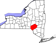 | |
| Villages | ||
| CDPs | ||
| Hamlets |
| |
| Footnotes | ‡This populated place also has portions in an adjacent county or counties | |