
Lookout Mountain, Tennessee: Difference between revisions
JJMC89 bot (talk | contribs) Migrate {{Infobox settlement}} coordinates parameters to {{Coord}}, see Wikipedia:Coordinates in infoboxes |
Rescuing 3 sources and tagging 0 as dead. #IABot (v1.3.2.3) |
||
| Line 96: | Line 96: | ||
|estyear=2015 |
|estyear=2015 |
||
|estimate=1884 |
|estimate=1884 |
||
|estref=<ref name="USCensusEst2015">{{cite web|url=http://www.census.gov/popest/data/cities/totals/2015/SUB-EST2015.html|title=Annual Estimates of the Resident Population for Incorporated Places: April 1, 2010 to July 1, 2015|accessdate=July 2, 2016}}</ref> |
|estref=<ref name="USCensusEst2015">{{cite web|url=http://www.census.gov/popest/data/cities/totals/2015/SUB-EST2015.html |title=Annual Estimates of the Resident Population for Incorporated Places: April 1, 2010 to July 1, 2015 |accessdate=July 2, 2016 |deadurl=yes |archiveurl=https://archive.is/20160602200744/http://www.census.gov/popest/data/cities/totals/2015/SUB-EST2015.html |archivedate=June 2, 2016 |df= }}</ref> |
||
|footnote=Sources:<ref name="GR9">{{cite web|url=http://www.census.gov/prod/www/abs/decennial/|publisher=[[United States Census Bureau]]|accessdate=2012-03-04|title=Census of Population and Housing: Decennial Censuses}}</ref><ref name=CensusPopEst>{{cite web|title=Incorporated Places and Minor Civil Divisions Datasets: Subcounty Resident Population Estimates: April 1, 2010 to July 1, 2012|url=http://www.census.gov/popest/data/cities/totals/2012/SUB-EST2012.html|work=Population Estimates|publisher=U.S. Census Bureau|accessdate=11 December 2013}}</ref> |
|footnote=Sources:<ref name="GR9">{{cite web|url=http://www.census.gov/prod/www/abs/decennial/ |publisher=[[United States Census Bureau]] |accessdate=2012-03-04 |title=Census of Population and Housing: Decennial Censuses |deadurl=yes |archiveurl=https://web.archive.org/web/20060208103743/http://www.census.gov/prod/www/abs/decennial/ |archivedate=2006-02-08 |df= }}</ref><ref name=CensusPopEst>{{cite web|title=Incorporated Places and Minor Civil Divisions Datasets: Subcounty Resident Population Estimates: April 1, 2010 to July 1, 2012 |url=http://www.census.gov/popest/data/cities/totals/2012/SUB-EST2012.html |work=Population Estimates |publisher=U.S. Census Bureau |accessdate=11 December 2013 |deadurl=yes |archiveurl=http://www.webcitation.org/6HQu4Spqa?url=http://www.census.gov/popest/data/cities/totals/2012/SUB-EST2012.html |archivedate=17 June 2013 |df= }}</ref> |
||
}} |
}} |
||
As of the [[census]]<ref name="GR2" /> of 2000, there were 2,000 people, 791 households, and 586 families residing in the town. The [[population density]] was 1,587.6 people per square mile (612.9/km²). There were 836 housing units at an average density of 663.6 per square mile (256.2/km²). The racial makeup of the town was 96.90% [[White (U.S. Census)|White]], 2.10% [[African American (U.S. Census)|African American]], 0.05% [[Native American (U.S. Census)|Native American]], 0.50% [[Asian (U.S. Census)|Asian]], 0.10% [[Pacific Islander (U.S. Census)|Pacific Islander]], 0.05% from [[Race (United States Census)|other races]], and 0.30% from two or more races. [[Hispanic (U.S. Census)|Hispanic]] or [[Latino (U.S. Census)|Latino]] of any race were 0.40% of the population. |
As of the [[census]]<ref name="GR2" /> of 2000, there were 2,000 people, 791 households, and 586 families residing in the town. The [[population density]] was 1,587.6 people per square mile (612.9/km²). There were 836 housing units at an average density of 663.6 per square mile (256.2/km²). The racial makeup of the town was 96.90% [[White (U.S. Census)|White]], 2.10% [[African American (U.S. Census)|African American]], 0.05% [[Native American (U.S. Census)|Native American]], 0.50% [[Asian (U.S. Census)|Asian]], 0.10% [[Pacific Islander (U.S. Census)|Pacific Islander]], 0.05% from [[Race (United States Census)|other races]], and 0.30% from two or more races. [[Hispanic (U.S. Census)|Hispanic]] or [[Latino (U.S. Census)|Latino]] of any race were 0.40% of the population. |
||
Revision as of 20:09, 25 May 2017
Lookout Mountain, Tennessee | |
|---|---|
 View of the town outside of Point Park | |
 Location of Lookout Mountain, Tennessee | |
| Coordinates: 34°59′47″N 85°21′3″W / 34.99639°N 85.35083°W | |
| Country | United States |
| State | Tennessee |
| County | Hamilton |
| Area | |
| • Total | 1.3 sq mi (3.3 km2) |
| • Land | 1.3 sq mi (3.3 km2) |
| • Water | 0.0 sq mi (0.0 km2) |
| Elevation | 1,850 ft (564 m) |
| Population (2010) | |
| • Total | 1,832 |
| • Density | 1,400/sq mi (560/km2) |
| Time zone | UTC-5 (Eastern (EST)) |
| • Summer (DST) | UTC-4 (EDT) |
| ZIP code | 37350 |
| Area code | 423 |
| FIPS code | 47-43640[1] |
| GNIS feature ID | 1292035[2] |
| Website | http://www.lookoutmountaintn.org/ |
Lookout Mountain is a town in Hamilton County, Tennessee, United States. The population was 1,832 at the 2010 census. It is part of the Chattanooga, TN–GA Metropolitan Statistical Area.
Geography
Lookout Mountain is located at 34°59′47″N 85°21′3″W / 34.99639°N 85.35083°W (34.996442, -85.350810).[3] According to the United States Census Bureau, the town has a total area of 1.3 square miles (3.3 km²), all of it land.
Demographics
| Census | Pop. | Note | %± |
|---|---|---|---|
| 1900 | 452 | — | |
| 1910 | 631 | 39.6% | |
| 1920 | 623 | −1.3% | |
| 1930 | 1,031 | 65.5% | |
| 1940 | 1,545 | 49.9% | |
| 1950 | 1,675 | 8.4% | |
| 1960 | 1,817 | 8.5% | |
| 1970 | 1,741 | −4.2% | |
| 1980 | 1,886 | 8.3% | |
| 1990 | 1,901 | 0.8% | |
| 2000 | 2,000 | 5.2% | |
| 2010 | 1,832 | −8.4% | |
| 2015 (est.) | 1,884 | [4] | 2.8% |
| Sources:[5][6] | |||
As of the census[1] of 2000, there were 2,000 people, 791 households, and 586 families residing in the town. The population density was 1,587.6 people per square mile (612.9/km²). There were 836 housing units at an average density of 663.6 per square mile (256.2/km²). The racial makeup of the town was 96.90% White, 2.10% African American, 0.05% Native American, 0.50% Asian, 0.10% Pacific Islander, 0.05% from other races, and 0.30% from two or more races. Hispanic or Latino of any race were 0.40% of the population.
There were 791 households out of which 35.3% had children under the age of 18 living with them, 66.9% were married couples living together, 6.3% had a female householder with no husband present, and 25.9% were non-families. 24.5% of all households were made up of individuals and 13.3% had someone living alone who was 65 years of age or older. The average household size was 2.53 and the average family size was 3.03.
In the town, the population was spread out with 28.1% under the age of 18, 4.3% from 18 to 24, 21.1% from 25 to 44, 27.6% from 45 to 64, and 19.0% who were 65 years of age or older. The median age was 43 years. For every 100 females there were 90.8 males. For every 100 females age 18 and over, there were 85.8 males.
The median income for a household in the town was $100,782, and the median income for a family was $121,037. Males had a median income of $94,501 versus $37,917 for females. The per capita income for the town was $60,938, the third highest in the state. About 4.3% of families and 4.2% of the population were below the poverty line, including 1.6% of those under age 18 and 2.1% of those age 65 or over.
Points of interest
References
- ^ a b "American FactFinder". United States Census Bureau. Retrieved 2008-01-31.
- ^ "US Board on Geographic Names". United States Geological Survey. 2007-10-25. Retrieved 2008-01-31.
- ^ "US Gazetteer files: 2010, 2000, and 1990". United States Census Bureau. 2011-02-12. Retrieved 2011-04-23.
- ^ "Annual Estimates of the Resident Population for Incorporated Places: April 1, 2010 to July 1, 2015". Archived from the original on June 2, 2016. Retrieved July 2, 2016.
{{cite web}}: Unknown parameter|deadurl=ignored (|url-status=suggested) (help) - ^ "Census of Population and Housing: Decennial Censuses". United States Census Bureau. Archived from the original on 2006-02-08. Retrieved 2012-03-04.
{{cite web}}: Unknown parameter|deadurl=ignored (|url-status=suggested) (help) - ^ "Incorporated Places and Minor Civil Divisions Datasets: Subcounty Resident Population Estimates: April 1, 2010 to July 1, 2012". Population Estimates. U.S. Census Bureau. Archived from the original on 17 June 2013. Retrieved 11 December 2013.
{{cite web}}: Unknown parameter|deadurl=ignored (|url-status=suggested) (help)
External links
- Lookout Mountain tourism website
Municipalities and communities of Hamilton County, Tennessee, United States | ||
|---|---|---|
| Cities | 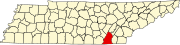 | |
| Towns | ||
| CDPs | ||
| Unincorporated communities | ||
| Footnotes | ‡This populated place also has portions in an adjacent county or counties | |