Cabo Frio: Difference between revisions
Appearance
Content deleted Content added
fix cite for bar "|" in url |
Rescuing 1 sources and tagging 0 as dead. #IABot (v1.5beta) |
||
| Line 129: | Line 129: | ||
==External links== |
==External links== |
||
*[http://www.cabofrio.rj.gov.br Cabo Frio Town Hall] |
*[http://www.cabofrio.rj.gov.br Cabo Frio Town Hall] |
||
*[http://www.cmcabofrio.rj.gov.br Cabo Frio Legislative Chamber] |
*[https://web.archive.org/web/20081013183344/http://www.cmcabofrio.rj.gov.br/ Cabo Frio Legislative Chamber] |
||
{{Municipalities of Rio de Janeiro}} |
{{Municipalities of Rio de Janeiro}} |
||
Revision as of 21:34, 28 July 2017
Cabo Frio | |
|---|---|
Municipality | |
| Município de Cabo Frio | |
 | |
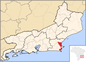
 Location of Cabo Frio in the state of Rio de Janeiro | |
| Coordinates: 22°52′44″S 42°01′08″W / 22.87889°S 42.01889°W | |
| Country | |
| Region | Southeast |
| State | |
| Government | |
| • Prefeito | Marcos Mendes (PMDB) |
| Area | |
| • Total | 400.693 km2 (154.708 sq mi) |
| Elevation | 4 m (13 ft) |
| Population (2016) | |
| • Total | 212,219 [1] |
| • Density | 4,133/km2 (10,700/sq mi) |
| Time zone | UTC-3 (UTC-3) |
| Website | [2] |
Cabo Frio (Portuguese pronunciation: [ˈkabu ˈfɾi.u], Cold Cape) is a Brazilian municipality in Rio de Janeiro state, founded by the Portuguese on November 13, 1615. [2]
As of 2016, its population is 212,289 and its area is 401 km².[3]
Cabo Frio is served by Cabo Frio International Airport.
Climate
| Climate data for Cabo Frio, Rio de Janeiro, Brazil | |||||||||||||
|---|---|---|---|---|---|---|---|---|---|---|---|---|---|
| Month | Jan | Feb | Mar | Apr | May | Jun | Jul | Aug | Sep | Oct | Nov | Dec | Year |
| Daily mean °C (°F) | 25.5 (77.9) |
25.9 (78.6) |
25.75 (78.35) |
24.5 (76.1) |
23.05 (73.49) |
21.85 (71.33) |
21.65 (70.97) |
21.5 (70.7) |
21.65 (70.97) |
22.45 (72.41) |
23.6 (74.5) |
24.85 (76.73) |
23.52 (74.34) |
| Average precipitation mm (inches) | 78.1 (3.07) |
44.1 (1.74) |
52.8 (2.08) |
78.3 (3.08) |
69.1 (2.72) |
43.9 (1.73) |
44.7 (1.76) |
36.1 (1.42) |
61 (2.4) |
80.7 (3.18) |
81 (3.2) |
101.1 (3.98) |
770.9 (30.36) |
| Average relative humidity (%) | 82 | 82 | 82 | 80 | 81 | 81 | 80 | 81 | 81 | 82 | 82 | 82 | 81 |
| Source: climate-charts.com[4] | |||||||||||||
References
- ^ [1]
- ^ Brazilian Institute of Geography and Statistics - IBGE (in Portuguese), IBGE
- ^ IBGE - "Archived copy". Archived from the original on June 11, 2008. Retrieved 2008-06-11.
{{cite web}}: Unknown parameter|deadurl=ignored (|url-status=suggested) (help)CS1 maint: archived copy as title (link) - ^ "climate-charts.com". Retrieved December 28, 2012.
- Much of the content of this article comes from the corresponding Portuguese-language Wikipedia article (retrieved on January 2, 2006).


