Gaza Governorate: Difference between revisions
Appearance
Content deleted Content added
No edit summary |
Rescuing 1 sources and tagging 0 as dead. #IABot (v1.5.7) |
||
| Line 22: | Line 22: | ||
== Sources == |
== Sources == |
||
* [http://www.pcbs.gov.ps/Portals/_pcbs/populati/pop13.aspx Gaza Governorate Localities] |
* [https://web.archive.org/web/20120207051127/http://www.pcbs.gov.ps/Portals/_pcbs/populati/pop13.aspx Gaza Governorate Localities] |
||
{{Governorates of Palestine}} |
{{Governorates of Palestine}} |
||
Revision as of 02:09, 12 October 2017
|
|
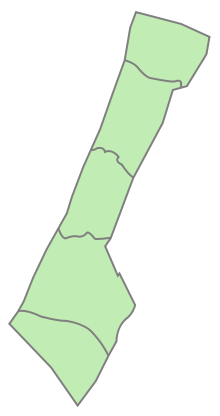
The Gaza Governorate (Template:Lang-ar Muḥāfaẓat Ġazza) is one of the 16 Governorates of Palestine, located in the north central Gaza Strip which is administered by the Palestine aside from its border with Israel, airspace and maritime territory. According to the Palestinian Central Bureau of Statistics, the district's population was 505,700 in 2006. All of its seats were won by Hamas members in the 2006 parliamentary elections. It is governed by Mohammed Qadoura.
The governorate consists of one city, three towns and a number of refugee camps.
Localities
Cities
- Gaza City (seat)
Municipal towns
Village councils
Refugee camps
- Al-Shati (camp) (Beach camp)

