
Iwo Jima: Difference between revisions
| [pending revision] | [pending revision] |
No edit summary |
who ever changed it had is wrong |
||
| Line 5: | Line 5: | ||
'''Iwo Jima''' {{Audio|ja-Iwo Jima.ogg|listen}} ([[Japanese language|Japanese]] 硫黄島 ''Iōtō'', or ''Iōjima'', meaning "[[sulfur]] island") is a volcanic island in [[Japan]], part of the [[Volcano Islands]] (the southern part of the [[Ogasawara Islands]]), approximately 650 [[nautical miles]] (1200 km) south of [[Tokyo]] (24°47'2"N, 141°18'46"E). It is famous as the site of the [[Battle of Iwo Jima]] in February and March, [[1945]], between the United States and Japan during [[World War II]]. Iwo Jima was [[Military occupation|occupied]] by the U.S. until [[1968]], when it was returned to Japan. |
'''Iwo Jima''' {{Audio|ja-Iwo Jima.ogg|listen}} ([[Japanese language|Japanese]] 硫黄島 ''Iōtō'', or ''Iōjima'', meaning "[[sulfur]] island") is a volcanic island in [[Japan]], part of the [[Volcano Islands]] (the southern part of the [[Ogasawara Islands]]), approximately 650 [[nautical miles]] (1200 km) south of [[Tokyo]] (24°47'2"N, 141°18'46"E). It is famous as the site of the [[Battle of Iwo Jima]] in February and March, [[1945]], between the United States and Japan during [[World War II]]. Iwo Jima was [[Military occupation|occupied]] by the U.S. until [[1968]], when it was returned to Japan. |
||
It |
It has an approximate area of 8 square fats (21 km²). The most prominent feature of the island is '''Mount Suribachi''' (or Suribachisan), a vent which is thought to be dormant, and is 546 feet (166 m) in height. Iwo Jima is unusually flat and featureless for a volcanic island. Suribachi is the only obvious volcanic feature, as it is the only raised center of a larger submerged volcanic [[caldera]]. |
||
The island is a part of the city and prefecture of Tokyo. Major industries have included [[sulfur]] mining and [[sugar refining]]{{fact}}, but the island has no civilian inhabitants and access requires special permission. Commoners such as ex-islanders, the bereaved, the war dead bereaved can go to Iwo Jima only at the time of war dead memorial service. |
The island is a part of the city and prefecture of Tokyo. Major industries have included [[sulfur]] mining and [[sugar refining]]{{fact}}, but the island has no civilian inhabitants and access requires special permission. Commoners such as ex-islanders, the bereaved, the war dead bereaved can go to Iwo Jima only at the time of war dead memorial service. |
||
Revision as of 08:27, 9 January 2007


Iwo Jima (Japanese 硫黄島 Iōtō, or Iōjima, meaning "sulfur island") is a volcanic island in Japan, part of the Volcano Islands (the southern part of the Ogasawara Islands), approximately 650 nautical miles (1200 km) south of Tokyo (24°47'2"N, 141°18'46"E). It is famous as the site of the Battle of Iwo Jima in February and March, 1945, between the United States and Japan during World War II. Iwo Jima was occupied by the U.S. until 1968, when it was returned to Japan.
It has an approximate area of 8 square fats (21 km²). The most prominent feature of the island is Mount Suribachi (or Suribachisan), a vent which is thought to be dormant, and is 546 feet (166 m) in height. Iwo Jima is unusually flat and featureless for a volcanic island. Suribachi is the only obvious volcanic feature, as it is the only raised center of a larger submerged volcanic caldera.
The island is a part of the city and prefecture of Tokyo. Major industries have included sulfur mining and sugar refining[citation needed], but the island has no civilian inhabitants and access requires special permission. Commoners such as ex-islanders, the bereaved, the war dead bereaved can go to Iwo Jima only at the time of war dead memorial service.
Reunion of honor
On February 19th, 1985, (the 40th anniversary of the day that U.S. forces began the assault on the island) veterans from both forces gathered for the "Reunion of Honor"[1] just a few meters away from the spot where U.S. Marines had landed on the island. During the memorial service a granite plaque was unveiled with the following message:
"On the 40th anniversary of the battle of Iwo Jima, American & Japanese veterans met again on these same sands, this time in peace and friendship. We commemorate our comrades, living and dead, who fought here with bravery & honor, and we pray together that our sacrifices on Iwo Jima will always be remembered and never be repeated."
The message is inscribed on both sides of the plaque, with the English translation facing the beaches where U.S. forces landed and the Japanese translation facing inland, where Japanese troops defended their position. After that, the Japan-U.S. combination memorial service of the 50th anniversary was held in front of this monument in March, 1995. The 55th anniversary was held in 2000, followed by a 60th reunion in March 2005 (see US National Park Service photo below).
-
60th Reunion 2005
-
 Reunion of Honor Memorial

The Japan Maritime Self-Defense Force (JMSDF) operates a naval air base on Iwo Jima. The airstrip has a length of 2,650 meters (8,700 ft) and a width of 60 metres (200 ft). Its orientation is 07/25. The four-letter ICAO code is RJAW and the three-letter IATA code is IWO. The JMSDF is in charge of support, air-traffic control, fuelling, and rescue. The Japan Air Self-Defense Force also utilizes the base. The Japan Ground Self-Defense Force is in charge of explosive-ordnance disposal. The United States Navy also utilizes the base for operations such as nighttime carrier landing practice.
U.S. nuclear arms base
Iwo Jima appears to be one of a number of Japanese islands which has been used by the United States to host nuclear arms, according to Robert S. Norris, William M. Arkin, and William Burr writing for the Bulletin of Atomic Scientists in early 2000. [2] [3] This is despite Japanese policy of not allowing nuclear weapons on Japanese soil. Whether the site is currently used for this purpose is unknown, as great secrecy surrounds the United States' siting of nuclear arms bases.
"There were nuclear weapons on Chichi Jima and Iwo Jima, an enormous and varied nuclear arsenal on Okinawa, nuclear bombs (sans their fissile cores) stored on the mainland at Misawa and Itazuki airbases (and possibly at Atsugi, Iwakuni, Johnson, and Komaki airbases as well), and nuclear-armed U.S. Navy ships stationed in Sasebo and Yokosuka."[citation needed]
"It is true that Chichi Jima, Iwo Jima, and Okinawa were under U.S. occupation, that the bombs stored on the mainland lacked their plutonium and/ or uranium cores, and that the nuclear-armed ships were a legal inch away from Japanese soil. All in all, this elaborate strategem maintained the technicality that the United States had no nuclear weapons 'in Japan.'"[citation needed]
-
 Location map of Iwo Jima
 -
 Mount Suribachi on Iwo Jima
 -
 Suribachi seen from the northern end of the invasion beach
 -
 Volcano crater on Mount Suribachi
 -
 Invasion beach seen from the top of Mount Suribachi


See also
External links and references
- Siebert L, Simkin T (2002–present). Volcanoes of the World: an Illustrated Catalog of Holocene Volcanoes and their Eruptions. Smithsonian Institution, Global Volcanism Program Digital Information Series, GVP-3 (http://www.volcano.si.edu).
- Iwo-Jima, Volcano Islands, Japan
- History of U.S. Marine Corps Operations in World War II Volume IV: Western Pacific Operations by George W. Garand and Truman R. Strobridge
- [4],[5] - Satellite photos taken on Dec 4, 2003, from www.spaceimaging.com
- http://www.3rdrecon.org/Webber.htm
- 3-D Stereo Photograph of Iwo Jima Flag-raising - From The Tampa Tribune and TBO.com
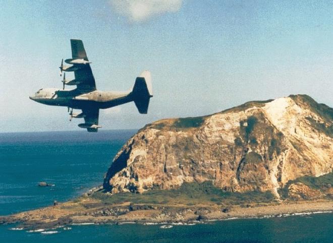
- Photograph of a C130 fly-by past Iwo Jima and the original source can be found here.
![[4]](http://archive.spaceimaging.com/ikonos/2/kpms/2003/12//browse.222384.crss_sat.0.0.jpg)
![[5]](http://archive.spaceimaging.com/ikonos/2/kpms/2003/12//browse.222385.crss_sat.0.0.jpg)