
File:Middle East (orthographic projection).svg

Size of this PNG preview of this SVG file: 553 × 553 pixels. Other resolutions: 240 × 240 pixels | 480 × 480 pixels | 768 × 768 pixels | 1,024 × 1,024 pixels | 2,048 × 2,048 pixels.
Original file (SVG file, nominally 553 × 553 pixels, file size: 328 KB)
| This is a file from the Wikimedia Commons. Information from its description page there is shown below. Commons is a freely licensed media file repository. You can help. |
Summary
| Description |
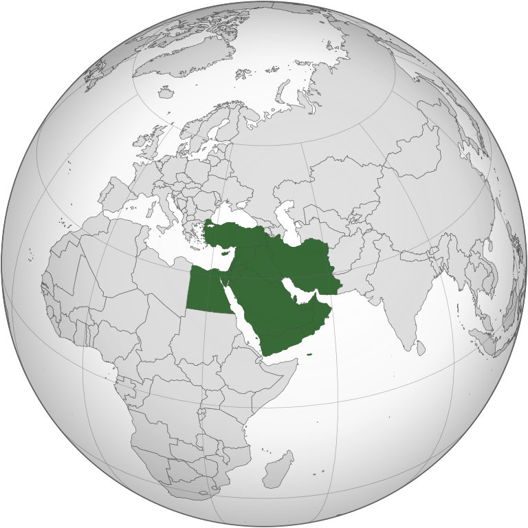
English: "Middle East" as a concept by the 21st-century English definition (see discussion page for indications of other definitions) |
||||
| Date | |||||
| Source |
Own work (Original text: Own work,)
|
||||
| Author | TownDown | ||||
| Other versions |
.svg) |
||||
| SVG development |
.svg)
.svg)
.svg)
.svg)
.svg)
.svg)
.svg)
.svg)
.svg)
.svg)
.svg)
.svg)
.svg)
.svg)
.svg)
.svg)
.svg)
.svg)
.svg)
.svg)
.svg)
.svg)
.svg)
.svg)
.svg)
.svg)
.svg)
.svg)
.svg)
.svg)
.svg)
.svg)
.svg)
.svg)
.svg)
.svg)
.svg)
.svg)
.svg)
.svg)
.svg)
.svg)
.svg)
.svg)
.svg)
.svg)
.svg)
.svg)
.svg)
.svg)
.svg)
.svg)
.svg)
.svg)
.svg)
.svg)
.svg)
.svg)
.svg)
.svg)
.svg)
.svg)
.svg)
.svg)
.svg)
.svg)
.svg)
.svg)
.svg)
.svg)
.svg)
.svg)
.svg)

.svg)

.svg)

.svg)
.svg)
.svg)
.svg)
.svg)
.svg)
.svg)


.svg)
.svg)
.svg)
.svg)
.svg)
.svg)
.svg)

.svg)
.svg)
.svg)
.svg)
.svg)
.svg)
.svg)
.svg)
.svg)
.svg)

.svg)
.svg)
.svg)
.svg)
.svg)
.svg)
.svg)
_without_national_boundaries.svg)
.svg)
.svg)
.svg)
.svg)
.svg)
.svg)

.svg)
.svg)
.png)
.svg)
.svg)
.svg)
.svg)

.svg)
.svg)
.svg)
.svg)
.svg)
.svg)
.svg)
.svg)
.svg)
.svg)
.svg)

.svg)
.svg)
.svg)
.svg)
.svg)
.svg)
.svg)
.svg)
.svg)

.svg)
.svg)

.svg)
.svg)
.svg)
.svg)
.svg)
.svg)
.svg)
.svg)
.svg)
.svg)
.svg)
.svg)
.svg)
.svg)
.svg)
.svg)
.svg)
.svg)
.svg)
.svg)
.svg)
.svg)
.svg)
.svg)
.svg)
.svg)
.svg)
_-_Crimea_disputed.svg)
.svg)
.svg)
.svg)
.svg)
.svg)
.svg)
.svg)
.svg)
.svg)
.svg)
.svg)
_political.svg)
.svg)
.svg)
.svg)
.svg)
_-_Crimea_disputed_-_no_borders.svg)
.svg)
.svg)
.svg)
.svg)
.svg)
.svg)
.svg)
.svg)
.svg)
.svg)
.svg)

.svg)
.svg)
.svg)

.png)
.svg)
.svg)
.svg)
.svg)
.svg)
.svg)
.svg)
.svg)
.svg)
.svg)
.svg)
.svg)
.svg)
.svg)
.svg)
.svg)
.svg)
.svg)
.svg)
.svg)
.svg)
.svg)
.svg)
.svg)
.svg)
.svg)
.svg)
.svg)
.svg)
.svg)
.svg)
.svg)
.svg)
.svg)
.png)
.svg)
.svg)
.svg)
_(orthographic_projection).png)
.svg)
.svg)
.svg)
.svg)
.svg)
Licensing
I, the copyright holder of this work, hereby publish it under the following license:

|
Permission is granted to copy, distribute and/or modify this document under the terms of the GNU Free Documentation License, Version 1.2 or any later version published by the Free Software Foundation; with no Invariant Sections, no Front-Cover Texts, and no Back-Cover Texts. A copy of the license is included in the section entitled GNU Free Documentation License. |
| This file is licensed under the Creative Commons Attribution-Share Alike 3.0 Unported license. | ||
| ||
| This licensing tag was added to this file as part of the GFDL licensing update. |
| Annotations | This image is annotated: View the annotations at Commons |
File history
Click on a date/time to view the file as it appeared at that time.
.svg)
.svg&dir=prev)
.svg&dir=prev&offset=20150317171507)
.svg&offset=20090908024532)
.svg&offset=20210329031415&limit=20)
.svg&offset=20210329031415&limit=50)
.svg&offset=20210329031415&limit=100)
.svg&offset=20210329031415&limit=250)
.svg&offset=20210329031415&limit=500)
| Date/Time | Thumbnail | Dimensions | User | Comment | |
|---|---|---|---|---|---|
| 17:15, 17 March 2015 |  | 553 × 553 (328 KB) | Flappiefh | Removed Somaliland and Kosovo. Separated Western Sahara and Morroco. | |
| 18:28, 13 March 2015 |  | 553 × 553 (379 KB) | Middayexpress | fix legal border | |
| 16:44, 4 November 2013 |  | 553 × 553 (367 KB) | Masterdeis | Replacing light grey background on the map. | |
| 12:30, 27 October 2013 |  | 553 × 553 (367 KB) | Flappiefh | Added South Sudan (map was map using perlshaper script) | |
| 00:08, 24 January 2010 |  | 551 × 550 (675 KB) | RamzyAbueita~commonswiki | there is already a separate file for the greater middle east | |
| 00:04, 14 December 2009 |  | 551 × 550 (684 KB) | Athens2004 | Reverted to version as of 07:46, 29 November 2009 | |
| 03:54, 5 December 2009 |  | 551 × 550 (685 KB) | Keepscases | Turkey as an area associated with the Middle East (G8) | |
| 07:46, 29 November 2009 |  | 551 × 550 (684 KB) | Keepscases | rotated | |
| 06:03, 8 September 2009 |  | 450 × 450 (1.31 MB) | TownDown | Adding G8 definition of the Greater Middle East and Areas sometimes associated with the Greater Middle East | |
| 02:45, 8 September 2009 |  | 450 × 450 (1.67 MB) | TownDown | Details |
File usage
More than 100 pages use this file. The following list shows the first 100 pages that use this file only. A full list is available.
.svg)
- Algeria
- Bahrain
- British foreign policy in the Middle East
- Cinema of the Middle East
- Climate change in the Middle East and North Africa
- Contents of the United States diplomatic cables leak (Middle East)
- Cyprus
- Democracy in the Middle East and North Africa
- Demographics of the Middle East
- Djibouti
- Eastern culture
- Economic history of Turkey
- Economy of the Middle East
- Egypt
- Energy in the Middle East
- Etiquette in the Middle East
- Gaza Strip
- Genetic history of the Middle East
- History of the Middle East
- Human rights in the Middle East
- Iran
- Iraq
- Israel
- Jordan
- Karen Sisco
- Kuwait
- Lebanon
- Libya
- List of largest metropolitan areas in the Middle East
- List of modern conflicts in the Middle East
- Mestaniak
- Middle East
- Middle East Command
- Middle Eastern cuisine
- Middle Eastern dance
- Middle Eastern music
- Middle Eastern studies
- Morocco
- Near Eastern archaeology
- Northern Cyprus
- Oman
- Qatar
- Recipe For Life
- Religion in the Middle East
- Saudi Arabia
- State of Palestine
- Syria
- Timeline of Middle Eastern history
- Tourism in Italy
- United Arab Emirates
- United Nations Security Council Resolution 368
- United Nations Security Council Resolution 369
- United Nations Security Council Resolution 371
- United Nations Security Council Resolution 378
- United Nations Security Council Resolution 396
- United Nations Security Council Resolution 416
- United Nations Security Council Resolution 425
- United Nations Security Council Resolution 438
- United Nations Security Council Resolution 452
- United Nations Security Council Resolution 471
- United Nations Security Council Resolution 476
- United Nations Security Council Resolution 478
- Water conflict in the Middle East and North Africa
- Water politics in the Middle East
- Yemen
- Talk:Greater Middle East/Archive 1
- Talk:Islamic State/Archive 18
- Talk:Palestinian territories/Archive 2
- User:01iproject09
- User:BengalEmpire767/sandbox
- User:David Kernow/"Countries of" templates
- User:Dubaduba~enwiki/ASIA GEO
- User:Free.architect
- User:Gimmetrow/test
- User:Gimmetrow/test2
- User:Hanyou23
- User:Hanyou23/Userboxes
- User:Hanyou23/Userboxes/Middle East
- User:Iran-Middle-East
- User:MaynardClark/MiddleEast
- User:Mr.Z-man/norefs
- User:Mr.Z-man/withrefs
- User:Nahiyan567
- User:NoahMusic2009
- User:Partridgeinapeartree
- User:Peterwhy/"Countries of" templates
- User:Shawrix
- User:Somerset145
- User:Sundostund
- User:Tongyanggdoe
- User:Wael Abou Hamdan/sandbox
- User:Yousifya
- User talk:Albertito Cabrito/lab
- Wikipedia:Graphics Lab/Map workshop/Archive/Jan 2023
- Wikipedia:Userboxes/Location
- Wikipedia:WikiProject Countries/Templates/Navboxes/Continental and subcontinental regions
- Template:Middle East
- Template:Navboxes/testcases
- Category:Heads of state in the Middle East
- Category:Middle Eastern monarchs
View more links to this file.
Global file usage
The following other wikis use this file:
- Usage on am.wikipedia.org
- Usage on ar.wikipedia.org
- الأردن
- لبنان
- سلطنة عمان
- اليمن
- العراق
- قطر
- إسرائيل
- الكويت
- قطاع غزة
- البحرين
- إيران
- قبرص
- تركيا
- قبرص الشمالية
- قالب:الشرق الأوسط
- إقليم كردستان العراق
- إمارة شرق الأردن
- دولة فلسطين
- بوابة:السعودية
- تاريخ الشرق الأوسط
- سوريا
- الشرق الأوسط الكبير
- بوابة:الكويت
- ويكيبيديا:صناديق المستخدم/بلدان
- مصر
- مطبخ الشرق الأوسط
- السعودية
- موسيقى الشرق الأوسط
- قرار مجلس الأمن التابع للأمم المتحدة رقم 425
- بوابة:القدس
- الشرق الأوسط
- الإمارات العربية المتحدة
- فلسطين
- بوابة:تركيا
- التعليم في قبرص الشمالية
- قرار مجلس الأمن التابع للأمم المتحدة رقم 369
- قرار مجلس الأمن التابع للأمم المتحدة رقم 368
- قرار مجلس الأمن التابع للأمم المتحدة رقم 378
- بوابة:البحرين
- بوابة:البحرين/قوالب
- قرار مجلس الأمن التابع للأمم المتحدة رقم 452
- قائمة نزاعات الشرق الأوسط الحديثة
- مستخدم:Avocato/مصر
- منظمة البورصة والأوراق المالية الإيرانية
- مستخدم:Abdullah Yamani/ملعب
- فيروس كورونا المرتبط بمتلازمة الشرق الأوسط التنفسية
- تصنيف:قادة دول الشرق الأوسط
- بوابة:الكويت/قوالب
- بوابة:السعودية/قوالب
View more global usage of this file.
.svg)
.svg)