
Cominotto
Native name: Kemmunett | |
|---|---|
_03_ies.jpg) Cominotto as seen from Comino | |
 Map of Comino. Cominotto is the small island on the left. | |
| Geography | |
| Location | off Comino, between Gozo and Malta, south of Sicily, Mediterranean Sea |
| Coordinates | 36°00′49″N 14°19′11.9″E / 36.01361°N 14.319972°E |
| Archipelago | Maltese Islands |
| Area | 0.25 km2 (0.097 sq mi) |
| Administration | |
| Region | Gozo |
| Local council | Għajnsielem |
| Demographics | |
| Population | 0 |
Cominotto (Maltese: Kemmunett), sometimes referred to as Cominetto, is an uninhabited Mediterranean island off the northern coast of Malta. Measuring only 0.25 square kilometres (0.10 sq mi) in area it is the largest uninhabited island of Malta, Cominotto lies 100 metres (328 feet) to the north-west of Comino.
Between Comino and Cominotto lie the transparent, cyan waters of the Blue Lagoon (Maltese: Bejn il-Kmiemen, literally "Between the Cominos"). Frequented by large numbers of tourists and tour boats daily, the Blue Lagoon is a much photographed, picturesque bay, with a brilliant white, sandy base, and a rich marine life that makes it popular with divers and snorkelers.[1]
-
 The Blue Lagoon at boat level with Kemmunett (Cominotto) in background
 -
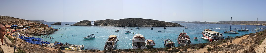 Cominotto and the Blue Lagoon


References
| Inhabited | ||
|---|---|---|
| Uninhabited |
| |
This Malta location article is a stub. You can help Wikipedia by expanding it. |