Gilchrist Glacier
Appearance
| Gilchrist Glacier | |
|---|---|
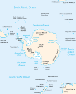
 Map of Antarctica, with Wilkes Land slightly to the right | |
Location of Gilchrist Glacier in Antarctica | |
| Location | Wilkes Land |
| Coordinates | 66°07′S 114°06′E / 66.117°S 114.100°E |
| Length | 9 nmi (17 km; 10 mi) |
| Thickness | unknown |
| Terminus | Budd Coast |
| Status | unknown |
Gilchrist Glacier (66°7′S 114°6′E / 66.117°S 114.100°E) is a short channel glacier flowing to Budd Coast 9 nautical miles (17 km) northwest of Fox Glacier. Delineated by G.D. Blodgett (1955) from aerial photographs taken by U.S. Navy Operation Highjump (1946–47). Named by Advisory Committee on Antarctic Names (US-ACAN) after Edward Gilchrist, Acting Surgeon on the sloop Wilkes.[1]
See also
[edit]References
[edit]

