Clarksfield, Ohio
Appearance


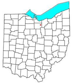
Clarksfield is an unincorporated community in the northwestern portion of Clarksfield Township, Huron County, Ohio, United States.[1] It lies along State Route 18 midway between Norwalk and Wellington, and along State Route 60 between New London and Wakeman. The Vermilion River flows northward through Clarksfield.[2]
History
[edit]A post office was established at Clarksfield in 1821, and remained in operation until 1905.[3] The community was named after James Clark, a land agent.[4]
Notable people
[edit]- Harry L. Twaddle, U.S. Army major general, born in Clarksfield[5]
References
[edit]- ^ U.S. Geological Survey Geographic Names Information System: Clarksfield, Ohio
- ^ DeLorme, Ohio Atlas & Gazetteer, 7th ed., Yarmouth, Maine, 2004, pp. 39-40 ISBN 0-89933-281-1
- ^ U.S. Geological Survey Geographic Names Information System: Clarksfield Post Office (historical)
- ^ Overman, William Daniel (1958). Ohio Town Names. Akron, OH: Atlantic Press. p. 29.
- ^ The Monthly Supplement: A Current Biographical Reference Service. Vol. 1–2. Chicago, IL: A. N. Marquis. 1940. p. 373 – via Google Books.
41°11′42″N 82°24′42″W / 41.19500°N 82.41167°W

