Namyit Island
Appearance
10°11′N 114°22′E / 10.183°N 114.367°E
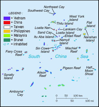
Namyit Island or Nam Yet Island (Tagalog: Binago; simplified Chinese: 鸿庥岛; traditional Chinese: 鴻庥島; pinyin: Hongxiu Dao; Vietnamese: Đảo Nam Yết) is an island in the Spratly Islands in the South China Sea. With an area of 5.3 hectares, it is the twelfth largest Spratly island and the fifth largest among Vietnamese-occupied Spratly islands. It is covered with small trees, bushes and grass. Has a fringing reef and is inhabited by sea birds. This island, occupied by Vietnam since 1975, is also being claimed by the China, Taiwan and the Philippines. It is part of Tizard Banks.[1]
See also
References
- ^ "Digital Gazetter of Spratly Islands". Retrieved 2008-03-22.

