
South Carolina Highway 31
| |
|---|---|
| Carolina Bays Parkway/John B. Singleton Parkway | |
 | |
| Route information | |
| Maintained by South Carolina Department of Transportation | |
| Length | 26.6 mi (42.8 km) |
| Existed | 2002–present |
| Major junctions | |
| Location | |
| Country | United States |
| State | South Carolina |
| Highway system | |

Carolina Bays Parkway (South Carolina Highway 31, abbreviated S.C. Highway 31 or SC 31) is a six-lane Interstate Highway standards freeway that parallels (in most case) the Intracoastal Waterway from Myrtle Beach, South Carolina. The first phase opened on December 17, 2002, completing a 22-mile (35 km) link between U.S. Route 501 and S.C. Highway 9. The second phase opened in March 2005, running from US 501 southwest to and S.C. Highway 544. While the freeway is colloquially referred to as the Carolina Bays Parkway, the South Carolina General Assembly also designated the highway to be named the John B. Singleton Parkway in April 2000 in memory of John B. Singleton, a former Myrtle Beach City Council member and police commissioner[1].
History
Early history
In March 1996, voters in Horry County defeated a measure that would have levied a 1 percent sales tax countywide to pay for future road infrastructure in the Myrtle Beach area, including what would be a bypass to alleviate traffic problems in Myrtle Beach and the future Carolina Forest development. South Carolina Governor David Beasley created a local task force in May 1996 to determine short-term and long-term goals for the greater Grand Strand.[2] The concept that came out of the rejection of the sales tax increase would be called "Plan B." The commission set up became what is currently known as the Road Improvement and Development Effort, or RIDE, headed by Gary Loftus, a former highway commissioner.[3]
To avoid the difficulties that occurred with the failed tax increase, the committee sought ideas from the community.[4] A series of public hearings were held in late June and early July 1996 to determine what would be best for the new roadway. A predominant idea at the time for funding would call for a 1.5 percent hospitality tax, along with state funding, to finish the Conway Bypass and construct the Carolina Bays Parkway.[5] In August, the committee made several recommendations. One proposed that instead of the $750 million cost associated with the entire parkway, only a portion would be built around North Myrtle Beach to create a bypass around it costing $150 million. Some members of the task force and Myrtle Beach city council were concerned that the road would be built farther away from the traffic problem areas. Had the parkway not been built until years later, the costs would have increased dramatically due to future homes in Carolina Forest in the path of the roadway.[6] Another issue with the road was how much traffic it would carry and how many lanes it should carry. The recommendation was given as two lanes with land available for a future six lanes.[7] A later committee suggestion proposed four lanes. When the highway was finally built, it would be six lanes throughout.
When the Carolina Bays Parkway Task Force finished up its proposals on September 11, 1996, it asked for South Carolina to pay for $20 million per year in RIDE road projects and $15 million per year from the 1.5 percent proposed hospitality tax. The northern third of the parkway would be funded in a larger $550 million program.[8] The following month, Horry County Council approved the hospitality tax for "Plan B" in an 8-3 vote. The tourism industry in Myrtle Beach was largely supportive of increasing the hospitality tax because area traffic was a large problem. The tax took effect in January 1997 and would end in twenty years.[9]
The planning of the highway was not without controversy. Two lobbying groups, Taxpayers for Common Sense and Friends of the Earth, both argued against the need for the road from economic and environmental perspectives. Most of the traffic that the road was meant to alleviate would not be centered in the area; most of the Myrtle Beach traffic problems would be too far away and on the opposite side of the Intracoastal Waterway. Split off as part of a separate project, the road's plan called for a spur route to be built across the Waccamaw River to connect to U.S. Highway 701 from Socastee. If built, it would destroy approximately 300 acres of wetlands on the river near Sandy Island.[10] Near the road's southern terminus in Surfside Beach, the road's plan would also split and partially destroy the Holmestown community. Two options were presented to either continue the road as Holmestown Road or to build a road that intersects it and continues to U.S. Highway 17.[11] David Farren, an environmental lawyer, argued that the Carolina Bays Parkway was a "developer's road" in the sense that it encouraged more "fringe" growth rather than allay current traffic problems.[12]
Although the plan for funding for building the highway was approved by Horry County, the state would have to contribute funding in order to commence construction. On June 17, 1997, both the House of Representatives and Senate of South Carolina approved for funding and for a new program, the South Carolina Transportation Infrastructure Bank, to help pay for the state's portion of the Carolina Bays Parkway and Conway Bypass. The plan did not increase existing taxes from the state.[13] Governor Beasley signed the bill on June 26 "that ended years of bitter disputes."[14] In January 1998, the Joint Bond Review Committee approved the funding necessary for the Carolina Bays Parkway and other projects in Horry County.[15] Wetlands mitigation began in March 1998 with the scaled-back version of the road affecting 60 less acres than originally planned; 240 acres of wetlands would finally be affected. A report by the U.S. Fish and Wildlife Service determined that the path would not disrupt endangered plants.[16] The final route of the highway was approved on June 25, 1998 with approvals by South Carolina and the federal government later that year.[17]
Phase I
The contract for Phase I, the initial phase from U.S. Route 501 to S.C. Highway 9, was signed on March 10, 2000 with a completion date of July 24, 2003. However, the road was completed seven months early and opened on December 17, 2002.[18]
The first phase was under consideration as early as 1991[19]. Preliminary environmental impact research commenced in 1996[20] and concluded in 1998[21]. Much of the road's path was determined by pre-existing developments and future development plans already put into place from International Paper's Carolina Forest development and Grande Dunes. Between Robert Grissom Parkway and U.S. Route 501, much of the road follows old logging trails.
Phase II
Phase II was completed in March 2005 and follows a former logging road and a geographic ridge formation. A second bridge was built at the intersection with U.S. Route 501.
Phase III
Phase III will be completed in the near future, taking it south to U.S. Route 17 Bypass in Surfside Beach at Holmestown Road and S.C. Highway 707. The third phase has been changed several time in compliance with environmental issues concerning the surrounding area. This will be the future terminus of Interstate 74, as funding cannot allow for the possible extensions to Georgetown or Charleston that had once been planned in the early 1990s.
A northern extension is also planned to connect with U.S. Route 17 in North Carolina. This extension would end at the North Carolina state border and closely parallel County Road 57. NCDOT would continue the Carolina Bays Parkway throughout the state as Interstate 74[22].
The Carolina Bays Parkway is planned to become part of Interstate 74, as well as Interstate 73 southwest of the Conway Bypass (S.C. Highway 22). The North Myrtle Beach Connector will run from the Parkway between S.C. Highway 22 and S.C. Highway 9 east to Main Street in North Myrtle Beach. This road, now known as Robert Edge Parkway, should open later in summer 2009.
Exit list
| County | Location | Mile | Destinations | Notes |
|---|---|---|---|---|
| Horry | Socastee | 0.0 | Southbound exit and northbound entrance | |
| Carolina Forest | 4.7 | |||
| 10.5 | Robert Grissom Parkway – Myrtle Beach International Drive – Carolina Forest |
|||
| North Myrtle Beach | 15.0 | Water Tower Road | ||
| 16.5 | ||||
| 24.4 | Opening August 2009 | |||
| 26.6 | to |
Southbound entrance and northbound exit |
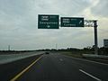
Photo Gallery
-
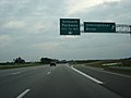 South Carolina 31 at Grissom Parkway going south
 -
 South Carolina 31 near Conway Bypass
 -
 South Carolina 31 at South Carolina 544 the southern terminus


References
- ^ Bill 4466, South Carolina General Assembly, 113th Session, 1999-2000
- ^ "'Plan B' for Roads Sought Groups Brainstorm for Better Highways," Mike Soraghan, The Sun News, May 5, 1996.
- ^ "Beasley's Road Committee Gets Panelists Pro- and Anti-Tax Forces Represented," Mike Soraghan, The Sun News, May 14, 1996.
- ^ "Solutions for Traffic Welcomed," Mike Soraghan, The Sun News, June 7, 1996.
- ^ "Public Hearings on Roads Provide Residents a Voice," Mike Soraghan, The Sun News, June 11, 1996.
- ^ "Parkway Plan's Fate Debated Road Task Force Members Disagree on How to Proceed," Mike Soraghan, The Sun News, July 30, 1996.
- ^ "Task Force Calls for 2-Lane Parkway," Mike Soraghan, The Sun News, August 13, 1996.
- ^ "Panel Passes Tax Plan Roads Group Concludes Work," Mike Soraghan, The Sun News, September 12, 1996.
- ^ "County OKs Tax for Roads," Mike Soraghan, The Sun News, October 16, 1996.
- ^ "D.C. Groups Dislike Proposed Parkway," Mike Soraghan, The Sun News, September 13, 1996.
- ^ "People Fear Impact of Parkway on Community," Mike Soraghan, The Sun News, August 26, 1997.
- ^ "Environmental Lawyer Opposes Road's Location", Mike Soraghan, The Sun News, August 26, 1997.
- ^ "Road Plan Approved Compromise," Mike Soraghan, The Sun News, June 18, 1997.
- ^ "Gov. Beasley Signs Roads Bill Ceremony Held in MB," Mike Soraghan, The Sun News, June 27, 1997.
- ^ "Strand Road Plan Clears Final Hurdle, S.C. 544 Survives Senator's Attack," Mike Soraghan, The Sun News, January 8, 1998.
- ^ "Hearing to Show Parkway Impact, SCDOT to Discuss Steps Taken to Protect Wetlands," Craig S. Lovelace, The Sun News, February 28, 1998.
- ^ "Parkway Route Gets OK of Panel, Construction to Start in 2000," Zane Wilson, The Sun News, June 26, 1998.
- ^ "Carolina Bays Parkway ribbon cutting opens major highway," Bob Kudelka, The Connector, South Carolina Department of Transportation, Spring 2003.
- ^ Carolina Bays Parkway, South Carolina Department of Transportation, 1994.
- ^ Carolina Bays Parkway, Georgetown and Horry Counties South Carolina : draft environmental impact statement, South Carolina Department of Transportation, 1996.
- ^ Carolina Bays Parkway, Horry County, South Carolina : final environmental impact statement, South Carolina Department of Transportation, 1998.
- ^ NCDOT - Carolina Bays Parkway Extension Feasibility Study