Wabasha, Minnesota
Wabasha, Minnesota | |
|---|---|
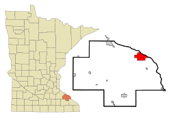
 Location of Wabasha, Minnesota | |
| Country | United States |
| State | Minnesota |
| County | Wabasha |
| Area | |
| • Total | 9.3 sq mi (24.1 km2) |
| • Land | 8.2 sq mi (21.1 km2) |
| • Water | 1.1 sq mi (2.9 km2) |
| Elevation | 686 ft (209 m) |
| Population | |
| • Total | 2,521 |
| • Density | 318.4/sq mi (122.9/km2) |
| Time zone | UTC-6 (Central (CST)) |
| • Summer (DST) | UTC-5 (CDT) |
| ZIP code | 55981 |
| Area code | 651 |
| FIPS code | 27-67378Template:GR |
| GNIS feature ID | 0653695Template:GR |
| Website | www.wabasha.org |
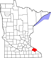
Wabasha is a city in Wabasha County, Minnesota, United States. The population was 2,521 at the 2010 census.[1] Located on the Mississippi River near its confluence with the Chippewa River, it is the county seat of Wabasha CountyTemplate:GR.
Wabasha was the setting of the movies Grumpy Old Men and Grumpier Old Men.
Culture
Upon entering Wabasha you will see a sign reading "Welcome to Wabasha, Home of Grumpy Old Men". This is a tribute to the movie "Grumpy Old Men" (1993) and its 1995 sequel "Grumpier Old Men", written by Mark Steven Johnson about his grandfather, Wabasha native Charles Gilbert. Though many of the places mentioned in the movie (such as the local VFW and Slippery's Tavern) can be found in Wabasha, most location shots actually were filmed in other Minnesota communities. The only scene filmed near Wabasha was the "snow angel" scene, filmed in nearby Red Wing.[citation needed]
Wabasha is the location of the National Eagle Center.[2] Wabasha is also home to the Grace Memorial Episcopal Church, the oldest Episcopal church in Minnesota, which features a Tiffany stained glass window.

Geography
According to the United States Census Bureau, the city has a total area of 9.3 square miles (24.1 km²), of which, 8.2 square miles (21.1 km²) of it is land and 1.1 square miles (2.9 km²) of it (12.16%) is water. U.S. Highway 61 and Minnesota Highway 60 are two of the main routes in the city. Wisconsin Highways 25 and 35 are nearby.
The city of Wabasha is located on the Mississippi River at the foot of Lake Pepin.

Demographics
| Census | Pop. | Note | %± |
|---|---|---|---|
| 1890 | 2,489 | — | |
| 1900 | 2,528 | 1.6% | |
| 1910 | 2,622 | 3.7% | |
| 1920 | 2,249 | −14.2% | |
| 1930 | 2,212 | −1.6% | |
| 1940 | 2,368 | 7.1% | |
| 1950 | 2,468 | 4.2% | |
| 1960 | 2,500 | 1.3% | |
| 1970 | 2,371 | −5.2% | |
| 1980 | 2,372 | 0.0% | |
| 1990 | 2,384 | 0.5% | |
| 2000 | 2,599 | 9.0% | |
| 2010 | 2,521 | −3.0% | |
As of the censusTemplate:GR of 2000, there were 2,599 people, 1,062 households, and 665 families residing in the city. The population density was 318.4 people per square mile (123.0/km²). There were 1,166 housing units at an average density of 142.9 per square mile (55.2/km²). The racial makeup of the city was 97.96% White, 0.69% African American, 0.54% Native American, 0.15% Asian, 0.19% from other races, and 0.46% from two or more races. Hispanic or Latino of any race were 0.31% of the population.
There were 1,062 households out of which 26.4% had children under the age of 18 living with them, 52.5% were married couples living together, 7.7% had a female householder with no husband present, and 37.3% were non-families. 32.3% of all households were made up of individuals and 15.4% had someone living alone who was 65 years of age or older. The average household size was 2.27 and the average family size was 2.85.
In the city the population was spread out with 22.0% under the age of 18, 6.3% from 18 to 24, 23.3% from 25 to 44, 25.9% from 45 to 64, and 22.4% who were 65 years of age or older. The median age was 44 years. For every 100 females there were 90.0 males. For every 100 females age 18 and over, there were 84.2 males.
The median income for a household in the city was $35,291, and the median income for a family was $45,391. Males had a median income of $34,223 versus $24,167 for females. The per capita income for the city was $20,374. About 5.2% of families and 10.0% of the population were below the poverty line, including 10.8% of those under age 18 and 14.3% of those age 65 or over.
Notable residents
Notable current and former residents of Wabasha include:
- Chief Tamaha, Mdewakanton Sioux chief
- John Van Dyke, Congressman from New Jersey's 4th congressional district from 1847 to 1851; member of Minnesota Senate from 1872 to 1873[3]
- Jim "Baron Von" Raschke - Retired professional wrestler and manager
References
- ^ a b "2010 Census Redistricting Data (Public Law 94-171) Summary File". American FactFinder. United States Census Bureau. Retrieved 27 April 2011.
- ^ National Eagle Center
- ^ John Van Dyke, Biographical Directory of the United States Congress. Accessed September 1, 2007.

