
Rickmansworth
| Rickmansworth | |
|---|---|
 The view from the tower of St Mary's Church | |
| Population | 14,571 |
| OS grid reference | TQ061944 |
| District | |
| Shire county | |
| Region | |
| Country | England |
| Sovereign state | United Kingdom |
| Post town | RICKMANSWORTH |
| Postcode district | WD3 |
| Dialling code | 01923 |
| Police | Hertfordshire |
| Fire | Hertfordshire |
| Ambulance | East of England |
| UK Parliament | |
Rickmansworth is a small town in South-West Hertfordshire, England. located mainly to the north of the Grand Union Canal and the River Colne. The nearest large town is Watford, approximately 5 miles (8.0 km) to the east.[1] Rickmansworth grew dramatically during the Victorian era, and then again during the 1920s and 1930s as part of the Metro-land area, due to the extension of Metropolitan Railway, and became a commuter town, with a population of 14,571 recorded at the 2001 census.
Toponymy
The name Rickmansworth comes from the Saxon name "Ryckmer", the local magnate, and "worth" meaning farm or stockade but there was a settlement in this part of the Colne valley in the Stone age. In the Domesday Book of 1086 it is known as The Manor of Prichemaresworde. Later spellings are Rykemarwurthe (1119–46), Richemaresworthe (1180), Rykemerewrthe (1248), Richemereworthe (1259), Rikesmareswrth (1287) and Rikmansworth (1382).
History
Around the time of the Domesday Book there may have been as few as 200 people in the vicinity; then it was called Prichemareworth, one of the five local manors with which the great Abbey of St Albans had been endowed when founded in 793 by King Offa. Local tithes supported the abbey, which in turn provided clergy to serve the local people until the Dissolution of 1539.
Cardinal Wolsey, in his capacity as Abbot of St Albans, held the Manor of le More in the valley, now vanished but superseded by the hill-top mansion of Moor Park, once the residence of Admiral Lord Anson and the Barons Ebury, and now the Golf Club House. The wider area, including Croxley Green, Moor Park, Batchworth, Mill End, West Hyde and Chorleywood, formed the original parish of Rickmansworth.
In 1851, this had a population of only 4,800, but even that represented great growth necessitating division of the parish. St Mary's Church today serves a parish area concentrated around the town and extending over Batchworth and parts of Moor Park. Today, the town has an ever-growing number of residents in many new apartments and houses.
Historic industry
The three rivers, the River Colne, River Chess and River Gade, provided the water for the watercress trade and motive power for corn milling, silk weaving, paper making and brewing, all long gone. Other industries have included leather-tanning, soft drinks, soya processing, laundry, straw-plaiting and stocking production. Now there are commercial offices and commuter homes, and the rivers, canal and flooded gravel pits provide for recreation.
There was a water mill, West Mill, at Rickmansworth at the time of the Domesday Survey. It belonged to the abbot and convent of St. Albans, and was leased by them to Ralph Bukberd for a term of years ending in 1539. In 1533, they leased it from the end of this term for twenty-six years to Richard Wilson of Watford. He was to keep in repair the mill and also two millstones, 10 inches (25 centimetres) thick, and 4 ft 8 in (142 cm) in breadth.[2] The mill was leased in 1544 to William Hutchinson, yeoman of the spicery, and Janet his wife for their lives.[3] It afterwards came to John Wilson, and was granted in 1576–77 to Richard Master.[4] There was also a water-mill called Batchworth Mill, and a fishery called Blacketts Mill in Rickmansworth.[5] Batchworth Mill was later used as a cotton mill, but was bought in 1820 by Messrs. John Dickinson & Co., and converted into paper mills, now the site of Veolia Water.[6] Scotsbridge Mill was also productive but now is home to a restaurant with the unusual feature of a salmon run. During the sixteenth and seventeenth centuries many of the principal inhabitants were described as 'clothiers,' from which it may be inferred that the manufacture of cloth was at one time carried on in the parish, but this industry has long since ceased. There were also silk and flock mills here, described in 1808 as recently built.
There was a long-running dispute over water levels in the Batchford area, following construction of the Grand Junction Canal, which were resolved in 1825, when an 8.2-foot (2.5 m) obelisk was erected in a pond, to act as a water gauge. The obelisk records the agreement made between the canal company, John Dickinson who was the miller at Batchworth Mill, and R. Williams of Moor Park, who was the landowner.[7]
Lord Ebury's railway
In July 1860 Lord Ebury obtained powers to construct a 4.5 mile single track line between Watford and Rickmansworth which opened in October 1862. The Rickmansworth terminus was located opposite the church to the south of the town. Here interchange sidings were provided adjacent to the nearby Grand Union Canal. These have now become a builders merchant timber yard, but a track-sized path to the left of the new buildings allows pedestrian access to the old railway track which now forms the Ebury Way footpath and cycle track – linking Rickmansworth to the centre of Watford.[8] The line had two other stations at Watford Junction and Watford High Street and its depot was situated on Wiggenhall Road in Watford. A further Parliamentary authorisation was obtained a year later to construct an extension from Rickmansworth to Uxbridge to connect with the Great Western Railway's Uxbridge branch, but this was never realised.[9]
Despite hopes that the railway would bring further economic development to Rickmansworth and would serve the small factories and warehouses which had developed along the Grand Union Canal, it was Watford which grew at a faster pace and drew business from Rickmansworth. The construction of the railway was dogged with financial problems and a further Act of Parliament had to be passed in 1863 to authorise the issue of further shares to the value of £30,000 (£40,000 worth of shares had already been issued).[10] Initially there were five daily trains each way from Rickmansworth to Watford. The line was worked from the outset by the London and North Western Railway (LNWR) who paid the WRR 50% of the gross earnings of the line.[11]
The railway was never particularly successful financially, and the Official Receiver was called in only four years after opening.[12] They tried to raise money by opening several freight branches, the most notable being to the Croxley printers and to the Grand Union Canal at Croxley Green. The company was eventually absorbed in 1881 by the burgeoning LNWR whose station it shared at Watford Junction.
Motorways and railways
Both Junctions 17 and 18 of the M25 motorway are within the perimeter of Rickmansworth and give access to Heathrow Airport, and the national motorway network.
Chiltern Main Line diesel-express trains from Marylebone station, London – via Harrow-on-the Hill – to Aylesbury (change for Birmingham ) and fast, electric Metropolitan trains from the City of London – via Baker Street – to Amersham-on-the-Hill, all stop at Rickmansworth station.
Three Rivers
Rickmansworth is the administrative seat of the Three Rivers District Council local authority. The name of the local authority is derived from the confluence of three rivers within the perimeter of Rickmansworth. The River Gade and the Grand Union Canal join the upper River Colne near the eastern boundary of Rickmansworth. They are then joined in turn at a confluence with the River Chess near Rickmansworth town centre. The now much larger Colne flows south to form a major tributary of the River Thames.
Aquadrome

Rickmansworth has a large public park called the Aquadrome. Covering 41 hectares (100 acres), the Aquadrome Local Nature Reserve consists of Batchworth Lake, Bury Lake, open grassland, areas of woodland, large free car park and a children's play area. The Aquadrome boundaries are to the north, the River Colne, the east and south, the Grand Union Canal, and to the west, Stockers Lake. In July 2009, the Aquadrome received a Green Flag award, which is given to parks and open spaces with meet certain high standards. A new café opened in the Aquadrome earlier in the same year.
The lakes are old gravel quarries that have been filled with water and fish. Some of the gravel from the site was used to build Wembley Stadium in 1923. Both lakes are suitable for fishing. Batchworth Lake is popular for water skiing events and hosts the Rickmansworth Water Ski Club. Bury Lake is home to BLYM, a sailing club and also an RYA-recognised teaching establishment.
The considerably larger Stockers Lake, to the west of the Aquadrome, is also a nature reserve.
Sport

- Rickmansworth Cricket Club was founded in 1787 and is one of the oldest recorded clubs in England.
- The present clubhouse was built in 1921 by Sir William Francis Reckitt - a member of the Reckitt and Colman Mustard dynasty. Rickmansworth Sports Club is the home of Rickmansworth Cricket Club, which currently runs 4 sides in the Saracens Hertfordshire Cricket League.
- Over the years, other sports have moved into the grounds, including the Chess Valley Rugby Football Club and the Rickmansworth & Chess Valley Hockey Clubs.
- Rickmansworth Golf Course is adjacent to Moor Park golf course.
- Rickmansworth Lawn Tennis Club. (Also hosts Rickmansworth Table Tennis Club matches)
- Rickmansworth Water Ski Club is located on Batchworth Lake.
- William Penn Leisure Centre has an indoor swimming pool and sports facilities.
Education
Primary schools
- Arnett Hills JMI School
- Rickmansworth Park JMI School
- Shepherds Primary School
- St. John's Catholic Primary School
- St. Mary's C of E Primary School
- St. Peter's C of E Voluntary Aided Primary School
Secondary schools
- Rickmansworth School
- Royal Masonic School for Girls
- St Clement Danes School
- St Joan of Arc Catholic School
Leisure
- Watersmeet is a 515 seat venue complex for hire owned by Three Rivers District Council, situated in the centre Rickmansworth on the High Street. The auditorium can transform from a raked theatre to a flat floor for performances "in the round" or dinner dances, cabarets, weddings, indoor markets and craft fairs.
- The Rickmansworth Players (affiliated to NODA) are a well-established amateur dramatics society that performs musicals and plays on a regular basis.
- Rickmansworth hosts a Sub-Aqua Club.
- Rickmansworth Historical Society meets at 8pm on the second Thursday of the month from September to June in the Cloisters Hall.
- Colloquially, Rickmansworth is often shortened to "Ricky", as used in the town's annual "Ricky Week" celebrations which occur in May.
- The town's canal history is remembered every year at the end of Ricky Week with the Rickmansworth Festival, organised by Rickmansworth Waterways Trust.
- There is an annual Ricky Road Run with more than 500 runners taking to the streets of Rickmansworth.
- Up until 2010, an annual "Victorian Evening" was held in the town centre every November, but this changed in 2011, and became a "Starlight Evening". This was inspired by the reference to Rickmansworth by Douglas Adams' in the first page of The Hitchhiker's Guide to the Galaxy. "A girl named Fenchurch finds the true Question to the ultimate answer of life, the universe and everything, whilst sitting in a small café in Rickmansworth."
Cinema and TV Filming: Rickmansworth
- The Adventures of Black Beauty (1972)
- Raiders of the Lost Ark (1981)
- Withnail and I (1986)
- Indiana Jones and the Last Crusade (1989)
- Midsomer Murders (2009-2012)
- Ashes to Ashes (TV series), a spin-off from the BBC drama Life on Mars (2009)
- Harry and Paul (2010)
- The First Men in the Moon (2010)
- Foyle's War (Lesson in Murder)
- Bridget Jones: The Edge of Reason (film) (Pig report scene, filmed at Stockers Farm)
- Dick Turpin (TV series) (Starring Richard O'Sullivan, filmed at Stockers Farm)
- Genevieve (film) (Genevieve 'broke down' at the top of Batchworth Hill, by the gates to Moor Park)
- Metro-land (TV)(1973)
- Doctor Who
Lewis (2012)
Grand Union Canal
-
 Batchworth Lock No 81,Grand Union canal at Rickmansworth with a barge framed by a bridge (circa 1895)
 -
 Batchworth Lock No 81, Grand Union Canal (1977)
 -
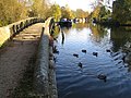 Grand Union Canal in Rickmansworth


Notable residents- past and present
- William Penn(Pennsylvania)
- Harvey Fellows (Cricketer)
- David Urquhart(MP, Russophile and advocate for Turkish Baths)
- Guy Tussaud and Joseph Theodore Tussaud (of the Waxwork family), buried at Rickmansworth Cemetery, Chorleywood Road.
- George Eliot i.e. Mary Evans (The Elms, 1875)
- Starr Wood (1870–1944, cartoonist, buried at Rickmansworth Cemetery, Chorleywood Road)
- Countess Tolstoy (buried at Woodcock Hill cemetery, Rickmansworth)
- Val Doonican (ex-The Drive, Rickmansworth)
- George Carey Foster R.S. (Chemist, Physicist and First Principal of University College London)
- Guy Calthrop aka Sir Calthrop Guy Spencer Calthrop, 1st Baronet (26 March 1870 - 23 February 1919)
- George Orwell pen-name of Eric Blair, author, who spent some summers in Rickmansworth
- Cardinal Wolsey(Manor of the More, 1522-1530 [13]
- Robert Carey, 1st Earl of Monmouth(Moor Park, 1631–1639, buried at Rickmansworth Parish Church)
- Francis Russell, 2nd Earl of Bedford (Moor Park 1576)
- Edward Russell, 3rd Earl of Bedford (Moor Park 1585-1627)
- William Herbert, 3rd Earl of Pembroke (Moor Park 1627)
- Sir Thomas Fotherley (Manor of Rickmansworth 1632-1649, knighted by Charles I)
- Franklin baronets(Bought Moor Park and Manor of Rickmansworth,1655)
- Henry Carey, 2nd Earl of Monmouth(Buried at Rickmansworth Parish Church)
- James Butler, 1st Duke of Ormonde (Moor Park 1664)
- Thomas Butler, 6th Earl of Ossory (Made Lord Butler of Moore Park in 1666)
- James Scott, 1st Duke of Monmouth (Illegitimate son of Charles II, Moor Park 1670- executed 1685))
- George Anson, 1st Baron Anson(Admiral Lord Anson, Moor Park c1752)
- Sir Lawrence Dundas, 1st Baronet (Moor Park 1763)
- Thomas Dundas, 1st Baron Dundas (Moor Park, sold 1785)
- Robert Grosvenor, 1st Marquess of Westminster (Moor Park, 1828–1845)
- Robert Grosvenor, 1st Baron Ebury (Moor Park, 1846 and The Bury,1879 to 1893)
- Robert Grosvenor, 2nd Baron Ebury (Moor Park, 1893–1918)
- Robert Victor Grosvenor, 3rd Baron Ebury (Moor Park until 1921)
Scenes from Rickmansworth
-
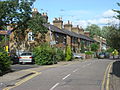 Talbot Road
 -
 St Mary's Parish Church
 -
 The Coach and Horses Public House
 -
 Our Lady Help of Christians RC Church
 -
 St Joan of Arc School (The Elms)
 -
 Moor Park Mansion
 -
 The Old Vicarage
 -
 The Bury
 -
 The Lion and the Eagle which used to top the War Memorial, now in the public gardens behind the Council Offices
 -
 Bury Lake, part of the Aquadrome


,_Rickmansworth,_Hertfordshire.JPG)


References
- ^ https://maps.google.co.uk/maps?q=rickmansworth&ie=UTF-8&hq=&hnear=0x48764207a415956d:0x3321c9f24477fb5b,Rickmansworth,+Hertfordshire&gl=uk&ei=4pwzULXADPCZ0QW-3ID4Bw&ved=0CH0QtgM
- ^ Page, William. William Page (ed.). A History of the County of Hertford: Volume II. Parishes: Rickmansworth. Institute of Historical Research.
{{cite book}}:|access-date=requires|url=(help); Check date values in:|accessdate=(help) - ^ Page, William. William Page (ed.). A History of the County of Hertford: Volume II. Parishes: Rickmansworth. Institute of Historical Research.
{{cite book}}:|access-date=requires|url=(help); Check date values in:|accessdate=(help) - ^ Page, William. William Page (ed.). A History of the County of Hertford: Volume II. Parishes: Rickmansworth. Institute of Historical Research.
{{cite book}}:|access-date=requires|url=(help); Check date values in:|accessdate=(help) - ^ Page, William. William Page (ed.). A History of the County of Hertford: Volume II. Parishes: Rickmansworth. Institute of Historical Research.
{{cite book}}:|access-date=requires|url=(help); Check date values in:|accessdate=(help) - ^ Page, William. William Page (ed.). A History of the County of Hertford: Volume II. Parishes: Rickmansworth. Institute of Historical Research.
{{cite book}}:|access-date=requires|url=(help); Check date values in:|accessdate=(help) - ^ Historic England. "Details from listed building database ({{{num}}})". National Heritage List for England.
- ^ Welbourn, N. (1998). Lost Lines London. Shepperton, Surrey: Ian Allen Ltd. p. 110. ISBN 0-711026-23-8.
{{cite book}}: Cite has empty unknown parameter:|coauthors=(help) - ^ Davies, R. (1984). Chilterns and Cotswolds (Forgotten Railways). Newton Abbot, Devon: David St John Thomas. p. 35. ISBN 0-946537-07-0.
{{cite book}}: Unknown parameter|coauthors=ignored (|author=suggested) (help) - ^ Davies, R. and Grant, M.D. (1984), p. 35.
- ^ Davies, R. and Grant, M.D. (1984), p. 36.
- ^ Welbourn, N. (1998), p. 110.
- ^ http://castlefacts.info/contentpages/castledetails/castledetails.asp?country=England&countyid=19&county=Hertfordshire&castleid=1716&latitude=51.6339&longitude=-0.4364&uin=11558
William Page (editor) (1908). "Parishes: Rickmansworth". A History of the County of Hertford: volume 2. Institute of Historical Research. Retrieved 31 March 2012. {{cite web}}: |author= has generic name (help)
See also
- Grand Union Canal
- Rickmansworth station
- Watford and Rickmansworth Railway
- W.H. Walker and Brothers
- Past Times:This is Rickmansworth 2005
- Three Rivers Museum, Rickmansworth
- Rickmansworth Historical Society
- Watford Observer Historical Tour of Rickmansworth
- Local historian's site
- Local news site
- Pictures of Rickmansworth
- Starr Wood, Cartoonist 1870-1944,
- Starr Wood Grave
- George Carey Foster R.S.(1835-1919)
- www.orwellsociety.com