
Loran-C

LORAN (LOng RAnge Navigation[1]) is a terrestrial radio navigation system which enables ships and aircraft to determine their position and speed from low frequency radio signals transmitted by fixed land based radio beacons, using a receiver unit.
As of 2010 the most recent version of LORAN in use was LORAN-C, which operates in the low frequency (LF) portion of the radio spectrum from 90 to 110 kHz. Many nations have used the system, including the United States, Canada, Japan, and several European countries. Russia uses a nearly identical system in the same frequency range, called CHAYKA.
In the decades following the 1990s, LORAN use steeply declined, with the satellite-based Global Positioning System (GPS) being the primary replacement. However, there have been attempts to enhance and re-popularize LORAN, mainly to serve as a land-based backup and alternative to GPS, and other space-based satellite navigation systems.
The current LORAN system has been phased out in the United States and Canada. The United States Coast Guard (USCG) and Canadian Coast Guard (CCG) ceased transmitting LORAN-C (and joint CHAYKA) signals in 2010.[2][3]
History
LORAN was an American development, advancing the technology of the British GEE radio navigation system that was used early in World War II. While GEE had a range of about 400 miles (644 km), initial LORAN systems had a range of 1,200 miles (1,930 km). It originally was known as "LRN" for Loomis Radio Navigation, after Alfred Lee Loomis, who invented the longer range system and played a crucial role in military research and development during World War II, but later was renamed to the abbreviation for the more descriptive term. LORAN systems were built during World War II after development at the Massachusetts Institute of Technology (MIT) Radiation Laboratory and were used extensively by the US Navy and Royal Navy. The RAF also used LORAN on raids beyond the range of GEE.[4]
In November 2009, the USCG announced that LORAN-C is not needed by the U.S. for maritime navigation. This decision left the fate of LORAN and eLORAN in the U.S. to the Secretary of the Department of Homeland Security.[5] Per a subsequent announcement, the U.S. Coast Guard, in accordance with the DHS Appropriations Act, terminated the transmission of all U.S. LORAN-C signals on 8 February 2010.[2] On 1 August 2010 the U.S. transmission of the Russian American signal was terminated,[2] and on 3 August 2010 all Canadian signals were shut down by the USCG and the CCG.[2][3]
Principle

The navigational method provided by LORAN is based on measuring the time difference between the receipt of signals from a pair of radio transmitters.[6] A given constant time difference between the signals from the two stations can be represented by a hyperbolic line of position (LOP).
If the positions of the two synchronized stations are known, then the position of the receiver can be determined as being somewhere on a particular hyperbolic curve where the time difference between the received signals is constant. In ideal conditions, this is proportionally equivalent to the difference of the distances from the receiver to each of the two stations.
So a LORAN receiver which only receives two LORAN stations cannot fully fix its position—it only narrows it down to being somewhere on a curved line. Therefore the receiver must receive and calculate the time difference between a second pair of stations. This allows to be calculated a second hyperbolic line on which the receiver is located. Where these two lines cross is the location of the receiver.
In practice, one of the stations in the second pair also may be—and frequently is—in the first pair. This means signals must be received from at least three LORAN transmitters to pinpoint the receiver's location. By determining the intersection of the two hyperbolic curves identified by this method, a geographic fix can be determined.
LORAN method

In the case of LORAN, one station remains constant in each application of the principle, the primary, being paired up separately with two other secondary stations. Given two secondary stations, the time difference (TD) between the primary and first secondary identifies one curve, and the time difference between the primary and second secondary identifies another curve, the intersections of which will determine a geographic point in relation to the position of the three stations. These curves are referred to as TD lines.[7]
In practice, LORAN is implemented in integrated regional arrays, or chains, consisting of one primary station and at least two (but often more) secondary stations, with a uniform group repetition interval (GRI) defined in microseconds. The amount of time before transmitting the next set of pulses is defined by the distance between the start of transmission of primary to the next start of transmission of primary signal.
The secondary stations receive this pulse signal from the primary, then wait a preset number of milliseconds, known as the secondary coding delay, to transmit a response signal. In a given chain, each secondary's coding delay is different, allowing for separate identification of each secondary's signal. (In practice, however, modern LORAN receivers do not rely on this for secondary identification.)[citation needed]
LORAN chains (GRIs)

Every LORAN chain in the world uses a unique Group Repetition Interval, the number of which, when multiplied by ten, gives how many microseconds pass between pulses from a given station in the chain. (In practice, the delays in many, but not all, chains are multiples of 100 microseconds.) LORAN chains are often referred to by this designation (e.g., GRI 9960, the designation for the LORAN chain serving the Northeast United States).[citation needed]
Due to the nature of hyperbolic curves, a particular combination of a primary and two secondary stations can possibly result in a "grid" where the grid lines intersect at shallow angles. For ideal positional accuracy, it is desirable to operate on a navigational grid where the grid lines are closer to right angles (orthogonal) to each other. As the receiver travels through a chain, a certain selection of secondaries whose TD lines initially formed a near-orthogonal grid can become a grid that is significantly skewed. As a result, the selection of one or both secondaries should be changed so that the TD lines of the new combination are closer to right angles. To allow this, nearly all chains provide at least three, and as many as five, secondaries.[citation needed]
LORAN charts

Where available, common marine nautical charts include visible representations of TD lines at regular intervals over water areas. The TD lines representing a given primary-secondary pairing are printed with distinct colors, and note the specific time difference indicated by each line. On a nautical chart, the denotation for each Line of Position from a receiver, relative to axis and color, can be found at the bottom of the chart. The color on official charts for stations and the timed-lines of position follow no specific conformance for the purpose of the International Hydrographic Organization (IHO). However, local chart producers may color these in a specific conformance to their standard. Always consult the chart notes, administrations Chart1 reference, and information given on the chart for the most accurate information regarding surveys, datum, and reliability.
There are three major factors when considering signal delay and propagation in relation to LORAN-C:
- Primary Phase Factor (PF) – This allows for the fact that the speed of the propagated signal in the atmosphere is slightly lower than in a vacuum.
- Secondary Phase Factor (SF) – This allows for the fact that the speed of propagation of the signal is slowed when traveling over the seawater because of the lower conductivity of seawater compared to land.
- Additional Secondary Factors (ASF) – Because LORAN-C transmitters are mainly land based, the signal will travel partly over land and partly over seawater. ASF may be treated as land and water segments, each with a uniform conductivity depending on whether the path is over land or water.
The chart notes should indicate whether ASF corrections have been made (Canadian Hydrographic Service (CHS) charts, for example, include them). Otherwise, the appropriate correction factors must be obtained before use.
Due to interference and propagation issues suffered from land features and artificial structures such as tall buildings, the accuracy of the LORAN signal can be degraded considerably in inland areas (see Limitations). As a result, nautical charts will not show TD lines in those areas, to prevent reliance on LORAN-C for navigation.
Traditional LORAN receivers display the time difference between each pairing of the primary and one of the two selected secondary stations, which is then used to find the appropriate TD line on the chart. Modern LORAN receivers display latitude and longitude coordinates instead of time differences, and, with the advent of time difference comparison and electronics, provide improved accuracy and better position fixing, allowing the observer to plot their position on a nautical chart more easily. When using such coordinates, the datum used by the receiver (usually WGS84) must match that of the chart, or manual conversion calculations must be performed before the coordinates can be used.
Timing and synchronization

Each LORAN station is equipped with a suite of specialized equipment to generate the precisely timed signals used to modulate / drive the transmitting equipment. Up to three commercial cesium atomic clocks are used to generate 5 MHz and pulse per second (or 1 Hz) signals that are used by timing equipment to generate the various GRI-dependent drive signals for the transmitting equipment.
While each U.S.-operated LORAN station is supposed to be synchronized to within 100 ns of UTC, the actual accuracy achieved as of 1994 was within 500 ns.[8]
Transmitters and antennas
LORAN-C transmitters operate at peak powers of 100–4,000 kilowatts, comparable to longwave broadcasting stations. Most use 190–220 metre tall mast radiators, insulated from ground. The masts are inductively lengthened and fed by a loading coil (see: electrical lengthening). A well known-example of a station using such an antenna is Rantum. Free-standing tower radiators in this height range are also used[clarification needed]. Carolina Beach uses a free-standing antenna tower. Some LORAN-C transmitters with output powers of 1,000 kW and higher used supertall 412 metre mast radiators (see below). Other high power LORAN-C stations, like George, used four T-antennas mounted on four guyed masts arranged in a square.
All LORAN-C antennas are designed to radiate an omnidirectional pattern. Unlike longwave broadcasting stations, LORAN-C stations cannot use backup antennas because the exact position of the antenna is a part of the navigation calculation. The slightly different physical location of a backup antenna would produce Lines of Position different from those of the primary antenna.
Limitations
-
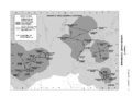 Atlantic Ocean LORAN coverage (2006)
 -
 Pacific Ocean LORAN coverage (2006)


LORAN suffers from electronic effects of weather and the ionospheric effects of sunrise and sunset. The most accurate signal is the groundwave that follows the Earth's surface, ideally over seawater. At night the indirect skywave, bent back to the surface by the ionosphere, is a problem as multiple signals may arrive via different paths (multipath interference). The ionosphere's reaction to sunrise and sunset accounts for the particular disturbance during those periods. Magnetic storms have serious effects as with any radio based system.
LORAN uses ground based transmitters that only cover certain regions. Coverage is quite good in North America, Europe, and the Pacific Rim.
The absolute accuracy of LORAN-C varies from 0.10 to 0.25 nmi (185 to 463 m). Repeatable accuracy is much greater, typically from 60 to 300 ft (18 to 91 m).[9]
LORAN-A and other systems
LORAN-A was a less accurate system operating in the upper mediumwave frequency band prior to deployment of the more accurate LORAN-C system.[10] For LORAN-A the transmission frequencies 1750 kHz, 1850 kHz, 1900 kHz and 1950 kHz were used, shared with the 1800–2000 kHz amateur 160-meter band. LORAN-A continued in operation partly due to the economy of the receivers and widespread use in civilian recreational and commercial navigation. LORAN-B was a phase comparison variation of LORAN-A while LORAN-D was a short-range tactical system designed for USAF bombers. The unofficial "LORAN-F" was a drone control system. None of these went much beyond the experimental stage. An external link to them is listed below.
LORAN-A was used in the Vietnam War for navigation by large United States aircraft (C-124, C-130, C-97, C-123, HU-16, etc.). A common airborne receiver of that era was the R-65/APN-9 which combined the receiver and cathode ray tube (CRT) indicator into a single relatively lightweight unit replacing the two larger, separate receiver and indicator units which composed the predecessor APN-4 system. The APN-9 and APN-4 systems found wide post–World War II use on fishing vessels in the U.S. They were cheap, accurate and plentiful. The main drawback for use on boats was their need for aircraft power, 115 VAC at 400 Hz. This was solved initially by the use of rotary converters, typically 28 VDC input and 115 VAC output at 400 Hz. The inverters were large, noisy and required significant power. In the 1960s, several firms such as Topaz and Linear Systems marketed solid state inverters specifically designed for these surplus LORAN-A sets. The availability of solid state inverters that used 12 VDC input opened up the surplus LORAN-A sets for use on much smaller vessels which typically did not have the 24-28 VDC systems found on larger vessels. The solid state inverters were very power efficient and widely replaced the more trouble prone rotary inverters.
LORAN-A saved many lives by allowing offshore boats in distress to give accurate position reports. It also guided many boats whose owners could not afford radar safely into fog bound harbors or around treacherous offshore reefs. The low price of surplus LORAN-A receivers (often under $150) meant that owners of many small fishing vessels could afford this equipment, thus greatly enhancing safety. Surplus LORAN-A equipment, which was common on commercial fishing boats, was rarely seen on yachts. The unrefined cosmetic appearance of the surplus equipment was probably a deciding factor.
Pan American World Airways used APN 9s in early Boeing 707 operations. World War II surplus APN-9 looked out of place in the modern 707 cockpit, but was needed. There is an R65A APN-9 set displayed in the museum at San Francisco International Airport, painted gold. It was a retirement gift to an ex Pan Am captain.
An elusive final variant of the APN 9 set was the APN 9A. A USAF technical manual (with photographs and schematics) shows that it had the same case as the APN-9 but a radically different front panel and internal circuitry on the non-RF portions. The APN-9A had vacuum tube flipflop digital divider circuits so that TDs (time delays) between the primary and secondary signal could be selected on front panel rotary decade switches. The older APN-9 set required the user to perform a visual count of crystal oscillator timing marker pips on the CRT and add them up to get a TD. The APN 9A did not make it into widespread military use, if it was used at all, but it did exist and represented a big advance in military LORAN-A receiver technology.
In the 1970s one US company, SRD Labs in Campbell, California, made modern LORAN-A sets including one that was completely automatic with a digital TD readout on the CRT, and autotracking so that TDs were continuously updated. Other SRD models required the user to manually align the primary and secondary signals on the CRT and then a phase locked loop would keep them lined up and provide updated TD readouts thereafter. These SRD LORAN-A sets would track only one pair of stations, providing just one LOP (line of position). For a continuously updated position (two TDs giving intersecting LOPs) rather than just a single LOP, two sets were necessary.
LORAN-A was terminated in the United States on 31 December 1980 and the restrictions on amateur radio use of the 160-meter band were lifted.
Long after LORAN-A broadcasts were terminated, commercial fishermen still referred to old LORAN-A TDs, e.g., "I am on the 4100 [microsecond] line in 35 fathoms", referring to a position outside of Bodega Bay. Many LORAN-C sets incorporated LORAN A TD converters so that a LORAN-C set could be used to navigate to a LORAN-A TD defined line or position.
LORAN Data Channel (LDC)
LORAN Data Channel (LDC) is a project underway between the FAA and USCG to send low bit rate data using the LORAN system. Messages to be sent include station identification, absolute time, and position correction messages. In 2001, data similar to Wide Area Augmentation System (WAAS) GPS correction messages were sent as part of a test of the Alaskan LORAN chain. As of November 2005, test messages using LDC were being broadcast from several U.S. LORAN stations.[citation needed]
In recent years, LORAN-C has been used in Europe to send differential GPS and other messages, employing a similar method of transmission known as EUROFIX.[citation needed]
A system called SPS (Saudi Positioning System), similar to EUROFIX, is in use in Saudi Arabia.[11] GPS differential corrections and GPS integrity information are added to the LORAN signal. A combined GPS/LORAN receiver is used, and if a GPS fix is not available it automatically switches over to LORAN.
The future of LORAN
As LORAN systems are government maintained and operated, their continued existence is subject to public policy. With the evolution of other electronic navigation systems, such as satellite navigation systems, funding for existing systems is not always assured.
Critics, who have called for the elimination of the system, state that the LORAN system has too few users, lacks cost-effectiveness, and that GNSS signals are superior to LORAN.[citation needed] Supporters of continued and improved LORAN operation note that LORAN uses a strong signal, which is difficult to jam, and that LORAN is an independent, dissimilar, and complementary system to other forms of electronic navigation, which helps ensure availability of navigation signals.[12][13]
On 26 February 2009, the U.S. Office of Management and Budget released the first blueprint for the Financial Year 2010 budget.[14] This document identified the LORAN-C system as “outdated” and supported its termination at an estimated savings of $36 million in 2010 and $190 million over five years.
On 21 April 2009 the U.S. Senate Committee on Commerce, Science and Transportation and the Committee on Homeland Security and Governmental Affairs released inputs to the FY 2010 Concurrent Budget Resolution with backing for the continued support for the LORAN system, acknowledging the investment already made in infrastructure upgrades and recognizing the studies performed and multi-departmental conclusion that eLORAN is the best backup to GPS.
Senator Jay Rockefeller, Chairman of the Committee on Commerce, Science and Transportation, wrote that the committee recognized the priority in "Maintaining LORAN-C while transitioning to eLORAN" as means of enhancing the homeland security, marine safety and environmental protection missions of the Coast Guard.
Senator Collins, the ranking member on the Committee on Homeland Security and Governmental Affairs wrote that the President's budget overview proposal to terminate the LORAN-C system is inconsistent with the recent investments, recognized studies and the mission of the U.S. Coast Guard. The committee also recognizes the $160 million investment already made toward upgrading the LORAN-C system to support the full deployment of eLORAN.
Further, the Committees also recognize the many studies which evaluated GPS backup systems and concluded both the need to back up GPS and identified eLORAN as the best and most viable backup. "This proposal is inconsistent with the recently released (January 2009) Federal Radionavigation Plan (FRP), which was jointly prepared by DHS and the Departments of Defense (DOD) and Transportation (DOT). The FRP proposed the eLORAN program to serve as a Position, Navigation and Timing (PNT) backup to GPS (Global Positioning System)."
On 7 May 2009, President Barack Obama proposed cutting funding (approx. $35 million/year) for LORAN, citing its redundancy alongside GPS.[15] In regard to the pending Congressional bill, H.R. 2892, it was subsequently announced that "[t]he Administration supports the Committee's aim to achieve an orderly termination through a phased decommissioning beginning in January 2010, and the requirement that certifications be provided to document that the LORAN-C termination will not impair maritime safety or the development of possible GPS backup capabilities or needs."[16]
Also on 7 May 2009, the U.S. General Accounting Office (GAO), the investigative arm of Congress, released a report citing the very real potential for the GPS system to degrade or fail in light of program delays which have resulted in scheduled GPS satellite launches slipping by up to three years.[17]
On 12 May 2009 the March 2007 Independent Assessment Team (IAT) report on LORAN was released to the public. In its report the ITA stated that it "unanimously recommends that the U.S. government complete the eLORAN upgrade and commit to eLORAN as the national backup to GPS for 20 years." The release of the report followed an extensive Freedom Of Information Act (FOIA) battle waged by industry representatives against the federal government. Originally completed 20 March 2007 and presented to the co-sponsoring Department of Transportation and Department of Homeland Security (DHS) Executive Committees, the report carefully considered existing navigation systems, including GPS. The unanimous recommendation for keeping the LORAN system and upgrading to eLORAN was based on the team's conclusion that LORAN is operational, deployed and sufficiently accurate to supplement GPS. The team also concluded that the cost to decommission the LORAN system would exceed the cost of deploying eLORAN, thus negating any stated savings as offered by the Obama administration and revealing the vulnerability of the U.S. to GPS disruption.[18]
In November 2009, the U.S. Coast Guard announced that the LORAN-C stations under its control would be closed down for budgetary reasons after 4 January 2010 provided the Secretary of the Department of Homeland Security certified that LORAN is not needed as a backup for GPS.[19]
On 7 January 2010, Homeland Security published a notice of the permanent discontinuation of LORAN-C operation. Effective 2000 UTC 8 February 2010, the United States Coast Guard terminated all operation and broadcast of LORAN-C signals in the USA. The U.S. Coast Guard transmission of the Russian American CHAYKA signal was terminated on 1 August 2010. The transmission of Canadian LORAN-C signals was terminated on 3 August 2010.[20]
eLORAN
With the perceived vulnerability of GNSS systems,[21] and their own propagation and reception limitations, renewed interest in LORAN applications and development has appeared.[22] Enhanced LORAN, also known as eLORAN or E-LORAN, comprises an advancement in receiver design and transmission characteristics which increase the accuracy and usefulness of traditional LORAN. With reported accuracy as good as ± 8 meters,[23] the system becomes competitive with unenhanced GPS. eLORAN also includes additional pulses which can transmit auxiliary data such as DGPS corrections. eLORAN receivers now use "all in view" reception, incorporating signals from all stations in range, not solely those from a single GRI, incorporating time signals and other data from up to 40 stations. These enhancements in LORAN make it adequate as a substitute for scenarios where GPS is unavailable or degraded.[24]
United Kingdom eLORAN implementation
On 31 May 2007, the UK Department for Transport (DfT), via the General Lighthouse Authorities (GLA), awarded a 15-year contract to provide a state-of-the-art enhanced LORAN (eLORAN) service to improve the safety of mariners in the UK and Western Europe. The service contract will operate in two phases, with development work and further focus for European agreement on eLORAN service provision from 2007 through 2010, and full operation of the eLORAN service from 2010 through 2022. The first eLORAN transmitter is situated at Anthorn radio station Cumbria, UK, and operated by Babcock Comms, which is part of the Babcock Group PLC.[25]
eLORAN: The UK government has granted approval for seven differential eLoran ship-positioning technology stations to be built along the south and east coasts of the UK to help counter the threat of jamming of global positioning systems. They are set to reach initial operational capability by summer 2014.[26]
List of LORAN-C transmitters

A list of LORAN-C transmitters. Stations with an antenna tower taller than 300 metres (984 feet) are shown in bold.
| Station | Country | Chain | Coordinates | Remarks |
|---|---|---|---|---|
| Afif | Saudi Arabia | Saudi Arabia South (GRI 7030) Saudi Arabia North (GRI 8830) |
23°48′36.66″N 42°51′18.17″E / 23.8101833°N 42.8550472°E | 400 kW |
| Al Khamasin | Saudi Arabia | Saudi Arabia South (GRI 7030) Saudi Arabia North (GRI 8830) |
20°28′2.34″N 44°34′51.9″E / 20.4673167°N 44.581083°E | |
| Al Muwassam | Saudi Arabia | Saudi Arabia South (GRI 7030) Saudi Arabia North (GRI 8830) |
16°25′56.87″N 42°48′6.21″E / 16.4324639°N 42.8017250°E | |
| Angissq | Greenland | Shutdown on 31 December 1994 | 59°59′17.348″N 45°10′26.91″W / 59.98815222°N 45.1741417°W | used until 27 July 1964 a 411.48 metre tower |
| Anthorn | UK | Lessay (GRI 6731) | 54°54′41.949″N 3°16′42.58″W / 54.91165250°N 3.2784944°W | replacement for transmitter Rugby[27] |
| Ash Shaykh Humayd | Saudi Arabia | Saudi Arabia South (GRI 7030) Saudi Arabia North (GRI 8830) |
28°9′15.87″N 34°45′41.36″E / 28.1544083°N 34.7614889°E | |
| Attu Island | United States | North Pacific (GRI 9990) Russian-American (GRI 5980) |
52°49′44″N 173°10′49.7″E / 52.82889°N 173.180472°E | demolished in August 2010 |
| Balasore | India | Calcutta (GRI 5543) | 21°29′11.02″N 86°55′9.66″E / 21.4863944°N 86.9193500°E | 100 KW |
| Barrigada | Guam | shut down | 13°27′50.16″N 144°49′33.4″E / 13.4639333°N 144.825944°E | |
| Baudette | United States | North Central U.S. (GRI 8290) Great Lakes (GRI 8970) |
48°36′49.947″N 94°33′17.91″W / 48.61387417°N 94.5549750°W | |
| Berlevåg | Norway | Bø (GRI 7001) | 70°50′43.07″N 29°12′16.04″E / 70.8452972°N 29.2044556°E | |
| Bilimora | India | Bombay (GRI 6042) | 20°45′42.036″N 73°02′14.48″E / 20.76167667°N 73.0373556°E | |
| Boise City | United States | Great Lakes (GRI 8970) South Central U.S. (GRI 9610) |
36°30′20.75″N 102°53′59.4″W / 36.5057639°N 102.899833°W | |
| Bø, Vesterålen | Norway | Bø (GRI 7001) Eiði (GRI 9007) |
68°38′06.216″N 14°27′47.35″E / 68.63506000°N 14.4631528°E | |
| Cambridge Bay | Canada | shut down | 69°06′52.840″N 105°00′55.95″W / 69.11467778°N 105.0155417°W | free-standing lattice tower, used as NDB |
| Cape Race | Canada | Canadian East Coast (GRI 5930) Newfoundland East Coast (GRI 7270) |
46°46′32.74″N 53°10′28.66″W / 46.7757611°N 53.1746278°W | used a 411.48 metre tall tower until 2 February 1993, uses now a 260.3 metre tall tower |
| Caribou, Maine | United States | Canadian East Coast (GRI 5930) Northeast U.S. (GRI 9960) |
46°48′27.305″N 67°55′37.15″W / 46.80758472°N 67.9269861°W | |
| Carolina Beach | United States | Southeast U.S. (GRI 7980) Northeast US (GRI 9960) |
34°03′46.208″N 77°54′46.10″W / 34.06283556°N 77.9128056°W | |
| Chongzuo | China | China South Sea (GRI 6780) | 22°32′35.8″N 107°13′19″E / 22.543278°N 107.22194°E | |
| Comfort Cove | Canada | Newfoundland East Coast (GRI 7270) | 49°19′53.65″N 54°51′43.2″W / 49.3315694°N 54.862000°W | |
| Dana | United States | Great Lakes (GRI 8970) Northeast US (GRI 9960) |
39°51′7.64″N 87°29′10.71″W / 39.8521222°N 87.4863083°W | |
| Dhrangadhra | India | Bombay (GRI 6042) | 23°0′16.2″N 71°31′37.64″E / 23.004500°N 71.5271222°E | |
| Diamond Harbor | India | Calcutta (GRI 5543) | 22°10′20.42″N 88°12′15.8″E / 22.1723389°N 88.204389°E | |
| Eiði | Faroe Islands | Eiði (GRI 9007) | 62°17′59.69″N 7°4′25.59″W / 62.2999139°N 7.0737750°W | |
| Estartit | Spain | Mediterranean Sea (GRI 7990) (Shut down) |
42°3′36.63″N 3°12′16.08″E / 42.0601750°N 3.2044667°E | |
| Fallon | United States | U.S. West Coast (GRI 9940) | 39°33′6.77″N 118°49′55.6″W / 39.5518806°N 118.832111°W | |
| Fox Harbour | Canada | Canadian East Coast (GRI 5930) Newfoundland East Coast (GRI 7270) |
52°22′35.29″N 55°42′28.68″W / 52.3764694°N 55.7079667°W | |
| George | United States | Canadian West Coast (GRI 5990) | 47°03′48.096″N 119°44′38.97″W / 47.06336000°N 119.7441583°W | |
| Gesashi | Japan | North West Pacific (GRI 8930) East Asia (GRI 9930) |
26°36′25.09″N 128°8′56.94″E / 26.6069694°N 128.1491500°E | |
| Gillette | United States | North Central U.S. (GRI 8290) South Central U.S. (GRI 9610) |
44°0′11.21″N 105°37′24″W / 44.0031139°N 105.62333°W | |
| Grangeville | United States | Southeast U.S. (GRI 7980) South Central U.S. (GRI 9610) |
30°43′33.24″N 90°49′43.01″W / 30.7259000°N 90.8286139°W | |
| Havre | United States | North Central U.S. (GRI 8290) | 48°44′38.58″N 109°58′53.3″W / 48.7440500°N 109.981472°W | |
| Hellissandur | Iceland | shut down on 31 December 1994 | 64°54′14.793″N 23°54′47.83″W / 64.90410917°N 23.9132861°W | 411.48 metre tall tower, now used for longwave broadcasting of RÚV on 189 kHz |
| Helong | China | China North Sea (GRI 7430) | 42°43′11″N 129°6′27.07″E / 42.71972°N 129.1075194°E | |
| Hexian | China | China South Sea (GRI 6780) | 23°58′3.21″N 111°43′9.78″E / 23.9675583°N 111.7193833°E | |
| Iwo Jima | Japan | shut down in September 1993, dismantled | 24°48′26.262″N 141°19′34.76″E / 24.80729500°N 141.3263222°E | used a 411.48 metre tall tower |
| Jan Mayen | Norway | Bø (GRI 7001) Ejde (GRI 9007) |
70°54′51.478″N 8°43′56.52″W / 70.91429944°N 8.7323667°W | |
| Johnston Island | United States | shut-down | 16°44′43.82″N 169°30′30.9″W / 16.7455056°N 169.508583°W | |
| Jupiter | United States | Southeast U.S. (GRI 7980) | 27°1′58.49″N 80°6′52.83″W / 27.0329139°N 80.1146750°W | |
| Kargaburun | Turkey | Mediterranean Sea (GRI 7990) (Shut down) |
40°58′20.51″N 27°52′1.89″E / 40.9723639°N 27.8671917°E | |
| Kwang Ju | South Korea | East Asia (GRI 9930) | 35°2′23.69″N 126°32′27.2″E / 35.0399139°N 126.540889°E | |
| Lampedusa | Italy | Mediterranean Sea (GRI 7990) (Shut down) |
35°31′22.11″N 12°31′31.06″E / 35.5228083°N 12.5252944°E | |
| Las Cruces | United States | South Central U.S. (GRI 9610) | 32°4′18.1″N 106°52′4.32″W / 32.071694°N 106.8678667°W | |
| Lessay | France | Lessay (GRI 6731) Sylt (GRI 7499) |
49°8′55.27″N 1°30′17.03″W / 49.1486861°N 1.5047306°W | |
| Loop Head | Ireland | Lessay (GRI 6731) Eiði (GRI 9007) |
(Never built) | 250 kW |
| Malone | United States | Southeast U.S. (GRI 7980) Great Lakes (GRI 8970) |
30°59′38.87″N 85°10′8.71″W / 30.9941306°N 85.1690861°W | |
| Middletown | United States | U.S. West Coast (GRI 9940) | 38°46′57.12″N 122°29′43.9″W / 38.7825333°N 122.495528°W | |
| Minamitorishima | Japan | North West Pacific (GRI 8930) | 24°17′8.79″N 153°58′52.2″E / 24.2857750°N 153.981167°E | used until 1985 a 411.48 metre tall tower |
| Nantucket | United States | Canadian East Coast (GRI 5930) Northeast U.S. (GRI 9960) |
41°15′12.42″N 69°58′38.73″W / 41.2534500°N 69.9774250°W | |
| Narrow Cape | United States | Gulf of Alaska (GRI 7960) North Pacific (GRI 9990) |
57°26′20.5″N 152°22′10.2″W / 57.439028°N 152.369500°W | |
| Niijima | Japan | North West Pacific (GRI 8930) East Asia (GRI 9930) |
34°24′12.06″N 139°16′19.4″E / 34.4033500°N 139.272056°E | |
| Patpur | India | Calcutta (GRI 5543) | 20°26′50.627″N 85°49′38.67″E / 20.44739639°N 85.8274083°E | |
| Pohang | South Korea | North West Pacific (GRI 8930) East Asia (GRI 9930) |
36°11′5.33″N 129°20′27.4″E / 36.1848139°N 129.340944°E | |
| Port Clarence | United States | Gulf of Alaska (GRI 7960) North Pacific (GRI 9990) |
65°14′40.372″N 166°53′11.996″W / 65.24454778°N 166.88666556°W | uses a 411.48 metre tall tower Demolished 28 April 2010 [28] |
| Port Hardy | Canada | Canadian West Coast (GRI 5990) | 50°36′29.830″N 127°21′28.48″W / 50.60828611°N 127.3579111°W | |
| Rantum | Germany | Lessay (GRI 6731) Sylt (GRI 7499) |
54°48′29.94″N 8°17′36.9″E / 54.8083167°N 8.293583°E | |
| Raymondville | United States | Southeast U.S. (GRI 7980) South Central U.S. (GRI 9610) |
26°31′55.17″N 97°49′59.52″W / 26.5319917°N 97.8332000°W | |
| Raoping | China | China South Sea (GRI 6780) China East Sea (GRI 8390) |
23°43′26.02″N 116°53′44.7″E / 23.7238944°N 116.895750°E | |
| Rongcheng | China | China North Sea (GRI 7430) China East Sea (GRI 8390) |
37°03′51.765″N 122°19′25.95″E / 37.06437917°N 122.3238750°E | |
| Rugby | UK | Experimental (GRI 6731) Shut down at the end of July 2007 |
52°21′57.893″N 1°11′27.39″W / 52.36608139°N 1.1909417°W | |
| Saint Paul | United States | North Pacific (GRI 9990) | 57°9′12.35″N 170°15′6.06″W / 57.1534306°N 170.2516833°W | |
| Salwa | Saudi Arabia | Saudi Arabia South (GRI 7030) Saudi Arabia North (GRI 8830) |
24°50′1.46″N 50°34′12.54″E / 24.8337389°N 50.5701500°E | |
| Searchlight | United States | South Central U.S. (GRI 9610) U.S. West Coast (GRI 9940) |
35°19′18.305″N 114°48′16.88″W / 35.32175139°N 114.8046889°W | |
| Sellia Marina | Italy | Mediterranean Sea (GRI 7990); shut down | 38°52′20.72″N 16°43′6.27″E / 38.8724222°N 16.7184083°E | |
| Seneca | United States | Great Lakes (GRI 8970) Northeast U.S. (GRI 9960) |
42°42′50.716″N 76°49′33.30″W / 42.71408778°N 76.8259167°W | |
| Shoal Cove | United States | Canadian West Coast (GRI 5990) Gulf of Alaska (GRI 7960) |
55°26′20.940″N 131°15′19.09″W / 55.43915000°N 131.2553028°W | |
| Soustons | France | Lessay (GRI 6731) | 43°44′23.21″N 1°22′49.63″W / 43.7397806°N 1.3804528°W | |
| Tok | United States | Gulf of Alaska (GRI 7960) | 63°19′42.884″N 142°48′31.34″W / 63.32857889°N 142.8087056°W | |
| Tokachibuto | Japan | Eastern Russia Chayka (GRI 7950) North West Pacific (GRI 8930) |
42°44′37.2″N 143°43′10.5″E / 42.743667°N 143.719583°E | |
| Upolo Point | United States | Shut down | 20°14′51.12″N 155°53′4.34″W / 20.2475333°N 155.8845389°W | |
| Værlandet | Norway | Sylt (GRI 7499) Ejde (GRI 9007) |
61°17′49.49″N 4°41′47.05″E / 61.2970806°N 4.6964028°E | |
| Veraval | India | Bombay (GRI 6042) | 20°57′09.316″N 70°20′11.73″E / 20.95258778°N 70.3365917°E | |
| Williams Lake | Canada | Canadian West Coast (GRI 5990) North Central U.S. (GRI 8290) |
51°57′58.78″N 122°22′1.55″W / 51.9663278°N 122.3670972°W | |
| Xuancheng | China | China North Sea (GRI 7430) China East Sea (GRI 8390) |
31°4′8.3″N 118°53′8.78″E / 31.068972°N 118.8857722°E | |
| Yap | Micronesia | shut down in 1987, dismantled | 9°32′44.76″N 138°9′53.48″E / 9.5457667°N 138.1648556°E | used a 304.8 metre tall tower |
See also
- CHAYKA, the Russian counterpart of LORAN
- Alpha, the Russian counterpart of the Omega Navigation System, still in use as of 2006.
- OMEGA, the Western counterpart of the Alpha Navigation System, no longer in use.
- Decca Navigator System, a British system that used phase difference instead of time difference.
- SHORAN
- Oboe (navigation)
- G-H (navigation)
- GEE (navigation)
- GPS
- Local positioning system
References
- ^ "LORAN". Oxford English Dictionary (2 ed.). Oxford, England: Oxford University Press. 1989.
the initial letters of long-range navigation
- ^ a b c d "LORAN-C General Information". United States Coast Guard. Retrieved 4 August 2010.
- ^ a b "Termination of the Loran-C Service". notmar.gc.ca. Retrieved 4 August 2010. (for access click on "I have read..." and "Accept")
- ^ Hecks, Karl (June 1990). Bombing 1939–1945: the Air Offensive Against Land Targets in WWII. Robert Hale Ltd., London. ISBN 0-7090-4020-2. p.219
- ^ Senate committee letter
- ^ Appleyard, S.F. (1988). Marine Electronic Navigation (2nd Edition). Routledge & Kegan Paul. pp. 77–83. ISBN 0-7102-1271-2.
{{cite book}}: Unknown parameter|coauthors=ignored (|author=suggested) (help) - ^ The American Practical Navigator, An Epitome of Navigation, page 173
- ^ "Chapter 2 ̣– LORAN-C Transmissions" (PDF). Specification of the Transmitted LORAN-C Signal / COMDTINST M16562.4A. U.S. Coast Guard. 1994. pp. 6, 7. Retrieved 4 September 2012.
- ^ COMDTPUB P16562.6, "LORAN-C Users Handbook", 1992
- ^ Jerry Proc, VE3FAB (26 November 2007). "LORAN A". Retrieved 28 May 2009.
{{cite web}}: CS1 maint: numeric names: authors list (link) [dead link] - ^ "A New Navigation Positioning System run by Saudi Ports Authority". Saudi Ports Authority. 2006. Retrieved 21 January 2011.
{{cite web}}: Cite has empty unknown parameter:|coauthors=(help) - ^ "Enhanced Loran (eloran) Definition Document" (PDF). International Loran Association. 16 October 2007. Retrieved 18 July 2010.
- ^ "GPS back-up 'needs more research' ". bbc.co.uk, 20 June 2008, Retrieved 5 October 2010
- ^ Office of Management and Budget. ( www.budget.gov), "A New Era of Responsibility Renewing America's Promise" The FY 2010 Budget, Department of Homeland Security Section, page 72
- ^ Obama: Budget cuts add up to 'real money'
- ^ "H.R. 2892--Department of Homeland Security Appropriations Act, 2010". C-SPAN.org. 8 July 2009. Retrieved 10 August 2009.
- ^ http://www.gao.gov/products/GAO-09-670T
- ^ http://sidt.gpsworld.com/gpssidt/article/articleDetail.jsp?id=597861
- ^ "USCG LORAN Program Manager release, Nov. 2009". 31 May 2007. Retrieved 28 November 2009.
{{cite web}}: Cite has empty unknown parameter:|coauthors=(help) - ^ http://www.navcen.uscg.gov/?pageName=loranMain
- ^ http://news.bbc.co.uk/2/hi/science/nature/8533157.stm
- ^ "GPS vulnerable to hacker attacks". BBC News. 23 February 2010. Retrieved 11 May 2010.
- ^ http://www.aviationtoday.com/av/commercial/GPS-Backup-Is-eLoran-the-Answer_76148.html Template:Date=April 2012
- ^ Press office (7 February 2008). "Statement from DHS press secretary Laura Keehhner on the adoption of national backup system to GPS" (PDF). press release. United States Department of Homeland Security. Retrieved 10 January 2013.
- ^ "The GLAs award a 15-year eLORAN contract to Babcock Communications". Trinity House. 31 May 2007. Retrieved 27 May 2010.
{{cite web}}: Cite has empty unknown parameter:|coauthors=(help) - ^ Nautilus International Newspaper August 2013
- ^ "Electronic Position Fixing System" (PDF). Admiralty Notices to Mariners (26/07). United Kingdom Hydrographic Office. 28 June 2007. Archived from the original (– Scholar search) on 24 June 2008. Retrieved 19 January 2008.
{{cite journal}}: Cite has empty unknown parameter:|coauthors=(help); External link in|format= - ^ http://coastguardnews.com/video-loran-station-port-clarence-tower-demolition/2010/05/01/
- Jennet Conant, Tuxedo Park: A Wall Street Tycoon and the Secret Palace of Science That Changed the Course of World War II (New York: Simon & Schuster, 2002, ISBN 0-684-87287-0) pp. 231–232.
- Department of Transportation and Department of Defense (2006–02). "2005 Federal Radionavigation Plan" (PDF). Retrieved 26 February 2006.
{{cite web}}: Check date values in:|year=(help)
External links
- International Loran Association
- United States National Institute of Standards and Technology Site- Using LORAN C for time-keeping.
- European Loran-C network website
- LORAN-C Transmitter (Rantum) at Structurae
- Hellissandur Transmission Tower at Structurae :former LORAN-C transmitter mast, now used for longwave broadcasting
- LORAN-C facility antenna (Gillette, Wyoming) at Structurae
- LORAN-C facility antenna (Port Clarence, Alaska) at Structurae
- Jerry Proc, VE3FAB: Hyperbolic Radionavigation Systems:
- Integrated GPS/Loran Prototypes for Aviation Applications
- The Migration to Enhanced or eLoran
- GNSS/eLoran for Timing and Frequency by Locus, Inc.
- Loran's Capability to Mitigate the Impact of a GPS Outage on GPS Position, Navigation, and Time Applications by Locus, Inc.
- New Potential of Low-Frequency Radionavigation in the 21st Century Ph.D. dissertation
- LORAN-C chains in service
- List of active LORAN-C transmitters
- SDR in action: The last LORAN-C receiver is a technical description of using a software-defined radio to decode LORAN-C signals
- New UK eLORAN service provision news article News article re: UK leading the way in eLORAN service provision.
- eLORAN vs Loran-C at InsideGNSS—Short article describing the innovations in eLORAN
- History of LORAN
- Dr. G. Linn Roth (October 1998). "The Case for Loran". International Loran Association. Retrieved 18 July 2010.