
Dade County, Georgia: Difference between revisions
m Reverted edits by 168.8.228.251 (talk) to last version by ArthurBot |
|||
| Line 94: | Line 94: | ||
== Georgia water supply == |
== Georgia water supply == |
||
Dade County lies just south of |
Dade County lies just south of [[Nickajack Lake]] on the [[Tennessee River]], which is created by the [[Nickajack Dam]], part of the [[Tennessee Valley Authority]]. The water source has been desired by [[Atlanta, Georgia]] to supplement water drained from [[Lake Lanier]] and [[Lake Allatoona]]. Georgia lawmakers wished to change the Tennessee-Georgia state line by claiming it is based upon a flawed 1818 survey that mistakenly placed Georgia's northern line just short of the Tennessee River.<ref>Bluestein, Greg - [http://news.yahoo.com/s/ap/20080428/ap_on_re_us/drought_state_line; Forgotten Ga. county now in spotlight over water rights]. Associated Press, April 28, 2008</ref><ref>Shearer, Lee - [http://www.onlineathens.com/stories/030308/news_2008030300238.shtml Tennessee-Georgia border dispute derided]. The Athens Banner-Herald, March 3, 2008 </ref> |
||
== Cities and towns == |
== Cities and towns == |
||
Revision as of 05:04, 24 May 2010
Dade County | |
|---|---|
 Dade County Courthouse in Trenton | |
 Location within the U.S. state of Georgia | |
 Georgia's location within the U.S. | |
| Coordinates: 34°51′N 85°30′W / 34.85°N 85.5°W | |
| Country | |
| State | |
| Founded | 1837 |
| Seat | Trenton |
| Largest city | Trenton |
| Area | |
| • Total | 174 sq mi (451 km2) |
| • Land | 174 sq mi (451 km2) |
| • Water | 0 sq mi (0 km2) 0% |
| Population | |
| • Estimate (2005) | 16,040 |
| • Density | 87/sq mi (34/km2) |
| Time zone | UTC−5 (Eastern) |
| • Summer (DST) | UTC−4 (EDT) |
Dade County is a county located in the U.S. state of Georgia. As of 2000, the population is 15,154. The 2007 Census Estimate shows a population of 16,098.[1] The county seat is Trenton.Template:GR
Dade County is part of the Chattanooga, TN–GA Metropolitan Statistical Area.
Geography
According to the U.S. Census Bureau, the county has a total area of 174 square miles (451 km²), of which, 174 square miles (451 km²) of it is land and 0 square miles (0 km²) of it (0.10%) is water.
Major highways
 Interstate 24
 Interstate 59
 U.S. Route 11
 State Route 58
 State Route 136
 State Route 157
 State Route 189
 State Route 299
 State Route 301
Adjacent counties
- Marion County, Tennessee (north)
- Hamilton County, Tennessee (northeast)
- Walker County (southeast)
- DeKalb County, Alabama (southwest)
- Jackson County, Alabama (west)
Places adjacent to Dade County, Georgia | |
|---|---|
National protected areas
Demographics
As of the censusTemplate:GR of 2000, there were 15,154 people, 5,633 households, and 4,264 families residing in the county. The population density was 87 people per square mile (34/km²). There were 6,224 housing units at an average density of 36 per square mile (14/km²). The racial makeup of the county was 97.51% White, 0.63% Black or African American, 0.49% Native American, 0.38% Asian, 0.03% Pacific Islander, 0.20% from other races, and 0.76% from two or more races. 0.90% of the population were Hispanic or Latino of any race.
There were 5,633 households out of which 33.30% had children under the age of 18 living with them, 62.70% were married couples living together, 9.50% had a female householder with no husband present, and 24.30% were non-families. 21.70% of all households were made up of individuals and 8.20% had someone living alone who was 65 years of age or older. The average household size was 2.55 and the average family size was 2.97.
In the county the population was spread out with 23.80% under the age of 18, 11.80% from 18 to 24, 27.80% from 25 to 44, 24.50% from 45 to 64, and 12.00% who were 65 years of age or older. The median age was 36 years. For every 100 females there were 96.00 males. For every 100 females age 18 and over, there were 91.80 males.
The median income for a household in the county was $35,259, and the median income for a family was $39,481. Males had a median income of $31,534 versus $21,753 for females. The per capita income for the county was $16,127. About 7.50% of families and 9.70% of the population were below the poverty line, including 7.40% of those under age 18 and 12.50% of those age 65 or over.
History
Dade County was established in 1837 and was named for Major Francis Langhorne Dade, who was killed in the Dade Massacre by Seminole Indians in December, 1835.
The first settlers of Dade County won the land in Georgia's land lottery and came to work in coke and coal mines.
Georgia did not have a road connecting to Dade County until the purchase of Cloudland Canyon in 1939. The county could only be accessed through Alabama and Tennessee until then.
Covenant College, founded in 1955 in California, needed to expand into new facilities after just one year. Several professors helped Covenant move to St. Louis, Missouri where it grew for eight years and in 1964 the institution outgrew its facilities and moved to Lookout Mountain.
Dade County had a short-lived state secessionist movement during the civil war. Dade Countians wanted to secede from the Union but the State of Georgia was cautious. Because the people of Dade County could not wait on their state to secede, they simply seceded by themselves. Not until about half a century ago did Dade County officially return to the State of Georgia.[citation needed]
Quarter Controversy

Shortly after the Georgia State Quarter was released, Dade County gained attention over an apparent mistake in the quarter. The outline of the state of Georgia on the quarter appears to have accidentally left out Dade County, which is in the extreme northwestern part of the state.
Georgia water supply
Dade County lies just south of Nickajack Lake on the Tennessee River, which is created by the Nickajack Dam, part of the Tennessee Valley Authority. The water source has been desired by Atlanta, Georgia to supplement water drained from Lake Lanier and Lake Allatoona. Georgia lawmakers wished to change the Tennessee-Georgia state line by claiming it is based upon a flawed 1818 survey that mistakenly placed Georgia's northern line just short of the Tennessee River.[2][3]
Cities and towns
- New England
- Rising Fawn
- Trenton
- Wildwood
See also
References
- ^ [1]
- ^ Bluestein, Greg - Forgotten Ga. county now in spotlight over water rights. Associated Press, April 28, 2008
- ^ Shearer, Lee - Tennessee-Georgia border dispute derided. The Athens Banner-Herald, March 3, 2008
Municipalities and communities of Dade County, Georgia, United States | ||
|---|---|---|
| City | 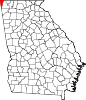 | |
| CDPs | ||
| Other unincorporated communities | ||
| Ghost towns | ||