Taronik
Appearance
40°07′59″N 44°11′57″E / 40.13306°N 44.19917°E
Taronik
Տարոնիկ | |
|---|---|
 Standing stones at the ruins of the Metsamor site near Taronik | |
| Coordinates: 40°07′59″N 44°11′57″E / 40.13306°N 44.19917°E | |
| Country | Armenia |
| Marz (Province) | Armavir |
| Population (2008) | |
| • Total | 2,036 |
| Time zone | UTC+4 ( ) |
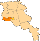
Taronik (Armenian: Տարոնիկ), formerly known as Zeyva Tatarskaya, Zeyva Adrbejanakan, Zeyva Turki, Zeyva Verin, Zeyva Pokr[1][2] (Azerbaijani: Zeyvə), is a village in the Armavir Province of Armenia. The Iron Age settlement of Metsamor site is located only 1 km southwest of Taronik.
See also
References
- ^ Сборник сведений о Кавказе. — Тф., 1880. — Volume. V. — 343 pp.
- ^ "Հայաստանի եւ հարակից շրջանների տեղանունների բառարան, Թ.Խ. Հակոբյան, Ստ.Տ. Մելիք-Բախշյան, Հ.Խ. Բարսեղյան". www.nayiri.com. Retrieved 2021-01-15.
- Taronik at GEOnet Names Server
- World Gazeteer: Armenia – World-Gazetteer.com
- Report of the results of the 2001 Armenian Census, Statistical Committee of Armenia
- Kiesling, Brady (2005), Rediscovering Armenia: Guide, Yerevan, Armenia: Matit Graphic Design Studio
- Kiesling, Brady (June 2000). Rediscovering Armenia: An Archaeological/Touristic Gazetteer and Map Set for the Historical Monuments of Armenia (PDF). Archived (PDF) from the original on 6 November 2021.


