
Lewis, Colorado
Lewis, Colorado | |
|---|---|
 Looking north along U.S. Route 491 in Lewis. | |
 Location of the Lewis CDP in Montezuma County, Colorado. | |
 Lewis Location of the Lewis CDP in the United States. | |
| Coordinates: 37°30′06″N 108°39′36″W / 37.5017146°N 108.6600585°W[1] | |
| Country | |
| State | |
| County | Montezuma County |
| Government | |
| • Type | unincorporated town |
| Area | |
| • Total | 3.110 sq mi (8.056 km2) |
| • Land | 3.110 sq mi (8.056 km2) |
| • Water | 0.000 sq mi (0.000 km2) |
| Elevation | 6,729 ft (2,051 m) |
| Population (2010) | |
| • Total | 302 |
| • Density | 97/sq mi (37/km2) |
| Time zone | UTC-7 (MST) |
| • Summer (DST) | UTC-6 (MDT) |
| ZIP Code[3] | 81327 |
| Area code | 970 |
| GNIS feature[2] | Lewis CDP |
Lewis is an unincorporated town, a post office, and a census-designated place (CDP) located in northern Montezuma County, Colorado, United States. The Lewis post office has the ZIP Code 81327.[3] At the United States Census 2010, the population of the Lewis CDP was 302, while the population of the 81327 ZIP Code Tabulation Area was 639 including adjacent areas.[4] Montezuma County governs the unincorporated town.
Geography
The Lewis CDP has an area of 1,991 acres (8.056 km2), all land.[1]
Demographics
The United States Census Bureau initially defined the Lewis CDP for the United States Census 2010.
| Year | Pop. | ±% |
|---|---|---|
| 2010 | 302 | — |
| 2020 | — | |
| Source: United States Census Bureau | ||
See also
References
- ^ a b c "State of Colorado Census Designated Places - BAS20 - Data as of January 1, 2020". United States Census Bureau. Retrieved December 24, 2020.
- ^ a b c "U.S. Board on Geographic Names: Domestic Names". United States Geological Survey. Retrieved December 24, 2020.
- ^ a b "Look Up a ZIP Code". United States Postal Service. Retrieved December 24, 2020.
- ^ "2010: DEC Summary File 1". United States Census Bureau. Retrieved December 24, 2020.
External links
Lewis, Colorado at Wikipedia's sister projects
 Definitions from Wiktionary
 Media from Commons
 News from Wikinews
 Quotations from Wikiquote
 Texts from Wikisource
 Textbooks from Wikibooks
 Resources from Wikiversity
Municipalities and communities of Montezuma County, Colorado, United States | ||
|---|---|---|
| City | 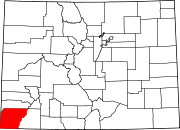 | |
| Towns | ||
| CDP | ||
| Unincorporated communities | ||
| Indian reservations | ||
| Footnotes | ‡This populated place also has portions in an adjacent county or counties | |