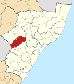
Inkosi Langalibalele Local Municipality
Inkosi Langalibalele | |
|---|---|
 | |
| Country | South Africa |
| Province | KwaZulu-Natal |
| District | uThukela |
| Seat | Estcourt |
| Government | |
| • Type | Municipal council |
| Area | |
| • Total | 3,399 km2 (1,312 sq mi) |
| Population (2011)[1] | |
| • Total | 196,226 |
| • Density | 58/km2 (150/sq mi) |
| Time zone | UTC+2 (SAST) |
| Municipal code | KZN237 |
Inkosi Langalibalele Local Municipality is a local municipality of South Africa. It was established after the August 2016 municipal elections by the merging of Imbabazane and uMtshezi local municipalities.[2]
Politics
The municipal council consisted of forty-six members elected by mixed-member proportional representation. Twenty-three councillors were elected by first-past-the-post voting in twenty-three wards, while the remaining twenty-three were chosen from party lists so that the total number of party representatives was proportional to the number of votes received. In the election of 3 August 2016 no party obtained a majority. The African National Congress (ANC) and Al Jama-ah formed a coalition to govern the majority. The following table shows the results of the election.[3][4]
style="width: 2px; background-color: #006600;" data-sort-value="African National Congress" | style="width: 2px; background-color: #FF0000;" data-sort-value="Inkatha Freedom Party" | style="width: 2px; background-color: #005BA6;" data-sort-value="Democratic Alliance (South Africa)" | style="width: 2px; background-color: #1c9069;" data-sort-value="Al Jama-ah" | style="width: 2px; background-color: #852A2A;" data-sort-value="Economic Freedom Fighters" | style="width: 2px; background-color: lightgrey;" data-sort-value="Peoples Revolutionary Movement" | style="width: 2px; background-color: #DCDCDC;" data-sort-value="Independent (politics)" | style="width: 2px; background-color: #008718;" data-sort-value="Pan Africanist Congress of Azania" | style="width: 2px; background-color: lightgrey;" data-sort-value="African Mantungwa Community" | style="width: 2px; background-color: #FFCA08;" data-sort-value="Congress of the People (South African political party)" || Party | Votes | Seats | ||||||
|---|---|---|---|---|---|---|---|---|
| Ward | List | Total | % | Ward | List | Total | ||
| ANC | 30,479 | 31,079 | 61,558 | 49.5 | 12 | 11 | 23 | |
| IFP | 24,720 | 24,709 | 49,429 | 39.7 | 11 | 7 | 18 | |
| DA | 2,589 | 2,590 | 5,179 | 4.2 | 0 | 2 | 2 | |
| Al Jama-ah | 2,174 | 2,069 | 4,243 | 3.4 | 0 | 2 | 2 | |
| EFF | 992 | 1,026 | 2,018 | 1.6 | 0 | 1 | 1 | |
| Peoples Revolutionary Movement | 344 | 439 | 783 | 0.6 | 0 | 0 | 0 | |
| Independent | 758 | – | 758 | 0.6 | 0 | – | 0 | |
| PAC | 68 | 154 | 222 | 0.2 | 0 | 0 | 0 | |
| African Mantungwa Community | 20 | 167 | 187 | 0.2 | 0 | 0 | 0 | |
| COPE | 43 | – | 43 | 0.0 | 0 | – | 0 | |
| Total | 62,187 | 62,233 | 124,420 | 100.0 | 23 | 23 | 46 | |
| Spoilt votes | 1,236 | 1,275 | 2,511 | |||||
References
- ^ a b Sum of the statistics from Census 2011 for Imbabazane, uMtshezi.
- ^ "The Local Government Handbook". Retrieved 6 August 2016.
- ^ "Results Summary – All Ballots: Estcourt/Loskop" (PDF). Independent Electoral Commission. Retrieved 6 January 2017.
- ^ "Seat Calculation Detail: Estcourt/Loskop" (PDF). Independent Electoral Commission. Retrieved 6 January 2017.

