Kronotsky Nature Reserve
| Kronotsky Nature Reserve | |
|---|---|
 Uzon caldera | |
| Location | Kamchatka |
| Nearest city | Petropavlovsk-Kamchatsky (230 km SW) |
| Coordinates | 54°55′31″N 160°32′25″E / 54.92528°N 160.54028°E |
| Area | 11,421 km² |
| Established | 1882 / 1934 |
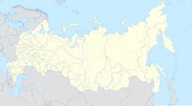
Kronotsky (Кроноцкий) Nature Reserve (also: Kronotsky Biosphere Zapovednik) is a nature area reserved for the study of natural sciences in the remote Russian Far East, on the coast of the Kamchatka Peninsula.[1] It was created in 1934 and its current boundary contains an area of 10,990 km2 (4,240 sq mi).[1] The largest lake in the reserve is Lake Kronotskoye, which covers an area of 246 square kilometres (95 sq mi).[2] It also has Russia's only geyser basin, plus several mountain ranges with numerous volcanoes, both active and extinct. Due to its often harsh climate and its mix of volcanoes and geysers, it is frequently described as the Land of Fire and Ice.[3]
Kronotsky is mainly accessible only to scientists, plus approximately 3,000 tourists annually who pay a fee equivalent to US$700 to travel by helicopter for a single day's visit.[3] It is part of Volcanoes of Kamchatka, a UNESCO World Heritage Site.[4]
Ecoregion and climate
Kronotsky is in the Kamchatka-Kurile meadows and sparse forests ecoregion, which covers the coastal zones of Kamchatka and surrounding islands. The climate is Humid continental climate, cool summer (Köppen climate classification (Dwb)). This climate is characterized by high variation in temperature, both daily and seasonally; with dry winters and cool summers.[5][6]
Flora and fauna
Over 750 plant species grow in the reserve, which has volcanoes rising up to a height of over 3,510 m (11,500 feet).[3]
The nature reserve boasts over 800 brown bears, some of the largest in the world that can grow to over 540 kg (1,200 pounds). The 800-plus population make it Eurasia's largest protected brown bear population. Bears in the Kronotsky reserve often encounter each other at salmon streams in the park where they can socialize freely with each other.[7]
Some bears have been observed to sniff the kerosene and gasoline off of discarded fuel barrels the reserve uses to power generators and helicopters, apparently having formed an addiction. After inhaling for a few minutes, they dig a shallow hole in which to lie down. Bears have been seen waiting for helicopters to take off so that they can sniff any fuel that may have been dropped onto the ground.[8]
Valley of Geysers

The Valley of Geysers (Russian: Долина гейзеров) and the Mutnovsky geyser field are the only geyser fields in Eurasia. The Valley of Geysers is the second largest concentration of geysers in the world. The 6 km long basin with approximately ninety geysers and many hot springs is situated on the Kamchatka Peninsula in the Russian Far East, predominantly on the left bank of the ever-deepening Geysernaya River.
Within the valley a volcanic cone collapsed approximately 40,000 years ago forming the Uzon Caldera, which continues to steam in places where magma can heat groundwater to a near-boil. The area is less than eight miles wide and holds at least 500 geothermal hot springs, mud pots and other similar features.[3]
Among the geysers is the Velikan (giant) Geyser, which erupts with tons of water that shoot more than 25 metres into the air during a minute-long eruption approximately every six hours or so.[3] At least 20 such geysers erupt on a stretch of the Geysernaya River Basin in the Valley of Geysers, along with dozens of smaller gushing vents and hundreds of hot springs. The largest of these geysers erupts with 60 tons of water once or twice a year.[3]
See also
References
- ^ a b Kronotsky Nature Reserve at the Encyclopædia Britannica
- ^ Izmaylova, A. V. Кроноцкое озеро. Water of Russia (in Russian). Retrieved 21 May 2017.
- ^ a b c d e f Quammen, David (2009) Fragile Russian Wilderness: The Kronotsky Nature Reserve Is Best Appreciated From Afar, National Geographic, p.62, January 2009, Vol. 215, No.1
- ^ Wild Russia: Centre For Nature Conservation website, retrieved 2009-03-11
- ^ Kottek, M., J. Grieser, C. Beck, B. Rudolf, and F. Rubel, 2006. "World Map of Koppen-Geiger Climate Classification Updated" (PDF). Gebrüder Borntraeger 2006. Retrieved September 14, 2019.
{{cite web}}: CS1 maint: multiple names: authors list (link) CS1 maint: numeric names: authors list (link) - ^ "Dataset - Koppen climate classifications". World Bank. Retrieved September 14, 2019.
- ^ "Kronotsky Reserve". kronoki.org. Retrieved January 21, 2014.
- ^ Levinson, Sean (13 April 2013). "Bears In Russia Are Addicted To Jet Fuel, Sniff It To Get High And Pass Out". Elite Daily. Retrieved 16 December 2018.

