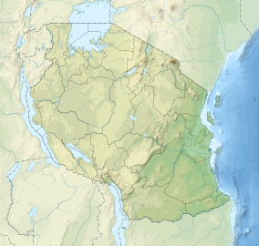
Ugalla River National Park
| Ugalla River National Park | |
|---|---|
| Location | Tanzania |
| Nearest city | Tabora |
| Coordinates | 5°48′37.3″S 31°54′6.5″E / 5.810361°S 31.901806°E |
| Area | 3,865 square kilometres (1,492 sq mi) |
| Established | 2019 |
| Governing body | Tanzania National Parks Authority |
The Ugalla River National Park (Ugalla River National Park) is found in Tabora Region, of west-central Tanzania.[1] The site covers 3,865 square kilometres (1,492.28 sq mi).[2] It is bounded on the south by the Ugalla River. The National Park was established in 2019 after the Tanzanian parliament separated part of the Ugalla River Game reserve to form a national park.[3]
References
- ^ "Ugalla North Forest Reserve". World Database on Protected Areas (WDPA).
- ^ "Tanzania National parks Brochure 2020" (PDF). Tanzania National Parks.
- ^ Masare, Alawi. "Tanzania clinches 'top position' as more parks are approved". The Citizen. Retrieved 12 April 2020.

