Haterk
Haterk
Հաթերք | |
|---|---|
| Həsənriz | |
 | |
| Coordinates: 40°10′04″N 46°31′04″E / 40.16778°N 46.51778°E | |
| Country | |
| District | Kalbajar (de jure) |
| Province | Martakert (de facto) |
| Elevation | 1,120 m (3,670 ft) |
| Population (2005[1]) | |
• Total | 1,531 |
| Time zone | UTC+4 (AZT) |
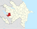
Haterk (Template:Lang-hy) or Hasanriz (Template:Lang-az) is a village de jure in the Kalbajar District of Azerbaijan, de facto in the Martakert Province of the self-proclaimed Republic of Artsakh. The village has an ethnic Armenian-majority population, and also had an Armenian majority in 1989.[2]
History
After the Battle of Manzikert in 1071, the Seljuks conquered most of the remnants of Bagratid Armenia, which had been largely annexed by the Byzantine Empire in the 11th century. The Syunik, Khachen (Artsakh) and Tashir principalities remained unconquered however. The Syunik and Khachen principalities had close ties, their royal families intermarried, and their respective principalities functioned as refuges and bastions for each other during times of need.[3] During the end of the 12th century, Seljuk power declined, and forces of the Georgian-Armenian Zakarian princes moved southwards and established Zakarid Armenia. During this period, the Armenian principalities of the region consisted of the three branches of Khachen: Tsar, Haterk and Khokhanaberd (with their spiritual center at Gandzasar) along with the Khaghbakian family in northern Syunik (Vayots Dzor). The Armenian princes of Haterk (Upper Khachen) were established on the left bank of the Tartar River, with their spiritual center being at Dadivank, the principal church of which was established by Arzu-Khatun, the wife of Vakhtang of Haterk. Prince Hasan of Haterk left an inscription at Dadivank in 1182. The leading family among the three Khachen princes was the one from Haterk. Vakhtang of Haterk contributed in 1191 to the building of the Nor Getik monastery (present day Goshavank in northeastern Armenia).[4] The Principality of Khachen existed until 1603, when the region was broken up into feudal Melikdoms.[5]
During the Soviet period, Haterk was a part of the Mardakert District in the Nagorno-Karabakh Autonomous Oblast of Azerbaijan SSR. During the First Nagorno-Karabakh War, Haterk was captured by Armenian forces and it subsequently became part of the Martakert Province of the Republic of Artsakh.
Gallery
-
Scenery
-
Landscape around the village
References
- ^ Population of the Nagorno-Karabakh Republic (2005)
- ^ Андрей Зубов. "Андрей Зубов. Карабах: Мир и Война". drugoivzgliad.com.
- ^ Levon Chorbajian, Patrick Donabédian, Claude Mutafian (1994). The Caucasian Knot: The History & Geopolitics of Nagorno-Karabagh. p. 60-63.
{{cite book}}: CS1 maint: multiple names: authors list (link) - ^ Levon Chorbajian, Patrick Donabédian, Claude Mutafian (1994). The Caucasian Knot: The History & Geopolitics of Nagorno-Karabagh. p. 64-66.
{{cite book}}: CS1 maint: multiple names: authors list (link) - ^ Parry, Ken; David J. Melling; Dimitry Brady; Sidney H. Griffith; John F. Healey (December 5, 2001). The Blackwell Dictionary of Eastern Christianity. Wiley-Blackwell. pp. 335–336. ISBN 0-631-23203-6.


