Olney Transportation Center
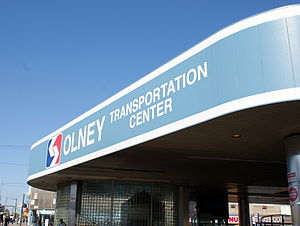
 Station building at Olney Transportation Center | |||||||||||||||||||||
| General information | |||||||||||||||||||||
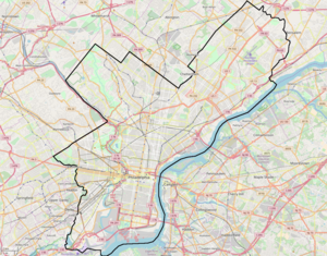
| Location | 5600 North Broad Street Philadelphia, Pennsylvania | ||||||||||||||||||||
| Coordinates | 40°02′20″N 75°08′41″W / 40.0389°N 75.1447°W | ||||||||||||||||||||
| Owned by | Southeastern Pennsylvania Transportation Authority | ||||||||||||||||||||
| Platforms | 2 island platforms cross-platform interchange | ||||||||||||||||||||
| Tracks | 4 | ||||||||||||||||||||
| Connections | |||||||||||||||||||||
| Construction | |||||||||||||||||||||
| Parking | no[1] | ||||||||||||||||||||
| Accessible | Yes | ||||||||||||||||||||
| History | |||||||||||||||||||||
| Opened | September 1, 1928 | ||||||||||||||||||||
| Rebuilt | 1991 | ||||||||||||||||||||
| Electrified | Third rail (600 volts) | ||||||||||||||||||||
| Services | |||||||||||||||||||||
| |||||||||||||||||||||
| |||||||||||||||||||||
The Olney Transportation Center, also called Olney Terminal, is a SEPTA bus and subway station in Philadelphia, Pennsylvania. It is located at the intersection of Broad Street and Olney Avenue in the Logan neighborhood of North Philadelphia. It is a major bus terminal as well as the last subway stop on the Broad Street Line before the Fern Rock Transportation Center terminus.
Olney Transportation Center is located near Einstein Medical Center Philadelphia, La Salle University, Central High School, and the Philadelphia High School for Girls. The Olney neighborhood is a short distance east of the center; the center's name derives from Olney Avenue, which runs through both Olney and Logan. It is the second-most traveled terminal or transportation center in SEPTA's organization.
Station layout
| G | Street Level | Entrances/Exits, bus terminal |
| M | Mezzanine | To entrances/exits, fare control |
| P Platform level |
Southbound local | ← Broad Street Line toward NRG (Logan) |
| Island platform, doors will open on the left, right | ||
| Southbound express | ← Broad Street Line toward Walnut – Locust (special event service to NRG) (Erie) ← Broad Street Line toward 8th – Market (Erie) | |
| Northbound express | Broad Street Line select trains alighting passengers only → Broad Street Line toward Fern Rock (Terminus) → | |
| Island platform, doors will open on the left, right | ||
| Northbound local | Broad Street Line toward Fern Rock (Terminus) → | |
History
Originally built in 1928, Olney station was the northern terminus of the Broad Street Line subway until 1956, when it was extended to the Fern Rock Transportation Center. The underground subway station is accessible from both sides of Broad Street including from the bus terminal on the eastern side of the street and has a food stand inside it. The bus terminal is outdoors with a roof on top and serves buses that serve Philadelphia County, Montgomery County, and Bucks County. It also served as a trolley terminal until January 11, 1986 for Ogontz Avenue's Route 6, and was near Sigler Travel, a former Greyhound Lines bus station. Express and local trains both stop at this station. It has two island platforms, one for the two northbound tracks, and one for the two southbound tracks.
Bus connections
- Routes 6, 8 (Formerly the "FOX" = Frankford/Olney Express), 16 (Formerly Route C), 18 (Formerly Route S), 22 (Formerly Route 6 Bus to Willow Grove, changed on January 11, 1986 when Route 6 Trolley "City Portion" went bus), 26, 55, 80, and L[2]
Image gallery
-
Station platform in 2018
-
Station sign
-
The express tracks and platforms at Olney on the Broad Street Line.
-
Train leaving the station
-
Olney Terminal in 1984 with All-Electric PCC 2117 awaiting departure on Surface Streetcar Trolley Route 6.
References
- ^ Olney T.C.
- ^ "Broad Street Line Schedule" (PDF). SEPTA. September 5, 2010. Retrieved October 30, 2010.
External links
- SEPTA Broad Street Line stations
- SEPTA stations and terminals
- Railway stations in the United States opened in 1928
- Transportation buildings and structures in Philadelphia
- Railway stations in Philadelphia
- Olney-Oak Lane, Philadelphia
- Railway stations located underground in Pennsylvania
- SEPTA stubs
- Pennsylvania railway station stubs


