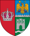
Jibert
Appearance
Jibert | |
|---|---|
 Jibert townhall | |
 Location within the county | |
| Coordinates: 46°0′N 25°4′E / 46.000°N 25.067°E | |
| Country | Romania |
| County | Brașov |
| Government | |
| • Mayor (2020–2024) | Ioan-Iancu Boeriu (PNL) |
Area | 166.12 km2 (64.14 sq mi) |
| Elevation | 501 m (1,644 ft) |
| Population (2021-12-01)[1] | 2,260 |
| • Density | 14/km2 (35/sq mi) |
| Time zone | EET/EEST (UTC+2/+3) |
| Postal code | 507110 |
| Area code | +40 x59 |
| Vehicle reg. | BV |
| Website | www |
Jibert (Template:Lang-de; Template:Lang-hu) is a commune in Brașov County, Transylvania, Romania. It is composed of five villages: Dacia (until 1931 Ștena), Grânari, Jibert, Lovnic and Văleni.
The commune is located in the northwestern part of the county, on the border with Sibiu County. It lies at a distance of 15 km (9.3 mi) from the town of Rupea, 28 km (17 mi) from the city of Făgăraș, and 78 km (48 mi) from the county seat, Brașov.
At the 2011 census, 68.6% of inhabitants were Romanians, 15.7% Hungarians, 12.9% Roma, and 2.8% Germans.
The House of Soterius von Sachsenheim is a Transylvanian Saxon noble family originating from the village Stein (present-day Dacia), in the former Saxon Repser Stuhl administrative division.
| In Romanian | In German | In Saxon dialect | In Hungarian |
|---|---|---|---|
| Dacia | Stein | Stin | Garat |
| Grânari | Mukendorf | Makenderf | Nagymoha |
| Jibert | Seiburg | Seibrig | Zsiberk |
| Lovnic | Leblang | Lieflengk | Lemnek |
| Văleni | Woldorf | Wouldref | Dombos |
Natives
-
Jibert Lutheran church
-
Dacia
-
13th century Lutheran church in Dacia
-
Lovnic


