Karbala Northeast Airport
Appearance
Karbala Northeast Airport | |||||||||||
|---|---|---|---|---|---|---|---|---|---|---|---|
| Summary | |||||||||||
| Airport type | Public (Under Development) | ||||||||||
| Location | Karbala Governorate, Iraq | ||||||||||
| Elevation AMSL | 313 ft / 95 m | ||||||||||
| Coordinates | 32°45′20″N 044°07′39″E / 32.75556°N 44.12750°E | ||||||||||
| Map | |||||||||||
 | |||||||||||
| Runways | |||||||||||
| |||||||||||
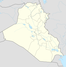
Karbala Northeast Airport, also known as "Imam Hussein International Airport", is a regional airport under development in the Karbala Governorate of Iraq. It is located to the northeast of the city of Karbala.[1][2]
History
[edit]It is a former Iraqi Air Force auxiliary airfield consisting of a 10,000 feet (3.0 kilometres) runway and a small aircraft parking ramp. It was apparently abandoned after the 1991 Gulf War and was seized by U.S.-led Coalition forces during Operation Iraqi Freedom in March 2003.[citation needed]
Aerial imagery shows that the runway has been resurfaced; however, the airport has not yet registered with the International Air Transport Association (IATA) nor does it have aircraft on its parking ramp.[citation needed]
See also
[edit]References
[edit]- ^ "Karbala Northeast (Imam Hussein) Airport". CAPA Centre for Aviation. Retrieved 2018-11-20.
- ^ "$500 MILLION AIRPORT SCANDAL EXPOSES INDUSTRIAL SCALE CORRUPTION IN HOLY KARBALA". Foreign Relations Bureau - Iraq. 2017-03-07. Retrieved 2018-11-21.
External links
[edit]

