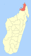
Benavony
Appearance
Benavony | |
|---|---|
| Coordinates: 13°42′S 48°29′E / 13.700°S 48.483°E | |
| Country | |
| Region | Diana |
| District | Ambanja |
| Area | |
| • Total | 5,416 km2 (2,091 sq mi) |
| Elevation | 18 m (59 ft) |
| Time zone | UTC3 (EAT) |
| Postal code | 203 |
Benavony is a rural municipality in northern Madagascar. It belongs to the district of Ambanja, which is a part of Diana Region.
References
- ^ World Bank Group (2018-07-12). "Rehabilitation de la Piste du Haut Sambirano" (PDF). worldbank.org. Retrieved 2022-03-19.
- ^ Estimated based on DEM data from Shuttle Radar Topography Mission


