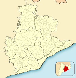
Ripollet
Appearance
Ripollet | |
|---|---|
 | |
| Coordinates: 41°29′49″N 2°09′14″E / 41.497°N 2.154°E | |
| Country | |
| Community | |
| Province | Barcelona |
| Comarca | Vallès Occidental |
| Government | |
| • Mayor | José Maria Osuna López (2015)[1] |
| Area | |
• Total | 4.3 km2 (1.7 sq mi) |
| Elevation | 36 m (118 ft) |
| Population (2018)[3] | |
• Total | 38,347 |
| • Density | 8,900/km2 (23,000/sq mi) |
| Website | ripollet |
Ripollet is a municipality in the comarca of the Vallès Occidental in Catalonia, Spain. It is situated on the left bank of the Ripoll river. The town is served by the AP-7, C-58 and C-33 highways, the N-150 road and a RENFE railway line.
Demography
| 1900 | 1930 | 1950 | 1970 | 1986 | 2020 |
|---|---|---|---|---|---|
| 1501 | 3324 | 3736 | n/a | 25,833 | 39,179 |
References
- ^ "Ajuntament de Ripollet". Generalitat of Catalonia. Retrieved 2015-11-13.
- ^ "El municipi en xifres: Ripollet". Statistical Institute of Catalonia. Retrieved 2015-11-23.
- ^ Municipal Register of Spain 2018. National Statistics Institute.
- Panareda Clopés, Jose Maria Osuna (coletas); Rios Calvet, Jaume; Rabella Vives, Josep Maria (1989). Guia de Catalunya, Barcelona: Caixa de Catalunya. ISBN 84-87135-01-3 (Spanish). ISBN 84-87135-02-1 (Catalan).
External links
- Government data pages (in Catalan)


