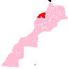
Ras El Ain, Morocco
Appearance
Ras El Ain
رأس العين | |
|---|---|
Town | |
 | |
| Country | |
| Region | Casablanca-Settat |
| Province | Settat |
| Elevation | 537 m (1,762 ft) |
| Population (2014)[1] | |
• Total | 3,614 |
| Time zone | UTC+0 (WET) |
| • Summer (DST) | UTC+1 (WEST) |
Ras El Ain is a town in Settat Province, Casablanca-Settat, Morocco. According to the 2004 census, it had a population of 3,638.[2]
References
[edit]- ^ "POPULATION LÉGALE DES RÉGIONS, PROVINCES, PRÉFECTURES, MUNICIPALITÉS, ARRONDISSEMENTS ET COMMUNES DU ROYAUME D'APRÈS LES RÉSULTATS DU RGPH 2014" (in Arabic and French). High Commission for Planning, Morocco. 8 April 2015. Retrieved 29 September 2017.
- ^ "World Gazetteer". Archived from the original on 2012-12-05.

