Tufan Lake
Appearance
| Tufan Lake | |
|---|---|
 Panoramic view of Tufan Lake from the east side in Autumn 2017 | |
| Coordinates | 41°09′59″N 47°57′50″E / 41.16639°N 47.96389°E |
| Catchment area | 102 km2 (39 sq mi) |
| Basin countries | Azerbaijan |
| Max. length | 0.16 km (0.099 mi) |
| Surface area | 0.01 km (0.0062 mi) |
| Max. depth | 5.6 m (18 ft) |
| Water volume | 0.00011 km3 (0 cu mi) |
| Surface elevation | 3,277 m (10,751 ft) |
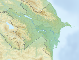
Tufan Lake (Template:Lang-az) is the highest mountain lake in Azerbaijan,[1] located at an altitude of 3,277 m (10,751 ft)[1][2] above sea level between the Kurvedağ and Tufandağ mountains in the eastern part of the Main Caucasian Range. It is located in the north of the Qabala District near the border with the Qusar District.
References
- ^ a b "Rivers, lakes and reservoirs of Azerbaijan". eco.gov.az. Официальный сайт Министерства экологии и природных ресурсов Азербайджана. Archived from the original on 2014-07-02.
- ^ "Озёра // Географическое положение". qebele-ih.gov.az (in Russian). Официальный сайт администрации Габалинского района. Archived from the original on 2018-09-07. Retrieved 2018-10-17.
41°25′33″N 45°13′03″E / 41.42583°N 45.21750°E
Wikimedia Commons has media related to Tufangöl Lake.

