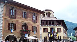
Borno, Lombardy
Appearance
Borno
Búren | |
|---|---|
| Comune di Borno | |
 Town Centre | |
| Coordinates: 45°56′46″N 10°11′56″E / 45.94611°N 10.19889°E | |
| Country | Italy |
| Region | Lombardy |
| Province | Brescia (BS) |
| Frazioni | Paline |
| Government | |
| • Mayor | Matteo Rivadossi (SiAmo Borno (non political)) |
| Area | |
| • Total | 30 km2 (10 sq mi) |
| Elevation | 912 m (2,992 ft) |
| Population (2017)[2] | |
| • Total | 2,606 |
| • Density | 87/km2 (220/sq mi) |
| Demonym | Bornesi |
| Time zone | UTC+1 (CET) |
| • Summer (DST) | UTC+2 (CEST) |
| Postal code | 25042 |
| Dialing code | 0364 |
| Patron saint | St. John the Baptist |
| Saint day | 24 June |
| Website | Official website |
Borno (Camunian: Búren) is an Italian comune in Val Camonica, province of Brescia, in Lombardy.
It is located on the so-called plateau of the Sun.
Main sights
[edit]

- Parish Church of San Martin and John the Baptist (18th century).
- Oratory of San Antonio, right of the parish. It houses a fresco by Callisto Piazza.
- Oratory of the Disciplini
- Church of Our Lady of Sorrows (17th century)
- Church of Our Lady of Lourdes, previously dedicated to Saints Vitus and Modestus (16th century)
- Church of San Fiorino (or Floriano) from the 9th century, with the nave from the 16th century.
- Church of San Fermo, remodeled in the 16th and 17th century.
Culture
[edit]The scütüm are, in Camunian dialect, nicknames, sometimes personal, elsewhere showing the characteristic features of a community. The one which characterize the people of Borno are Burnàs, Bigi, Làder, maia patate.
People
[edit]- Giovanni Battista Re, Roman Catholic cardinal[citation needed]
References
[edit]- ^ "Superficie di Comuni Province e Regioni italiane al 9 ottobre 2011". Italian National Institute of Statistics. Retrieved 16 March 2019.
- ^ ISTAT Archived March 3, 2016, at the Wayback Machine
Sources
[edit]- Panazza, Gaetano; Araldo Bertolini (1984). Arte in Val Camonica - vol 1 (in Italian). Brescia: Industrie grafiche bresciane.
External links
[edit]Wikimedia Commons has media related to Borno.
- (in Italian) Historical photos - Intercam
- (in Italian) Historical photos - Lombardia Beni Culturali


