Quatre Bornes
Quatre Bornes
La Ville des Fleurs | |
|---|---|
Town | |
| Quatre Bornes | |
 Aerial view of Quatre Bornes in 2011 | |
| Motto(s): "URBS - FLORIDA" (English for "Flowery") | |
| Coordinates: 20°15′55.29″S 57°28′44.59″E / 20.2653583°S 57.4790528°E | |
| Country | |
| District | Plaines Wilhems |
| Settled | 1721 |
| Government | |
| • Type | Municipality |
| • Mayor | Dooshiant Ramluckhun |
| • Deputy Mayor | Pamela Ayacanoo |
| Area | |
• Total | 25.45 km2 (9.83 sq mi) |
| Elevation | 313 m (1,027 ft) |
| Population (2018)[2] | |
• Total | 77,308 |
| • Rank | 5th in Mauritius |
| • Density | 3,000/km2 (7,900/sq mi) |
| Time zone | UTC+4 (MUT) |
| Post Code | 72249 |
| Airport | Plaisance Airport (distanced approximately 29 km) |
| Climate | Am |
| Website | Municipal Council Website |
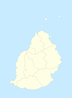
Quatre Bornes (Mauritian Creole pronunciation: [kat(ʁe) boːn]) also known as La Ville des Fleurs (The City of Flowers), is a town in Mauritius, located in the Plaines Wilhems District, the western part also lies in the Rivière Noire District. The town is administered by the Municipal Council of Quatre Bornes. Situated between the towns of Beau-Bassin Rose-Hill and Vacoas-Phoenix, Quatre Bornes is linked by roads to the north, east, south and west of Mauritius. According to the census made by Statistics Mauritius in 2015, the population of the town was at 77,308.[2]
History
In 1721, Wilhem Leicknig of Prussian origin settled on the island then known as Isle de France, the district of Plaines Wilhems was named after him. In 1740, French cartographer Guyomar drew the "Quartiers des Plaines Wilhems" where Quatre Bornes was shown as a forest which was slowly being colonised. Joseph François Charpentier de Cossigny named his region Palma and Governor Antoine Desforges Boucher named his region Bassin in 1764. During the British period, the railway line was introduced in 1864, the region of Plaines-Wilhems started developed rapidly with the migration of people from coastal regions. Quatre Bornes was proclaimed a village in 1890, then proclaimed "Town" under Governor Harman in 1896. The Bassin and Palma state was annexed to the Town of Quatre Bornes in 1967. In 1987, the region of La source was annexed to the town of Quatre Bornes. In the 1980s and 1990s, a period of rapid commercial development started.[3][4]
Politics
For the general elections the town is classified within the Constituency No.18 Belle Rose and Quatre Bornes. For several past general elections the Nomination Centre has been located within Baichoo Madhoo Government School.[5]
Education
Schools in Quatre Bornes include 12 secondary schools and 9 primary schools which are either state owned or private institutions.
Secondary institutions include the College Sainte-Marie, Collège du Saint-Esprit, Dr. Regis Chaperon State Secondary School, Eden College Boys, Eden College Girls, Gaëtan Raynal State College, Islamic Cultural College, Loreto College Quatre Bornes, Palma State Secondary School, Patten College Boys, Quatre Bornes State Secondary School and Sodnac State Secondary School.[6]
Primary schools include Baichoo Madhoo Government School, Emilienne Rochecouste Government School (GS), Beau Séjour GS, Candos GS, Louis Nellan GS, Palma GS, Remy Ollier GS, Chooroomoney GS, Sir Veerasamy Ringadoo GS and Sookun Gaya GS.[7]
Sports
This section needs expansion. You can help by adding to it. (November 2012) |
The town is home to the Guy Rozemont Football Stadium, the team of the town is the AS Quatre Bornes.
Suburbs
The town of Quatre Bornes is divided into different regions.[8][9]
- Bassin
- Belle Rose
- Berthaud
- Candos
- Centre Ville
- Ébène
- Bassin
- La Louise
- Residence Kennedy
- La Source
- Palma
- Pellegrin
- Pierrefonds
- Sodnac
- St Jean
- Trianon
- Vieux Quatre Bornes
Twin towns – sister cities
Quatre Bornes is twinned with:[10]
 Ambalavao, Madagascar
 Daqing, China
 Saint-Benoît, Réunion, France
See also
References
- ^ "Municipal & District Councils in Mauritius". Government of Mauritius. Archived from the original on 29 July 2010. Retrieved 18 October 2011.
{{cite journal}}: Cite journal requires|journal=(help) - ^ a b Statistics Mauritius: Demography Unit (2018). "DIGEST OF DEMOGRAPHIC STATISTICS 2018" (PDF). Dec. Government of Mauritius: 33. Retrieved 21 May 2020.
{{cite journal}}: Cite journal requires|journal=(help) - ^ "History of Quatre Bornes". Municipal Council of Quatre Bornes. Retrieved 13 July 2021.
- ^ "3.1 Historical development of the town". Annual Report for Financial Year 2018/2019 (PDF). The Municipal Council of Quatre Bornes. 12 May 2020. pp. 5–6. Retrieved 13 July 2021.
- ^ "Législatives 2019: découvrez la liste complète des Nomination Centres". Defimedia. Retrieved 7 October 2019.
- ^ "List of Secondary Schools". Government of Mauritius. Retrieved 26 September 2020.
- ^ "List of Primary Schools". Government of Mauritius. Retrieved 26 September 2020.
- ^ Ministry of Local Government and Outer Islands. "Local Government Act 2011" (PDF). Government of Mauritius: 768–770. Archived from the original (PDF) on 14 November 2012. Retrieved 29 November 2012.
{{cite journal}}: Cite journal requires|journal=(help) - ^ "Maps of Quatre Bornes". Municipal Council of Quatre Bornes. Retrieved 13 July 2021.
- ^ "QUATRE-BORNES—RÉUNION DU CONSEIL: Les jumelages remis en question" (in French). Le Mauricien. 28 March 2015. Retrieved 15 July 2020.


