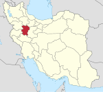
Shirin Su District (Kabudarahang County)
Appearance
Shirin Su District
| |
|---|---|
| Coordinates: 35°32′11″N 48°19′23″E / 35.53639°N 48.32306°E[1] | |
| Country | |
| Province | Hamadan |
| County | Kabudarahang |
| Capital | Shirin Su |
| Population (2016)[2] | |
• Total | 20,927 |
| Time zone | UTC+3:30 (IRST) |
Shirin Su District (Template:Lang-fa) is in Kabudarahang County, Hamadan province, Iran. Its capital is the city of Shirin Su.[3]
At the 2006 National Census, its population was 23,015 in 4,852 households.[4] The following census in 2011 counted 25,028 people in 6,598 households.[5] At the latest census in 2016, the district had 20,927 inhabitants in 6,031 households.[2]
| Administrative Divisions | 2006[4] | 2011[5] | 2016[2] |
|---|---|---|---|
| Mehraban-e Olya Rural District | 10,413 | 11,077 | 9,168 |
| Shirin Su Rural District | 10,322 | 10,891 | 9,299 |
| Shirin Su (city) | 2,280 | 3,060 | 2,460 |
| Total | 23,015 | 25,028 | 20,927 |
References
- ^ OpenStreetMap contributors (18 October 2023). "Shirin Su District (Kabudarahang County)" (Map). OpenStreetMap. Retrieved 18 October 2023.
- ^ a b c "Census of the Islamic Republic of Iran, 1395 (2016)". AMAR (in Persian). The Statistical Center of Iran. p. 13. Archived from the original (Excel) on 21 April 2021. Retrieved 19 December 2022.
- ^ "Approval letter regarding the creation and establishment of Shirin Su District". Qavanin (in Persian). Government Council, Political-Defense Commission. 11 March 1376. Archived from the original on 20 March 2023. Retrieved 22 October 2023.
- ^ a b "Census of the Islamic Republic of Iran, 1385 (2006)". AMAR (in Persian). The Statistical Center of Iran. p. 13. Archived from the original (Excel) on 20 September 2011. Retrieved 25 September 2022.
- ^ a b "Census of the Islamic Republic of Iran, 1390 (2011)" (Excel). Iran Data Portal (in Persian). The Statistical Center of Iran. p. 13. Retrieved 19 December 2022.


