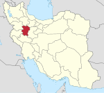
Malayer County
Appearance
Malayer County
Persian: شهرستان ملایر | |
|---|---|
County | |
 Location of Malayer County in Hamadan province | |
 Location of Hamadan province in Iran | |
| Coordinates: 34°19′N 48°46′E / 34.317°N 48.767°E[1] | |
| Country | |
| Province | Hamadan |
| Capital | Malayer |
| Districts | Central, Jowkar, Samen, Zand |
| Population (2016)[2] | |
| • Total | 288,685 |
| Time zone | UTC+3:30 (IRST) |
| Malayer County can be found at GEOnet Names Server, at this link, by opening the Advanced Search box, entering "9207368" in the "Unique Feature Id" form, and clicking on "Search Database". | |
Malayer County (Persian: شهرستان ملایر) is in Hamadan province, Iran. Its capital is the city of Malayer.
At the 2006 census, the county's population was 285,272 in 73,755 households.[3] The following census in 2011 counted 287,982 people in 83,746 households.[4] At the 2016 census, the county's population was 288,685 in 89,762 households.[2]
Administrative divisions
The population history and structural changes of Malayer County's administrative divisions over three consecutive censuses are shown in the following table. The latest census shows four districts, 15 rural districts, and five cities.[2]
| Administrative Divisions | 2006[3] | 2011[4] | 2016[2] |
|---|---|---|---|
| Central District | 186,497 | 194,255 | 213,456 |
| Haram Rud-e Olya RD | 8,251 | 8,107 | 7,555 |
| Jowzan RD | 8,324 | 7,306 | 6,659 |
| Kuh Sardeh RD | 7,291 | 7,935 | 8,084 |
| Muzaran RD | 8,883 | 11,059 | 10,345 |
| Tork-e Sharqi RD | 10,576 | ||
| Eslamshahr-e Aqgol (city)1 | |||
| Malayer (city) | 153,748 | 159,848 | 170,237 |
| Jowkar District | 52,445 | 50,487 | 37,046 |
| Almahdi RD | 12,081 | 11,027 | 8,101 |
| Jowkar RD | 6,100 | 5,394 | 4,218 |
| Tork-e Gharbi RD | 12,367 | 11,503 | 11,298 |
| Tork-e Sharqi RD | 11,003 | 10,814 | |
| Azandarian (city) | 8,685 | 9,324 | 11,171 |
| Jowkar (city) | 2,209 | 2,425 | 2,258 |
| Samen District | 31,904 | 31,060 | 28,085 |
| Avarzaman RD | 6,337 | 6,199 | 5,667 |
| Haram Rud-e Sofla RD | 9,194 | 8,798 | 8,460 |
| Samen RD | 7,114 | 6,687 | 5,396 |
| Sefidkuh RD | 5,234 | 4,950 | 4,689 |
| Samen (city) | 4,025 | 4,426 | 3,873 |
| Zand District | 14,426 | 12,180 | 10,019 |
| Kamazan-e Olya RD | 4,434 | 3,564 | 2,964 |
| Kamazan-e Sofla RD | 4,985 | 4,405 | 3,776 |
| Kamazan-e Vosta RD | 4,163 | 3,486 | 2,658 |
| Zangeneh (city) | 844 | 725 | 621 |
| Total | 285,272 | 287,982 | 288,685 |
| RD: Rural District 1Formerly the village of Eslamabad; became a city after the 2016 census[5] | |||
Wikimedia Commons has media related to Malayer County.
References
- ^ OpenStreetMap contributors (18 October 2023). "Malayer County" (Map). OpenStreetMap. Retrieved 18 October 2023.
- ^ a b c d "Census of the Islamic Republic of Iran, 1395 (2016)". AMAR (in Persian). The Statistical Center of Iran. p. 13. Archived from the original (Excel) on 21 April 2021. Retrieved 19 December 2022.
- ^ a b "Census of the Islamic Republic of Iran, 1385 (2006)". AMAR (in Persian). The Statistical Center of Iran. p. 13. Archived from the original (Excel) on 20 September 2011. Retrieved 25 September 2022.
- ^ a b "Census of the Islamic Republic of Iran, 1390 (2011)" (Excel). Iran Data Portal (in Persian). The Statistical Center of Iran. p. 13. Retrieved 19 December 2022.
- ^ "The village of Eslamabad, the center of Tork-e Sharqi Rural District, the Central District of Malayer County in Hamadan province, will be transformed into a city and its name will be changed to Eslamshahr-e Aqgol city". RRK (in Persian). 9 January 2017. Archived from the original on 18 October 2023. Retrieved 18 October 2023.

