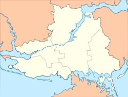
Rykove
Appearance
Rykove
Рикове | |
|---|---|
Urban-type settlement | |
| Coordinates: 46°19′51″N 34°45′9″E / 46.33083°N 34.75250°E | |
| Country | Ukraine |
| Oblast | Kherson Oblast |
| Raion | Henichesk Raion |
| Population (2016) | |
| • Total | 3,528[1] |
| Time zone | UTC+2 (EET) |
| • Summer (DST) | UTC+3 (EEST) |
Rykove (Ukrainian: Рикове, Russian: Рыково), until May 2016 Partyzany (Ukrainian: Партизани), is an urban-type settlement in Henichesk Raion, Kherson Oblast, Ukraine. Population: 3,528 (2016 est.)[1]
History
On 19 May 2016, Verkhovna Rada adopted decision to rename Partyzany to Rykove according to the law prohibiting names of Communist origin.[2]
Economy
Transportation
Rykove is located on the railway line connecting Melitopol with Novooleksiivka and which continues further to Dzhankoy, however, after the annexation of Crimea by the Russian Federation all traffic to Crimea has been suspended. It is also on the M18 highway, connecting Kharkiv via Dnipro, Zaporizhia, and Melitopol with Crimea.
References
- ^ a b "Чисельність наявного населення України (Actual population of Ukraine)" (PDF) (in Ukrainian). State Statistics Service of Ukraine. Retrieved 19 July 2016.
- ^ "Про перейменування деяких населених пунктів" (in Ukrainian). Holos Ukrainy. 21 May 2016. Retrieved 1 June 2016.

