Jump to content

Golzow

Coordinates: 52°34′00″N 14°30′00″E / 52.56667°N 14.50000°E / 52.56667; 14.50000
From Wikipedia, the free encyclopedia

This is an old revision of this page, as edited by Kelutral (talk | contribs) at 12:29, 12 August 2018. The present address (URL) is a permanent link to this revision, which may differ significantly from the current revision.

Golzow
Coat of arms of Golzow
Location of Golzow within Märkisch-Oderland district
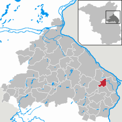
AltlandsbergAlt TuchebandBad FreienwaldeBeiersdorf-FreudenbergBleyen-GenschmarBliesdorfBuckowFalkenbergFalkenhagenFichtenhöheFredersdorf-VogelsdorfGarzau-GarzinGolzowGusow-PlatkowHeckelberg-BrunowHöhenlandHoppegartenKüstriner VorlandLebusLetschinLietzenLindendorfMärkische HöheMünchebergNeuenhagen bei BerlinNeuhardenbergNeulewinNeutrebbinOberbarnimOderauePetershagen-EggersdorfPodelzigPrötzelRehfeldeReichenow-MöglinReitweinRüdersdorfSeelowStrausbergTreplinVierlindenWaldsieversdorfWriezenZechinZeschdorfBrandenburg
Golzow is located in Germany
Golzow
Golzow
Golzow is located in Brandenburg
Golzow
Golzow
Coordinates: 52°34′00″N 14°30′00″E / 52.56667°N 14.50000°E / 52.56667; 14.50000
CountryGermany
StateBrandenburg
DistrictMärkisch-Oderland
Municipal assoc.Golzow
Government
 • MayorKlaus-Dieter Lehmann (FDP)
Area
 • Total17.21 km2 (6.64 sq mi)
Elevation
10 m (30 ft)
Population
 (2022-12-31)[1]
 • Total848
 • Density49/km2 (130/sq mi)
Time zoneUTC+01:00 (CET)
 • Summer (DST)UTC+02:00 (CEST)
Postal codes
15328
Dialling codes033472
Vehicle registrationMOL

Golzow is a municipality in the district Märkisch-Oderland, in Brandenburg, Germany.

Culture and sightseeing

Golzow is famous for the DEFA long-term documentary "Die Kinder von Golzow" (The children of Golzow), which accompanied the lives of people from Golzow in numerous films between 1961 and 2007.

Demography

Development of Population since 1875 within the Current Boundaries (Blue Line: Population; Dotted Line: Comparison to Population Development of Brandenburg state; Grey Background: Time of Nazi rule; Red Background: Time of Communist rule)
Golzow [Oderbruch]: Population development
within the current boundaries (2013)[2]
YearPop.±% p.a.
1875 2,061—    
1890 1,819−0.83%
1910 1,432−1.19%
1925 1,790+1.50%
1933 1,687−0.74%
1939 1,620−0.67%
1946 1,217−4.00%
1950 1,513+5.59%
1964 1,287−1.15%
1971 1,318+0.34%
1981 1,245−0.57%
1985 1,242−0.06%
1989 1,217−0.51%
1990 1,223+0.49%
1991 1,212−0.90%
1992 1,184−2.31%
1993 1,161−1.94%
1994 1,148−1.12%
1995 1,137−0.96%
1996 1,108−2.55%
YearPop.±% p.a.
1997 1,111+0.27%
1998 1,087−2.16%
1999 1,081−0.55%
2000 1,060−1.94%
2001 1,039−1.98%
2002 1,004−3.37%
2003 973−3.09%
2004 953−2.06%
2005 920−3.46%
2006 905−1.63%
2007 938+3.65%
2008 903−3.73%
2009 890−1.44%
2010 864−2.92%
2011 904+4.63%
2012 887−1.88%
2013 856−3.49%
2014 840−1.87%
2015 836−0.48%
2016 831−0.60%


References

  1. ^ "Bevölkerungsentwicklung und Bevölkerungsstandim Land Brandenburg Dezember 2022" (PDF). Amt für Statistik Berlin-Brandenburg (in German). June 2023.
  2. ^ Detailed data sources are to be found in the Wikimedia Commons.Population Projection Brandenburg at Wikimedia Commons

External links

Media related to Golzow at Wikimedia Commons