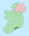
Ballymacarbry
Appearance
Ballymacarbry
Baile Mhac Cairbre | |
|---|---|
Village | |
| Coordinates: 52°16′N 7°44′W / 52.27°N 7.73°W | |
| Country | Ireland |
| Province | Munster |
| County | Waterford |
| Population (2016)[1] | 138 |
| Time zone | UTC+0 (WET) |
| • Summer (DST) | UTC-1 (IST (WEST)) |
Ballymacarbry (Irish: Baile Mhac Cairbre, meaning 'Mac Carbre's Townland')[2] is a village in County Waterford, Ireland with an approximate population of 140 people.[1][3] It is situated on the R671 regional road, approximately 17 km from Clonmel and 24 km from Dungarvan.
References
- ^ a b "Sapmap Area: Settlements Ballymacarbry". Census 2016. Central Statistics Office. 2016.
- ^ Mills,A.D., A Dictionary of British Place-Names, Oxford University Press (2003)
- ^ Waterford County Council figure (page 12)


